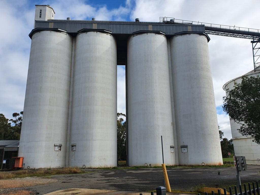
Mudbrick BarBoab TreeVan SiteVan siteBulls and donkeysVan siteBulls and donkeysThe lookoutDonkeyShed bric-a-bracShed bric-a-bracBank Banka shedsOld station equipmentWeird foliageWaterholeWaterholeBlue sky, red dirt, old shedsSurfs up phone boothArid flowerClassic windmill
Mudbrick Bar
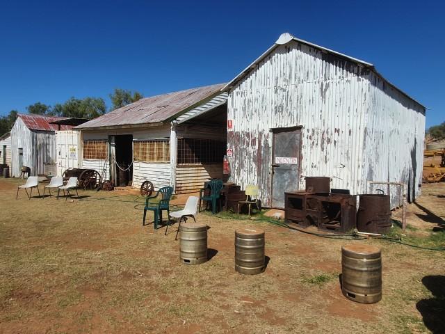
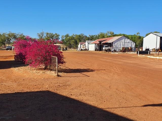
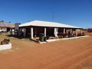
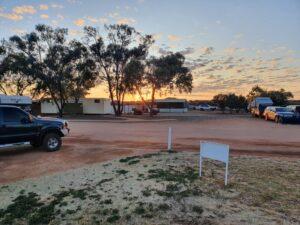
Banka Banka Station, also referred to as Banka Banka West Station as the caravan park/campground, is a working cattle station owned and operated by indigenous people. It also operates a caravan park and campground that is a welcome stop between the Devils Marbles and Daly Waters…
The station homestead is right on the Stuart Highway and and easy 217km tow from the Devils Marbles. The bloke that manages the camprground were very friendly and hospitable. Typical Aussie outback character…
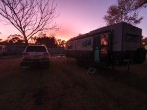
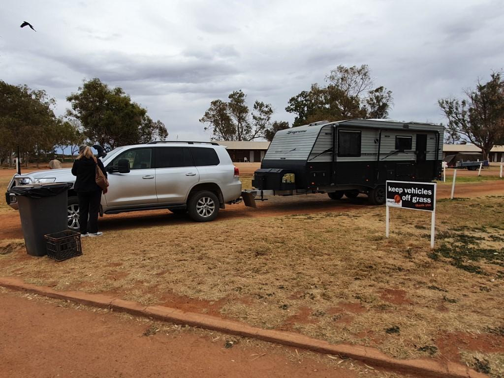
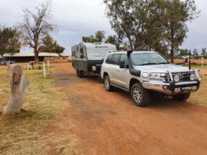
Van Site
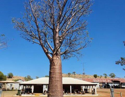
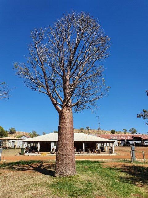
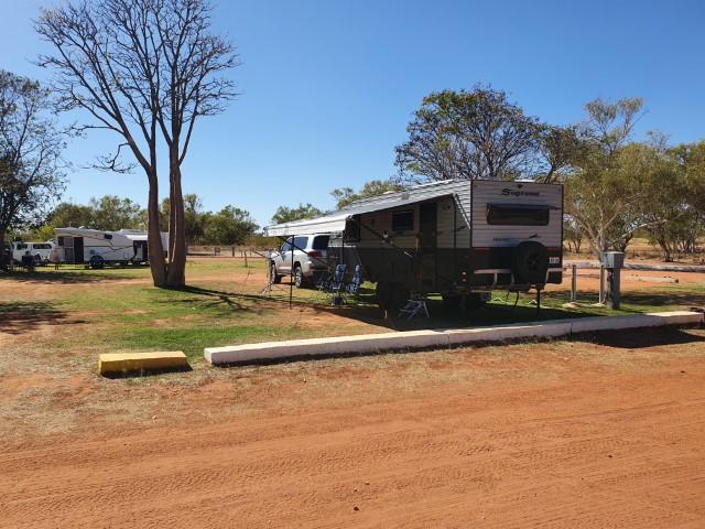
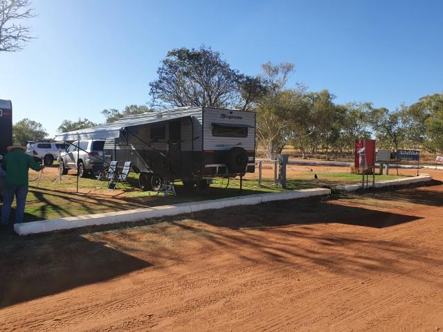
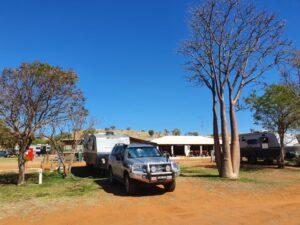
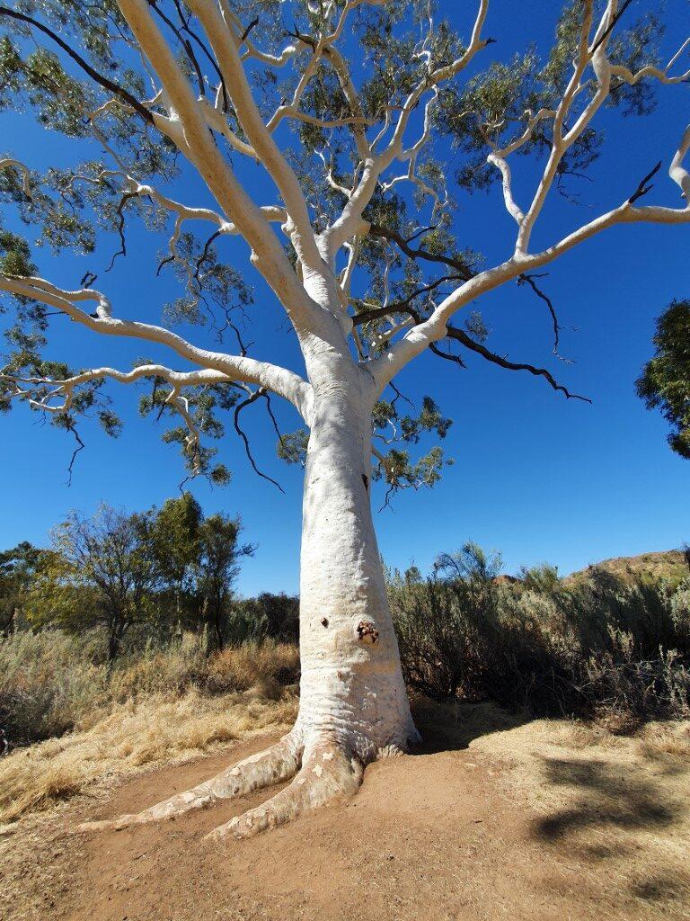
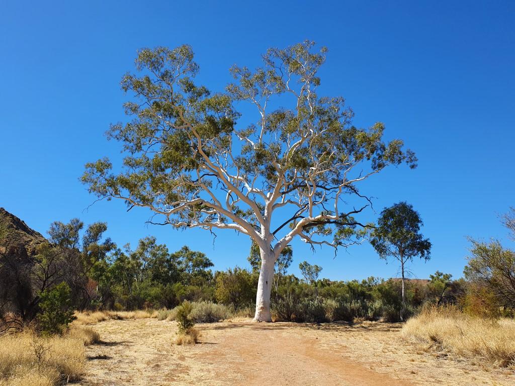
We were given a prime van site close to the mudbrick bar… but still a fair walk from the loos! The site was quite large and right next to a boab tree. We later learnt that the two boabs were brought in an planted. They only occur naturally in the Kimberly region of W.A. and the north western side of the N.T. Beautiful trees none the less.
Mudbrick Bar
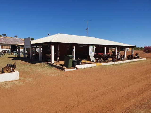
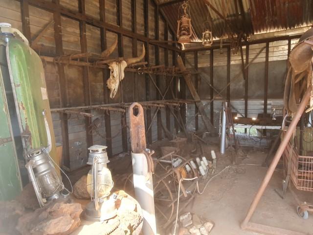
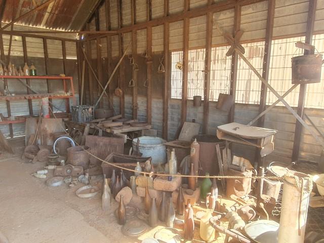
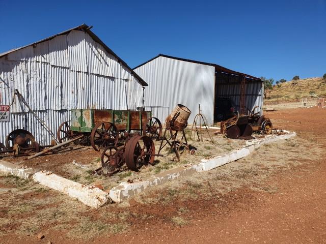
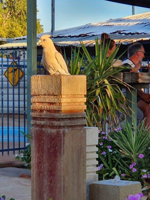
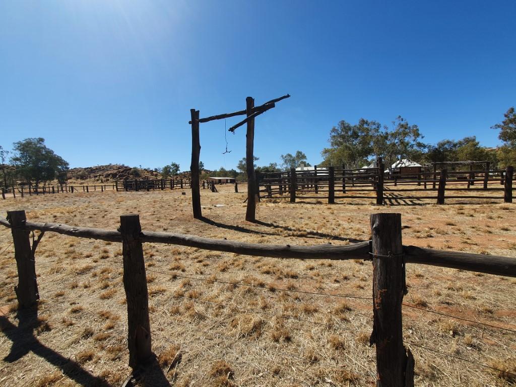
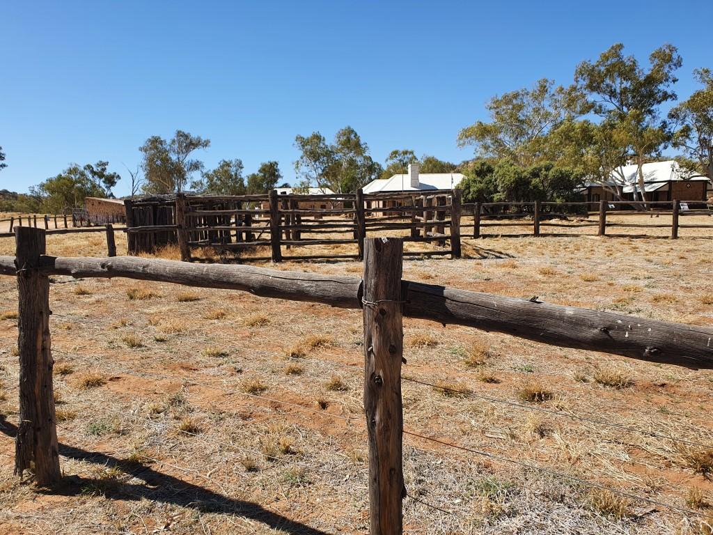
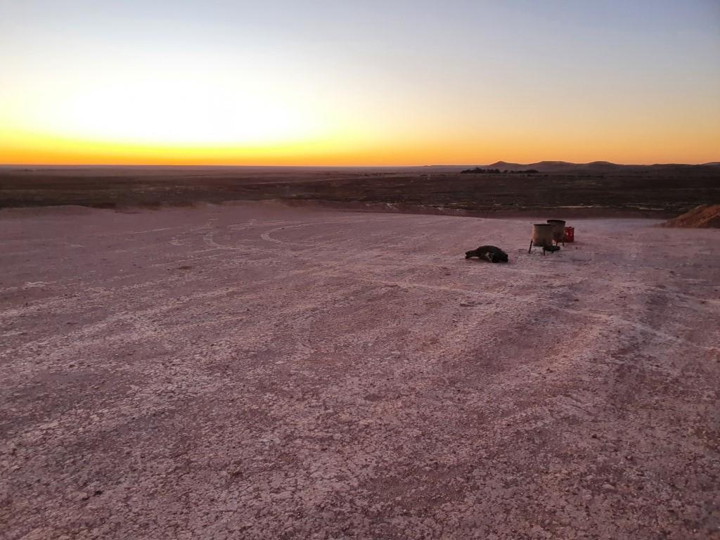
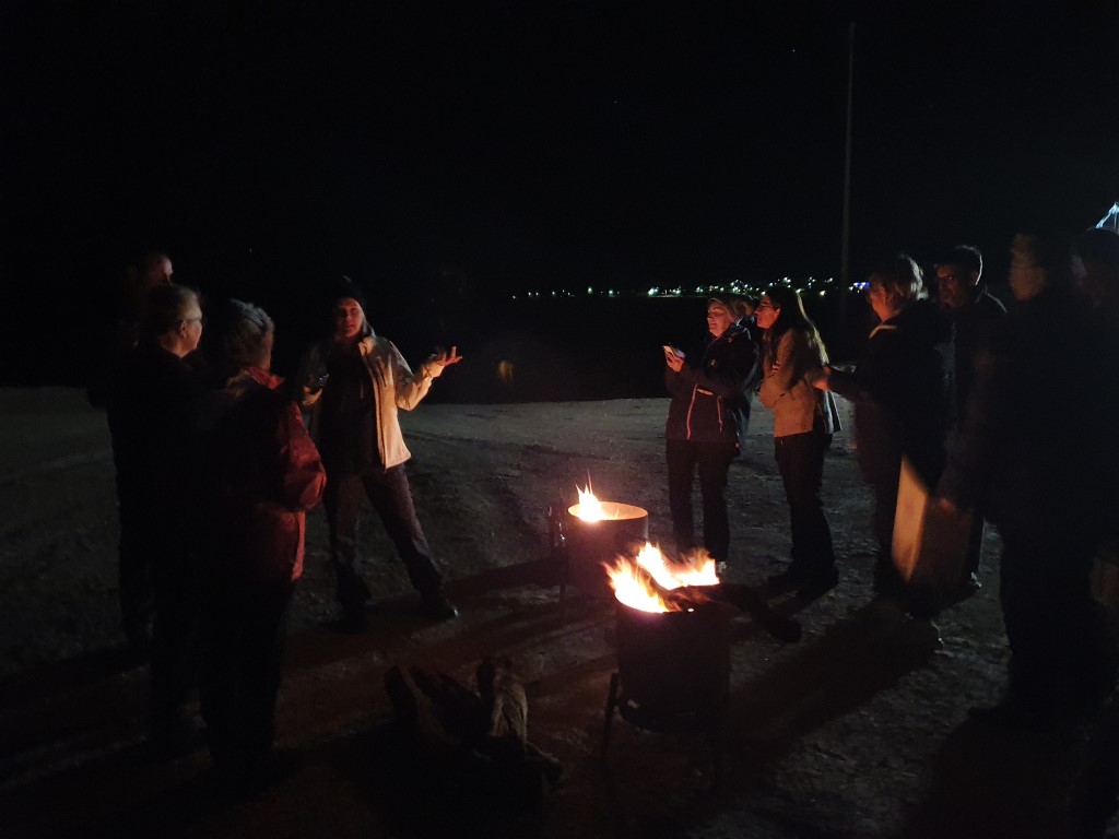
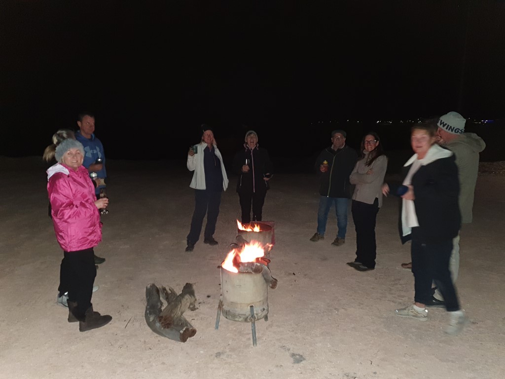
Banka Banka Station differentiates itself from roadhouse campgrounds by offering campers the chance to view the station buildings and some historic equipment in the sheds. The happy hour operates out of the historic mudbrick homestead building and often has live music around the massive fire-pit area. A number of campers used the fire-pit (more like a fire trough) to cook on the coals.
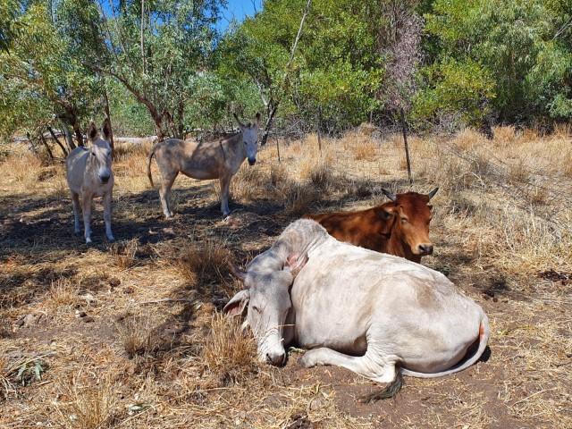
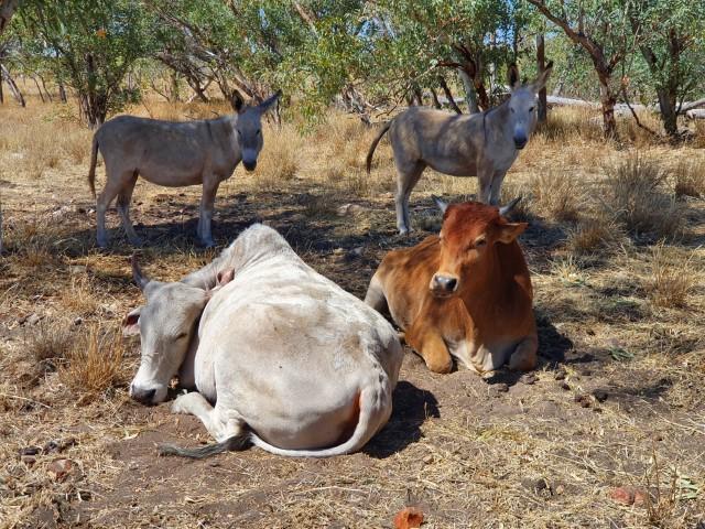
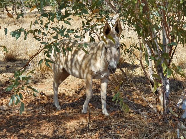
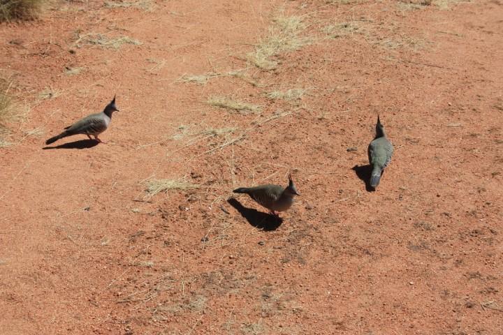
Bulls and donkeys
There are a couple of fairly docile bulls and donkey in the yard by the campground. The donkeys occasionally let off a series of incredibly loud ‘hee-hawing’ that takes you by surprise with its volume as it rolls across the campground.
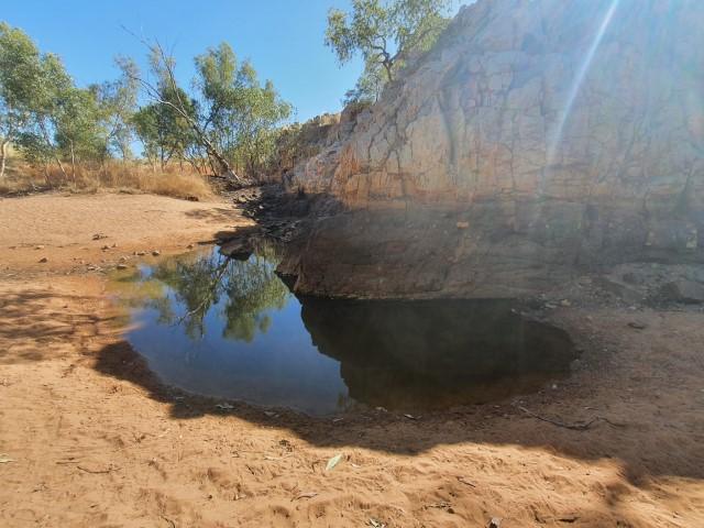
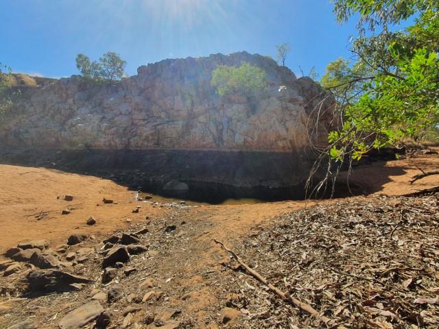
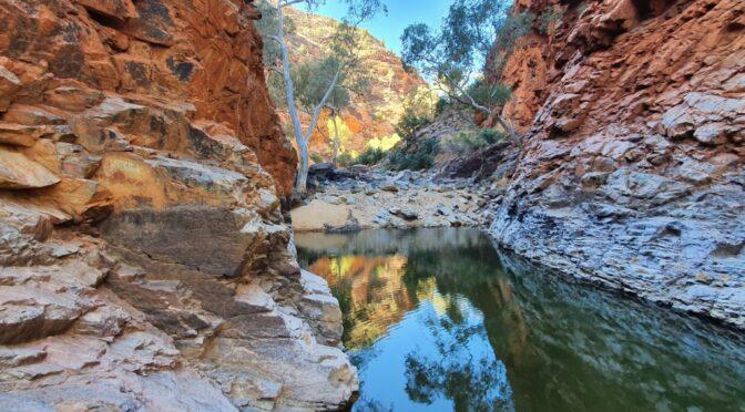
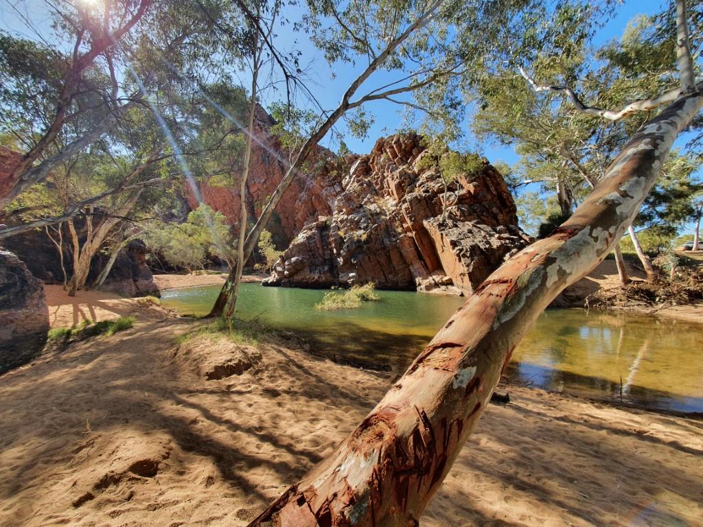
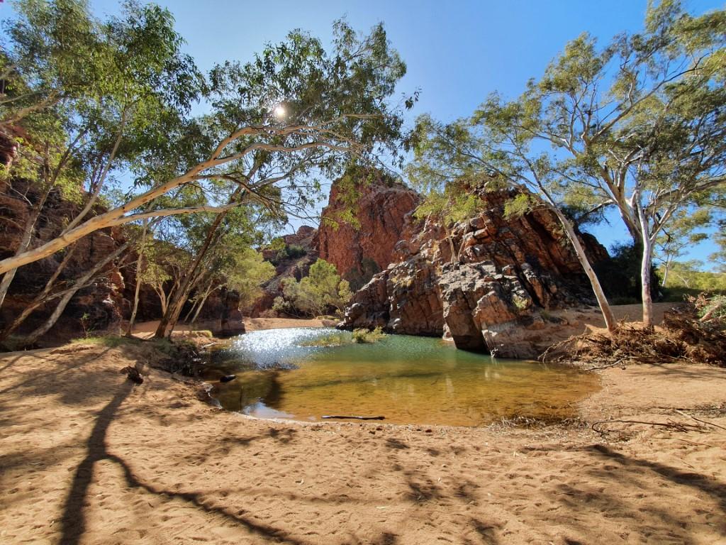
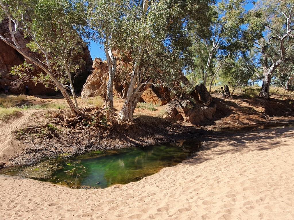
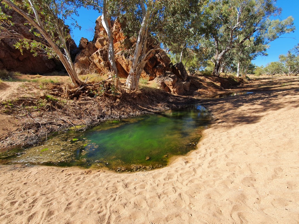
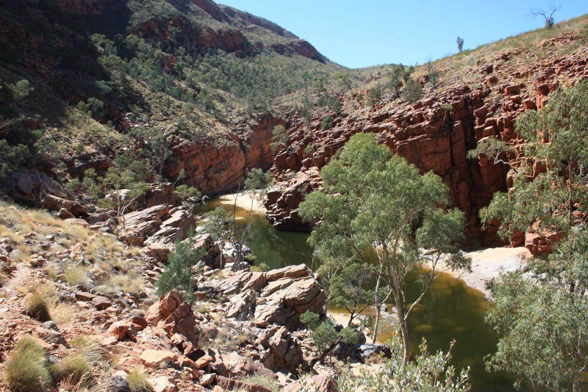
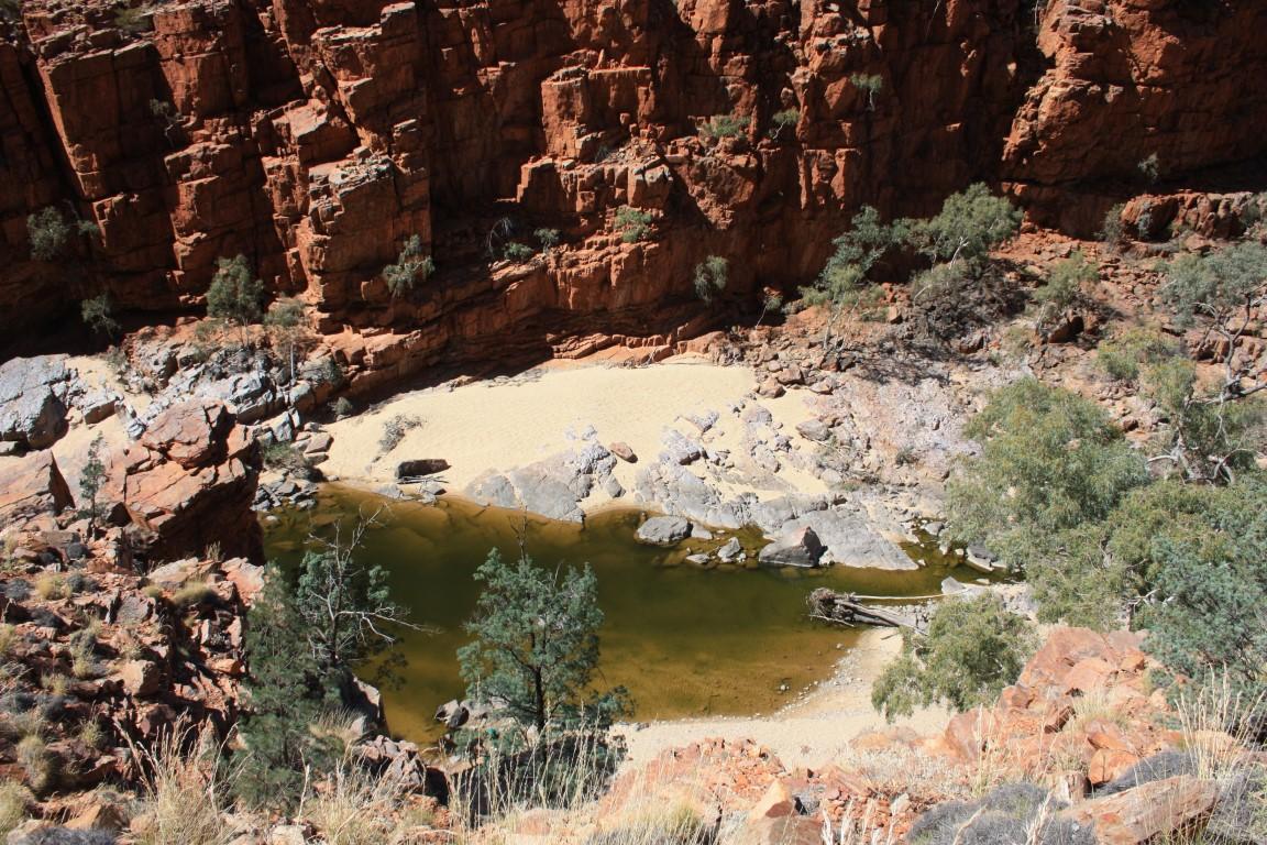
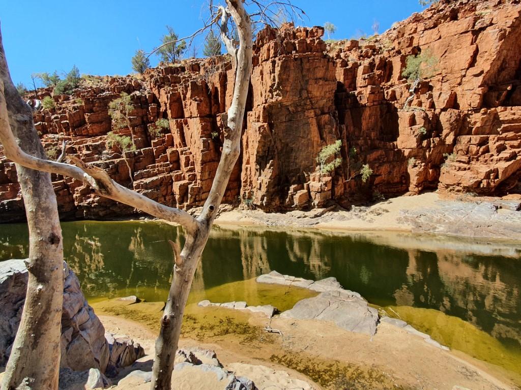
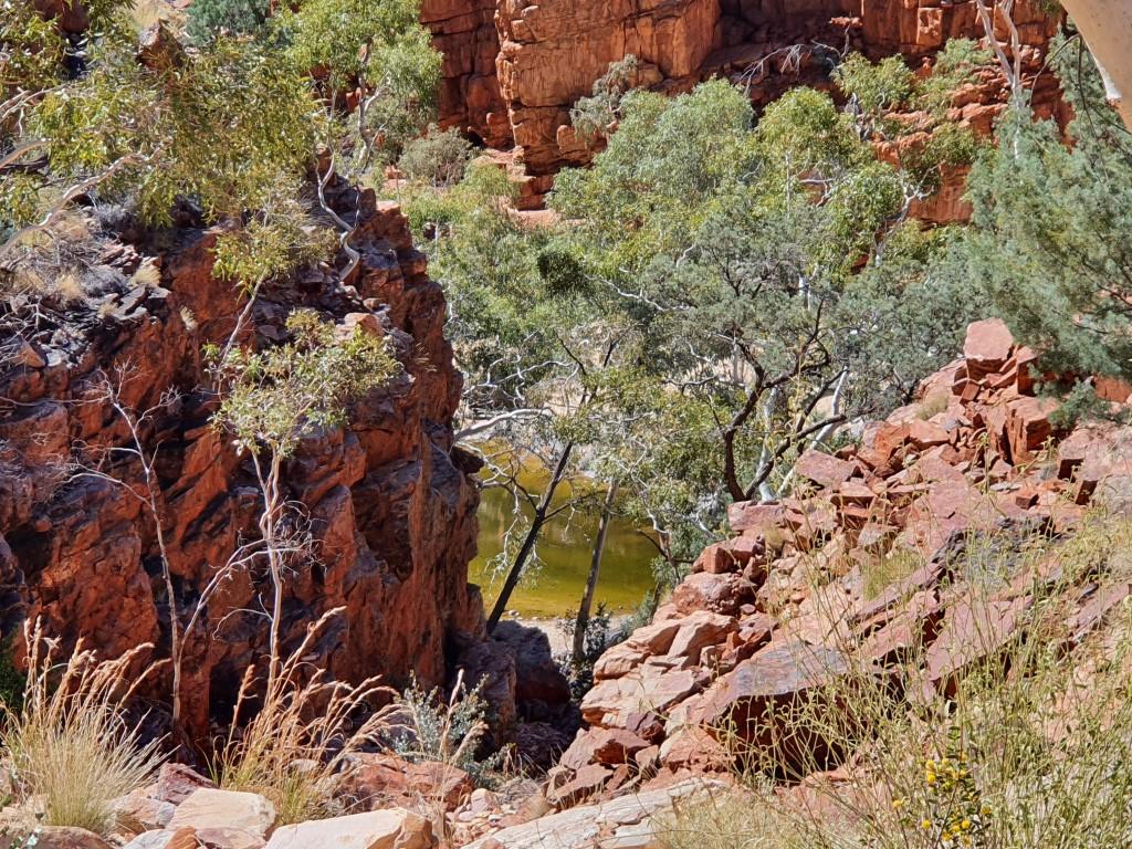
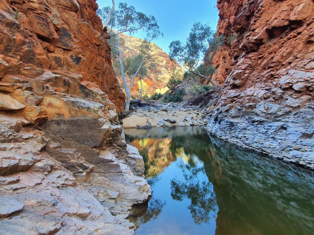
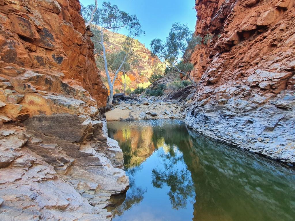
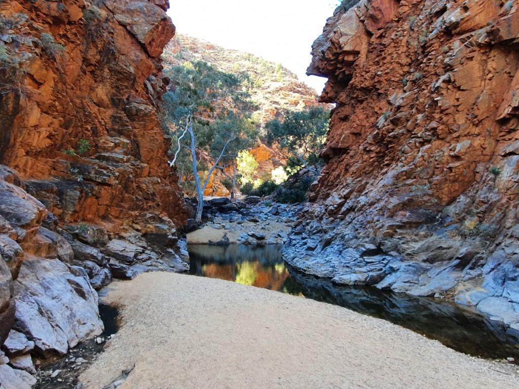
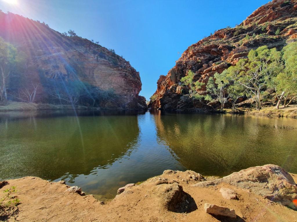
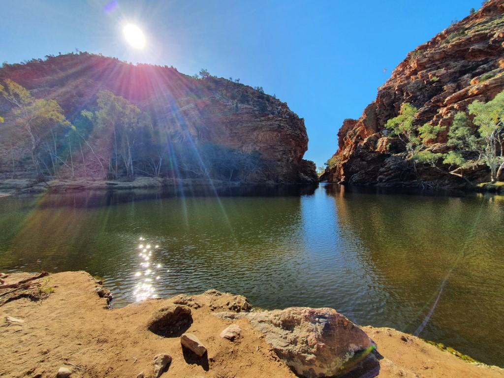
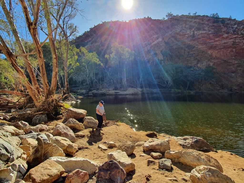
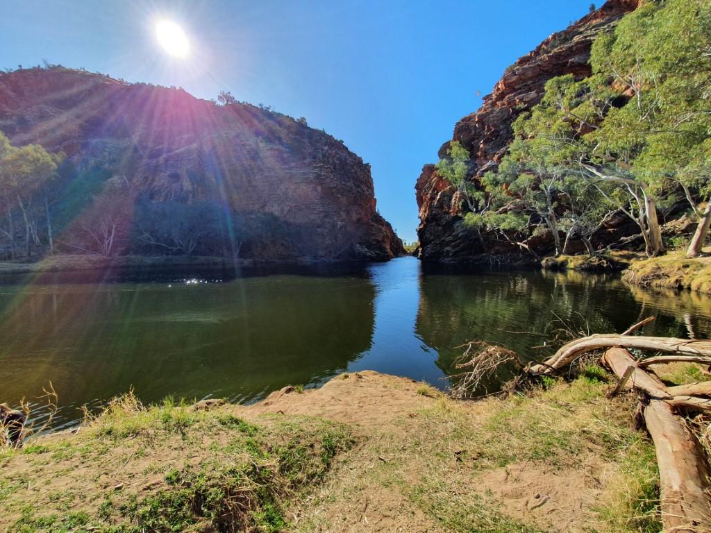
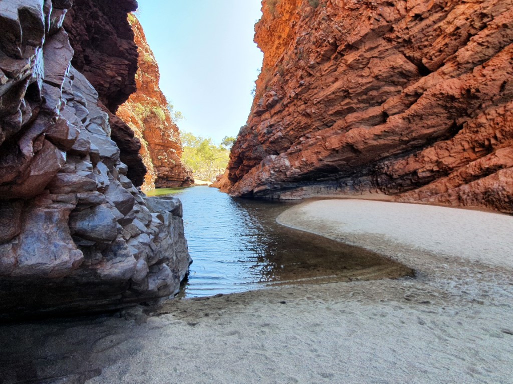
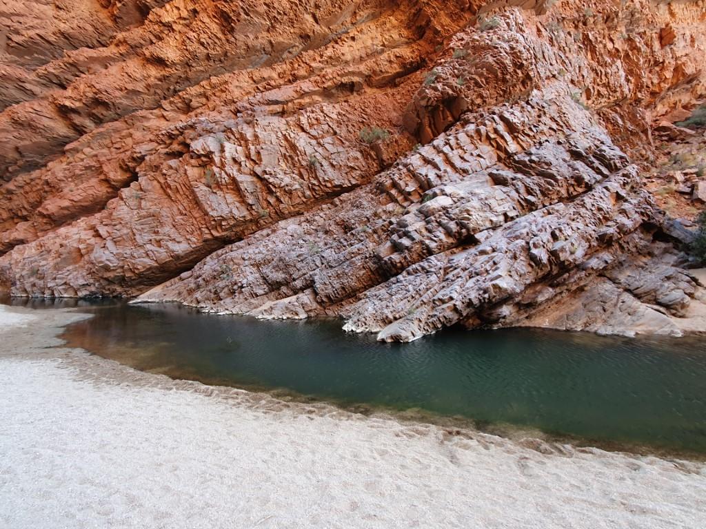
Waterhole
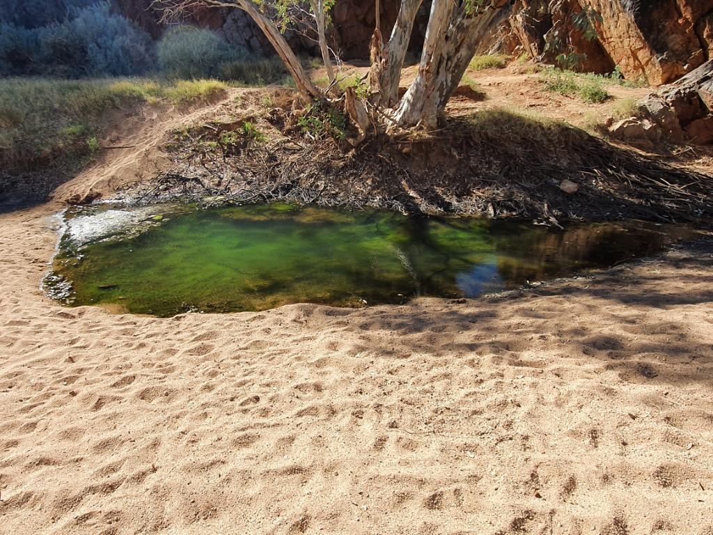
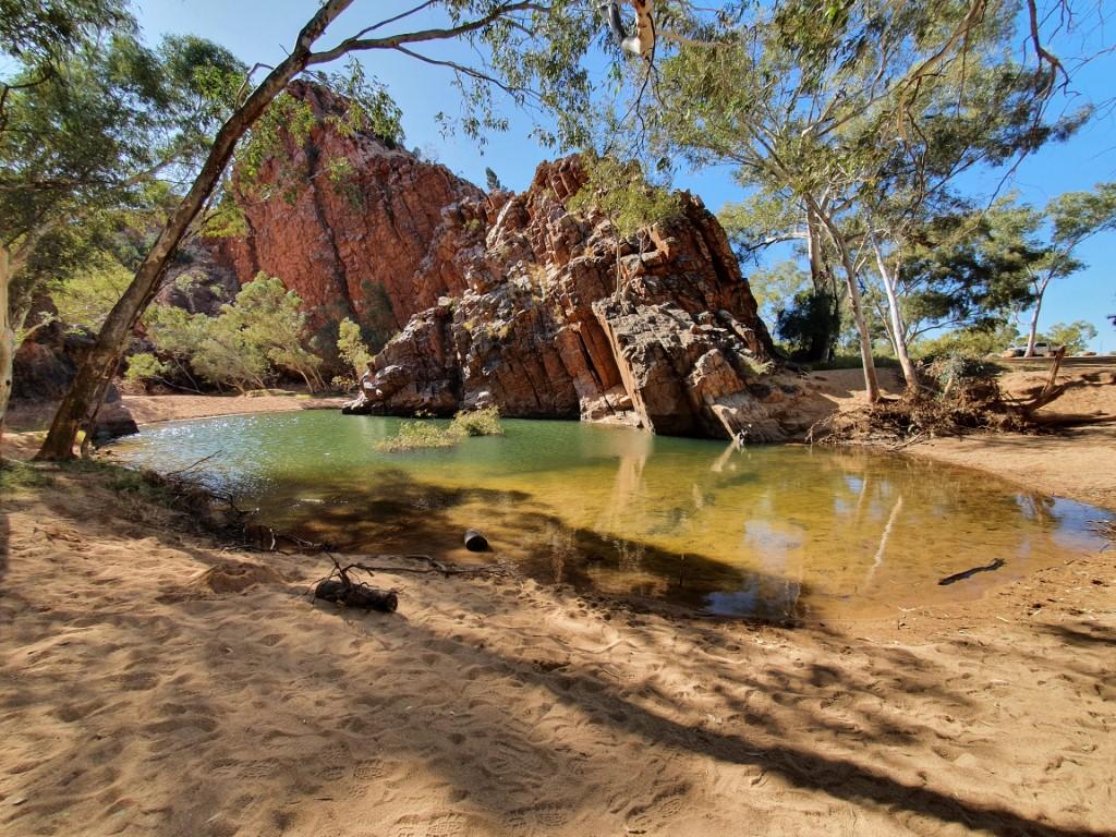
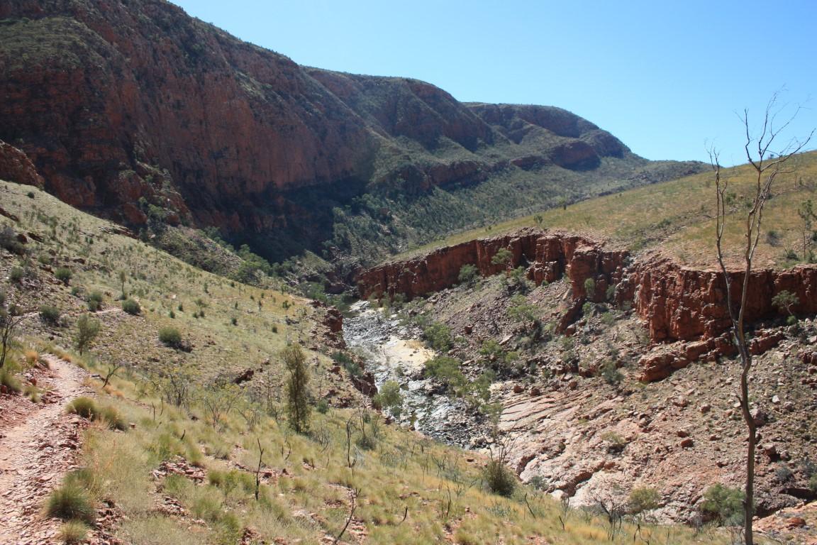
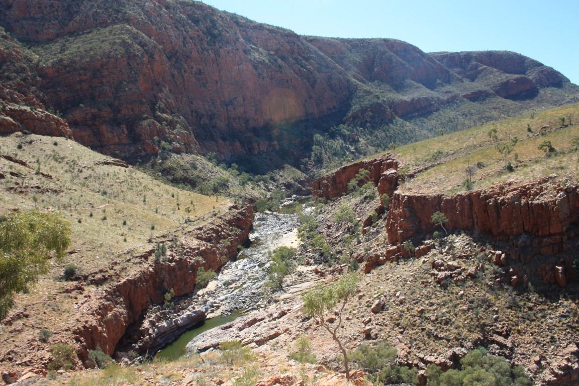
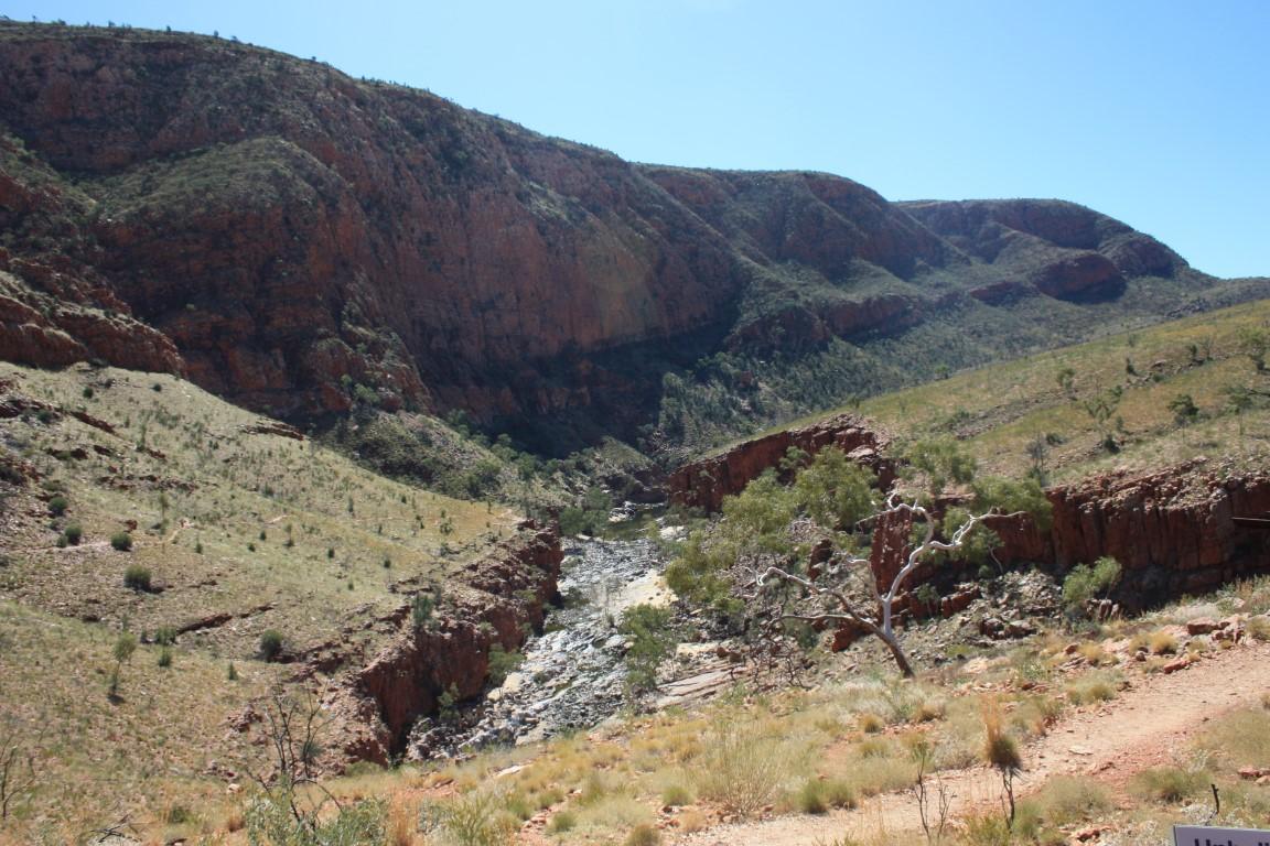
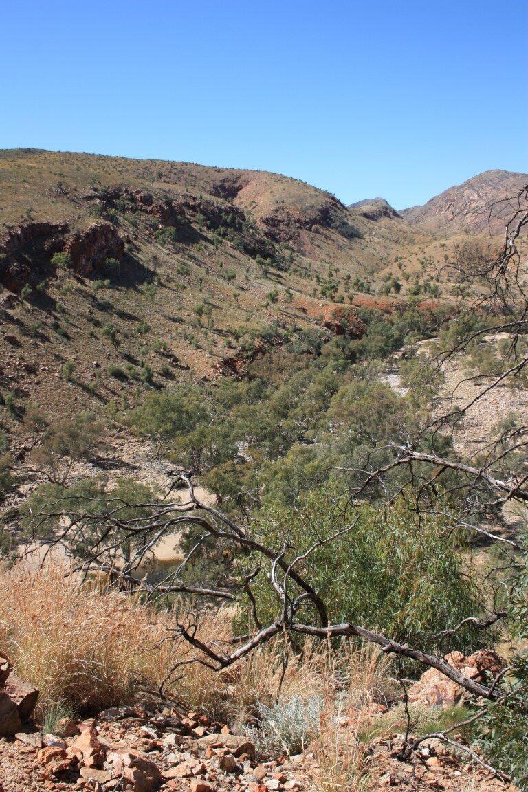
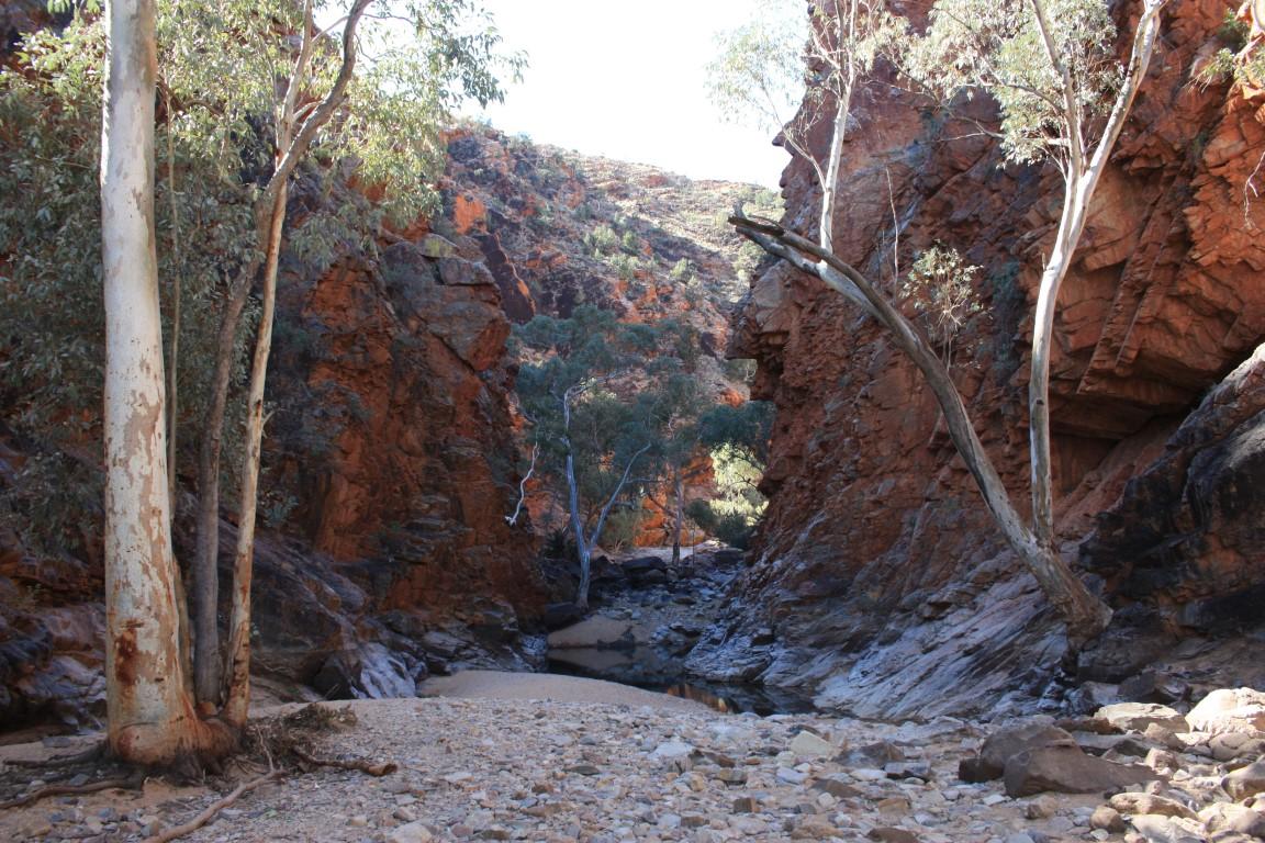
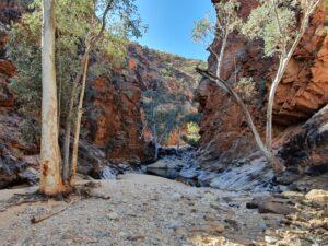
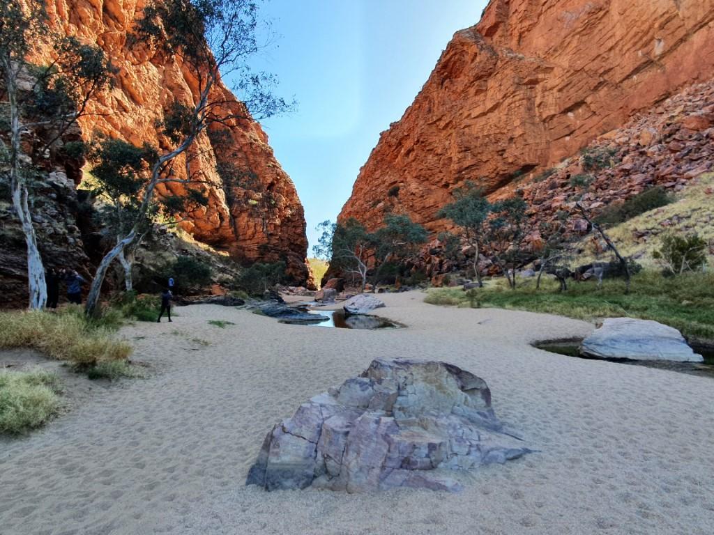
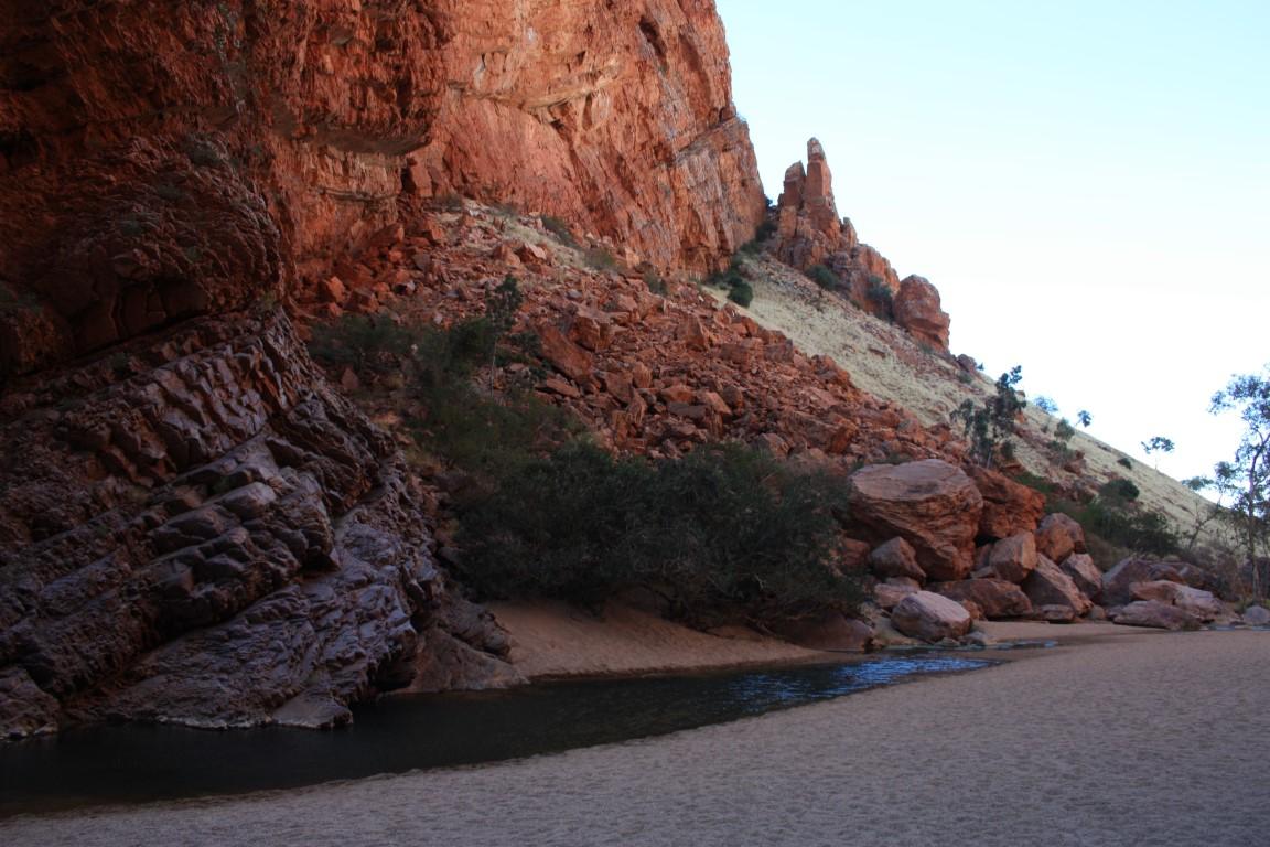
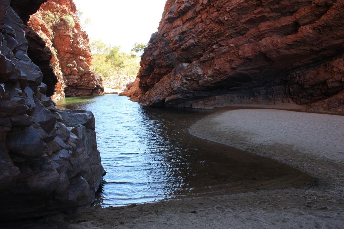
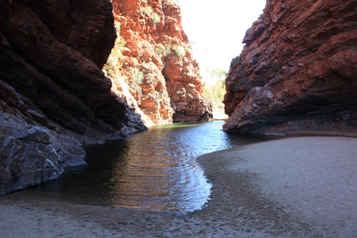
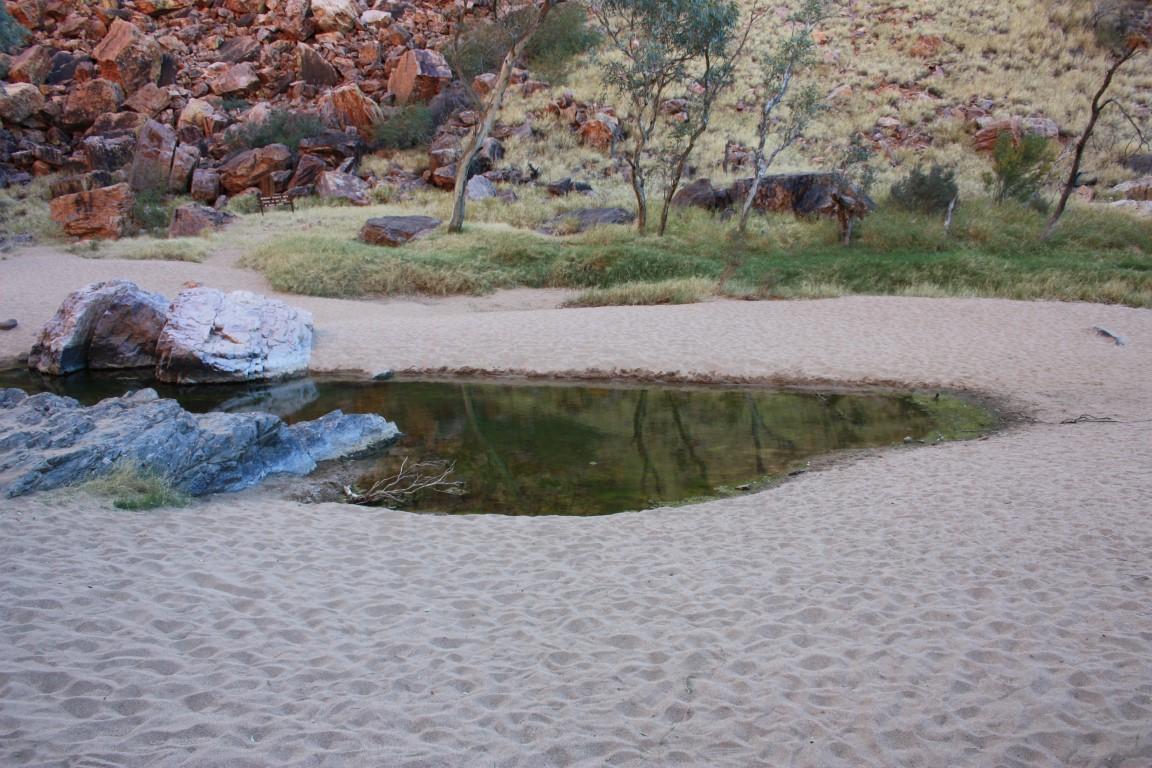
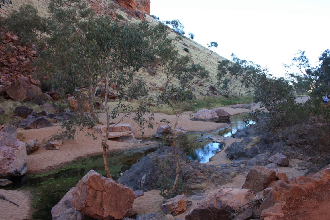
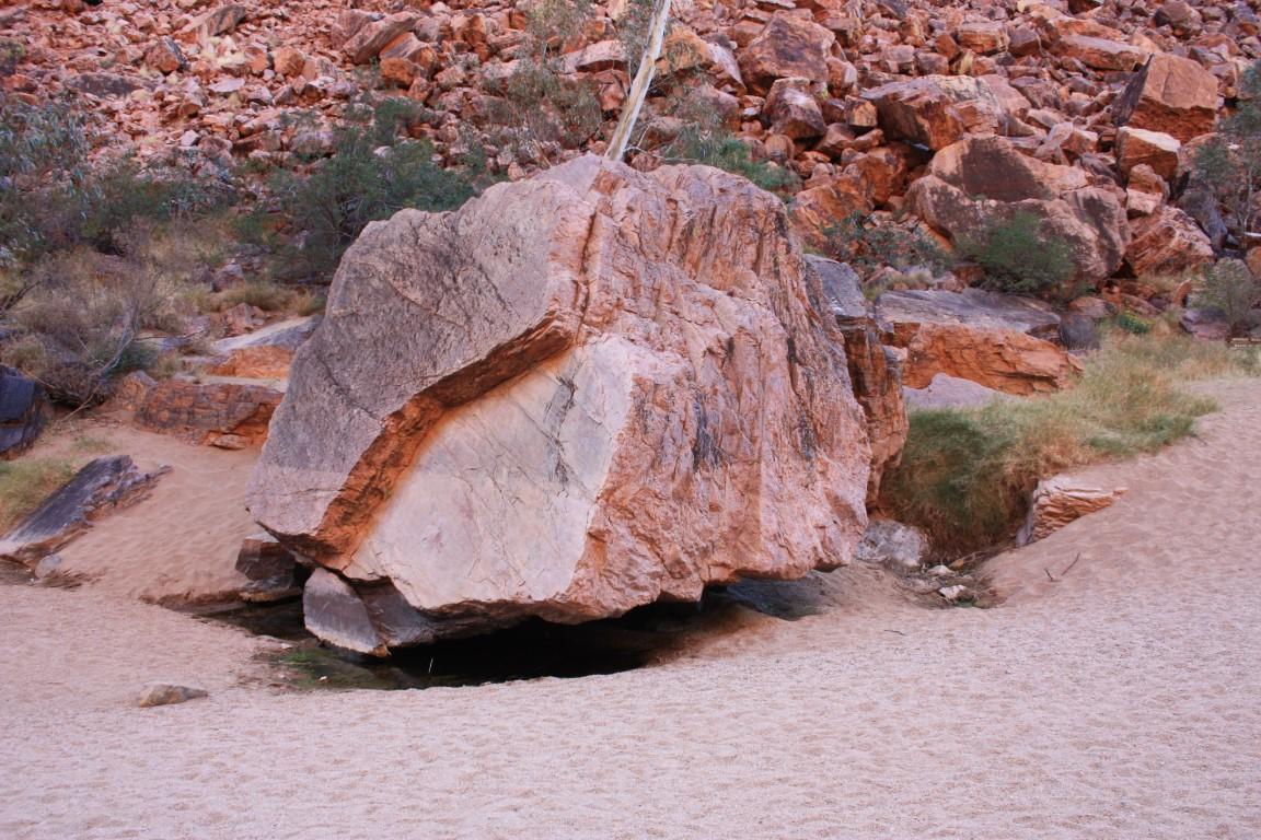
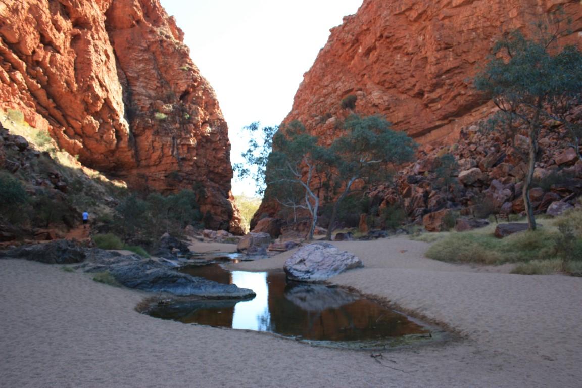
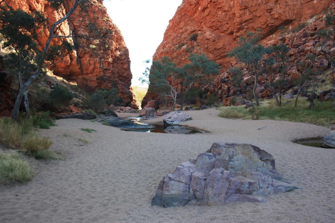
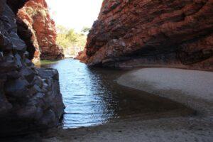
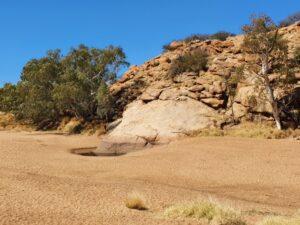
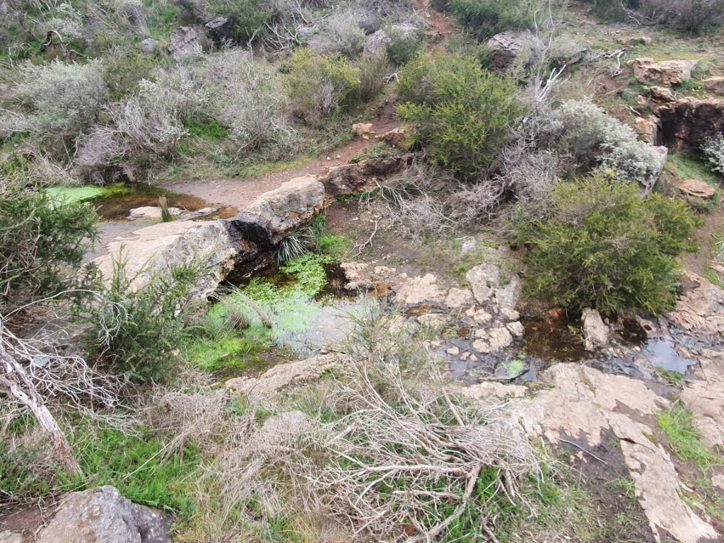
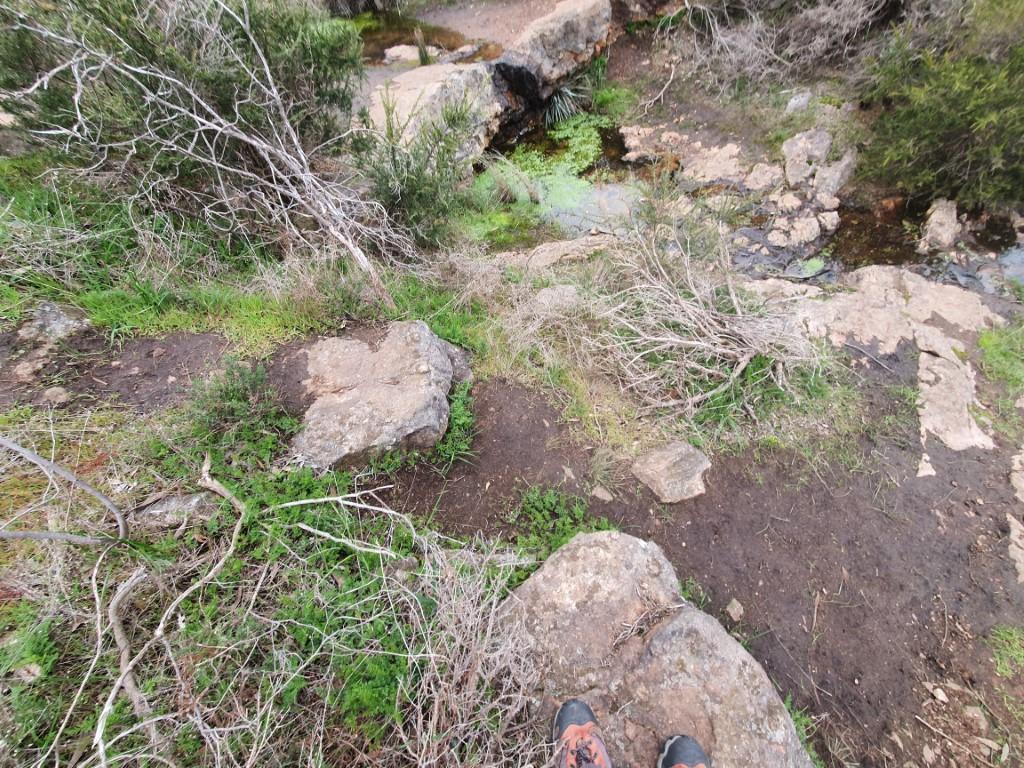
We stayed two nights so that we could break up the drive and also talk a walk to the nearby waterhole and take in the view from the lookout. The waterhole was about 2km from the campground and a fairly flat walk through the scrub. We passed a number of old car wrecks on the track but didn’t really see anything in the form of wildlife.
Arriving at the waterhole we discovered that it was pretty low and not suitable for swimming. Still id a number of small fish living in it despite it slowly shrinkng. It’s amazing that these permanent and semi-permanent water holes can exist in such a hot dry environment. That fish live there is even more amazing.
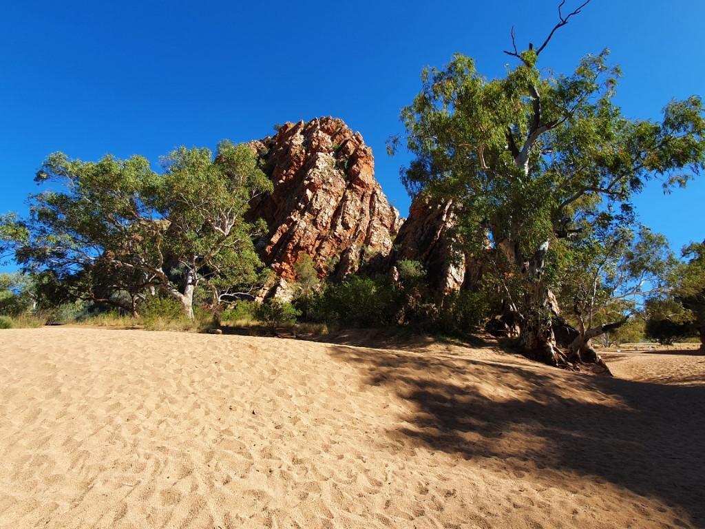
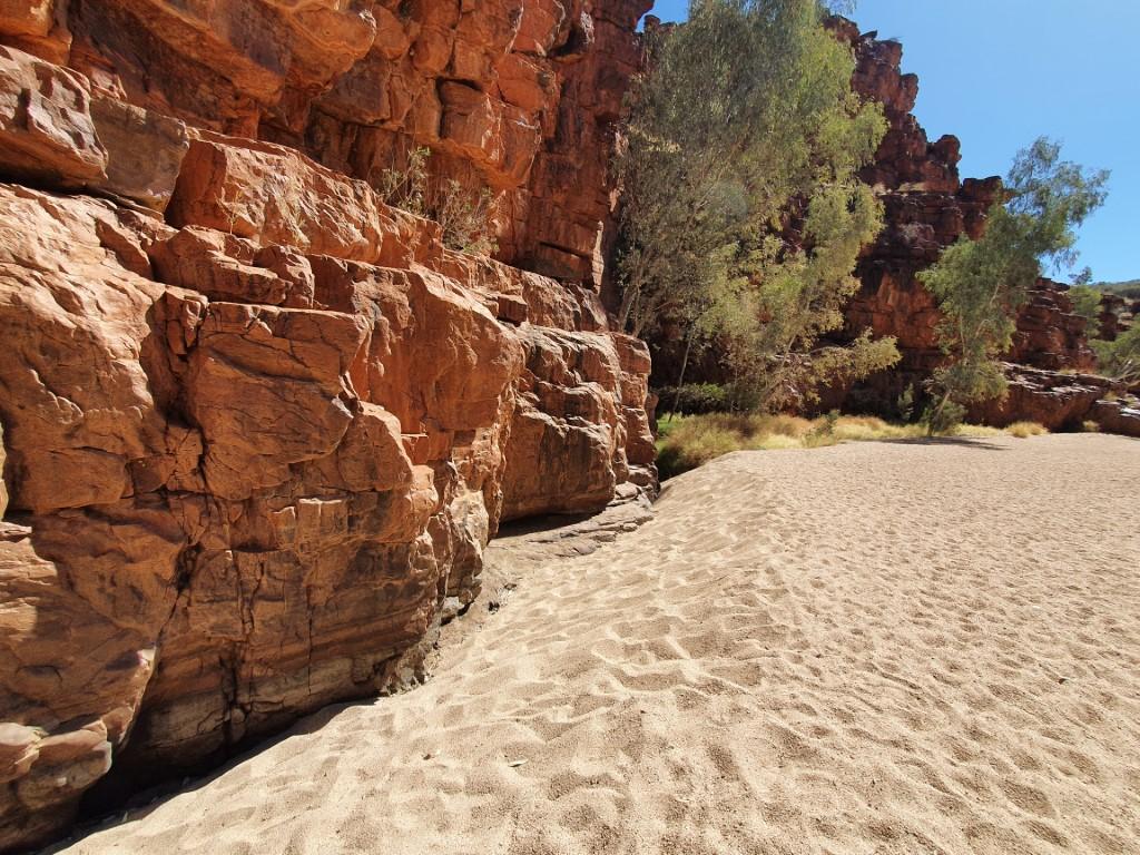
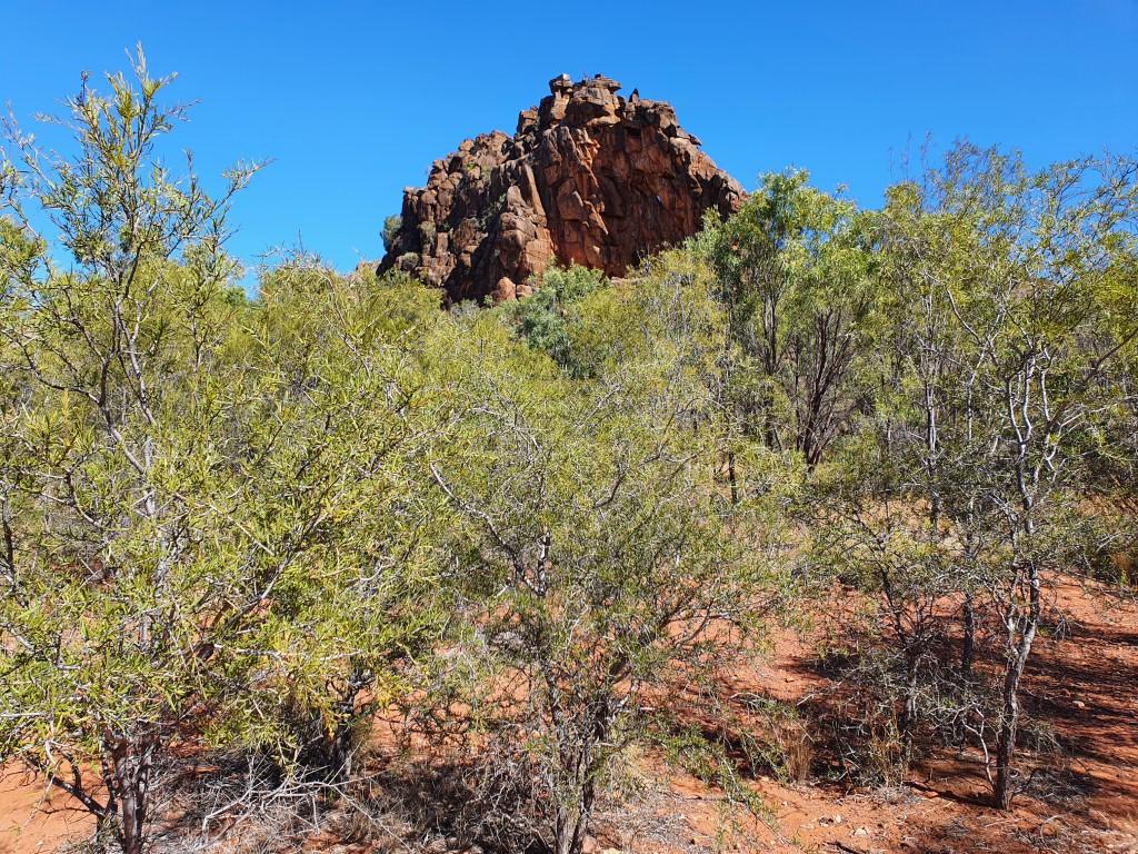
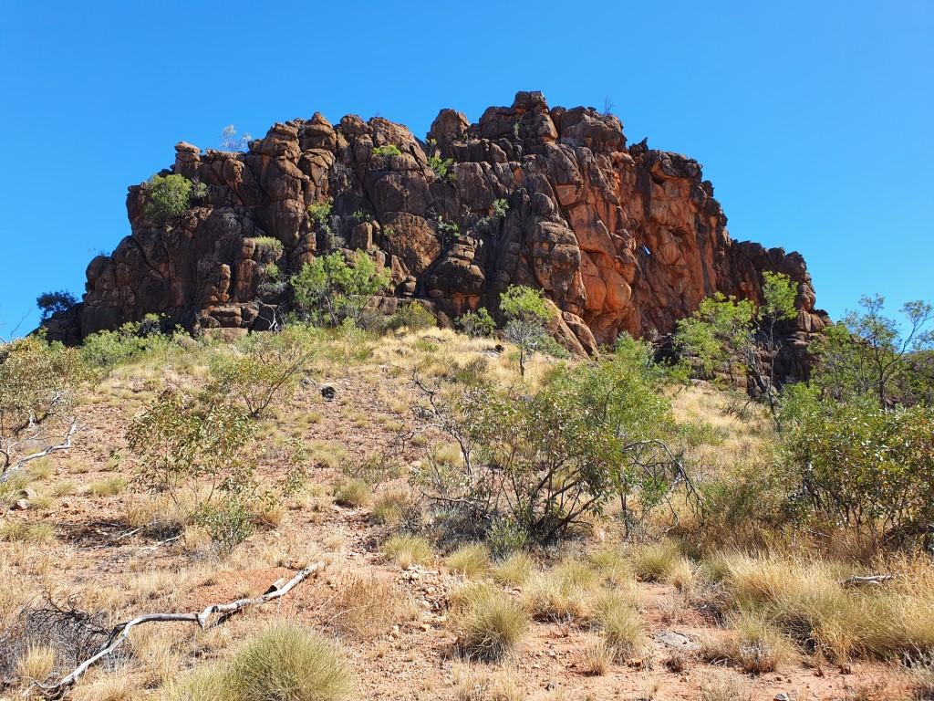
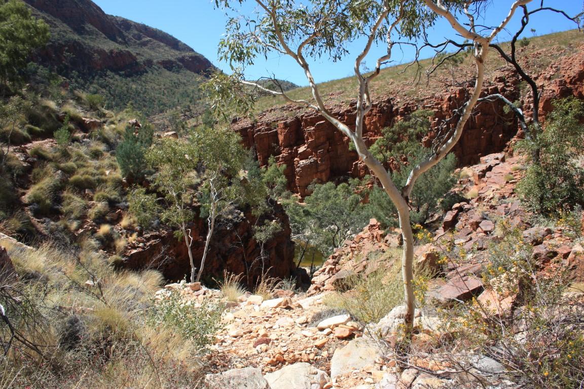
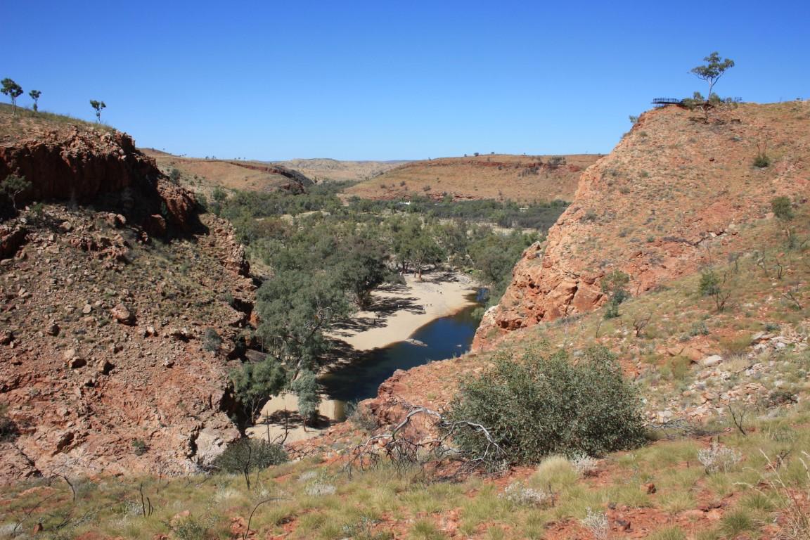
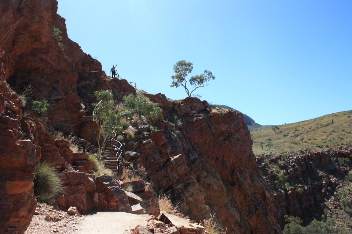
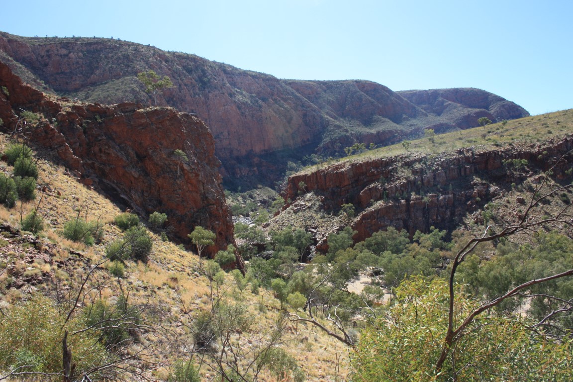
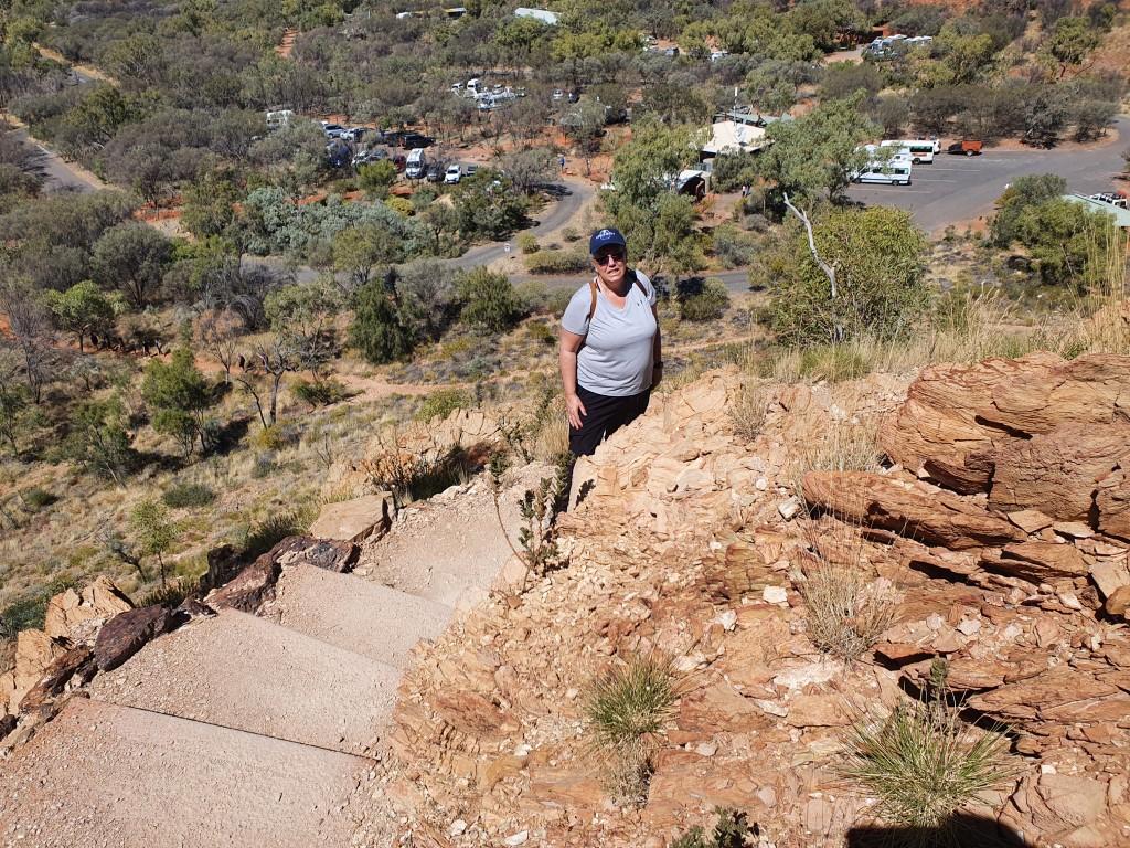
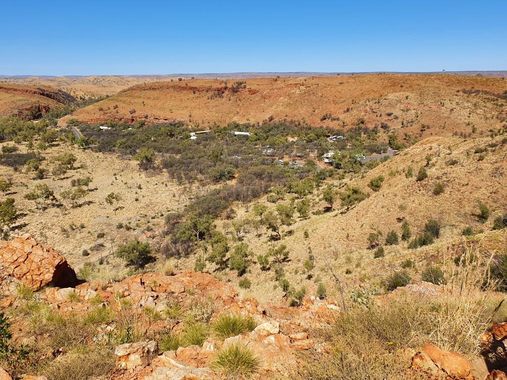
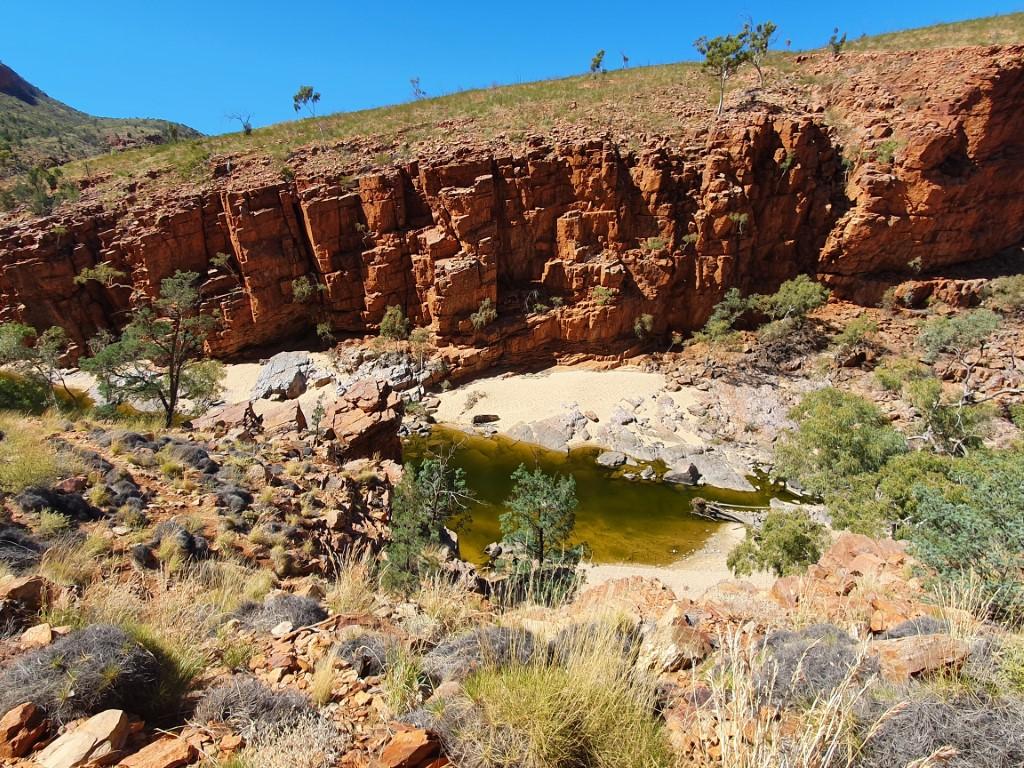
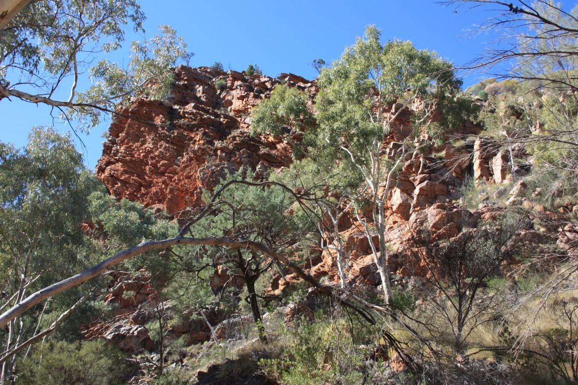
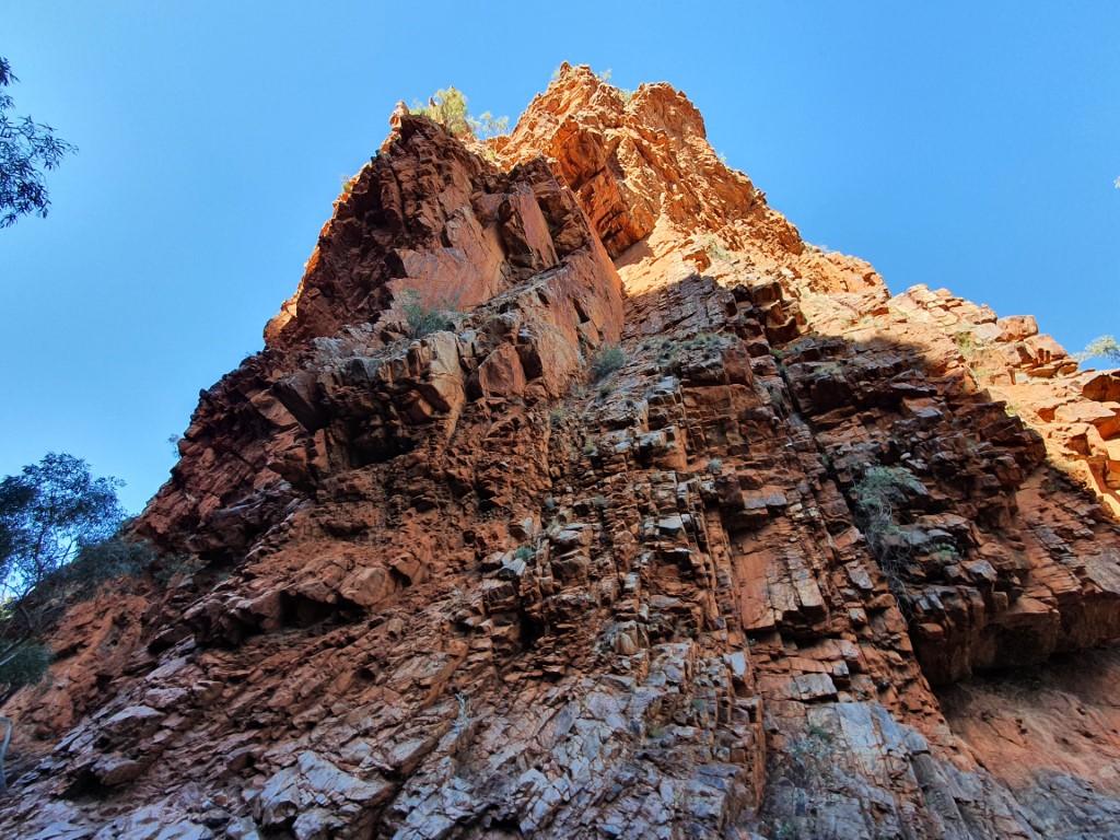
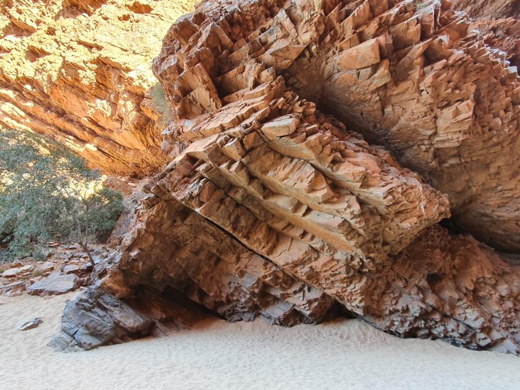
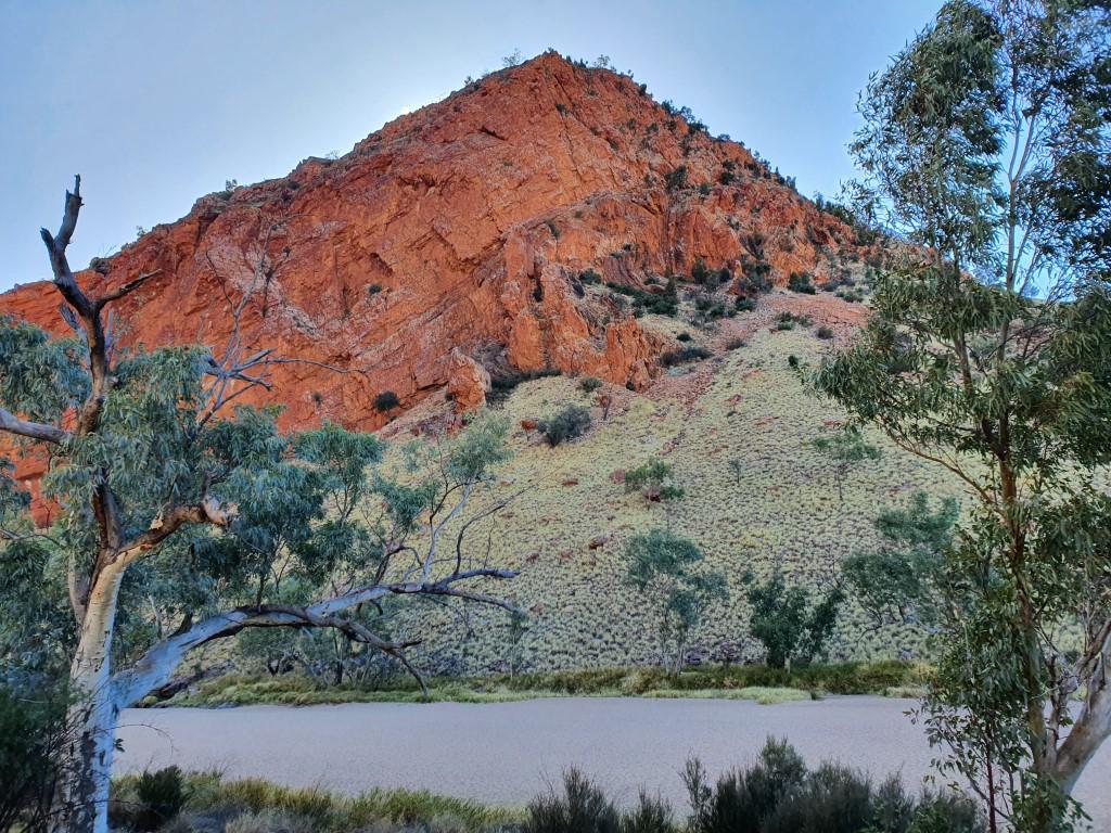
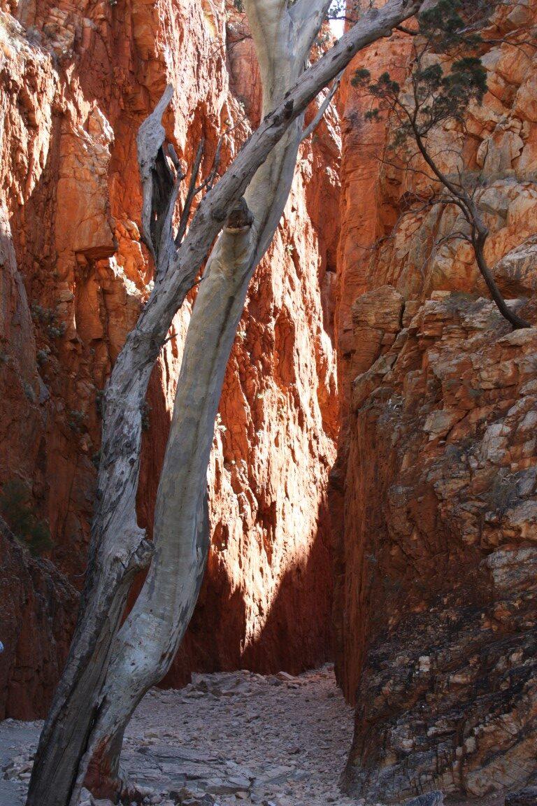
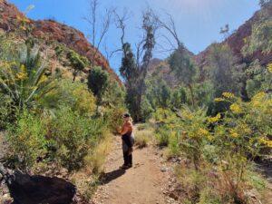
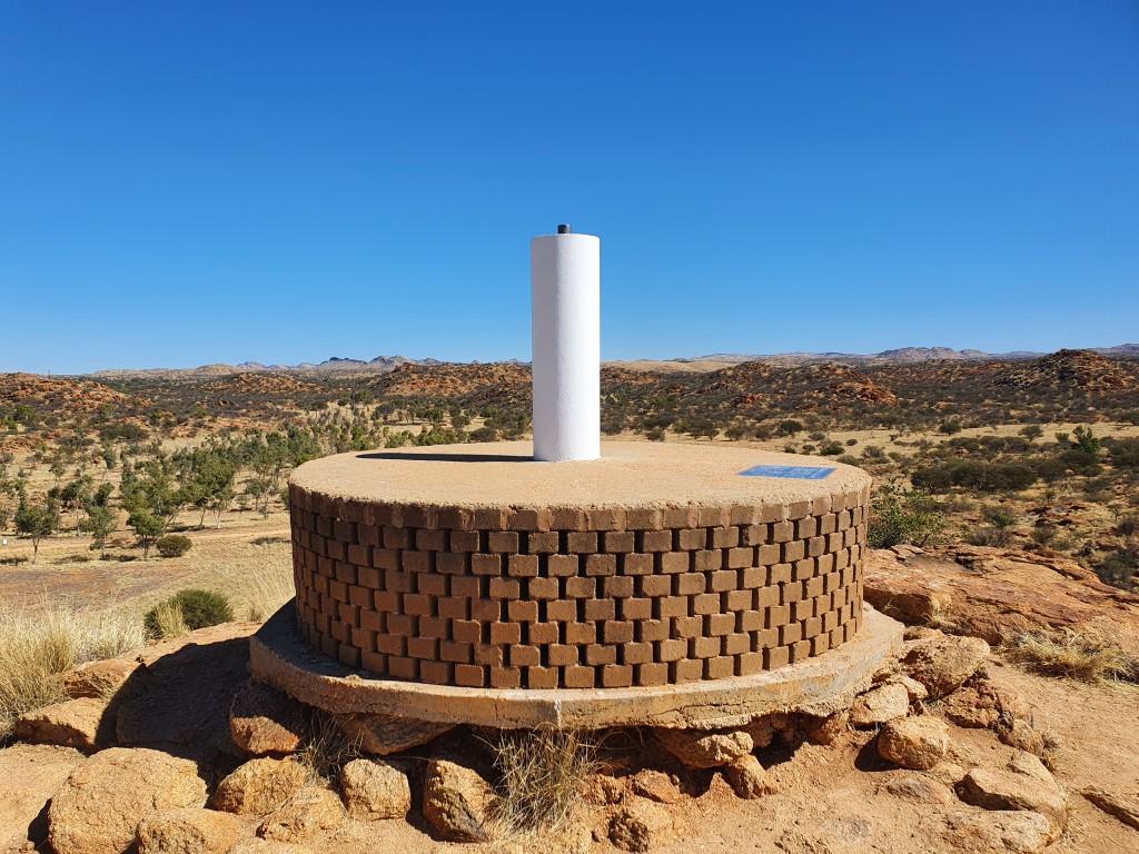
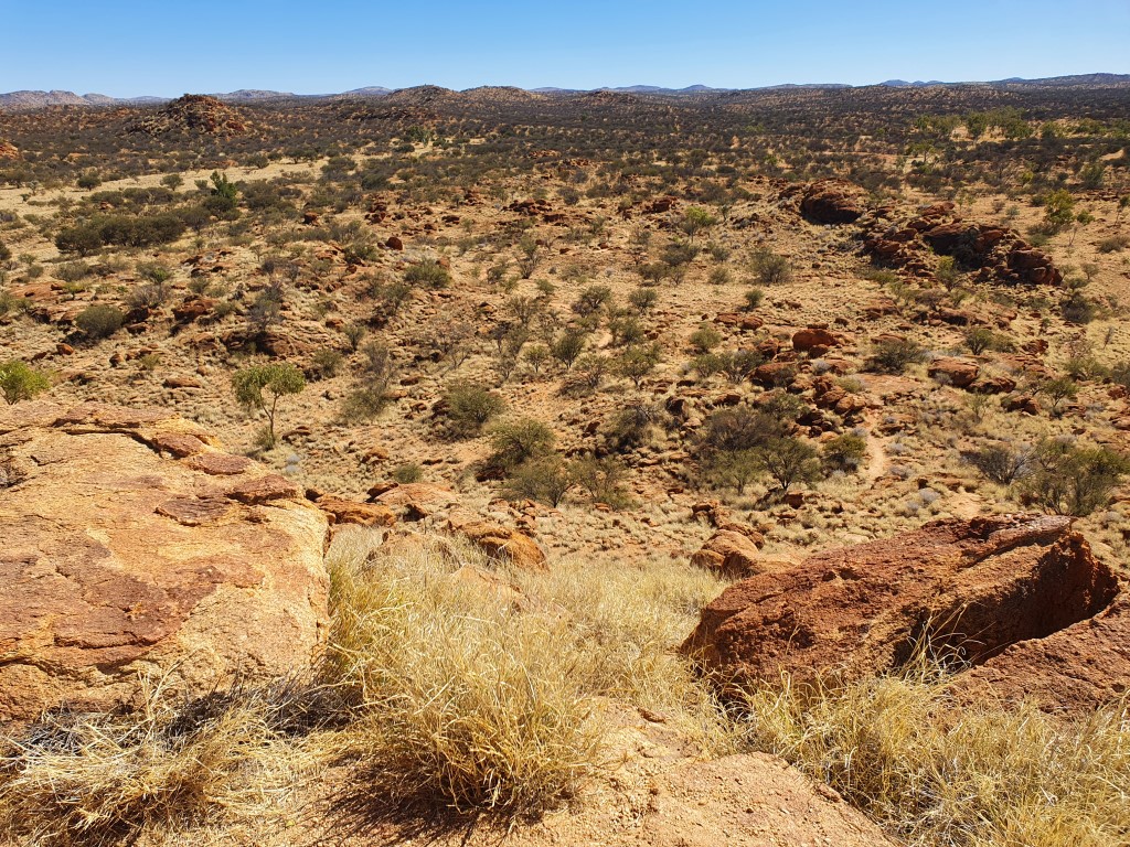
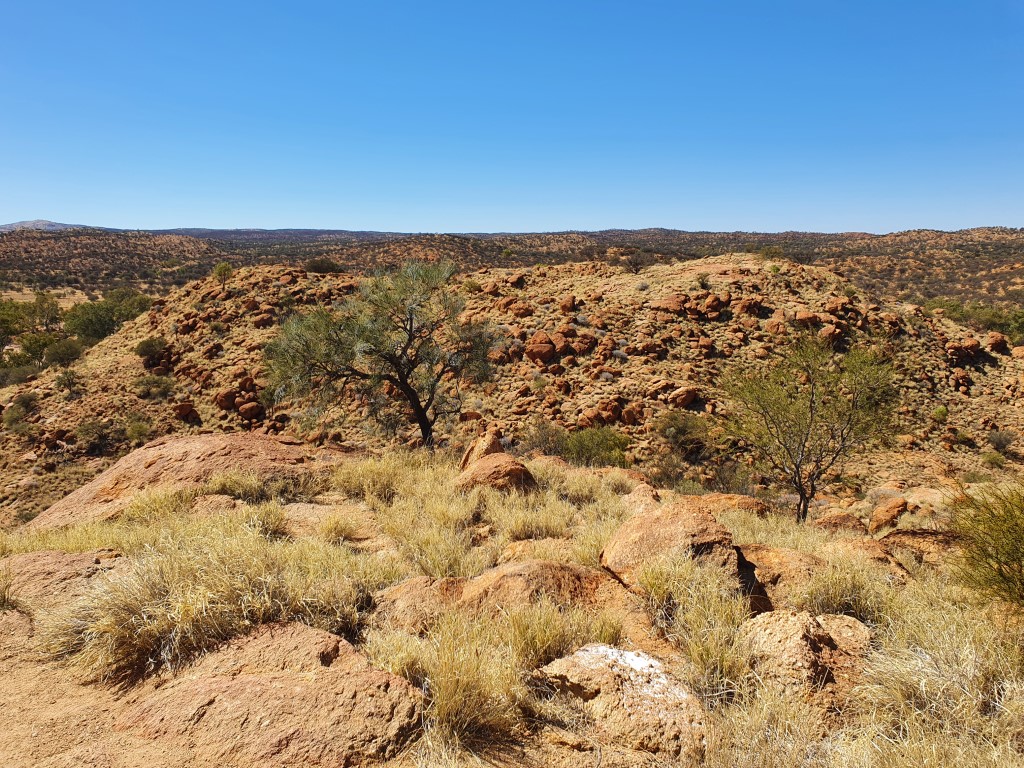
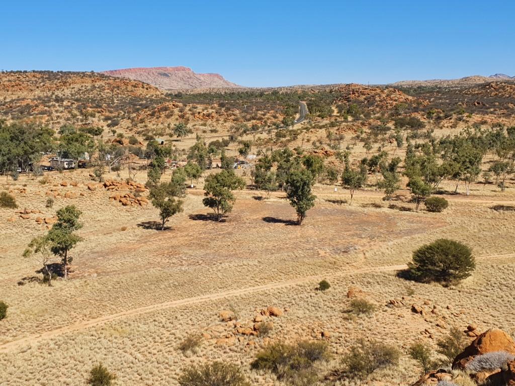
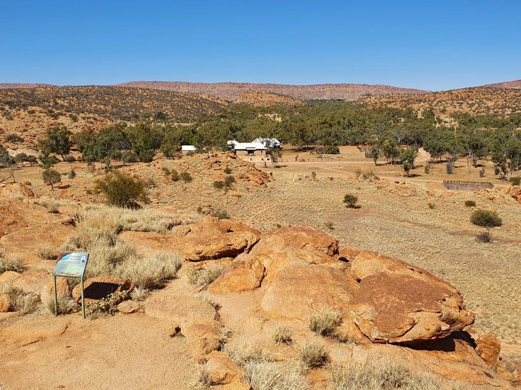
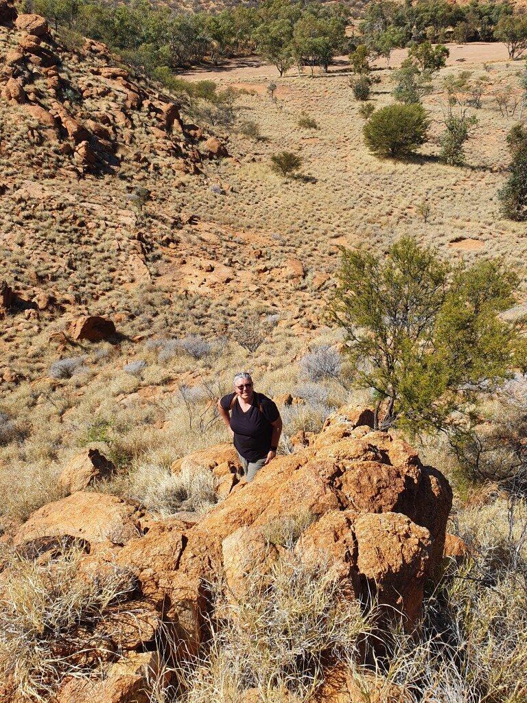
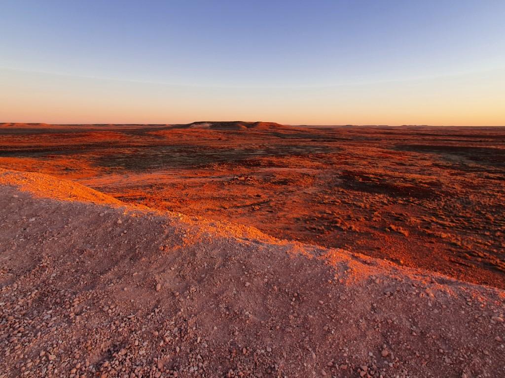
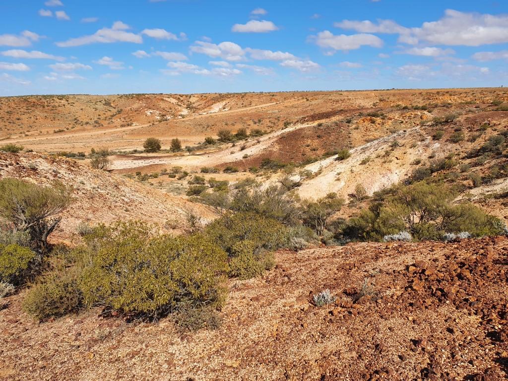
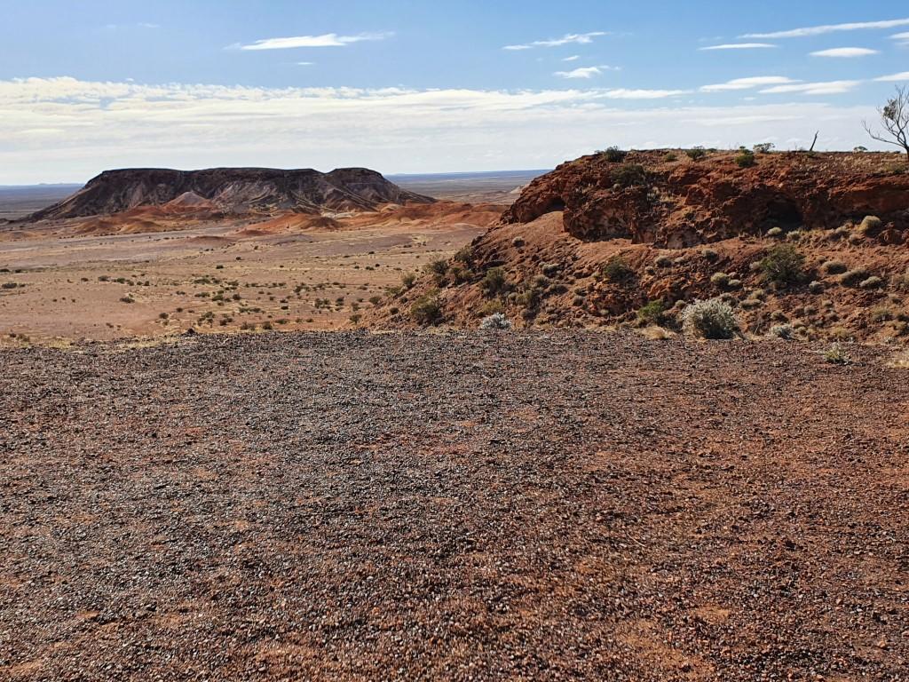
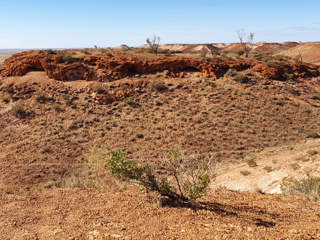
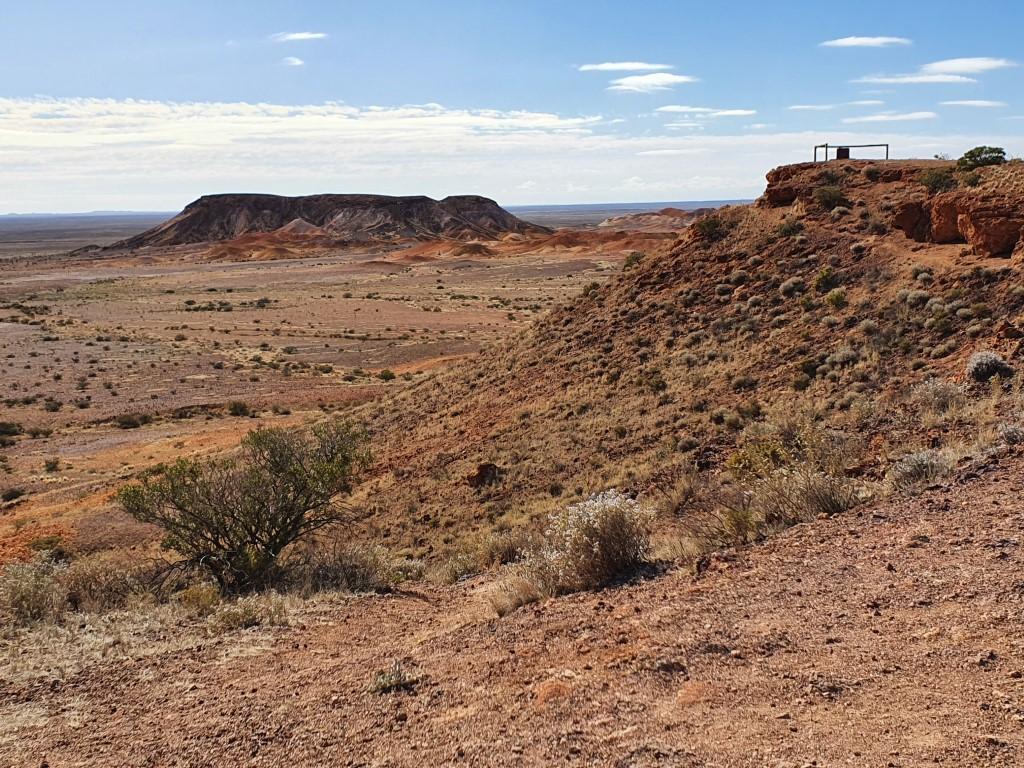
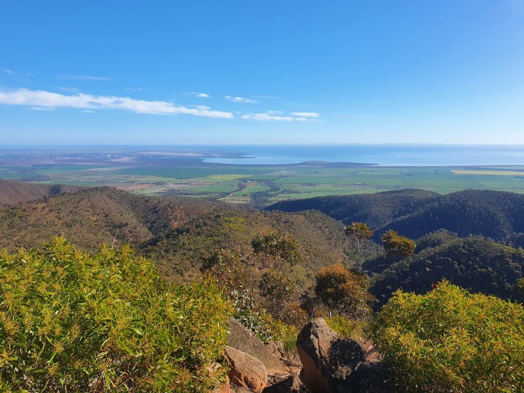
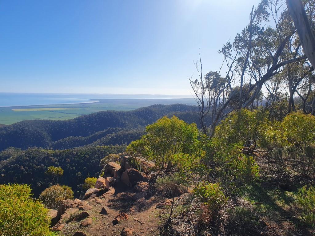
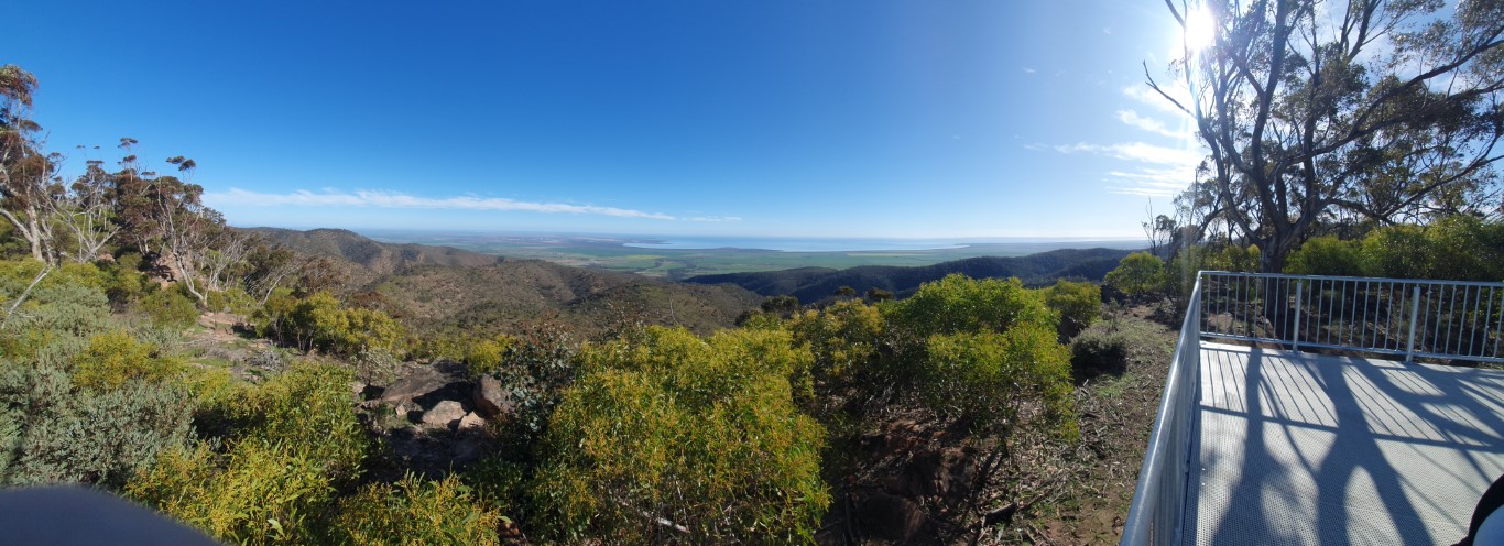
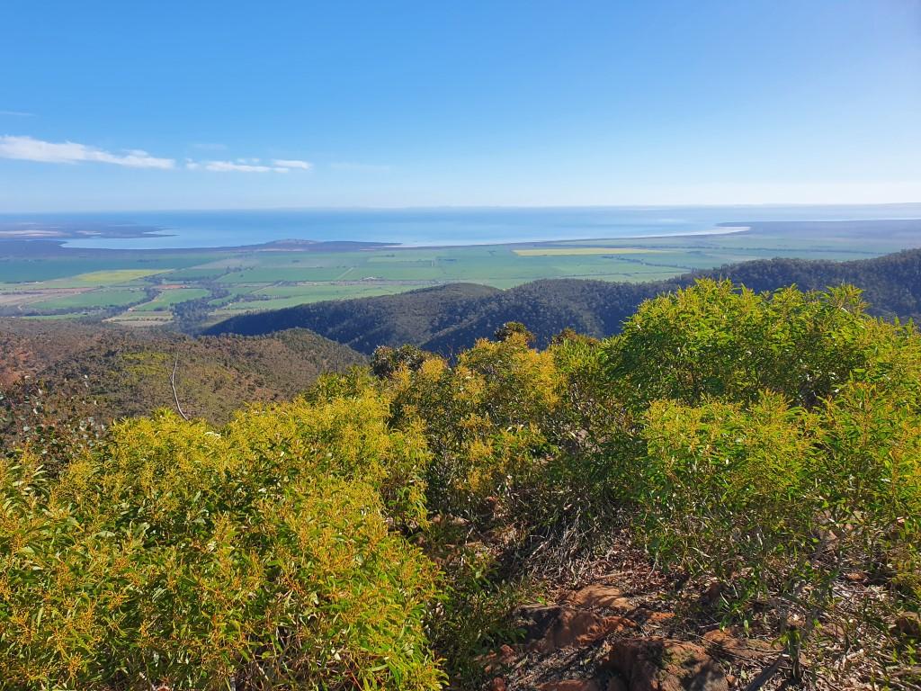
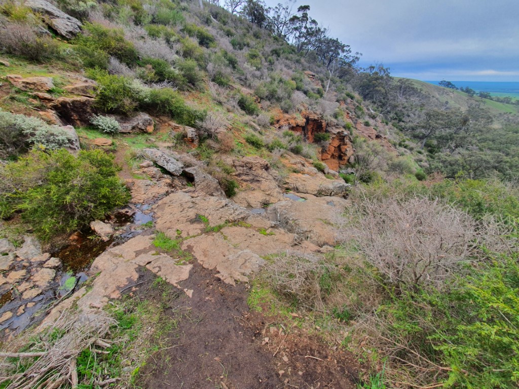
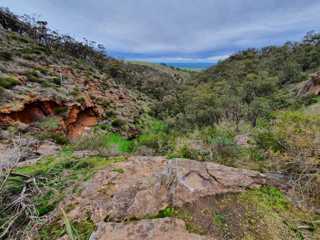
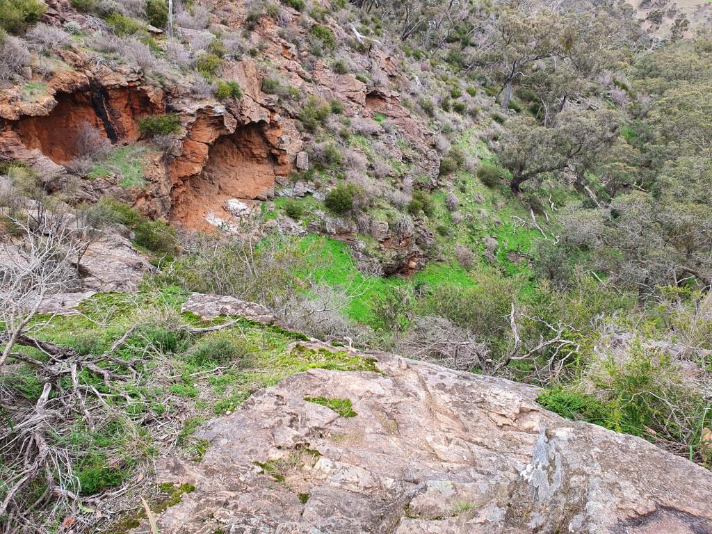
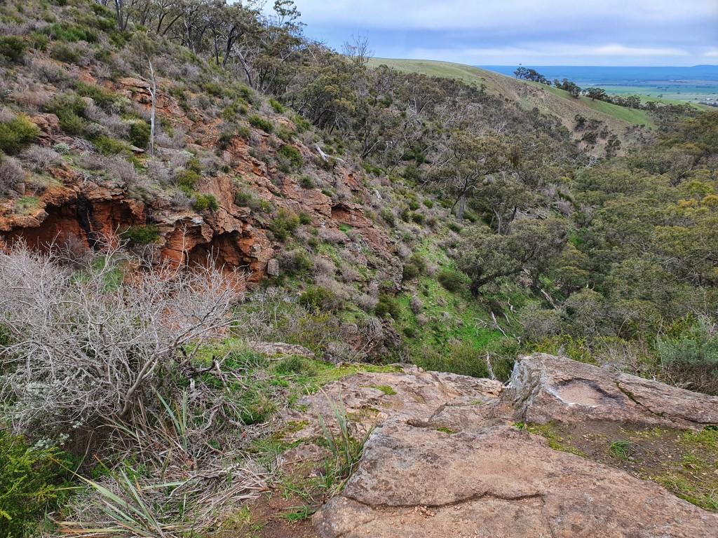
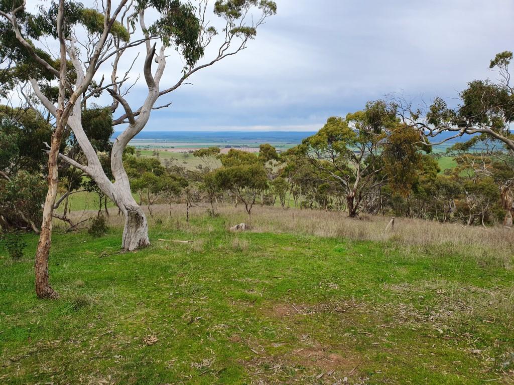
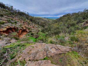
The trail to the lookout
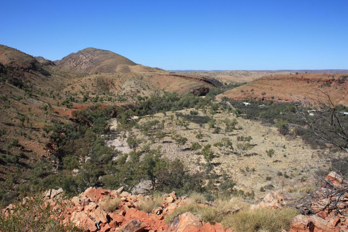
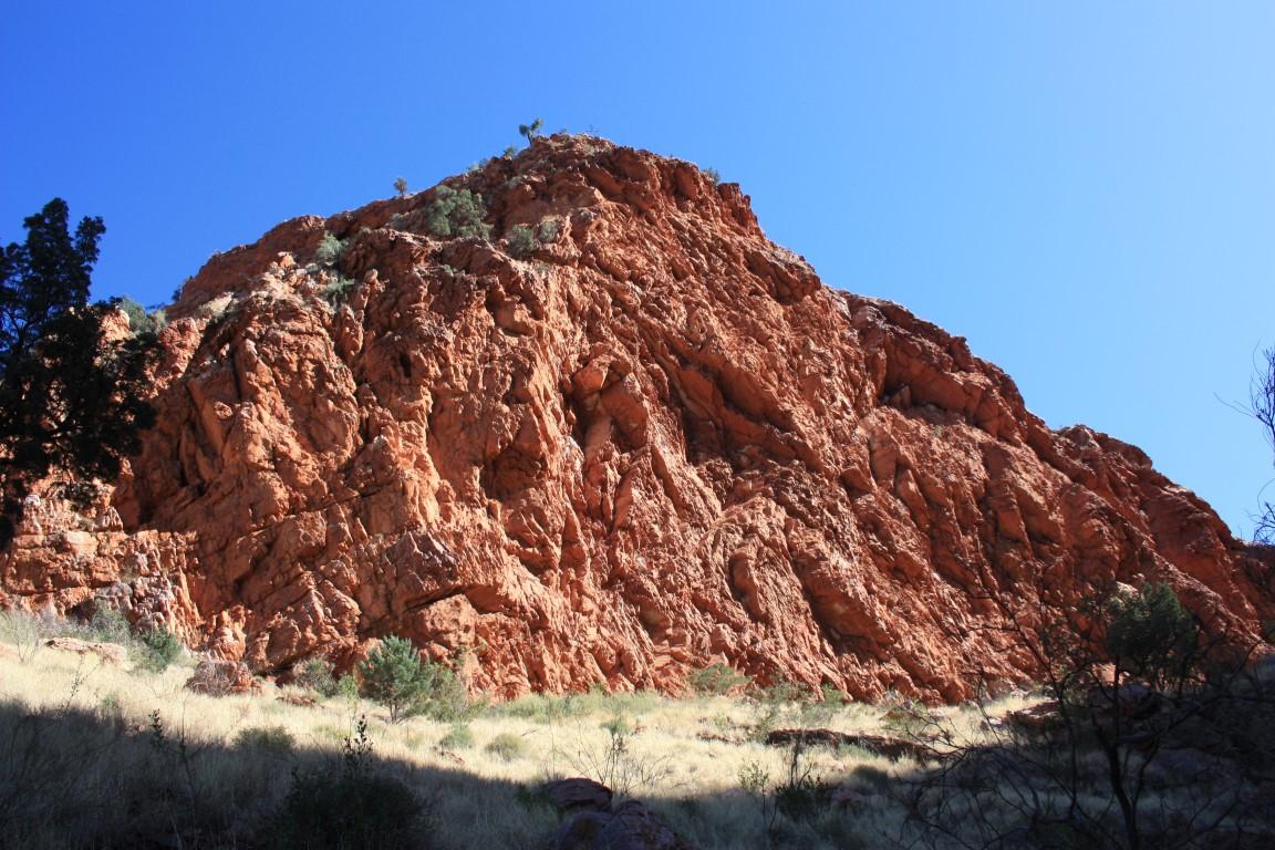
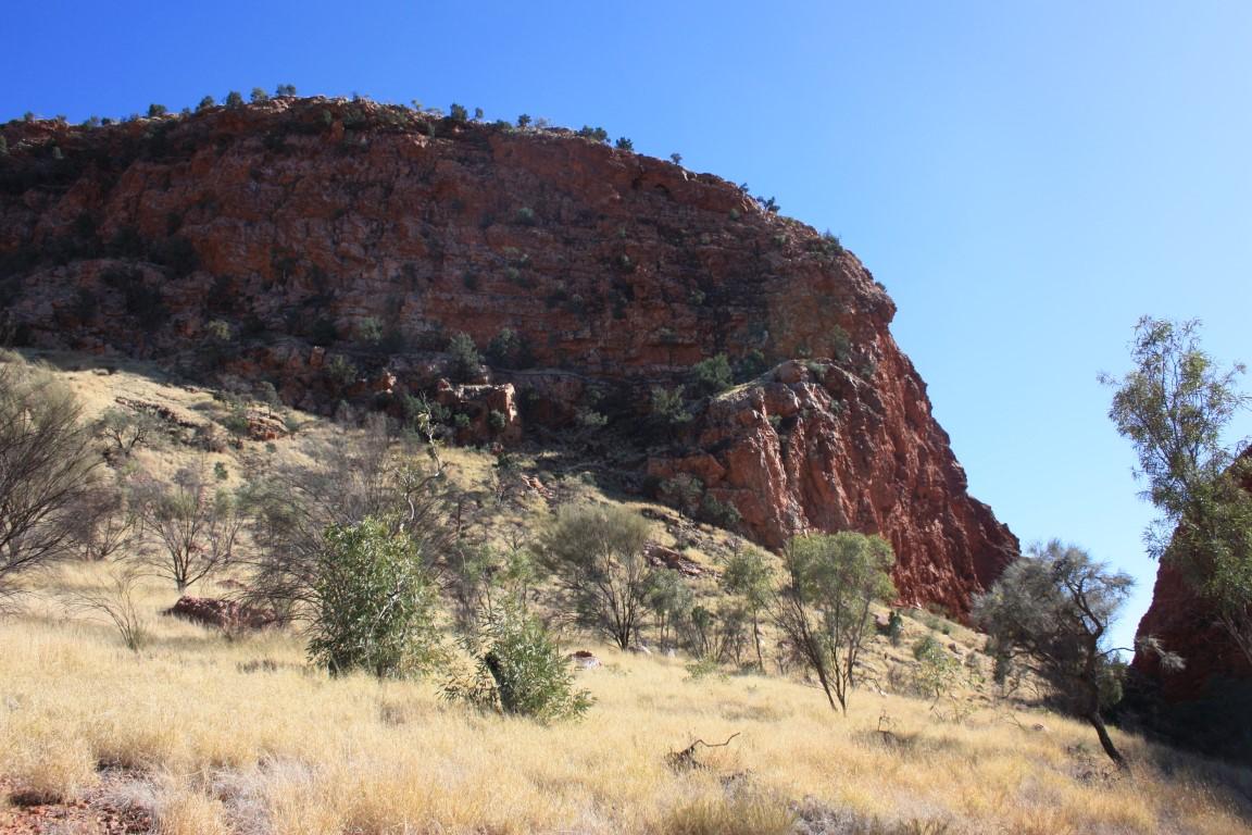
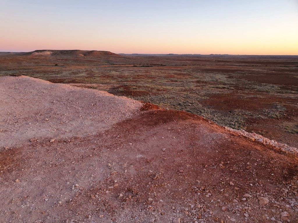
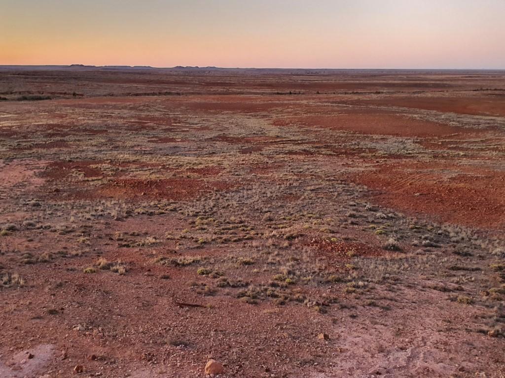
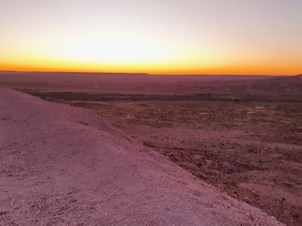
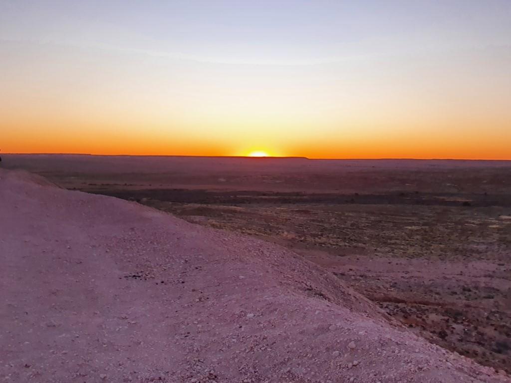
After returning from the waterhole we trapsed up the hill behind the station to the lookout to see Banka Banka Station from above. We discovered that the lookout was a bit of a deception… Upon reaching the top you quickly realise that the lookout is actually a plateau that extends off onto the far distance behind the station, which is really more like a wide valley along the highway. We took the drone up to get a birdseye view of the station and the plateau behind.
We were told by the caretaker that there was a camel in the stock pen near the campground but having not seen one we suspect that this is a bit tourist leg-pulling to see if they fall for it by thinking that the brown Brahman bull is a camel because of the breeds hump…
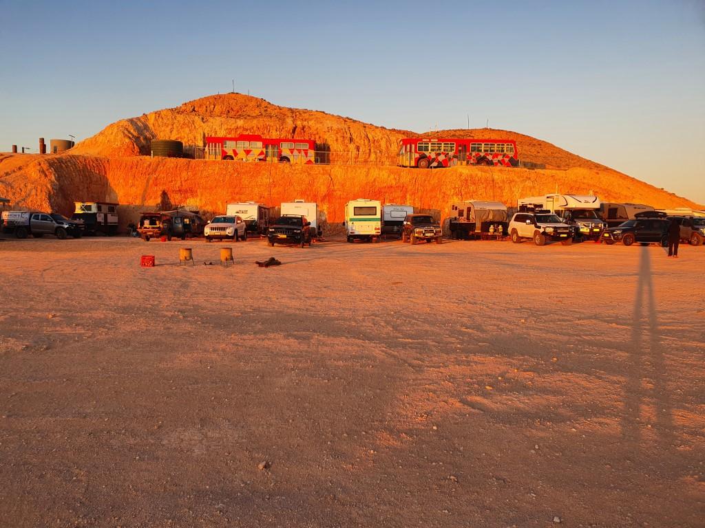
All in all… Banka Banka Station was a really pleasant stopover and we imagine that you could easily stay three or four days earlier in the season with the nightly happy hour, fire pit and live music. As it was we were arriving towards the end of the season and things were beginning to slowly wind down as campers either header north or south for the coming wet season.
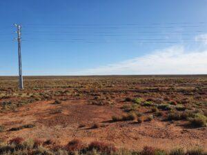
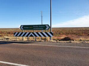
So… a long 391km tow up the Stuart Highway from Alice Springs to Wauchope where the Devils Marbles are located. The township (roadhouse) of Wauchope seemed a little weird since Rob grew up in Kempsey, where the somewhat more sizable town of Wauchope was one of the nearby places. The Stuart Highway really is an amazing piece of tarmac… In such good condition considering that the bulk of the traffic is caravans and road-trains. Driving 100km on the Pacific Highway is more tiring than 400km on the Stuart Highway…
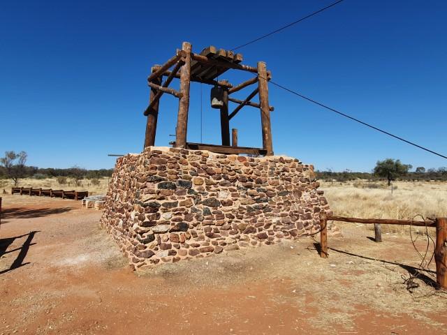
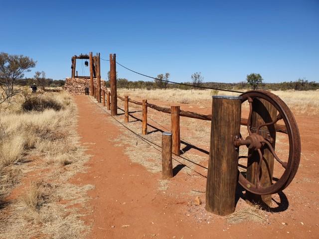
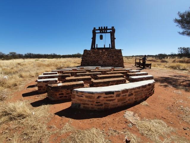
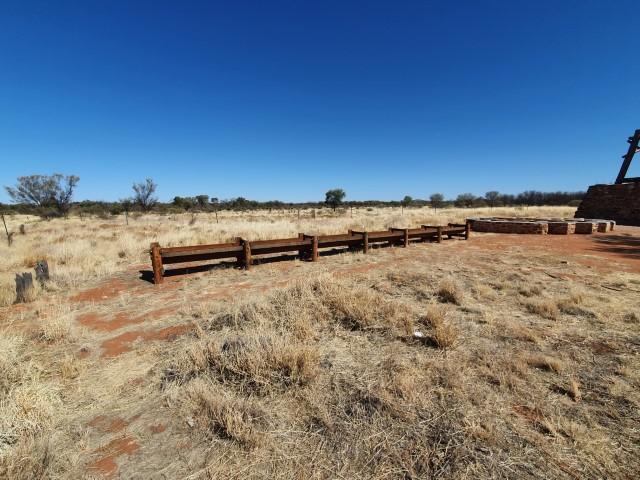
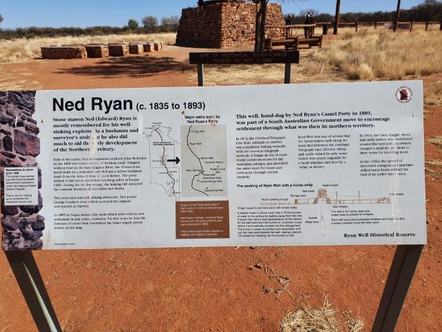
Ryan Well
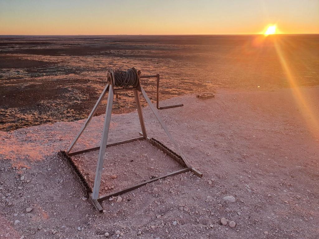
Ryan Well camel powered bucketRyan Well camel powered bucketRyan Well camel powered bucketRyan Well water troughRyan Well
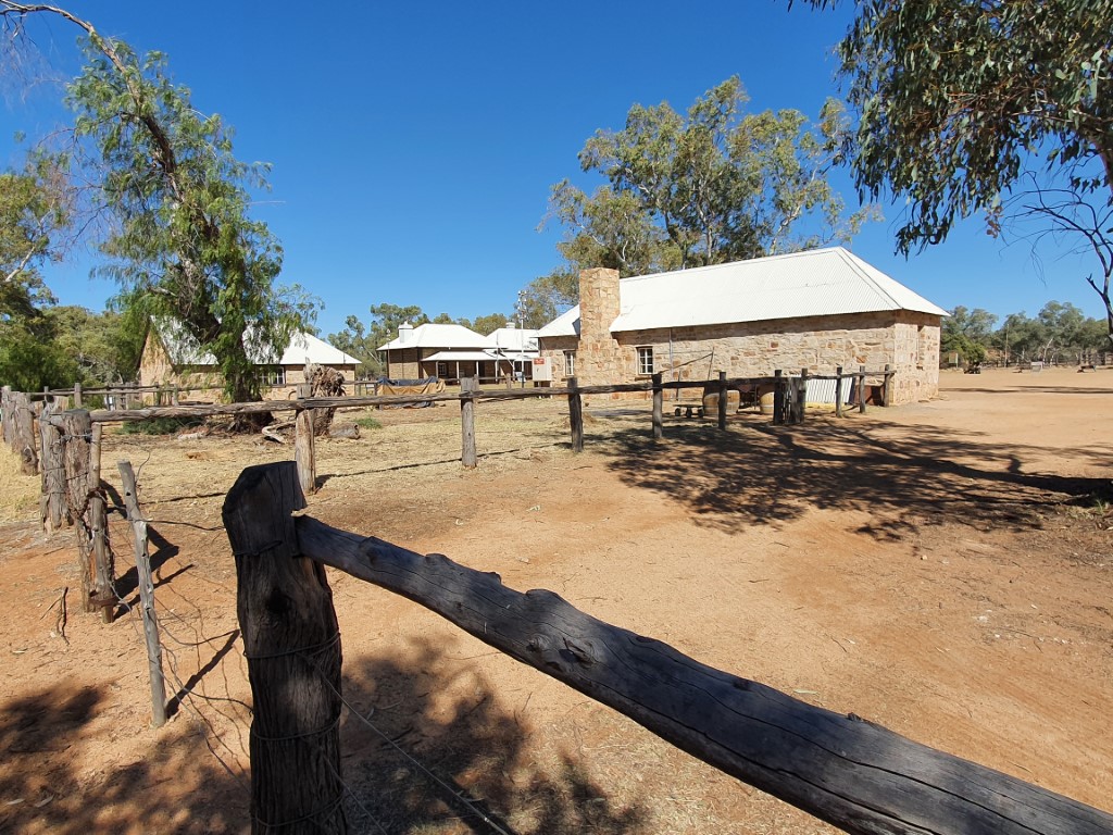
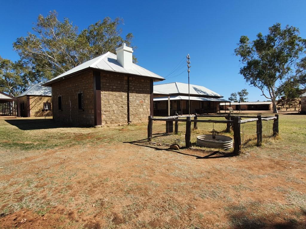
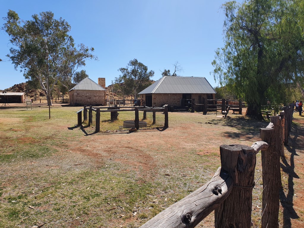
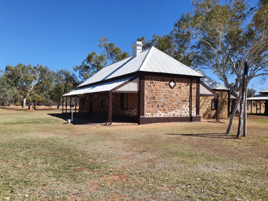
Ryan Well was not too far out of Alice Springs… by outback standards. It is an extremely well preserved well that was dug to support the teams of workers on the Overland Telegraph, the significance of which increases the further you go up the centre.
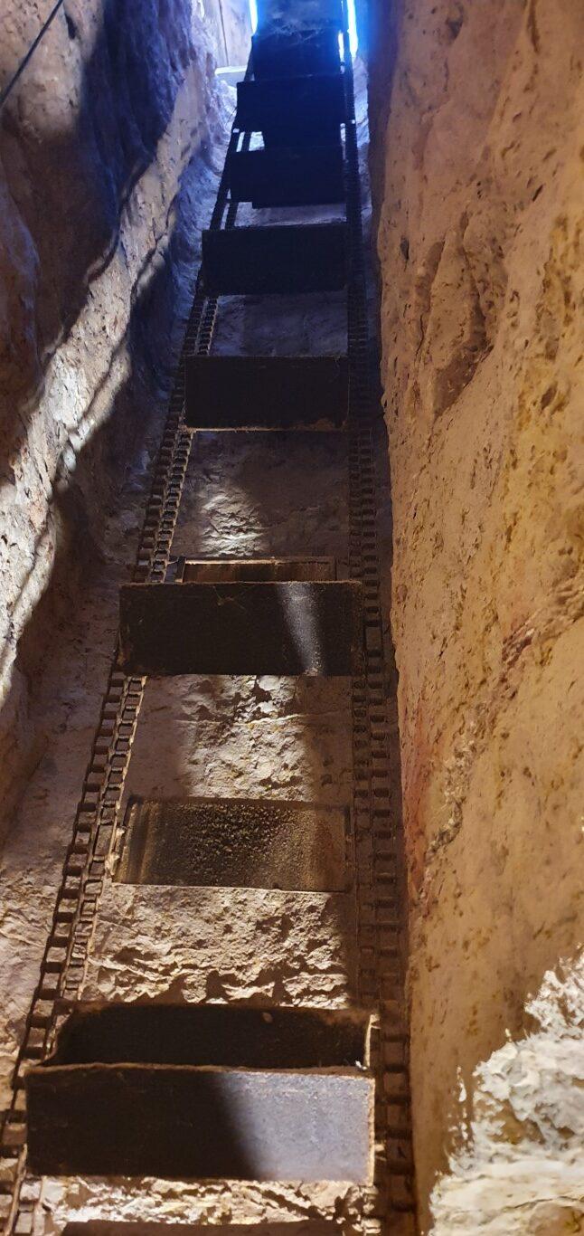
It’s quite a large well structure, which has undergone some restoration, consisting of a walled well with large bucket, a long livestock trough, the remains of a tank stand and a long cable driven bucket lifter that was powered by camels or horses. The well was hand dug and is one of a number of wells along the Overland Telegraph route.
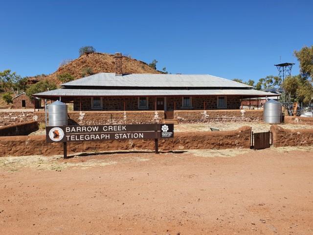
Barrow Creek
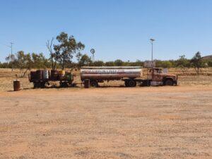
Barrow Creek Telegraph StationBarrow Creek BarBarrow Creek tanker wreck
Barrow Creek tanker wreck
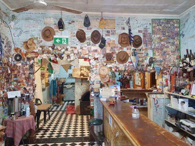
We had a lunch break at Barrow Creek and the Barrow Creek Roadhouse, which was a bit of an outback experience… The roadhouse has seen better days but is still operating. We ‘enjoyed’ a pie from the pie warmer, that needed to be microwaved to make it warm, and cold drink served by a friendly local. It was really just an excuse for a toilet break (50c surcharge for non-customers)…
Barrow Creek Bar
The walls of the bar were wall-papered with bank notes, mostly $5 notes and mostly Australian, on which visitors have written their names to signify their visit to Barrow Creek. Since cash is rarely used these days we weren’t carrying anything less than a $50 so didn’t join ritual.
Barrow Creek Telegraph Station
Next door to the roadhouse is the Barrow Creek Telegraph Station, the first repeater station after Alice Springs. It is also well preserved but we opted not to visit as we were in the heat of the day with a long drive ahead of us.
Devils Marbles Hotel (Wauchope)
Devils Marbles Hotel Beer GardenDevils Marbles Hotel Beer GardenDevils Marbles Hotel Beer GardenVery beefy Beef CheeksWrapped Chicken SpecialRusty wrecks at Devils Marbles HotelDevils Marbles distances
Devils Marbles distances
We pulled in at the Devils Marbles Hotel, about 10km south of the Devils Marbles themselves and settled in for a lazy afternoon/evening before visiting the Devils Marbles the next day. Jo went in to to book us in as the group of bikers we encountered at Wycliffe Well roared past. You can read about this in the Biker Encounter tab.
Rusty wrecks at Devils Marbles Hotel
From the outside the Devils Marbles Hotel looks a bit barran and quirky but once you pull around the back you encounter a large caravan/camping area that backs onto a really impfessive beer garden, dining area and pool.
There’s not all that much to do at the hotel other than happy hour in the beer garden, which we were more than happy to partake of. The beer garden was really well done with rough slab style benches and tables under shade and pretty good drinks prices with a fair selection.
Devils Marbles Hotel Beer Garden
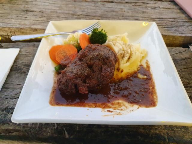
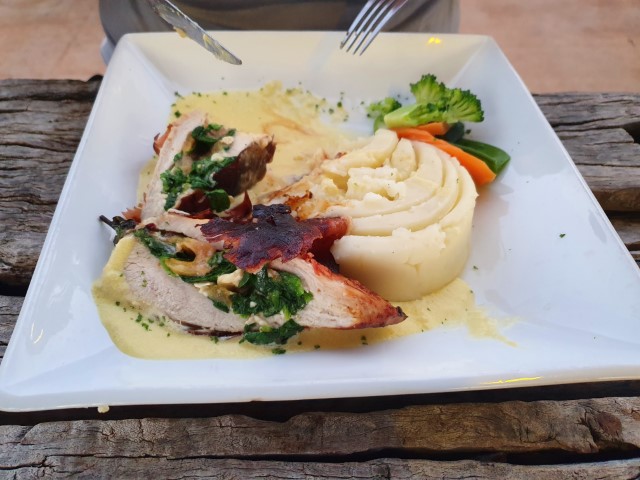
Dinner was another matter again… Rob enjoyed a plate of braised beef spare ribs and Jo went for that night’s special, proscuitto wrapped stuffed chicken breast. Both absolutely magnificent and as good as you’ll get anywhere else (and pay more for). Nobody starves in an outback roadhouse…
All in all, our stay at the Devils Marbles Hotel was very comfortable and quite memorable after one of our longer tows to get there…
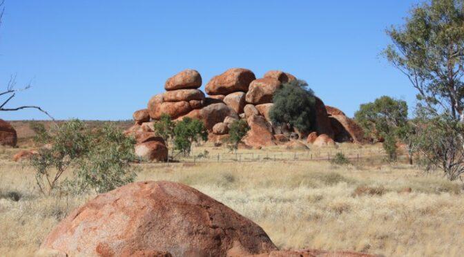
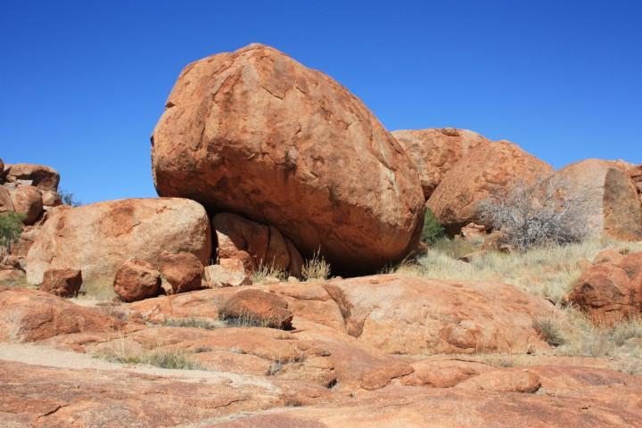
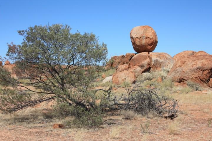
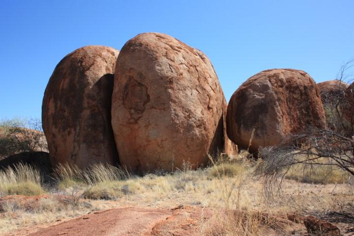
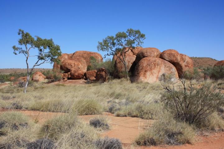
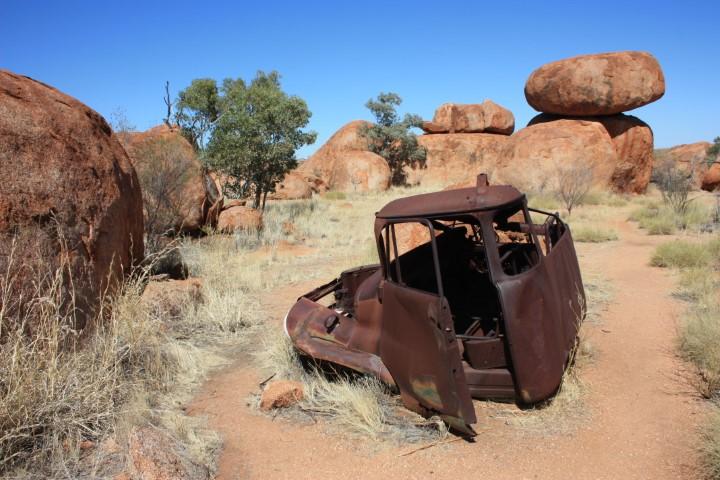
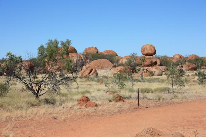
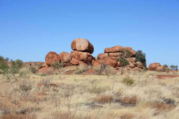
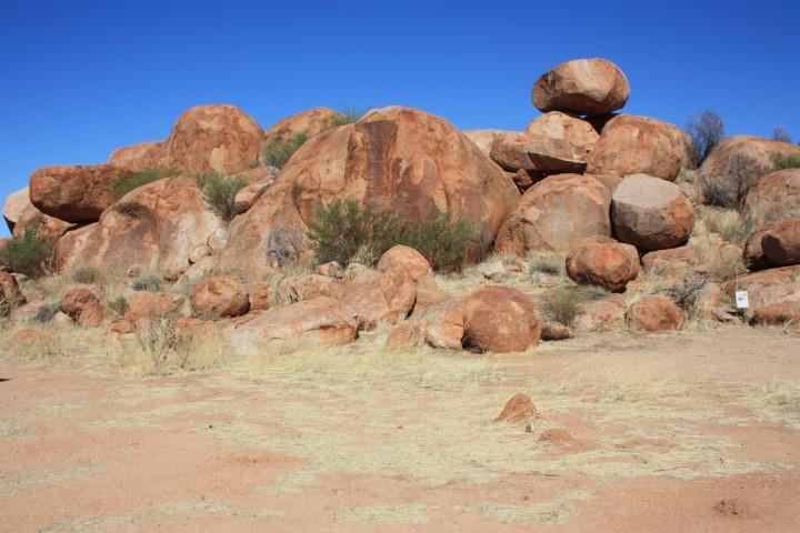
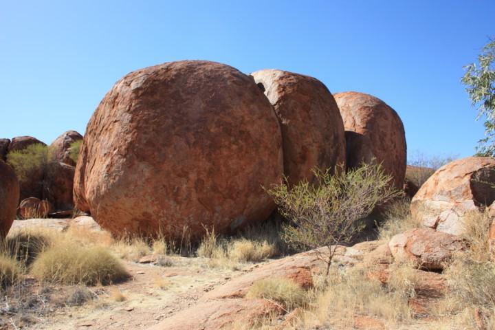
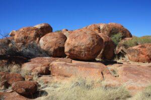
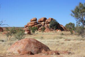
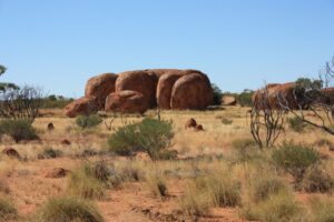
The Devils Marbles are an absolutely remarkable group of weathered rounded granite rocks that just pop up out of nowhere as both a jumbled but orderly piles of earthy red boulders scattered in clumps and groups over a few square kilometres.
Missed!!!
As with most of these places they are a significant sacred site to local Alyawarre indigenous people and neighbouring groups. There is a free-camp campground at the site, which is quite close to the main viewing area and is also the start/end point of some walking trail that takes you around the entire site for about 5km or so and crosses the Stuart Highway at two points.
Karlu Karlu – Devils Marbles
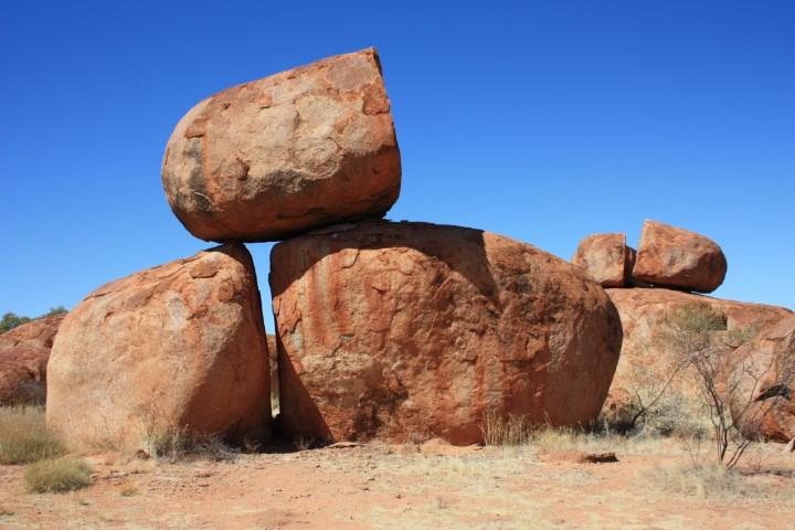
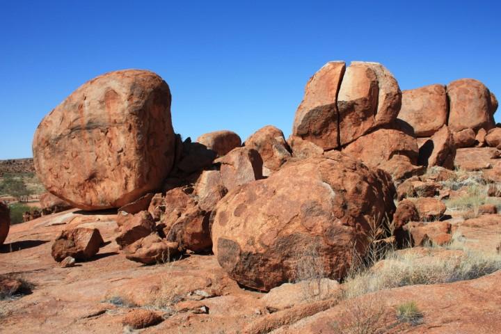
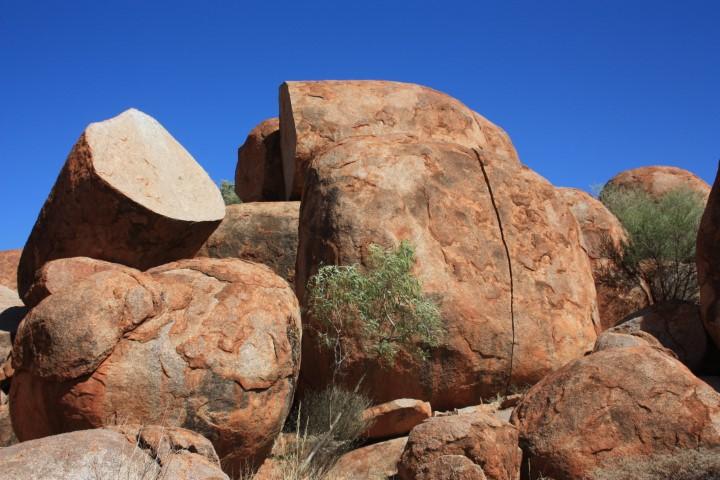
The ‘marbles’ are huge granite boulders that have weathered and eroded over millenia into a series of groups and clumps of rounded balls, some of which are stacked on top of each other like a croquembouche tower.
Karlu Karlu – Devils Marbles
Other formations create a string of marbles, while others have a single marble perched on top of another as though it is balancing in place. Each formation is completely unique and interesting in its own right.
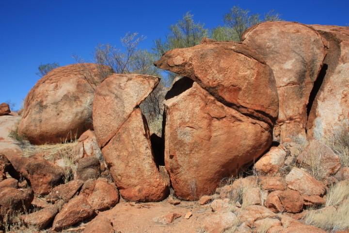
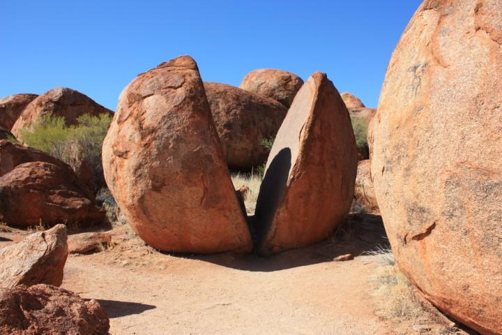
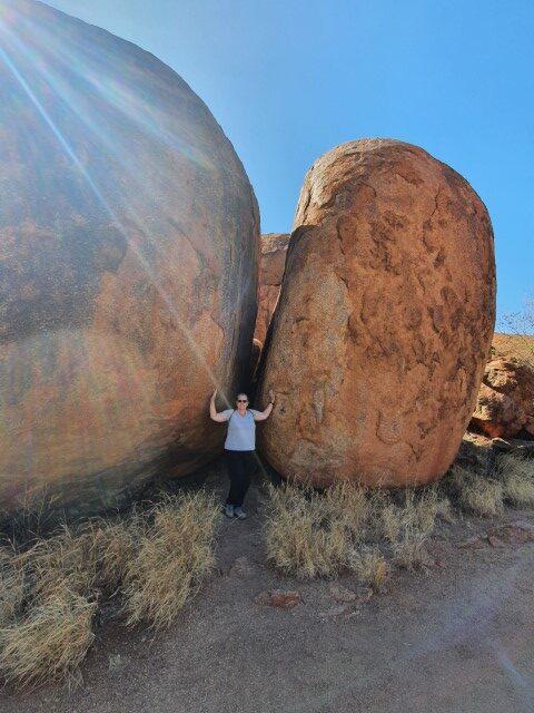
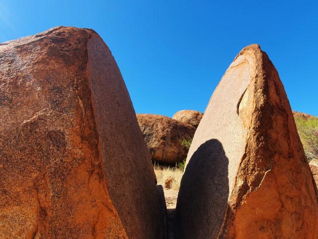
Weather split boulder
A few of the boulders have split cleanly down the middle through expansion and contraction in the baking sun and cooler overnight temperatures. The split face of these boulders show a ring known as onion weathering as opposed to the weathering of the outside surface known as exfoliation weathering.
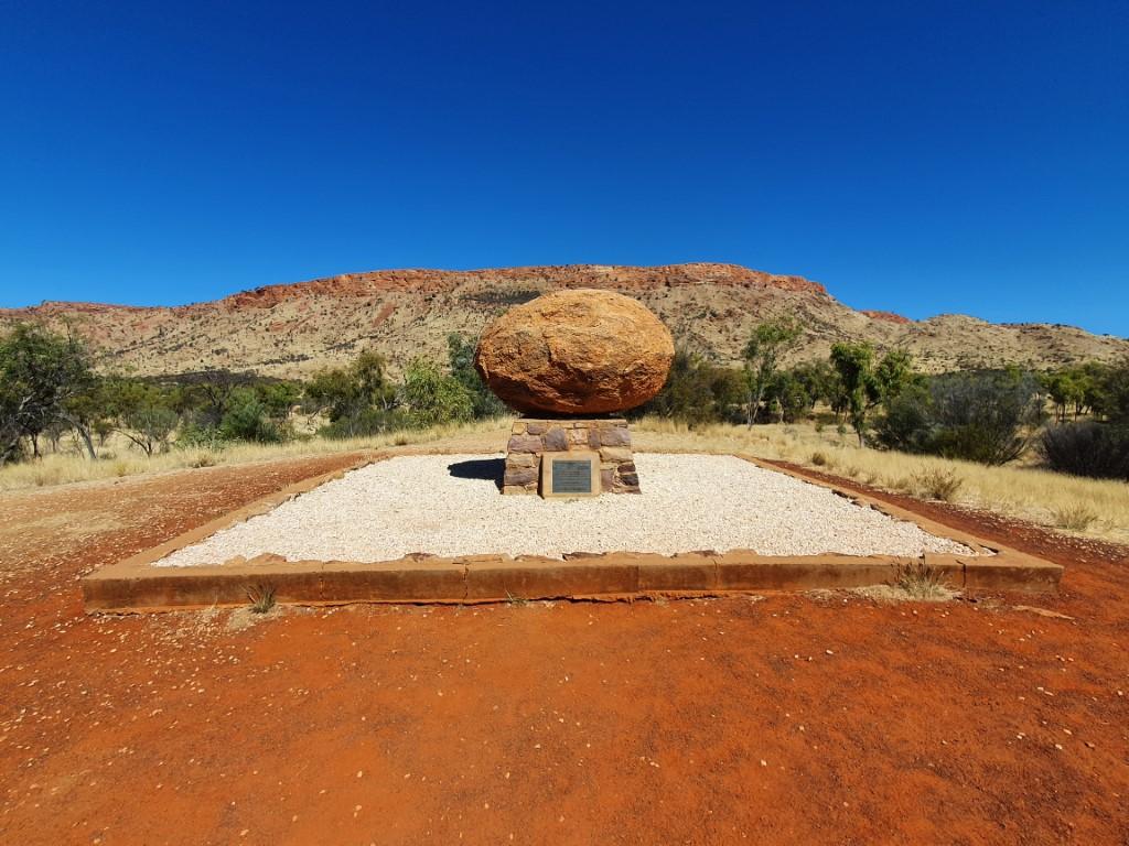
It is interesting to note that the original boulder on John Flynn’s grave in Alice Springs was sourced from the Devils Marbles. This did not have the approval of the local indigenous people and was a cause of great hurt to them. A reconciliation took place whereby the boulder was returned and re-placed at the Devils Marbles. The Arrernte people of Alice Springs negotiated this and replaced the boulder with one locally sourced from the Alice Springs region.
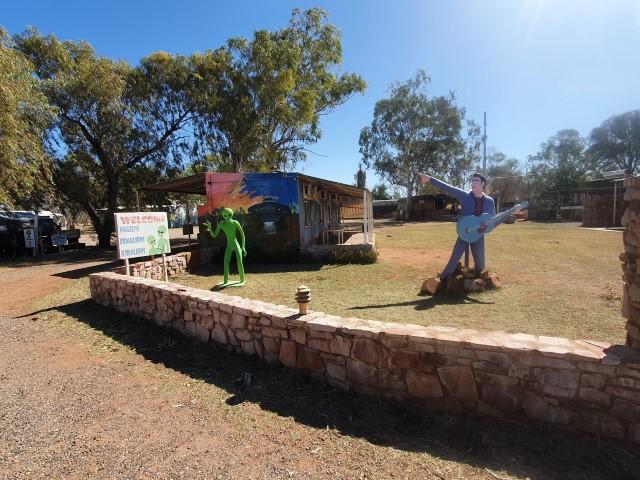
Wycliffe Well
So we decided to pull into the roadhouse at Wycliffe Well to fill up with fuel…
But first… Wycliffe Well regards itself as the UFO capital of the outback and styles itself after a kitchy (somewhat lame) mashup of Roswell and Area 51 in the U.S. Their caravan park and campground has a number of alien statues and UFO related sculptures as well as a statue of Elvis Presley just to boost the cringe level…
Anyway… the cruiser fuel cap is on the driver’s side so we pulled into the right hand side of the pumps, which was very squeezy with the van on the back. There were about thirty bikers (as opposed to bikies) parked around the pumps and in front of the exit point from the pumps.
Two young women had their bikes lined up at each of the two pumps and were fiddling around and re-adjusting the loads on their bikes. Meanwhile two more vans pulled in behind us so we were effectively locked in.
The two women could see we were waiting but continued to fiddle around. Then after a couple of minutes decided to go inpay for their fuel, which took more minutes… They returned to their bikes and stood there yapping and then decided to fiddle a bit more with the panniers and load.
After a small eternity they moved their bikes away, which meant that we could move forward and fill our tanks. After filling our tanks and paying, which took considerably less time that the two women we were stuck in place with the vans behind and about a eighteen harleys in front of us blocking our exit. All of the bikers could see that we wanted to exit but nobody moved an inch preferring to stand around a lick their golden gaytimes…
At some point, one of the older bikers called out to the others that they needed to move their bikes so that we could get out. Well you’ve never seen such a set of looks of abject indifference to this request. Grudgingly one or two them shifted their bikes so that they were still just perfectly blocking us. Then another four or five moved theirs to a position that gave us about one inch of manoeuvering space. Rob kept inching forward and the bikers, one by one, kept shuffling their harleys forward so that they were still blocking us from exiting without ploughing over the tops of their bikes.
Now at some point, anyone with a brain would have moved their bike over to the two acres of empty space across from the pumps but not these intellectual giants who continued to play shuffle and leap-frog with their bikes, grumbling all the way…
So finally, after four or five micro shuffles, these biker Einsteins had cleared enough of an exit that we could get out with about 2 inches either side… Our van has a long turning point and it started to scrape a bollard as we inched through the gap.
So then a couple of their geniuses decided to help me with some (genuinely well meaning) help to reverse a bit so that I could get past the bollard without scraping and miss their bikes by half an inch… At this point Rob wanted to just plough into the bikes to start a domino chain effect but resisted the temptation on the grounds that he probably couldn’t defend himself against a mob of that size.
In all honesty, we both think that a bag of hair has more intelligence than this group of thirty dimwits… On a good day!
So… as mentioned in a previous tab, when Jo was booking us in later at the Devils Marbles Hotel, this merry band of Jobbernowls rode past. The receptionist ran out and asked Jo whether they were heading north or south, after which Jo explained that they were heading north and that we had had a minor but harmless interaction with them. She then proceeed to advise the manager who was on the phone to the Tennant Creek police to advise them of a group of bikers headed north. It seems that they operate as an early warning system for the Ketherine police of any potential nuisance or threat headed their way.
Nothing was to come of this particular event though… mainly because this group were bikers not bikies. They also didn’t have half-a-dozen brain cells between them…
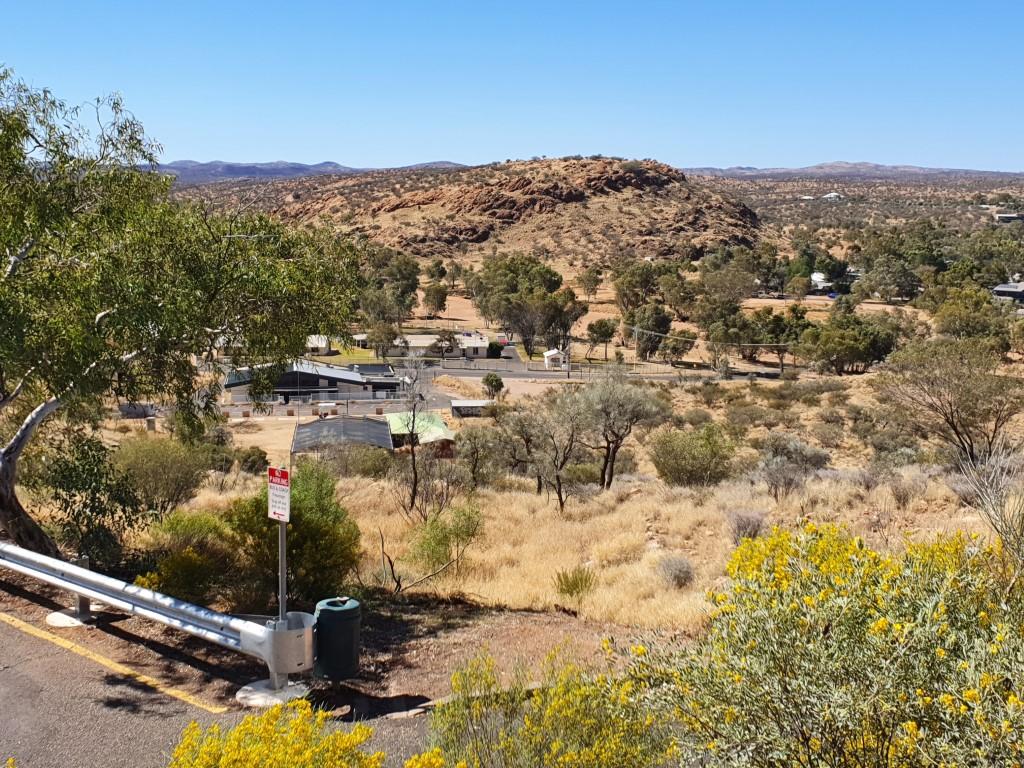
The GapANZAC HillWintersun Van SiteView from ANZAC HillView from ANZAC HillView from ANZAC HillView from ANZAC HillView from ANZAC HillANZAC Hill
So… We continued our long trek up the middle from Erldunda to Alice Springs, which is pretty much the half-way point between Adelaide and Darwin. It’s at this point that you really begin to grasp the enormity of the distances and the vastness of Australia. We suspect that had we crossed the Nullarbor instead that we would probably be learning the same lesson. And that’s a lesson that we’re yet to learn… as well as when we tackle the West Australian coast from Darwin to Margaret River.
It was a decent tow of 275km but the daytime temperature was still relatively cool in the mid-twenties. Not a huge amount of traffic but it was beginning to become noticable that more caravans were beginning to head south with the approaching wet season in the top end.
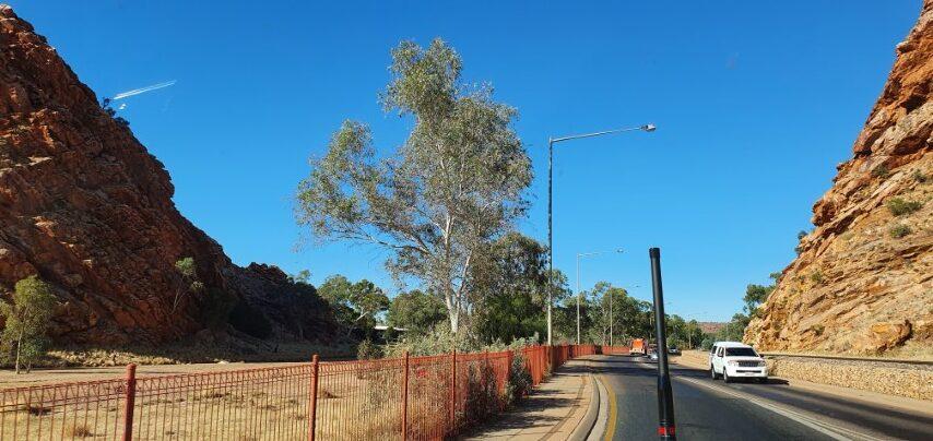
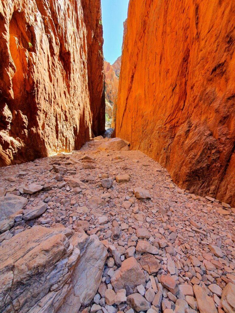
The Gap
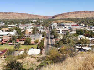
At last we approached the ‘Gap‘, which signalled that we had arrived at Alice Springs. It’s quite an impressive way to enter the town and splits the MacDonnell Ranges into East and West. Our destination was the Wintersun Cabin & Caravan Park on the northern side of town. This meant we go to see the town itself as we drove through.
As you travel up the centre you hear all sorts of warnings about Alice Springs (and other places). That you need to be very careful, where to park or not park, to lock your things up, to not be in town after 3:30pm, etc. Despite it’s reputation, it’s still a pretty tidy and well kept town with good facilities and services. Plenty of green grassy areas that are well irrigated.
Wintersun Van Site
The Wintersun had good reviews and Jo was told that there had only been one break-in in the last year. Some idiot had left his van unlocked with cah on the table… so what would you expect! Still the whole park was fenced with overlapping circles of razor wire sitting atop. It was a nice clean park with decent sized sites and easy to manoeuvre into them.
The park boom gate and entry gate were broken for a day or two while we we there but the caretakers warned everybody that the gate would remain open for one night and to just be sensible. That said… a van across from us left their Weber BabyQ out on their table unsecured so I set ours up and chained it to the van as I do anywhere else. We still have it and the other guy still has his…
We did hear on our second day there that the Coles and another store had been broken into overnight and a car stolen, which had also been recovered and the offenders caught. The ABC radio seems to broadcast a daily crime report and you also see ads on tv about making Alice Springs a better community.
The other major indicator was when we visited the BWS to buy some drinks. The entrance was being guarded by three N.T. Police Officers who were screening customers through the door and refusing entry to certain locals. They were quite thorough asking where we were from and ensuring that our intention was to drink the alcohol we bought and not supply it to anyone else. We also had to provide I.D. at the cash register so they’re pretty serious about their alcohol control but were also doing it all discretely and respectfully.
Our friends from earlier places, Barbara and Paul, had arrived in Alice Springs a few days before us and this was the last stop before turning around and heading back home to the Adelaide Hills. So on their last night we met up for the last time at The Gap View Hotel for dinner and to swap stories once again. Having arrived in Alice Springs before us they gave us plenty of welcome advice on the things to see and do. It was sad to finally farewell them as they turned south and we kept our northern bearings a few days later.
All in all Alice Springs seems to be thriving albeit with a set of serious social problems that will probably take a generation or two to solve… if they can be. On the surface there seems to be ‘will’ for it but the ‘way’ appears to be mired in political ineptness with decisions being made too far away by uninformed politicians.
Hopefully the ‘Uluru Statement From the Heart‘ will go some way to addressing it but symbolic politics probably won’t be enough to help the current generation.
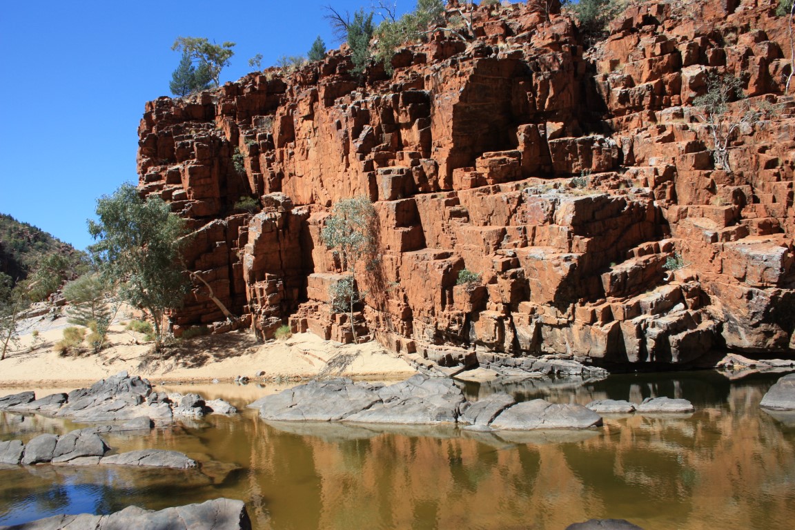
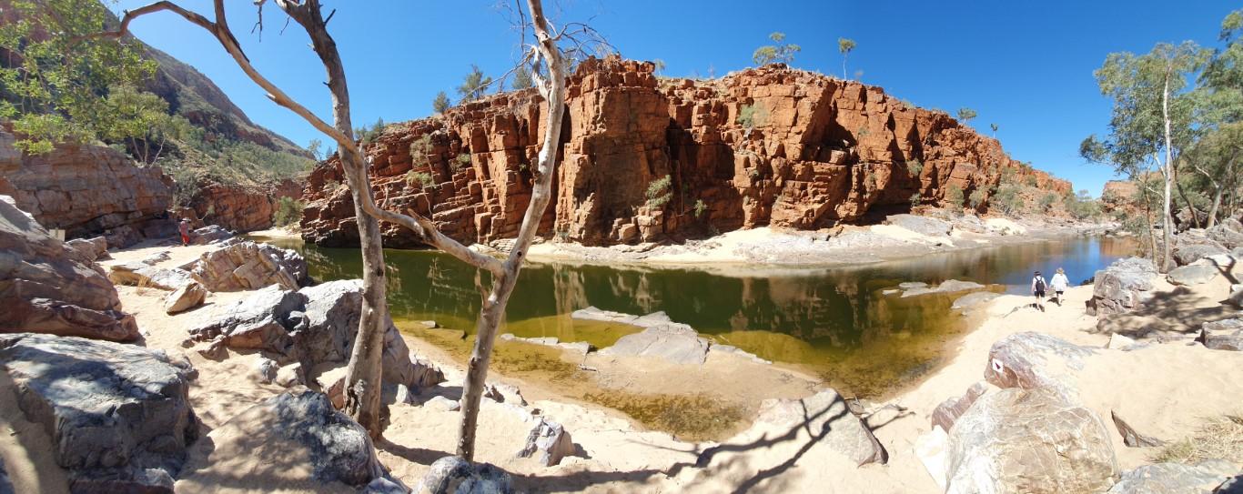
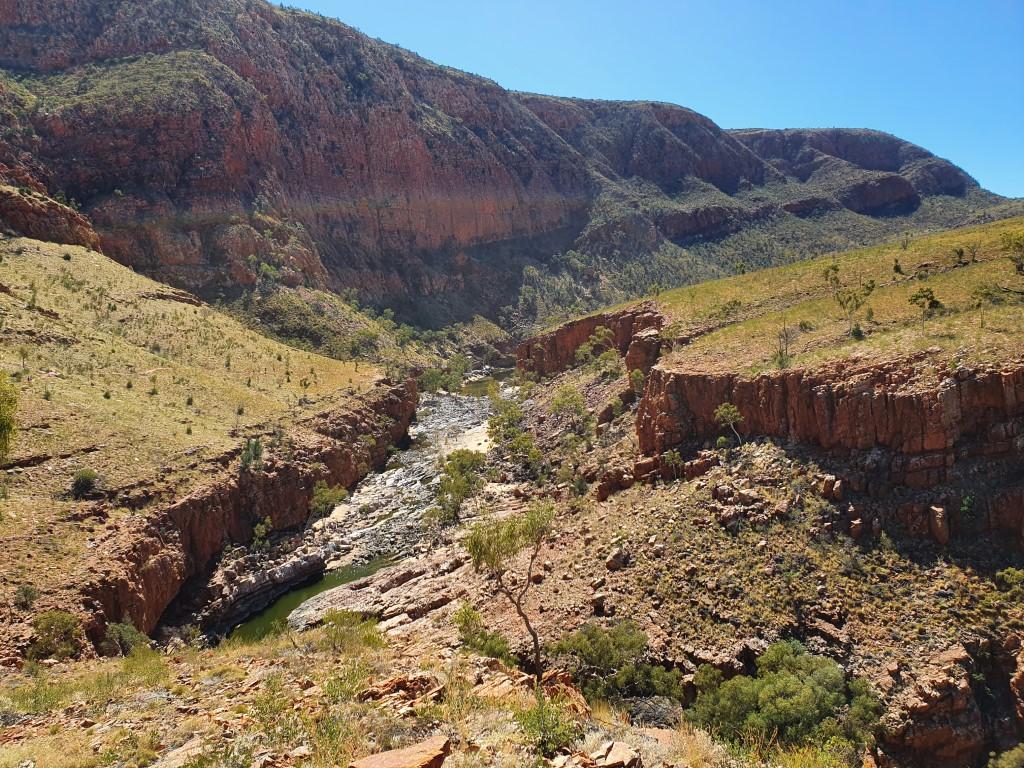
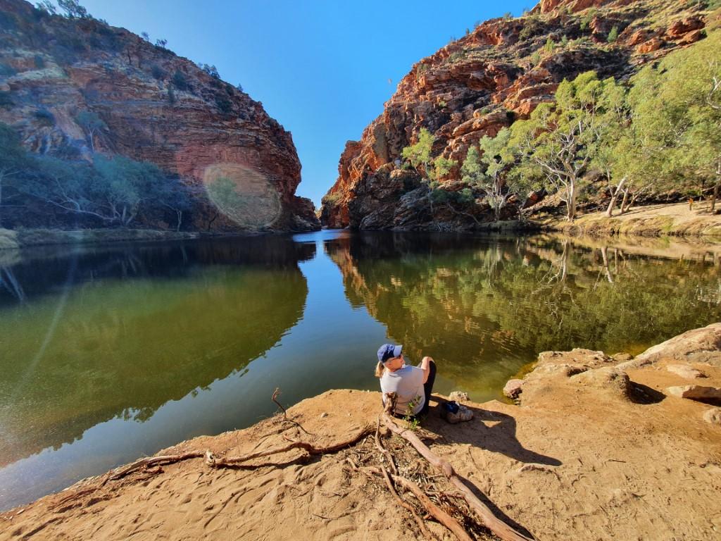
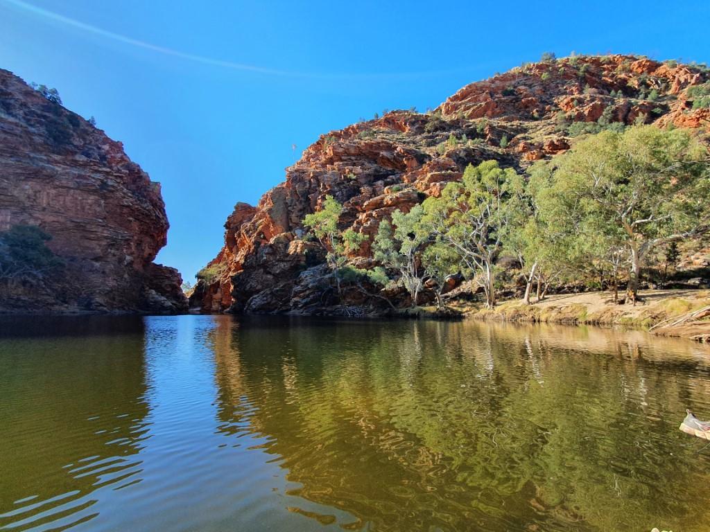
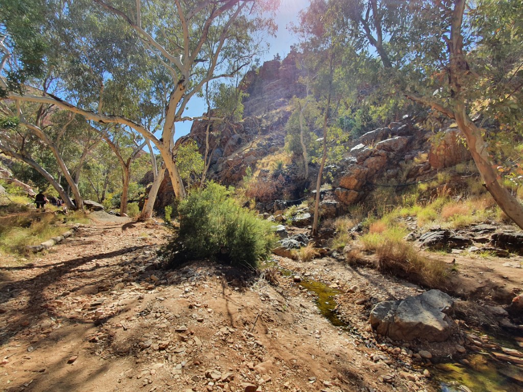
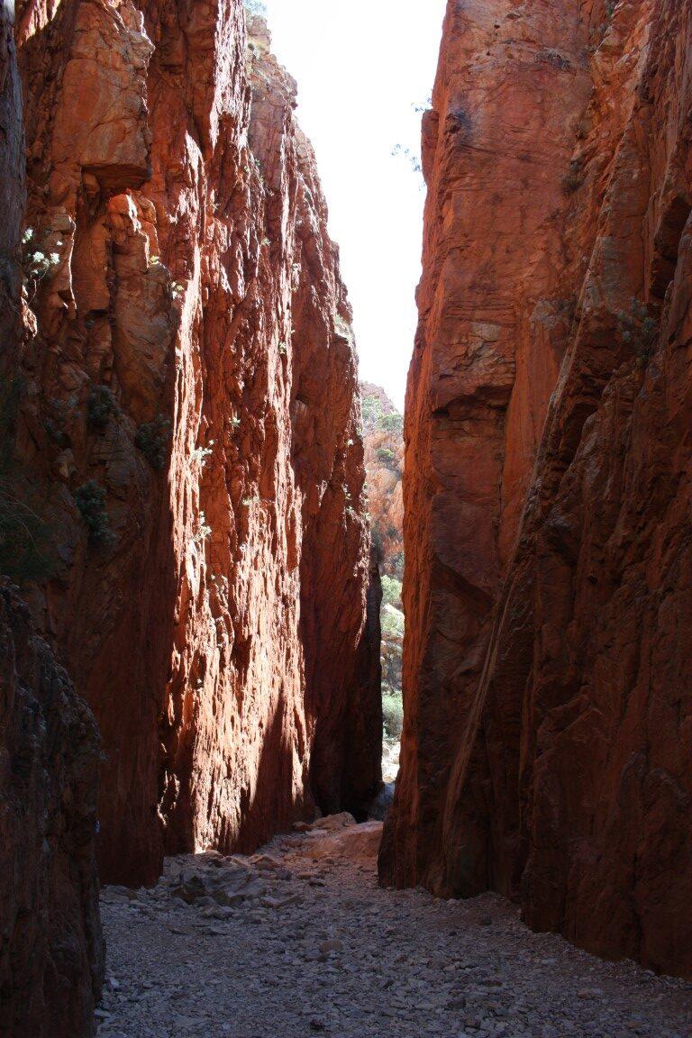
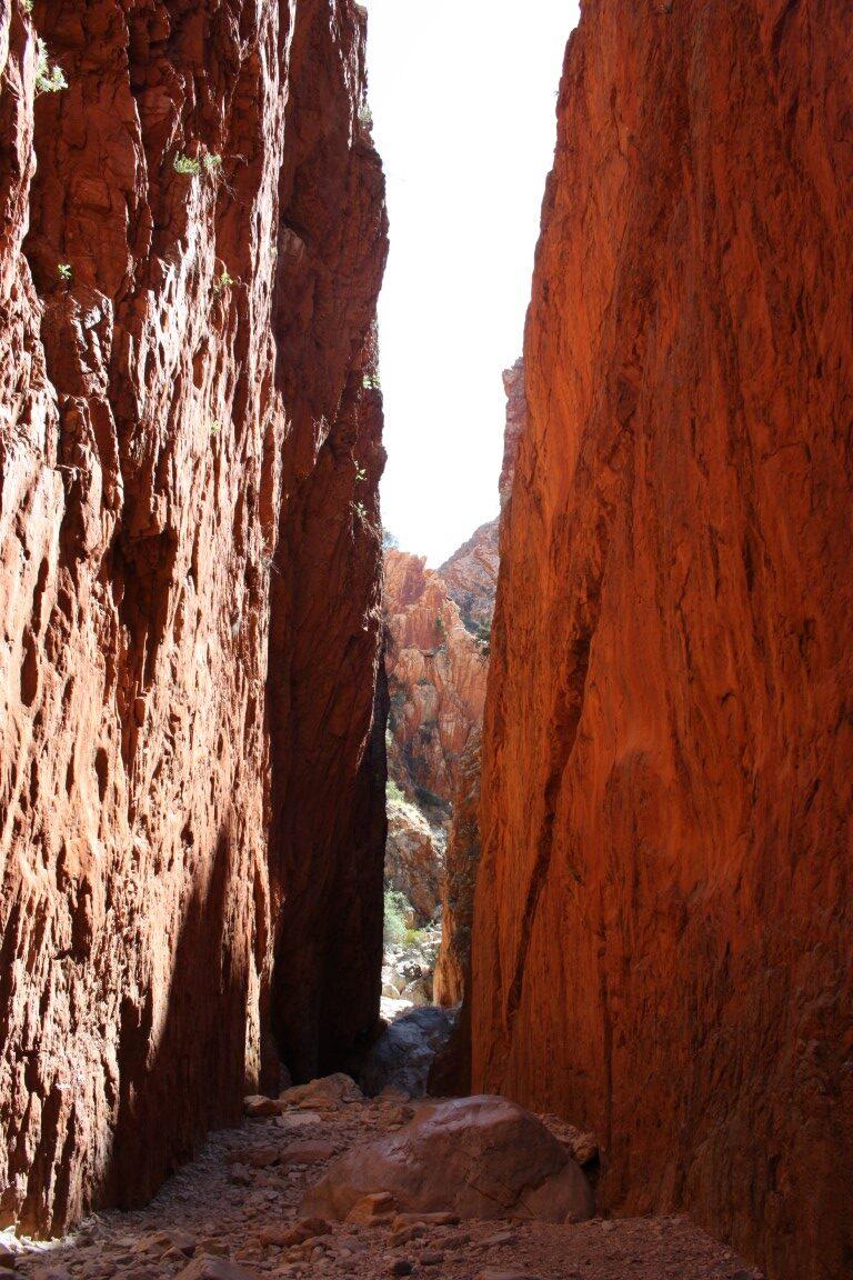
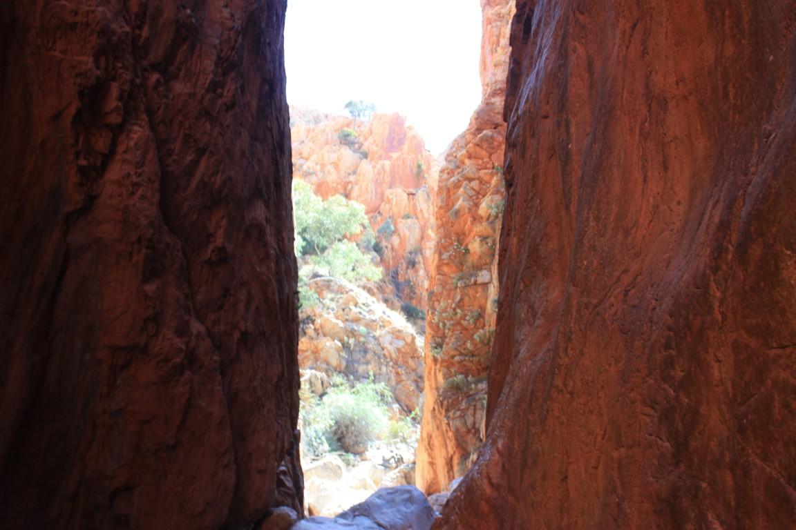
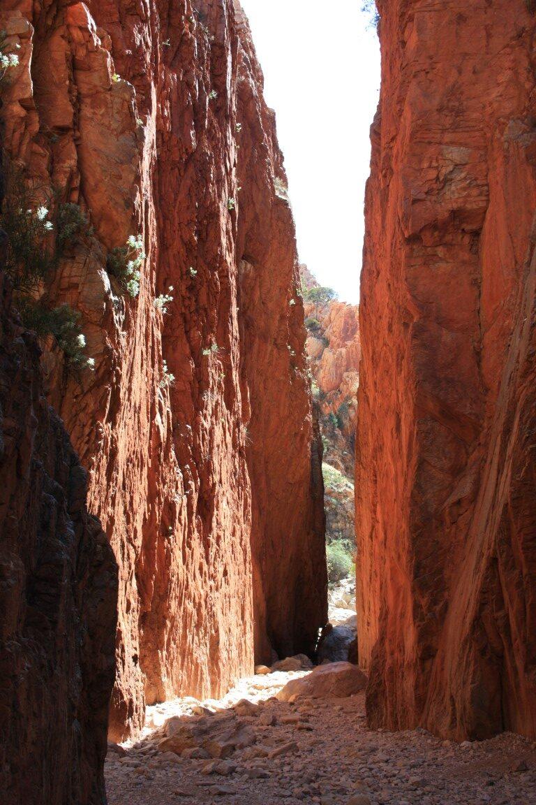
Our first day in Alice Springs saw us heading east along the East MacDonnel Ranges. You could be forgiven for thinking that Alice Springs is the land of ‘gaps’, ‘gorges’ and ‘chasms’…
The gaps, gorges and chasms are passages through the ranges that have been created through folding, faulting and erosion over thousands of years. Most of them have water holes of varying size depending on their geology and the amount of rain received throughout the year.
Barbara and Paul had suggested to us that the best way to tackle the MacDonnel Ranges (either side) was to pick the farthest point you want to visit, go there first and then work your way back towards town, Despite this we actually did it the other way around (on the east side) as things were much closer than the west side.
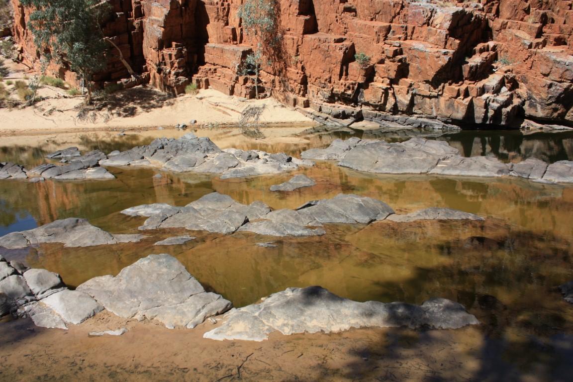
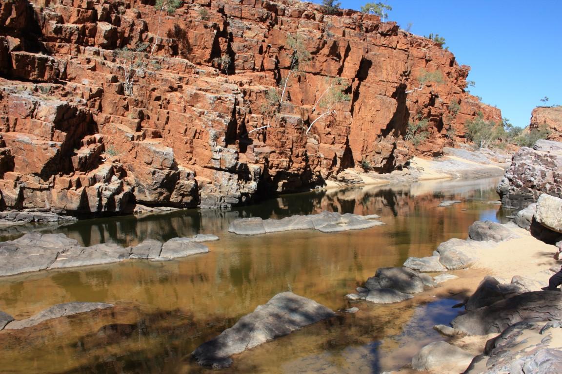
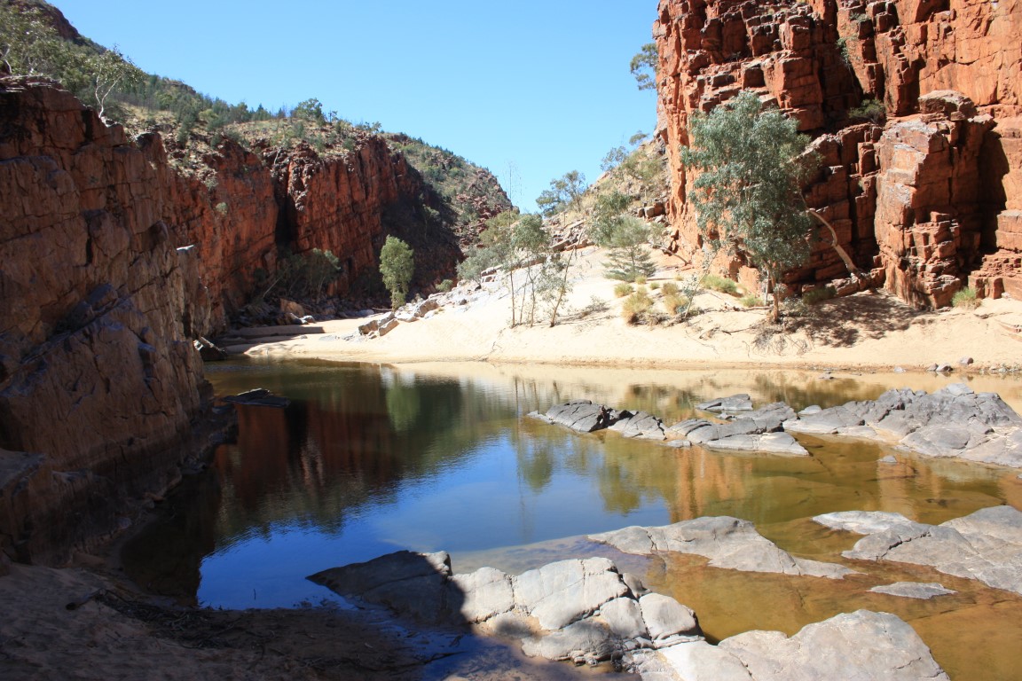
Emily & Jessie Gap
First stop was Emily Gap and the nearby Jessie Gap. The two gaps are thought to be named after the daughters of Charles Todd who was responsible for the Australian Overland Telegraph Line. A monumental feat of engineering and pererverance from Adelaide to Darwin linking Australia to the world.
Emily Gap water holeEmily Gap water holeGum tree buds at Jessie GapWild flowers at Jessie GapJessie Gap water holeJessie GapJessie Gap water holeJessie Gap water holeJessie Gap water hole
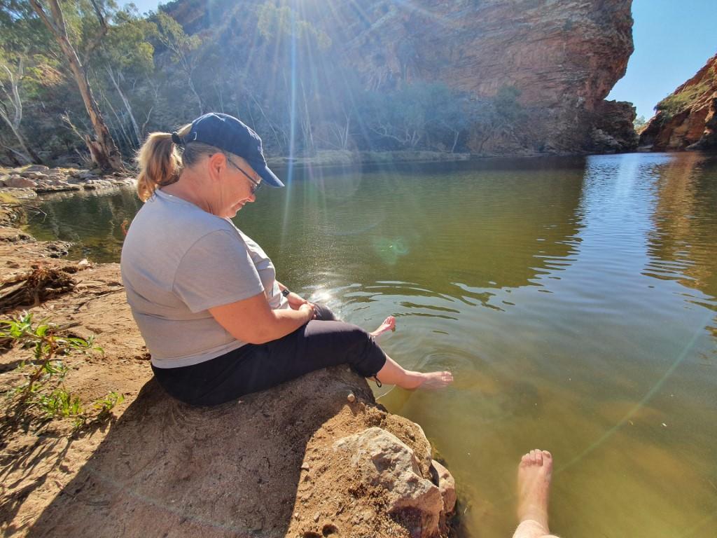
The water in the water holes at Emily and Jessie Gap was fairly stagnant and the smaller ones were thick with algae growth which turned the water a light turquoise green in colour. Quite beautiful to look at but certainly not for wading.
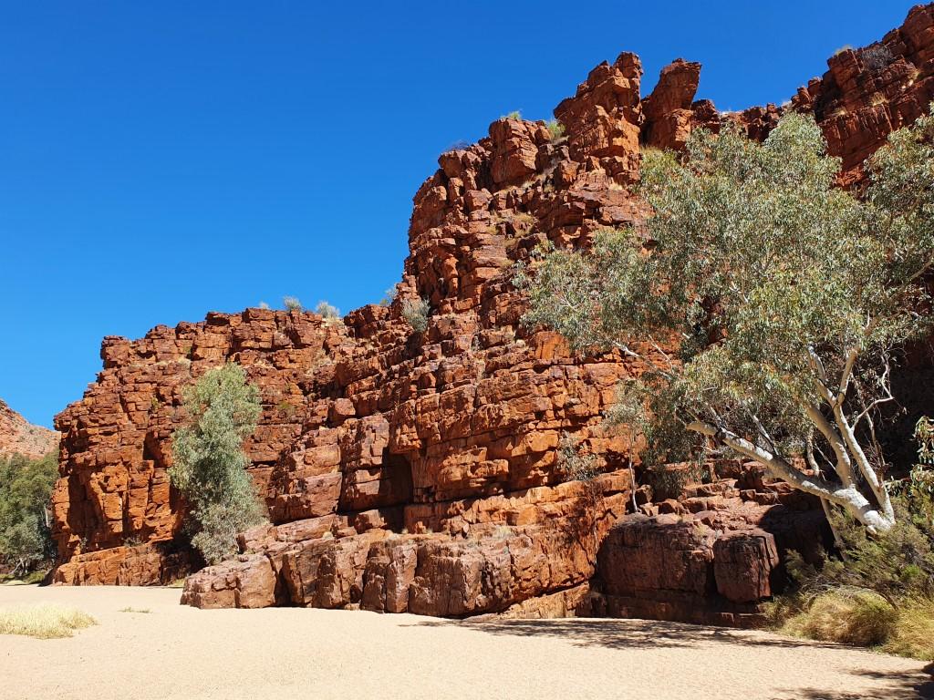
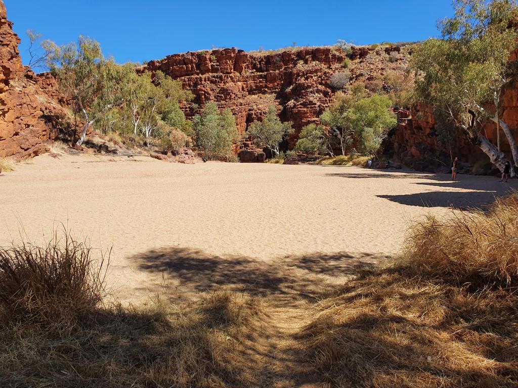
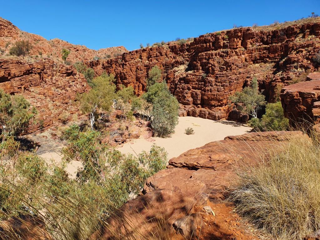
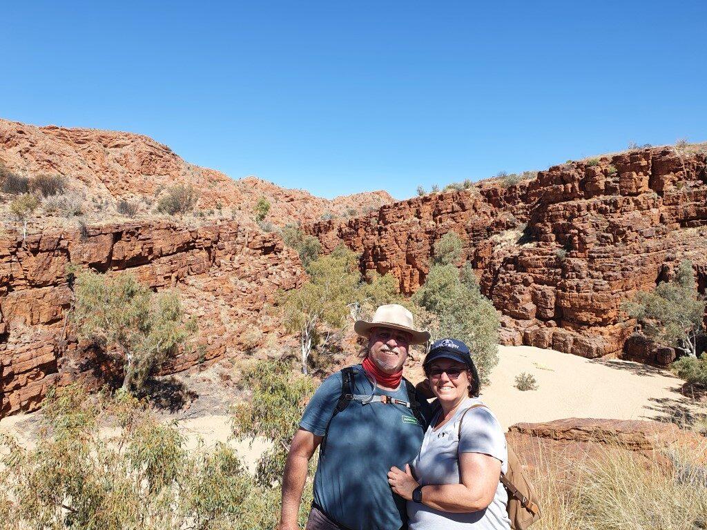
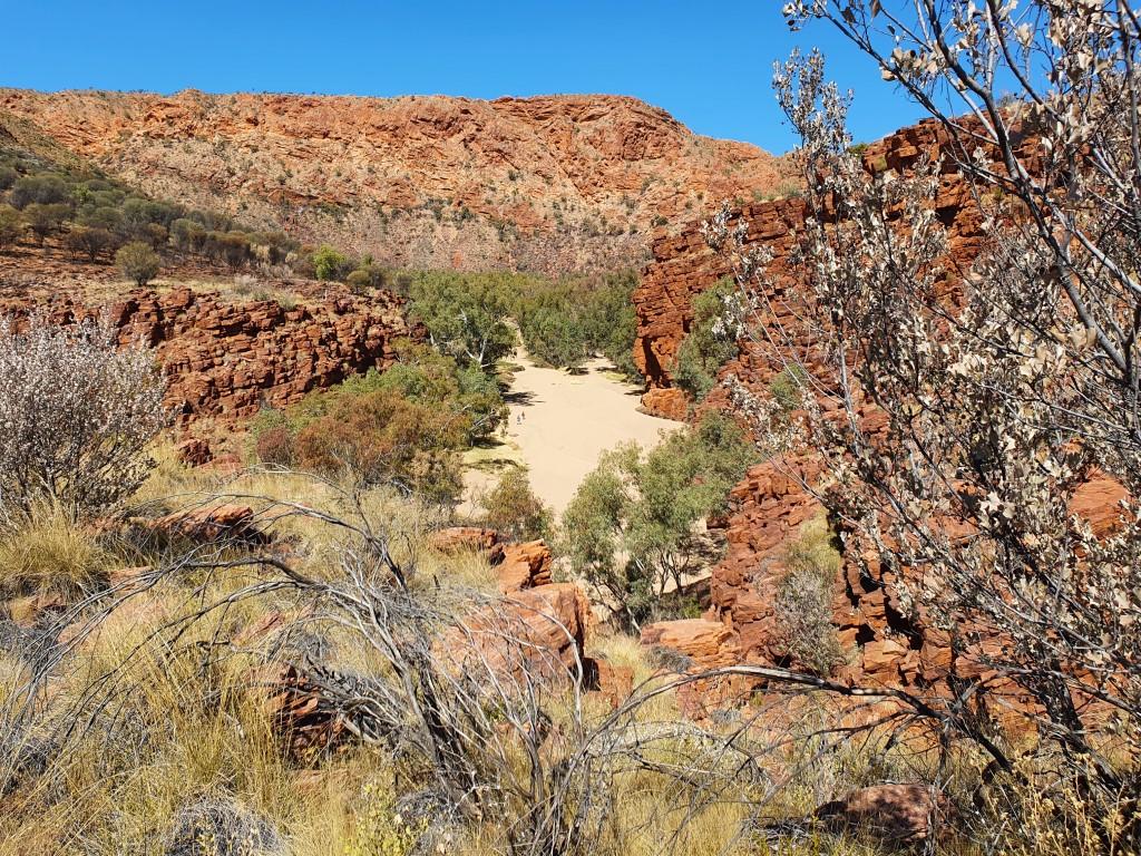
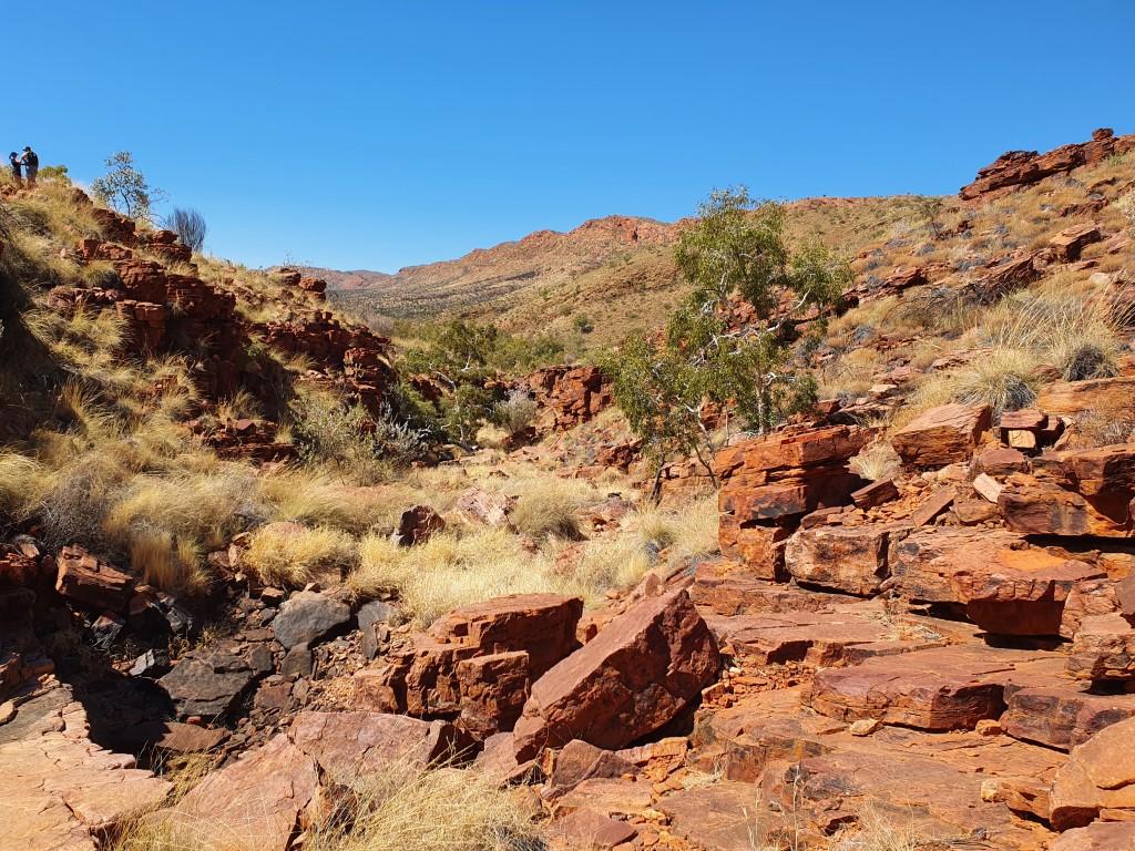
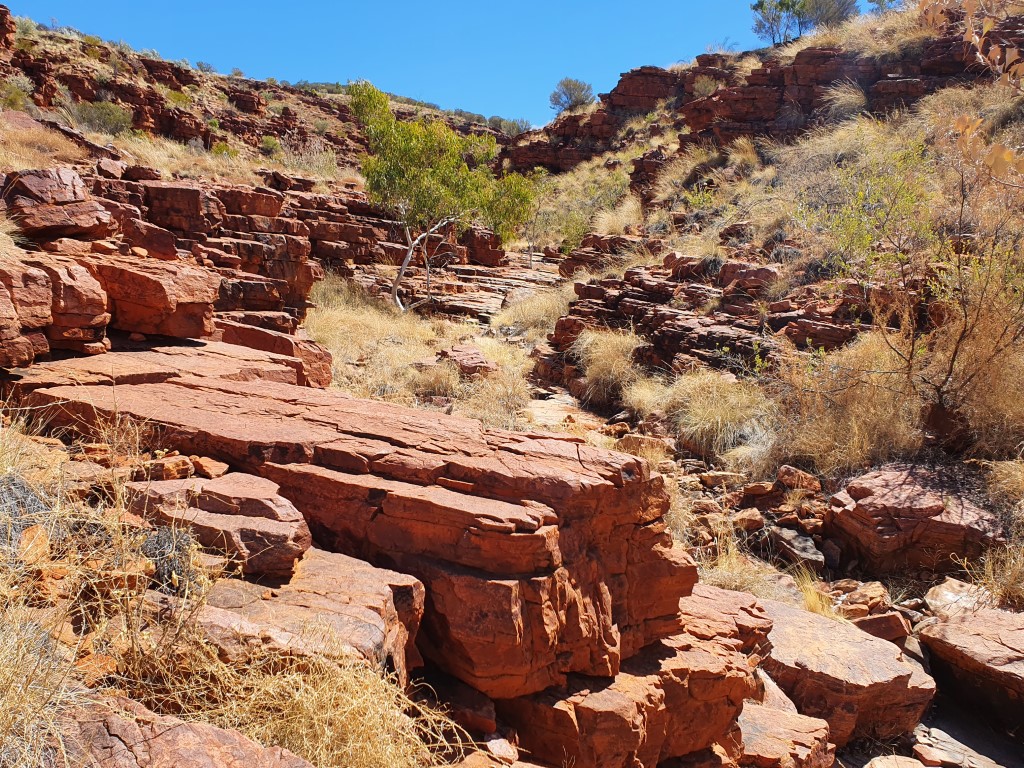
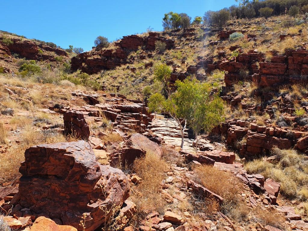
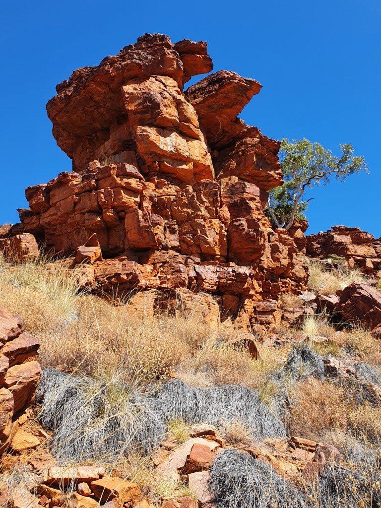
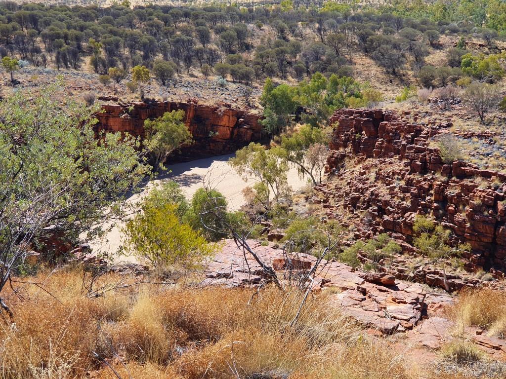
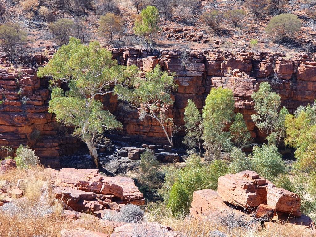
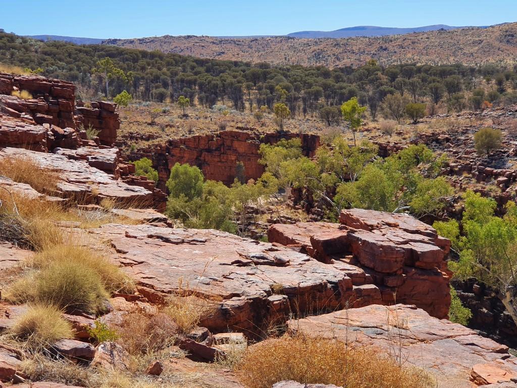
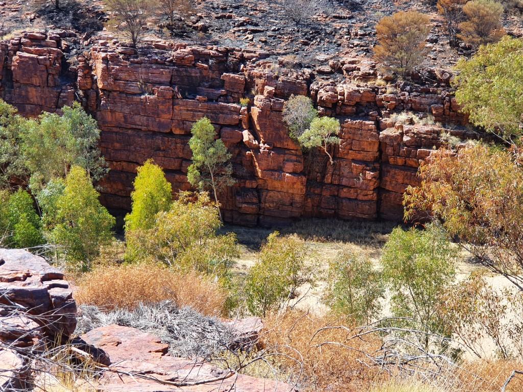
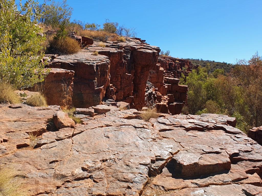
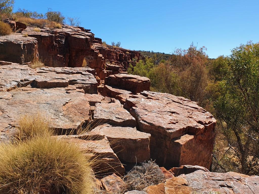
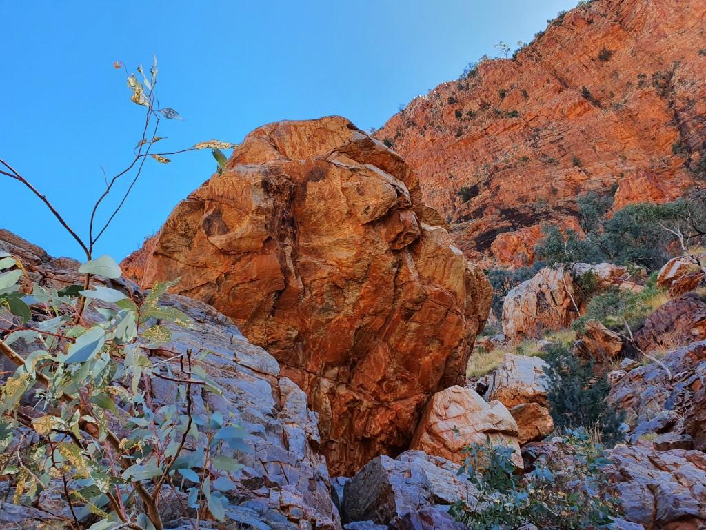
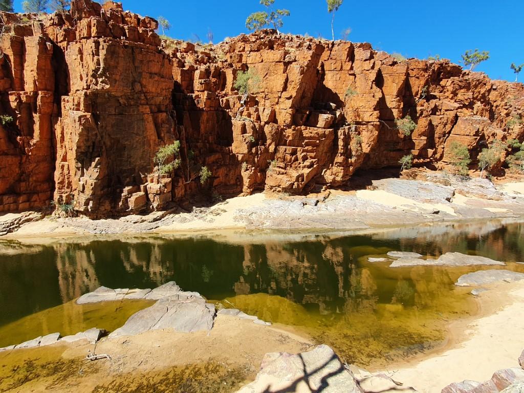
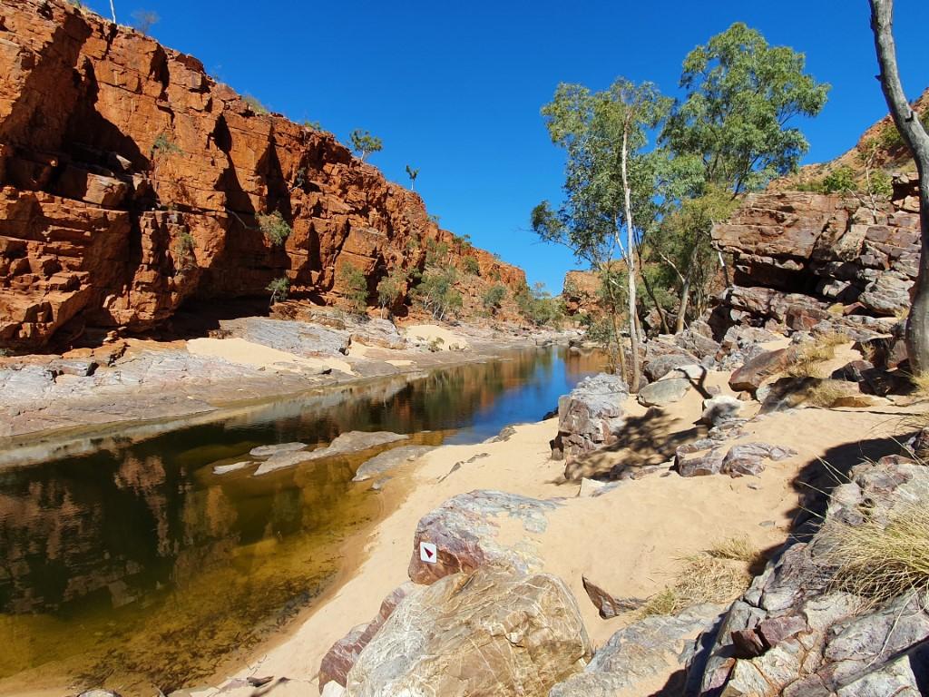
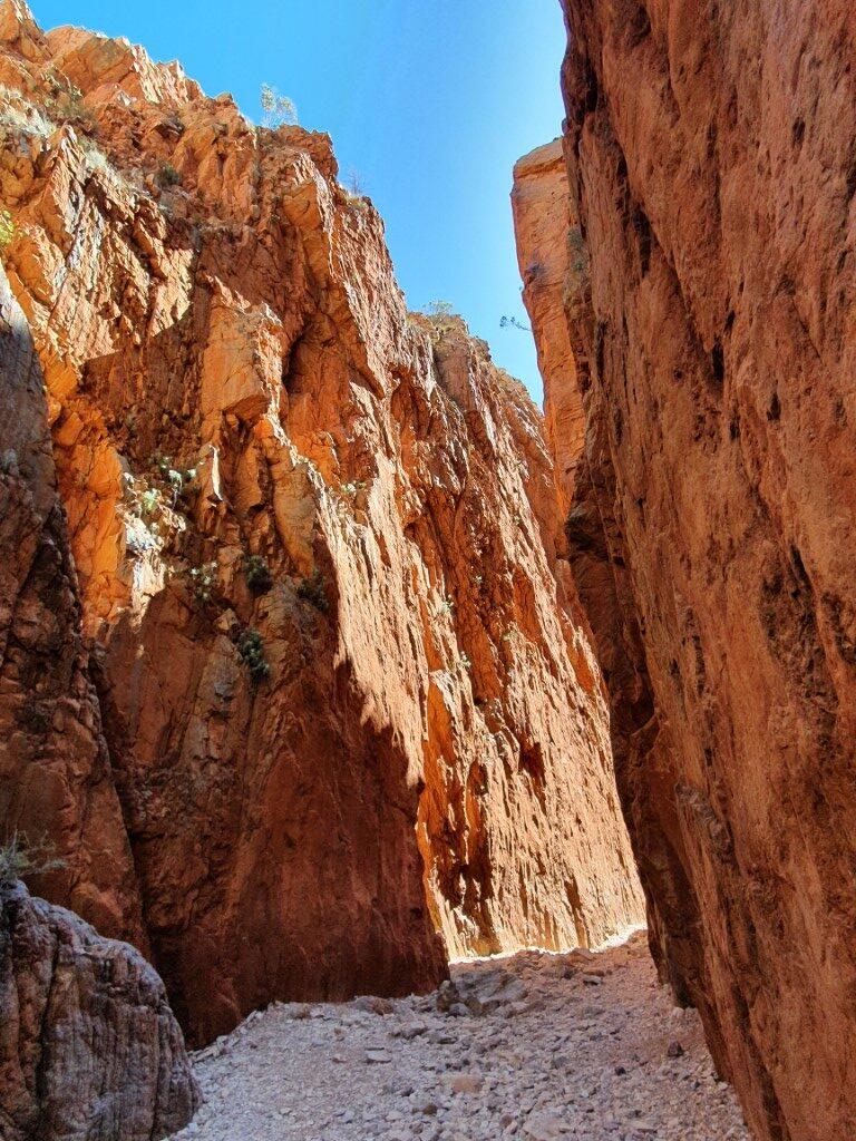
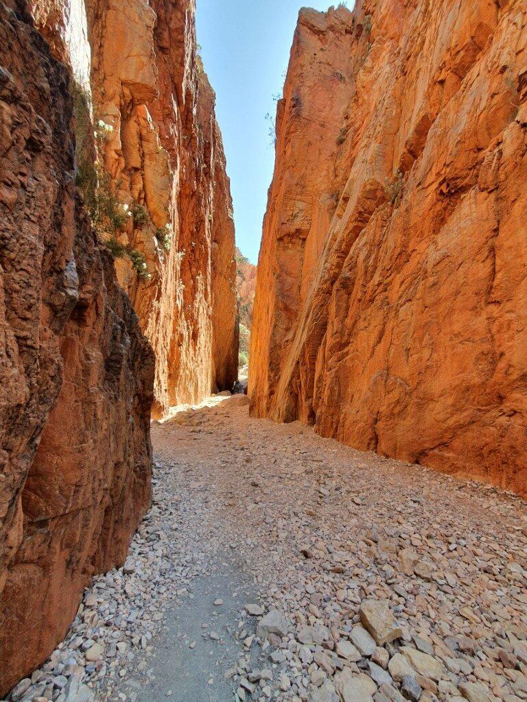
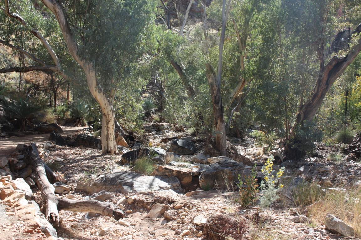
Trephina Gorge
Trephina Gorge is located ~55km from Alice Springs. As our first gorge we were immediately blown away by the red rock walls of the gorge with the contrasting biege sand on the floor of the corridor.
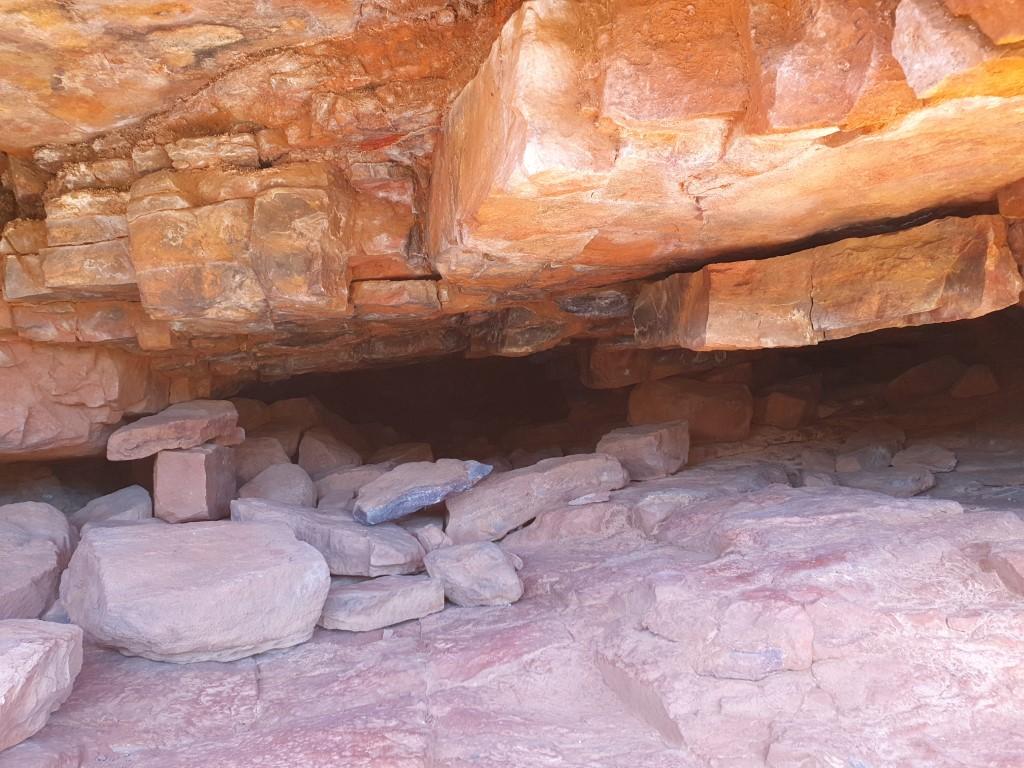
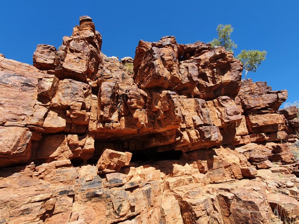
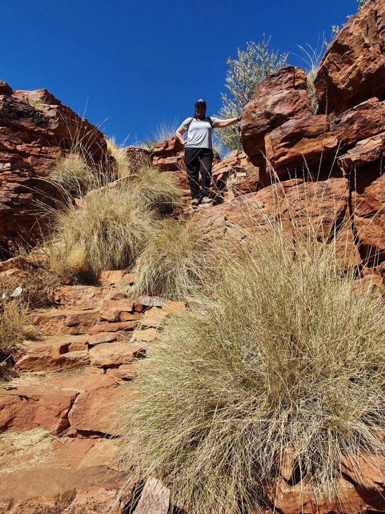
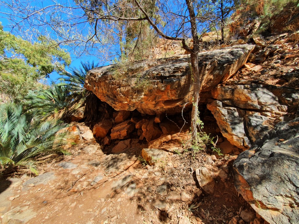
Trephina GorgeWater smoothed rocks at Trephina GorgeTrephina GorgeTrephina GorgeTrephina GorgeTrephina GorgeTrephina GorgeTrephina GorgeTrephina GorgeTrephina GorgeUndercroft cave at Trephina GorgeTrephina GorgeTrephina GorgeTrephina GorgeTrephina GorgeTrephina GorgeTrephina GorgeTrephina GorgeTrephina GorgeTrephina GorgeTrephina GorgeTrephina GorgeTrephina GorgeTrephina GorgeTrephina Gorge300 year old Ghost Gum – Trephina Gorge300 year old ghost gum – Trephina Gorge300 year old ghost gum – Trephina Gorge
There was a nice hike up onto the gorge walls that provided a lookout view into the gorge as well as being able to walk along the sandy bottom.
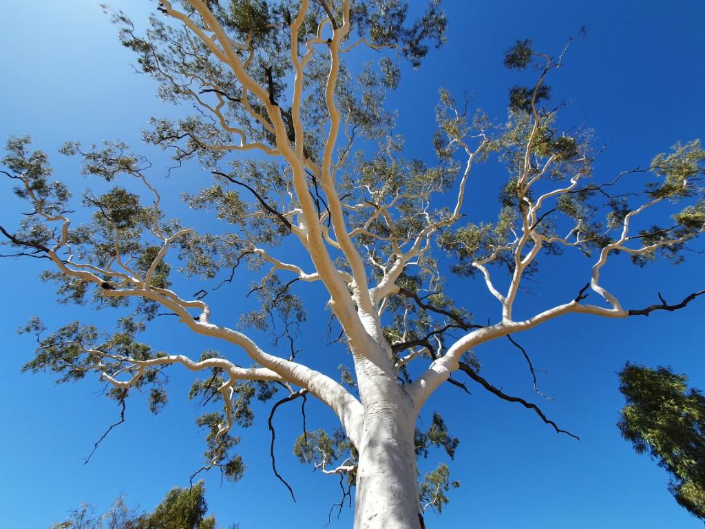
300 year old ghost gum – Trephina Gorge
Nearby to Trephina Gorge is a magnificent 300 year old ghost gum that towers up out of the ground with some younger smaller ghost gums dotting the landscape around it. These wonderful trees survive by sending down deep tap roots to find the ground water below.
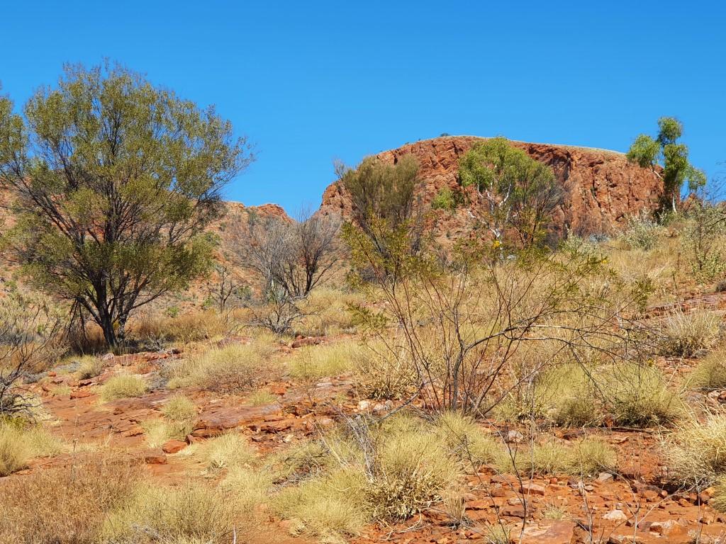
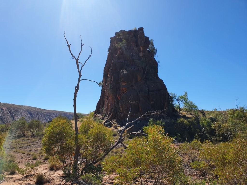
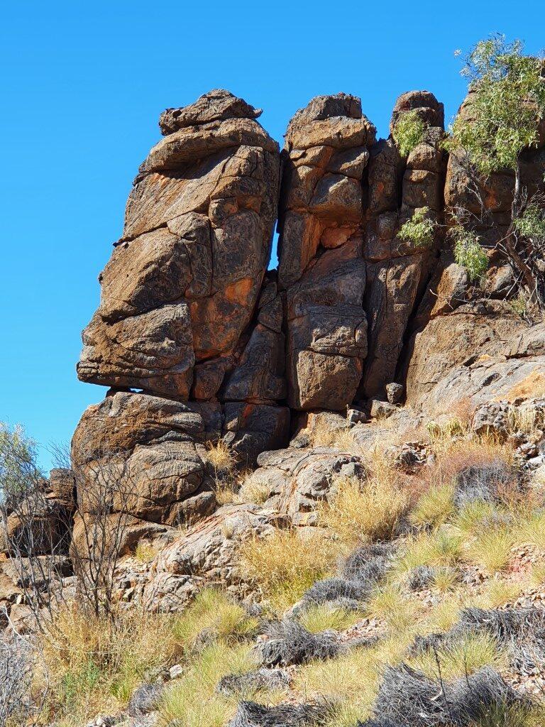
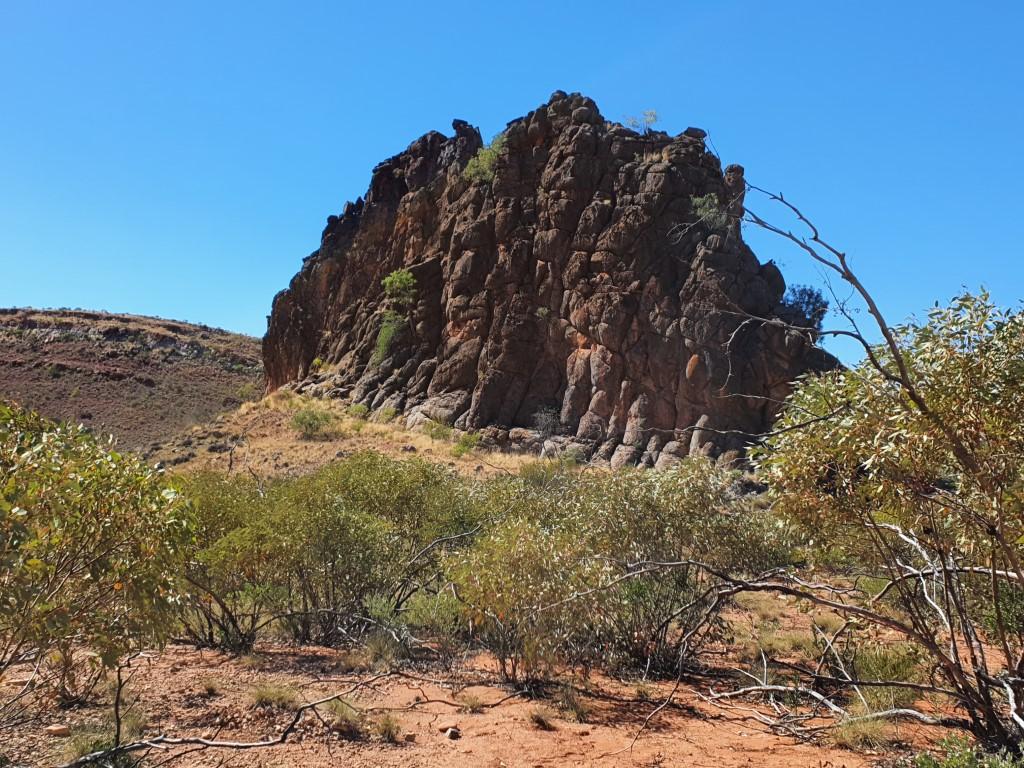
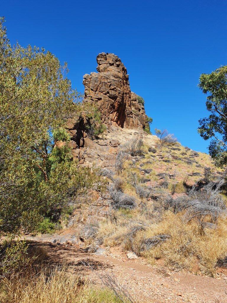
Corroboree Rock
Corroboree Rock is an interesting rock crop that appears quite large as you approach with a dome like appearance. As you move towards one side you suddenly discover that it is very thin and even has some holes through in some places. It is very visually deceptive.
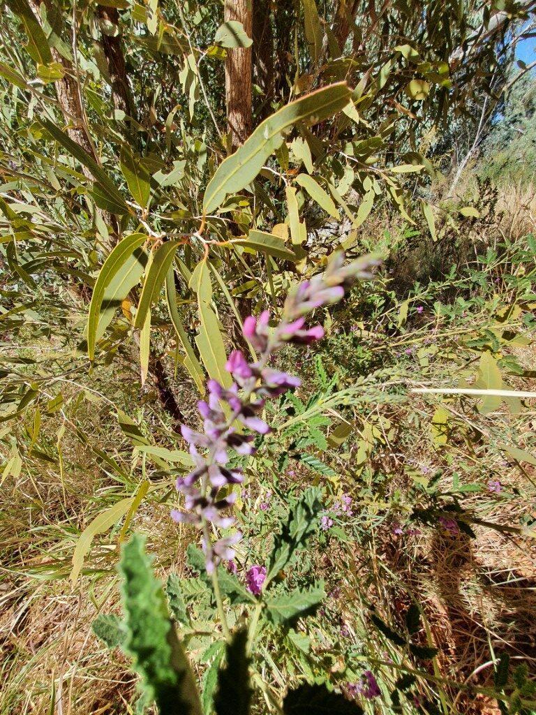
Corroboree RockCorroboree RockCorroboree RockCorroboree RockWild flowers at Corroboree RockWild flowers at Corroboree RockFlowering gum blossoms at Corroboree RockFlowering gum blossoms at Corroboree RockCorroboree RockCorroboree RockCorroboree RockCorroboree Rock
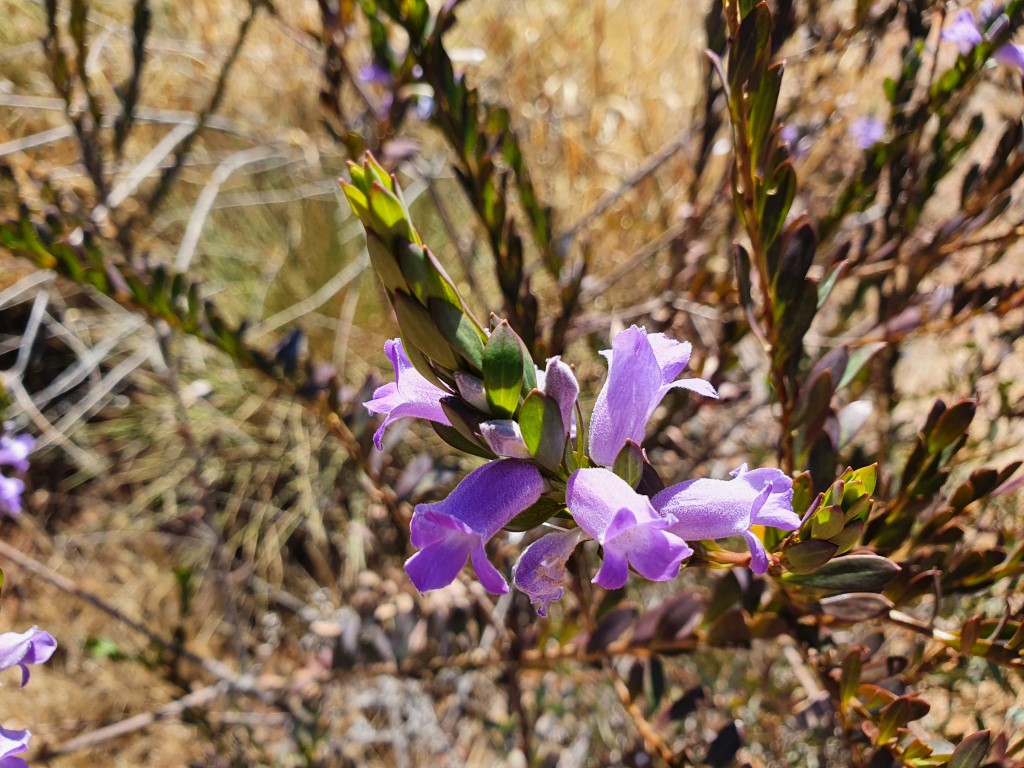
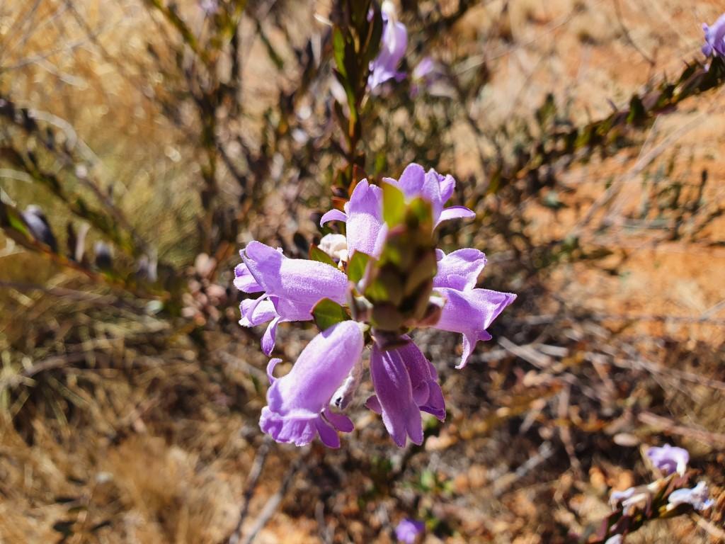
Corroboree Rock is part of a conservation area and is a very sacred men’s site for Arrernte indigenous people. We were able to walk around it and see it from all angles. The area also put on a small show of wild flowers and flowering gum blossoms, which were really quite surprising as we were expecting the whole area to be very sparse and arid. Definitely not the case.
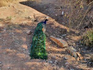
Ross River Resort
Ross River Resort
We noticed a sign to Ross River River Resort as we headed east and thought we would drop in and see if we could get some lunch there. It was a complete surprise with a large green grassy lawn area fronting a well maintained homestead,
Ross River Resort
Upon entering we found a cosy, rustic interior that also had a massive additional bar and cafe area to one side that was built from hardwood sleepers stacked on top of each other and held in place between steel support posts, covered over with galvanised roof sheeting.
The bar area had all sorts of homestead memorabilia on display as well as some local fauna, i.e. snake and lizard skeletons. The beer was cold and the food was excellent. They provided a ‘loaner’ stubby holder for my beer and Jo decided, once again, to have calamari as far away from the coast as possible!
Ross River Resort Peacock
The homestead grounds were home to a flock(?) of peacocks and peahens that wandered around endlessy pecking at the ground for tasty morsels.
Mount Sonder Lookout
Unlike the previous day, we decided to tackle the West MacDonnell Ranges by driving out to our furthest point first and progressively work our way back towards Alice Springs. Our first stop was the Mount Sonder Lookout.
A young woman, and her dog, were at the lookout where she was beginning to paint a water-colour of the view. It seemed like an artists paradise looking out over the Finke River and the plains towards the mountain range.
Ormiston Gorge
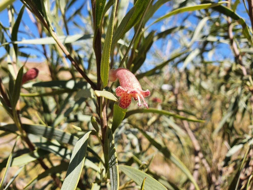
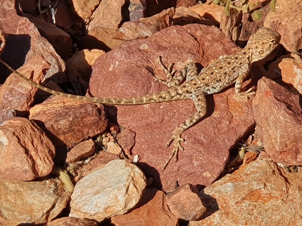
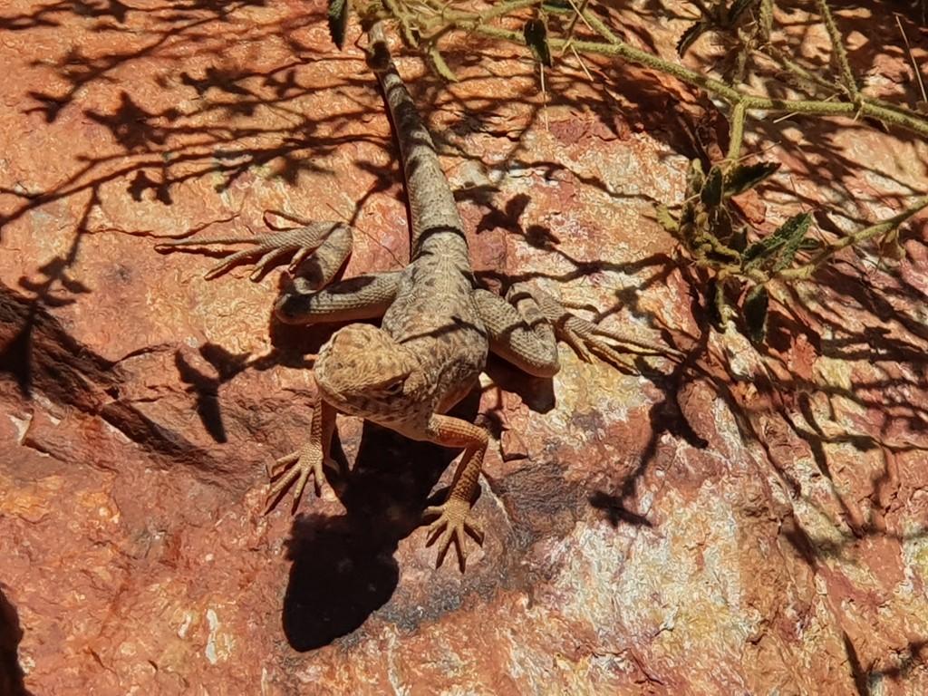
Wildflowers at Ormiston GorgeOrmiston GorgeOrmiston GorgeOrmiston GorgeOrmiston GorgeOrmiston GorgeOrmiston GorgeOrmiston GorgeOrmiston GorgeOrmiston GorgeOrmiston GorgeOrmiston GorgeOrmiston GorgeOrmiston GorgeOrmiston GorgeOrmiston GorgeOrmiston GorgeOrmiston GorgeOrmiston GorgeOrmiston GorgeOrmiston Gorge TrailWildflowers at Ormiston GorgeWildflowers at Ormiston GorgeOrmiston GorgeOrmiston GorgeOrmiston GorgeOrmiston GorgeWater soothed rock walls Ormiston GorgeOrmiston GorgeOrmiston GorgeOrmiston GorgeOrmiston GorgeOrmiston GorgeOrmiston GorgeLizard at Ormiston GorgeLizard at Ormiston GorgeOrmiston Gorge
Ormiston Gorge gave us a chance to stretch our legs again with a decent hike that took us up above the gorge itself and then down to the water hole and sandy creek bottom.
Ormiston Gorge
Not the most spectacular of the gorges, gaps and chasms but still an impressive display that also included wild-flowers and a very approachable little lizard that posed for us whilst sunning itself on a rock.
Ormiston Gorge
The water hole at Ormiston Gorge displayed an algae green colour from evaporation and the corresponding concentration of salts and minerals. A few brave souls waded through part of the water-hole to continue further into the gorge but we decided that discretion was the better part of valour on this occasion and stuck with the walking trail and dry creek bed. By all accounts the water was quite cold as well.
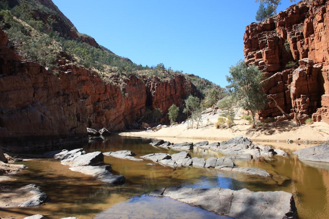
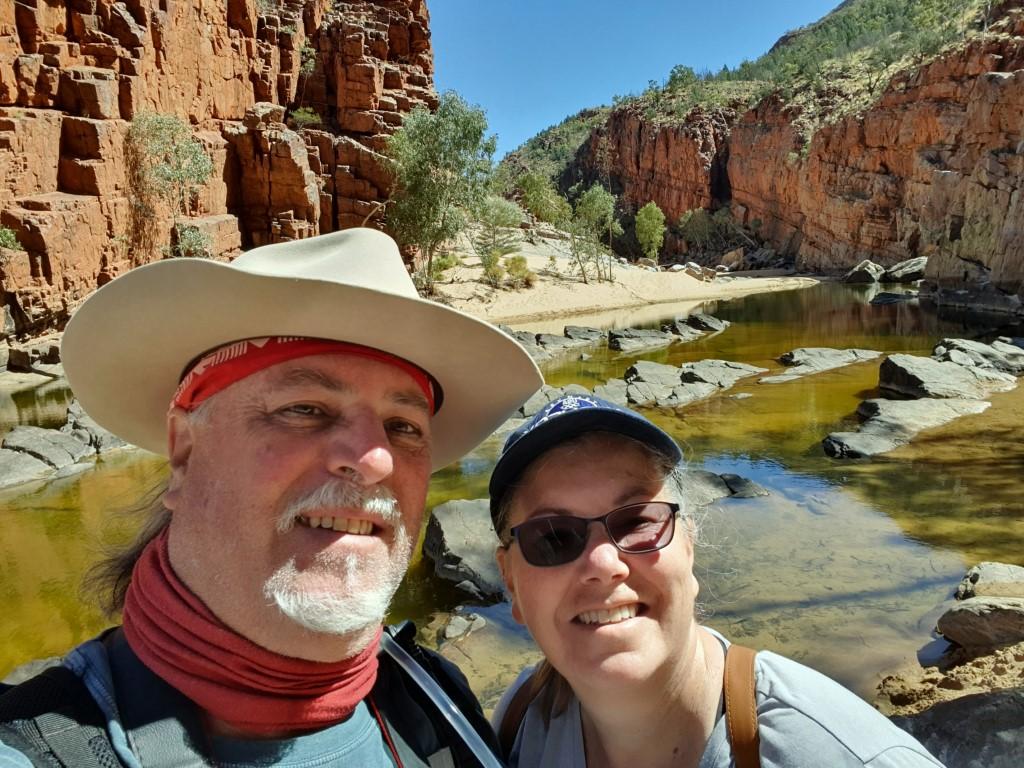
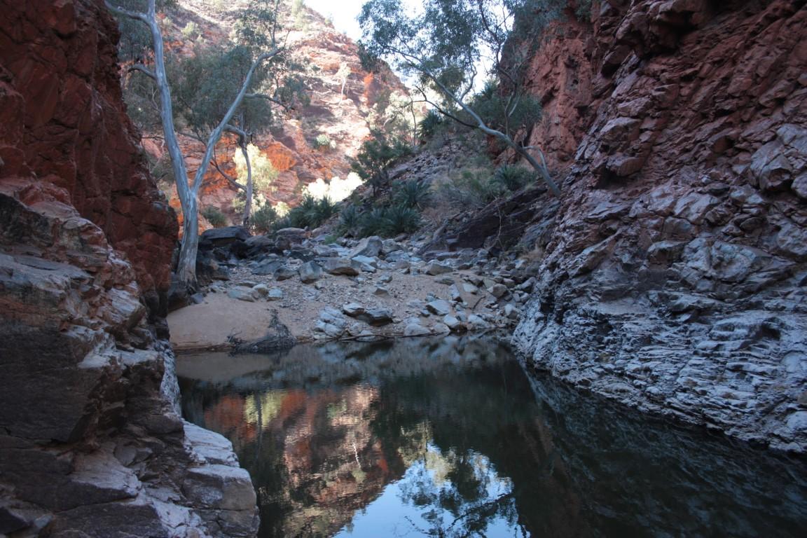
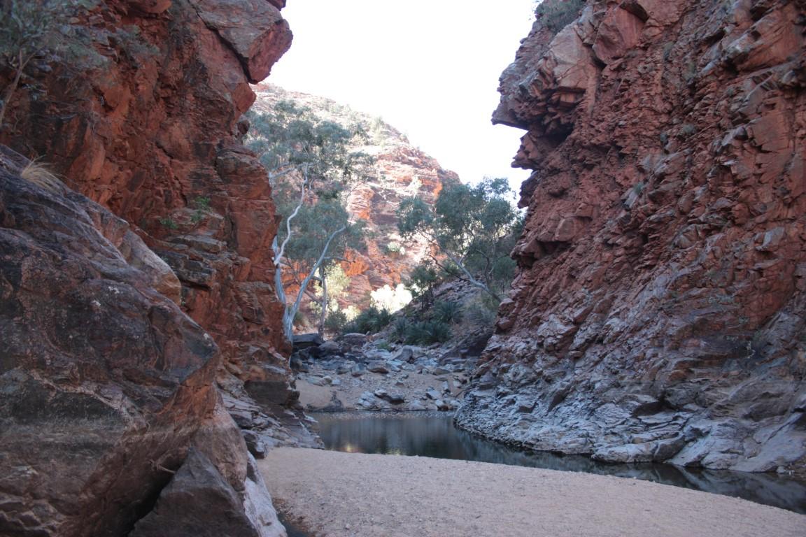
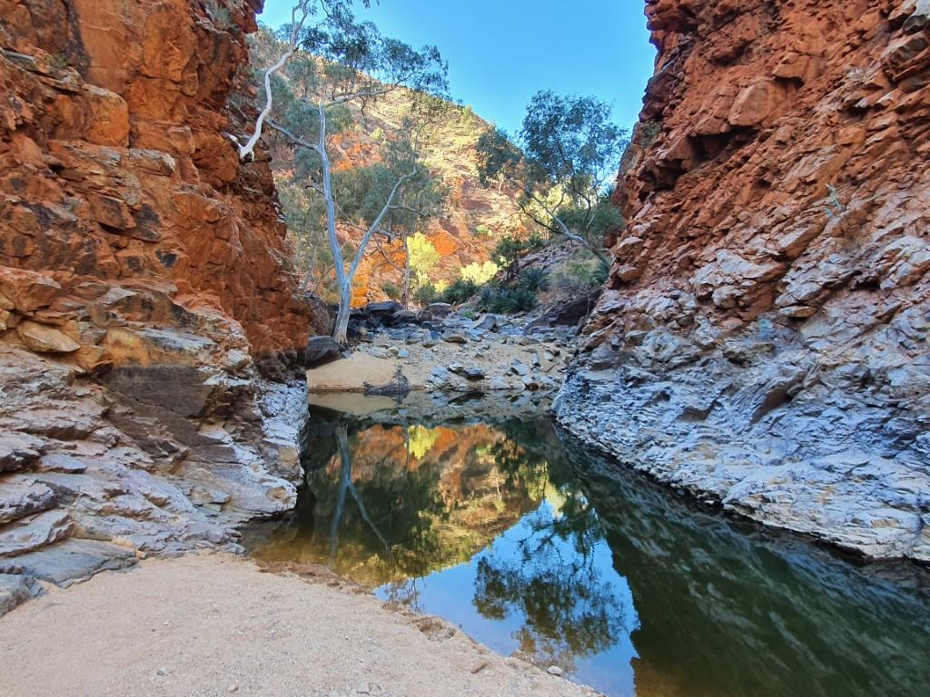
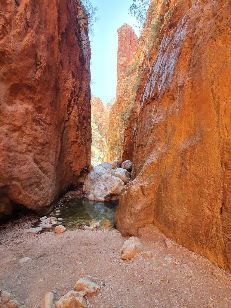
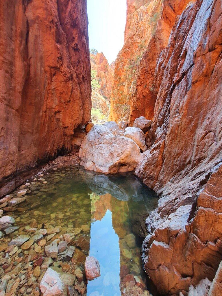
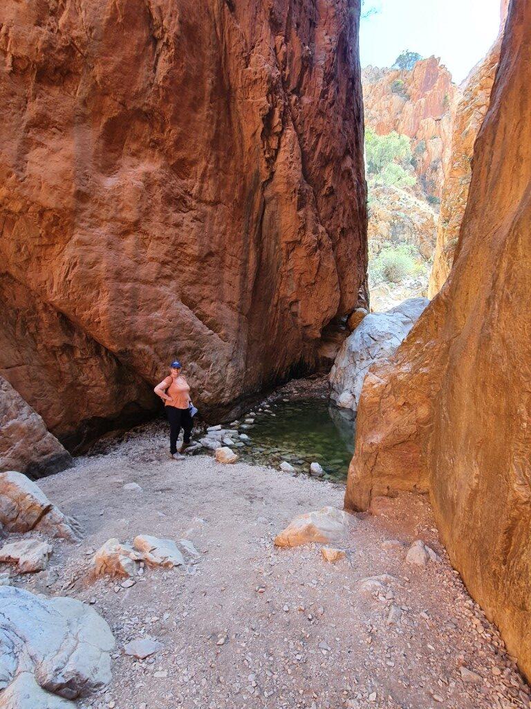
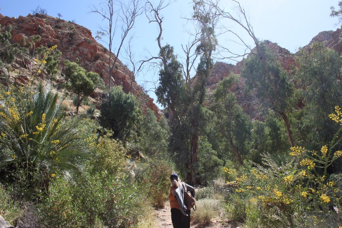
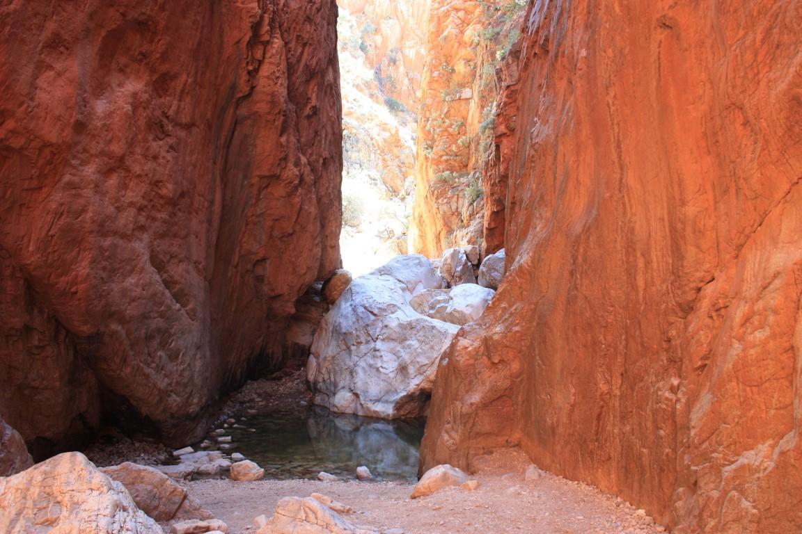
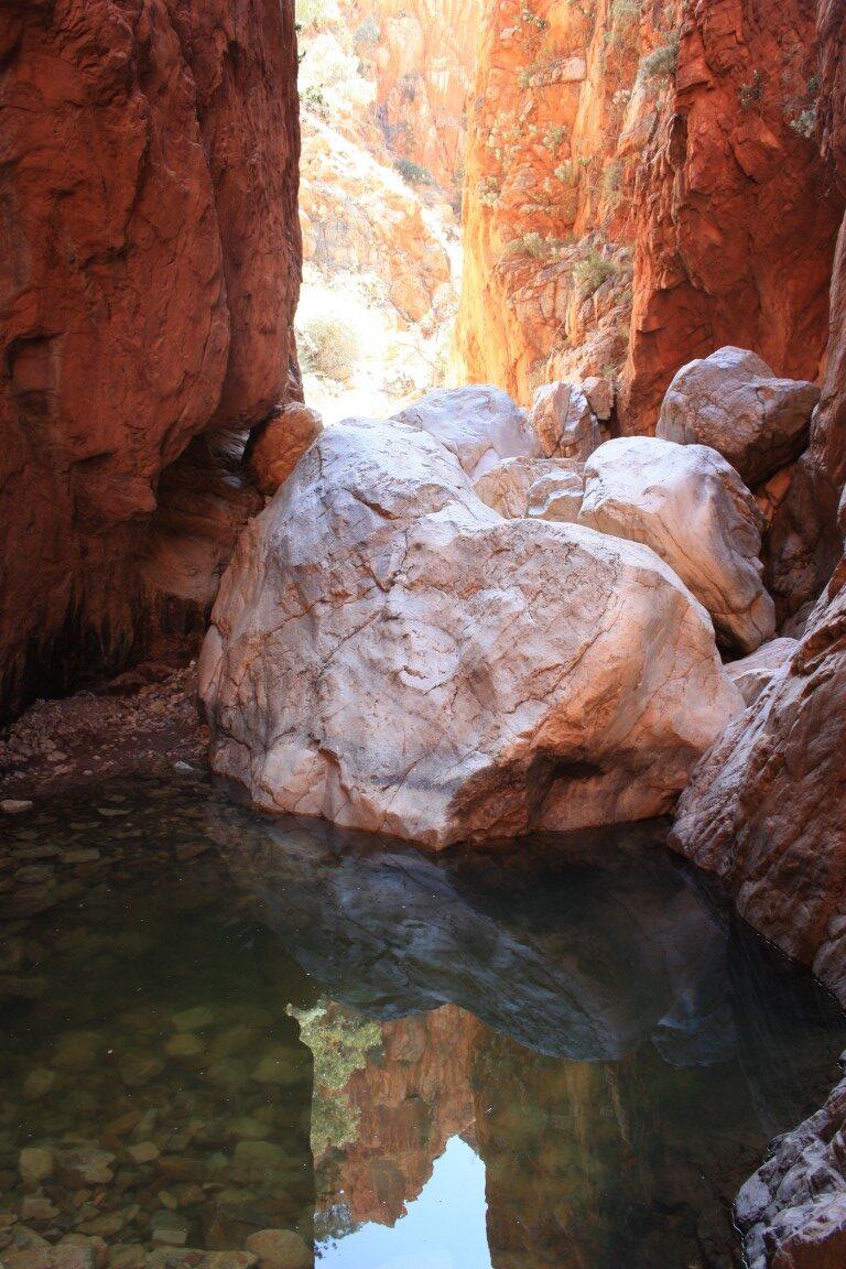
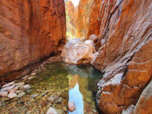
Our next stop was Serpentine Gorge. We both agreed that Serpentine Gorge was the standout of all the gaps, gorges and chasms and this may have been due to the time of day. The sun was in perfect position to create a mirror reflection of the colourful cliff walls behind the gorge in the water-hole that was truly superb.
Serpentine Gorge required a reasonable 1.3km hike to get to and was worth every single step. That combined with the dirt road into it means that some people bypass it so we largely had it to ourselves while we were there.
Serpentine Gorge
The indigenous locals do not like to go to Serpentine Gorge as they regard it as being a place where an angry rainbow serpent lives. If they do have to go there then they must approach it slowly and sing specific chants to calm the rainbow serpent so that it won’t attack them.
Ellery Creek Big Hole
Ellery Creek Big HoleEllery Creek Big HoleEllery Creek Big HoleEllery Creek Big HoleEllery Creek Big HoleEllery Creek Big HoleEllery Creek Big HoleEllery Creek Big HoleEllery Creek Big HoleEllery Creek Big Hole
Ellery Creek Big Hole
Ellery Creek Big Hole is a permanent water-hole with a sandy bank that quickly drops away to fairly deep water. There is a campground there and it’s only a short walk from the campground and carpark to the water-hole.
It is a long and broad expanse of water and there were quite a few visitors there when we arrived. Despite the warm, dry temperatures the water is quite cold and this was proven by one visitor who stripped down and fully submerged. He only lasted a few minutes before getting out to warm up again,
Ellery Creek Big Hole
We opted to sit on the bank, take our shoes and socks off and soak our feet, which was both relaxing and soothing after two days of hiking around the gaps, gorges and chasms of the MacDonnell Ranges.
Ellery Creek Big Hole
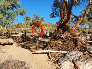
There’s something quite surreal about sitting in 30oC heat in an arid outback setting with your feet dangling in deep, cold clear water. It’s also a little surreal walking past a rope-and-ring type life preserver, of the type you see on ocean liners, hanging on a post beside the water-hole in the middle of the outback.
Simpson Gap
Rare black footed rock wallaby – Simpson GapSimpson GapSimpson GapSimpson GapSimpson GapSimpson GapSimpson GapSimpson GapSimpson GapSimpson GapSimpson GapSimpson GapSimpson GapSimpson GapSimpson GapSimpson GapSimpson GapSimpson GapSimpson GapSimpson GapSimpson GapSimpson Gap
Simpson Gap
Simpson Gap was yet another magnificent passage way through the range with yet another permanent water-hole sitting in the gap between the layered rock walls. This gap opened out onto a wide, dry sandy expanse that had some large ghost gums growing in the middle where they could easily send tap roots down to the water.
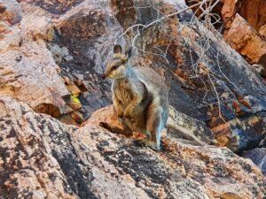
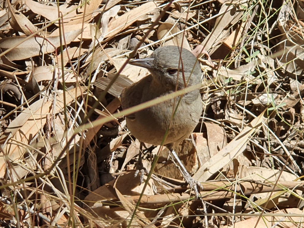
Rare black footed rock wallaby – Simpson Gap
It is home to the black-footed rock wallaby, which is rare and endangered. We we privileged to spot on and get up quite close and personal with one. It perched itself on a rock above us and happily posed for us. When we got to about 15m away it showed us its incredible agility as is bounded up a series of fallen boulders until it judged that it was back at a safe distance from us.
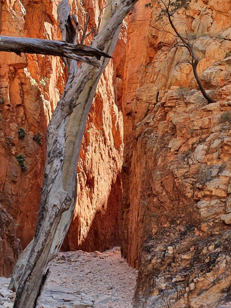
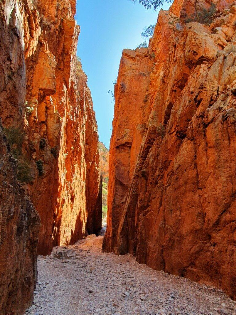
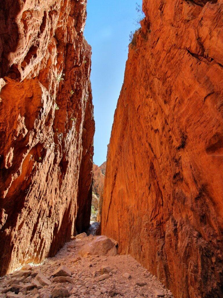
Standley Chasm
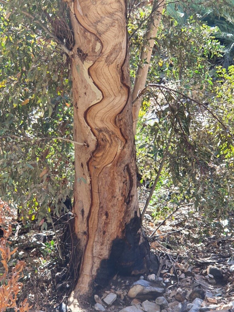
Trail at Standley ChasmStandley Chasm TrailStandley ChasmWattle blooms at Standley ChasmTrail at Standley ChasmTrail at Standley ChasmWildflowers at Standley ChasmStrangely scarred tree at Standley ChasmStandley ChasmStandley ChasmStandley ChasmStandley ChasmStandley ChasmStandley ChasmStandley ChasmStandley ChasmStandley ChasmStandley ChasmStandley ChasmJo at Standley ChasmStandley ChasmStandley ChasmStandley Chasm TrailStandley Chasm TrailStandley ChasmStandley ChasmStandley ChasmStandley ChasmStandley ChasmStandley Chasm
Standley Chasm
Standley Chasm is without a doubt the most ‘touristy’ of the gaps, gorges and chasms with a huge carpark and plenty of tourist coaches. It also has a cafe/kiosk and shop as well as an entry fee to hike up to Standley Chasm itself.
Standley Chasm Trail
Having said that… it is a very pleasant hike on a well made trail that ascends along the way to the actual chasm. Unlike the other gaps, gorges and chasms that we visited, Standley Chasm is very green and lined with trees, palms, ferns and wild-flowers.
It is not an especially difficult hike although we met an 80+ year elderly lady with a walking frame on our way back, who was almost there asked asked us how much further to go and if it was worth it. We actually saw her again at the cafe and discovered that she had persevered and was very proud of herself and thoroughly enjoyed viewing the chasm. Good for her!!!
Standley Chasm
Standley Chasm is somewhat unique compared to the other gaps and gorges due to it’s sheer, smooth vertical walls. We arrived at the perfect time in the middle of the day as the sun crossed from one side to the other, changing colours of the rock walls as it passed.
The colours of the outback are what make it such a spectacular and beautiful place and to think that this show has been played out every single day for hundreds of thousands of years is something quite special.
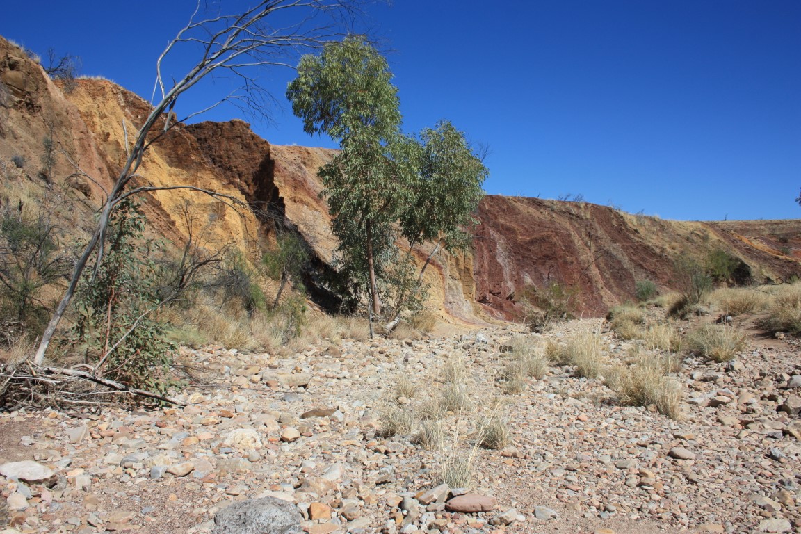
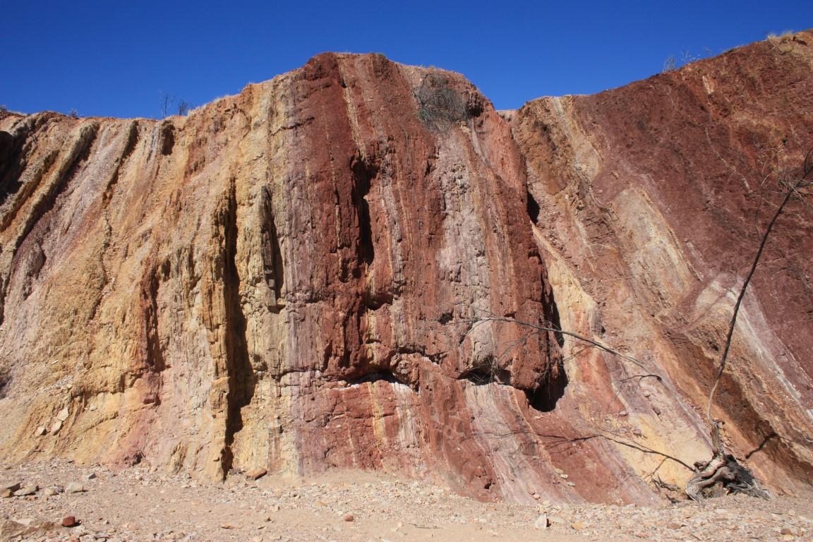
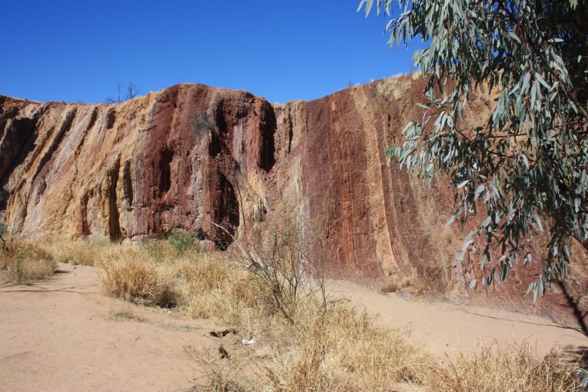
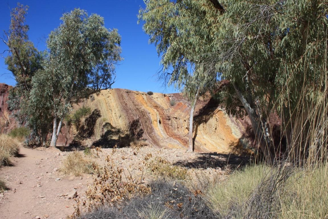
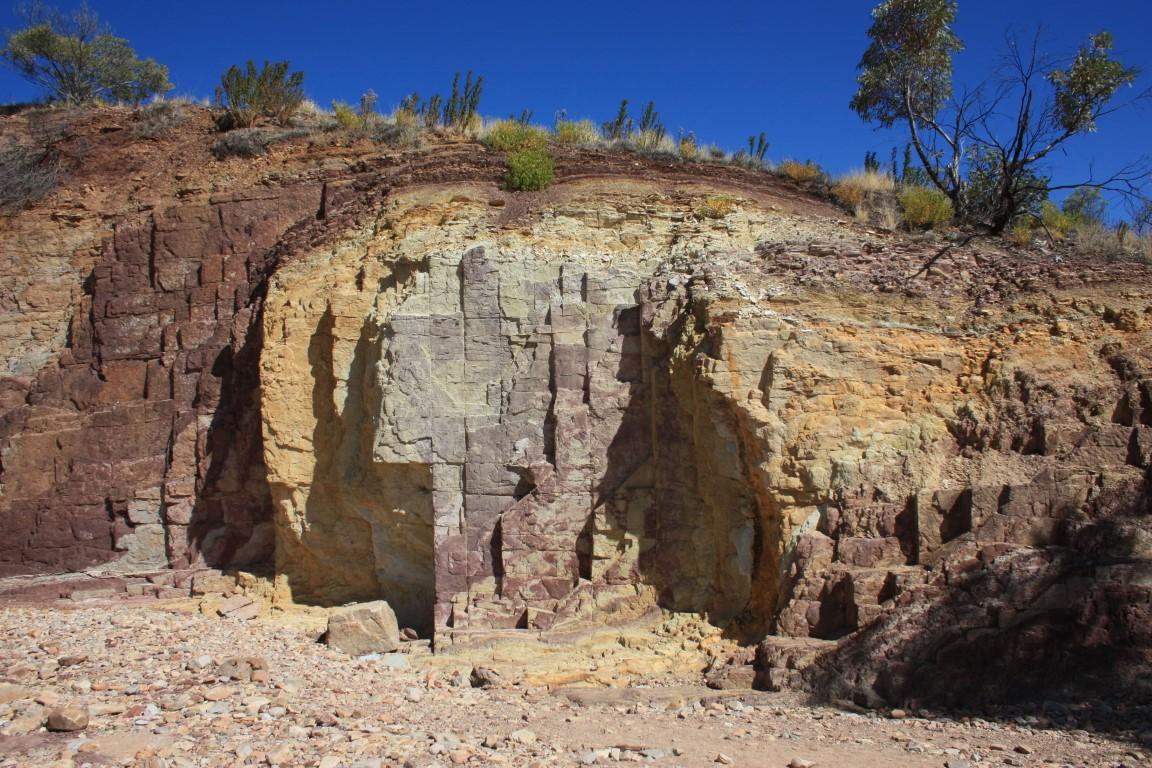
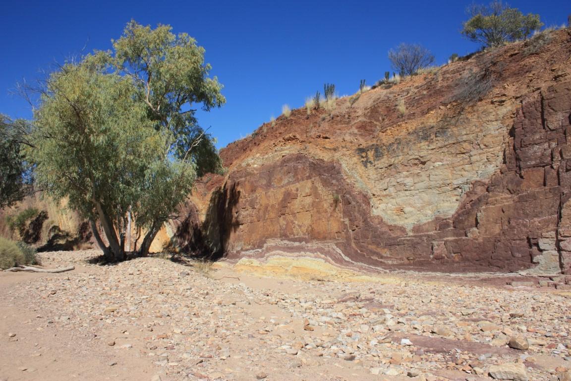
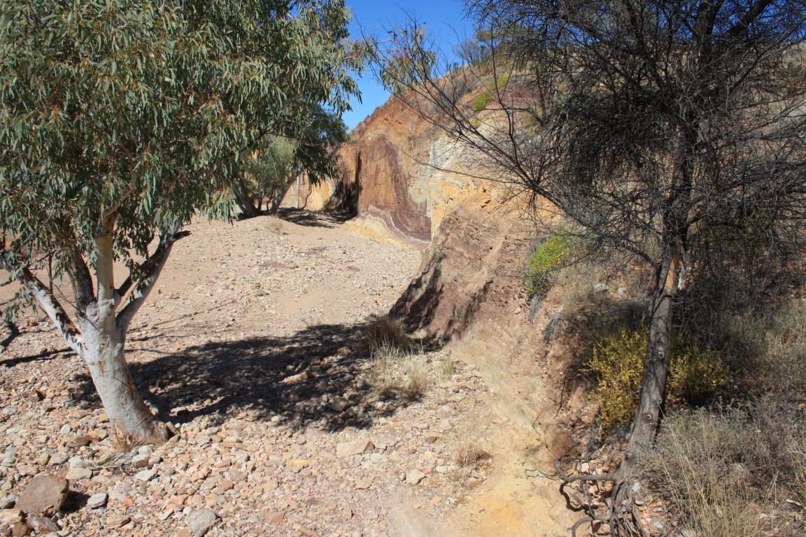
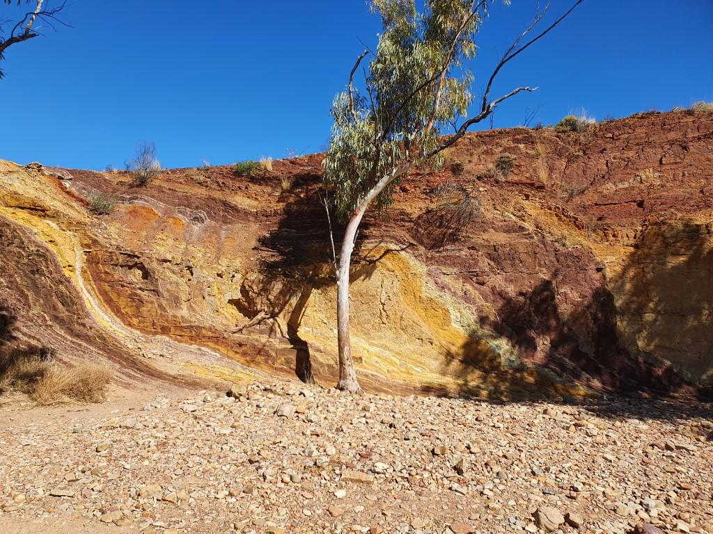
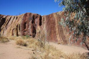
We visited the Ochre Pits on the day that we went sight-seeing along the Western MacDonnell Ranges. They are a very sacred site to the Arrernte people of Alice Springs and played a vital part in indigenous trade prior to colonisation.
Ochre Pits
The ochre is dug out of the uplifted layers of coloured rock ranging in colour from grey/white through gold, brown/red to crimson.
Ochre from this particular pit has been traced as far as coastal Queensland showing the extent to which it was valued for ceremonies and rock art.
The MacDonnell Range ochre is particularly fine and when mixed with goanna or emu fat has a slight sheen to it. Only men were allowed to dig the ochre from the Ochre Pits. Women were permitted to use it after the appropriate rituals and ceremonies performed.
Ochre Pits
The Ochre Pits are reminiscent of the ‘Coloured Sands’ at Teewah Beach near Noosa in Queensland with their striped layers rising the earth along the cliff face. They’re a must to visit in this area and give a real sense of why culture is so important to indigenous peoples of central Australia and why it must be preserved for their future.
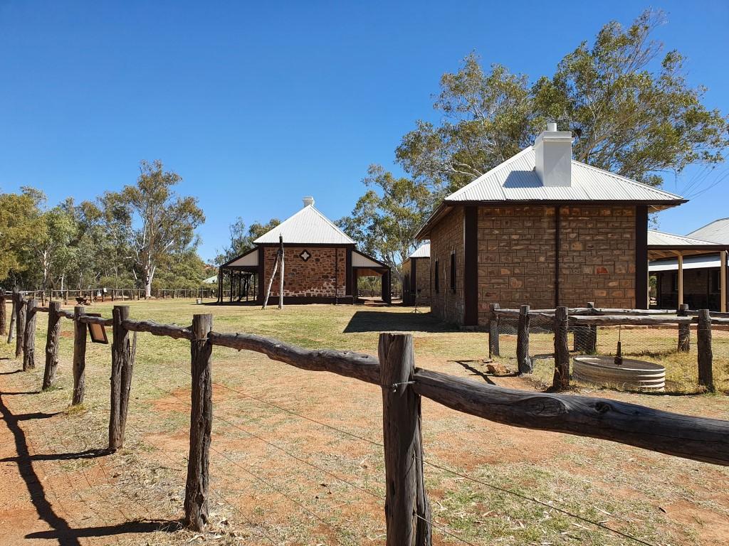
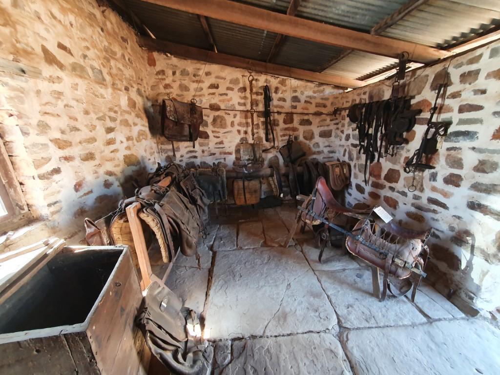
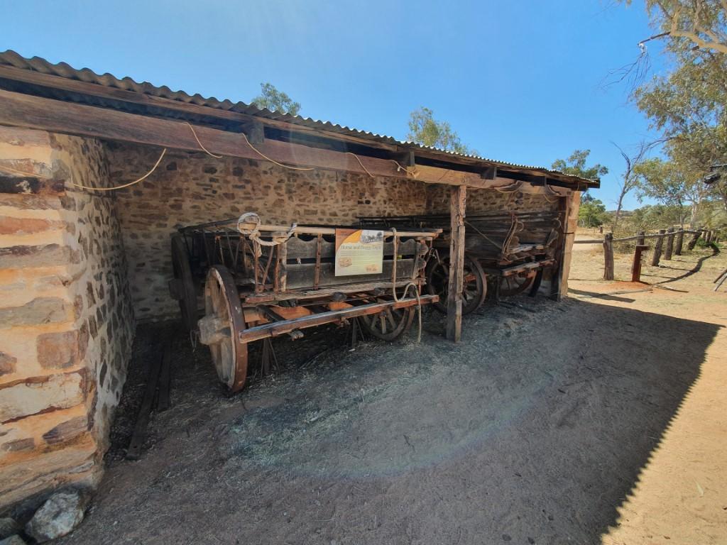
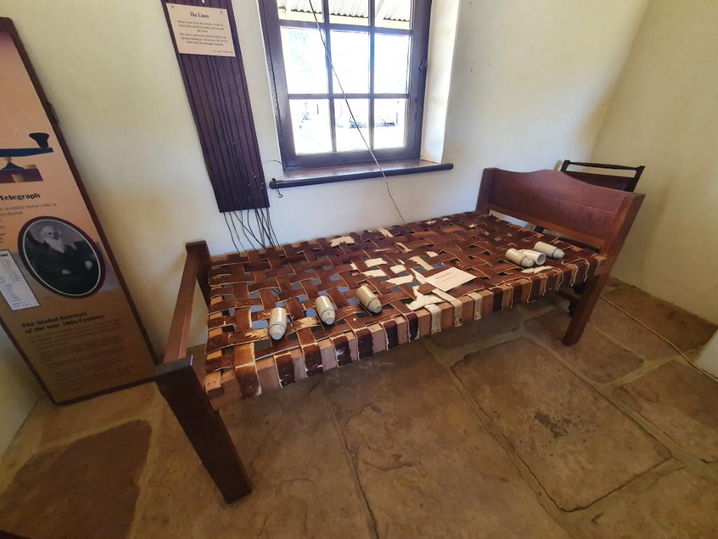
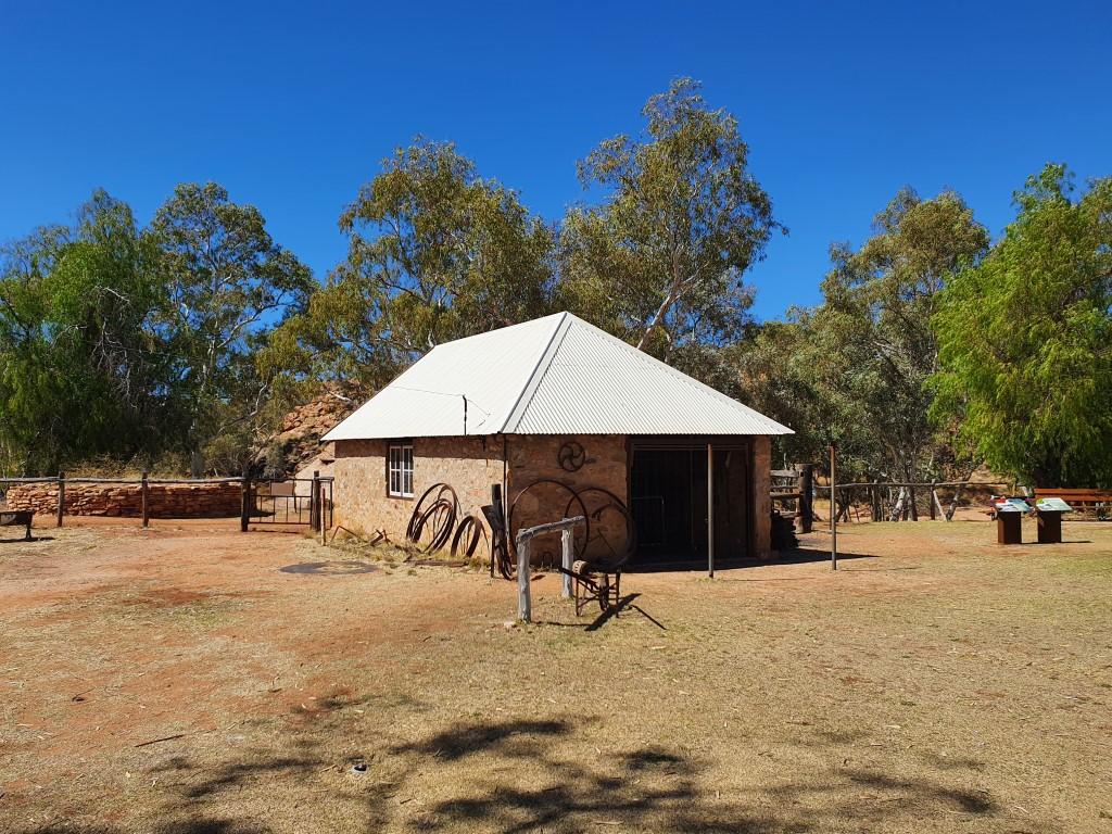
Alice Springs Telegraph StationAlice Springs Telegraph StationOriginal Alice SpringsThe ‘Alice Springs’Dry River ToddAlice Springs Telegraph StationAlice Springs Telegraph StationAlice Springs Telegraph StationAlice Springs Telegraph StationAlice Springs Telegraph StationAlice Springs Telegraph StationAlice Springs Telegraph StationAlice Springs Telegraph Station Trig PointView from the Trig PointView from the Trig PointView from the Trig PointView from the Trip PointView from the Trig PointAlice Springs Telegraph StationAlice Springs Telegraph StationAlice Springs Telegraph StationAlice Springs Telegraph StationANZAC HillView from ANZAC HillView from ANZAC HillView from ANZAC HillView from ANZAC HillView from ANZAC HillANZAC Hill
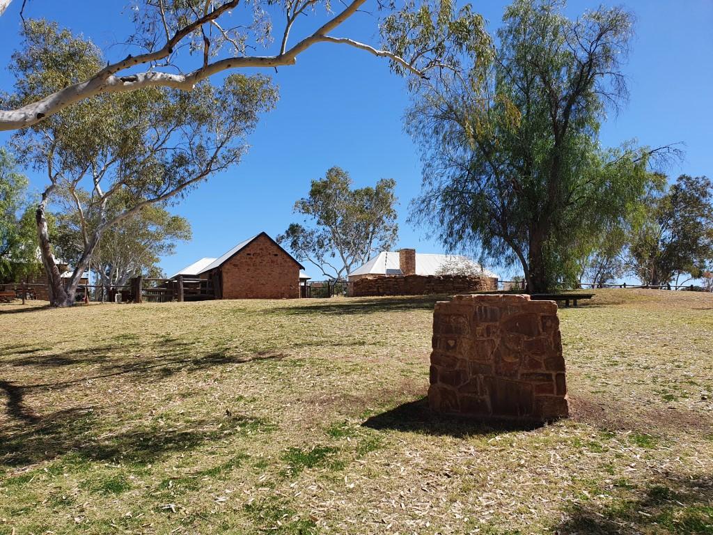
Alice Springs Telegraph Station
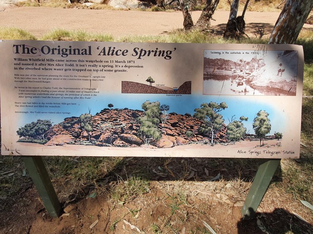
The ‘Alice Spring’
Alice Springs began as a settlement to the west of it’s current location called Stuart, named after the explorer John MacDouall Stuart. A telegraph repeater station was built at the location a permanent water hole that was thought to be a spring that could supply valuable water to the settlement.
So… as we were to learn on our vist to the Alice Springs Telegraph Station, Alice Todd was very flattered to learn that the town had been named after her but declined the offer to visit the place. Also the ‘spring’ is not actually a spring, just a water-hole that generally has water in it.
As such, the ‘spring’ is not a spring and Alice never went there…
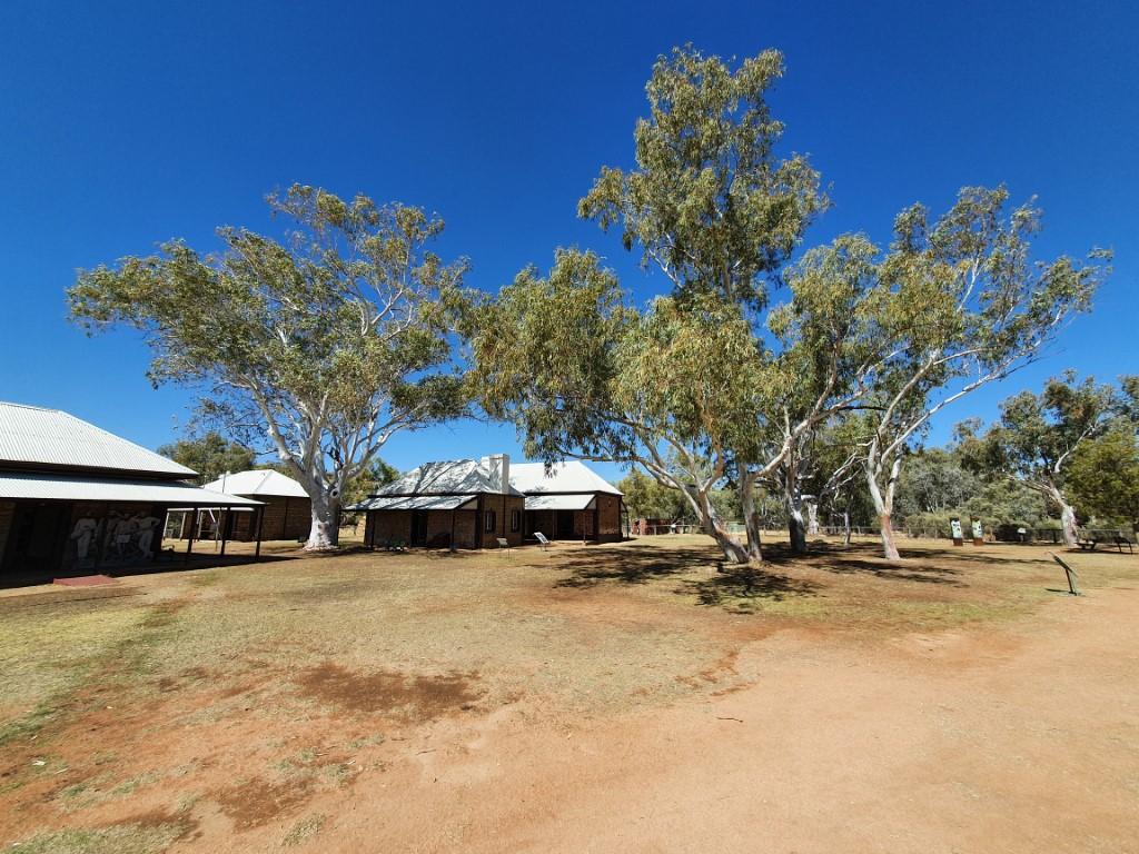
In any case, the Alice Springs Telegraph Station is a fascinating place to visit and you quickly learn how amazing this place was in the history of Australia. The Australian Overland Telegraph was the internet of it’s day. Sending a letter via ship to the U.K. could take anywhere from four to eight months one-way. The new-fangled overland telegraph cut this time down to a matter of hours via the series of repeater stations from Adelaide to Darwin of which the Alice Springs Telegraph station was one.
Alice Springs Telegraph Station
Life was tough though, with supplies only coming in once a year via camel train so order had to be meticulously planned months in advance and the one-hundred and eighty chemical glass jar batteries that powered the lines requiring constant maintence every few months.
The station these days has been carefully restored and kept as a museum to celebrate this historic piece of outback ingenuity and perserverence. It’s also used a function venue with a crew of people setting up an outdoor function, in the dry dusty wind, whist we were there.
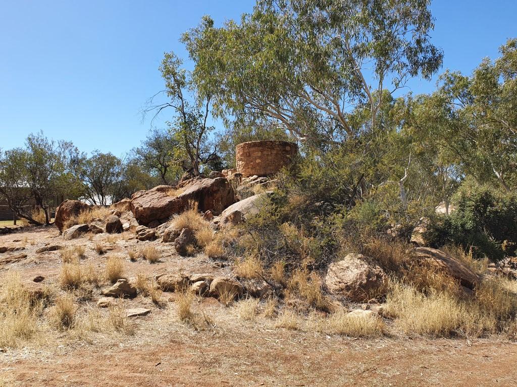
Alice Springs Telegraph Station Trig Point
There was also a mountain bike race going on there whilst we visited that looked like sheer torture in the harsh dry heat. We watched a few riders struggle past along the track and also looking down upon the from the trig station on the hill adjacent to the station.
We enjoyed our visit there very much and it was well worth waiting for the guide talk that explaned the history and operation of the station and its huge impact on Australian communications back in the day. Every bit as amazing and disrupting as the internet is today…
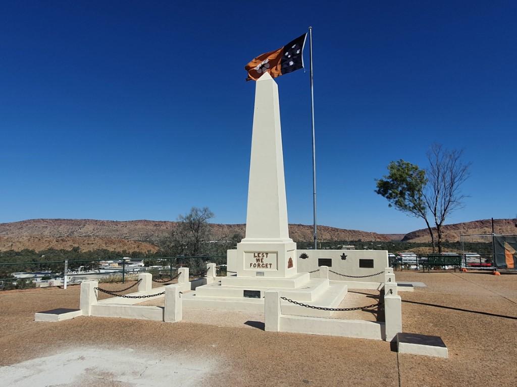
ANZAC Hill
ANZAC Hill
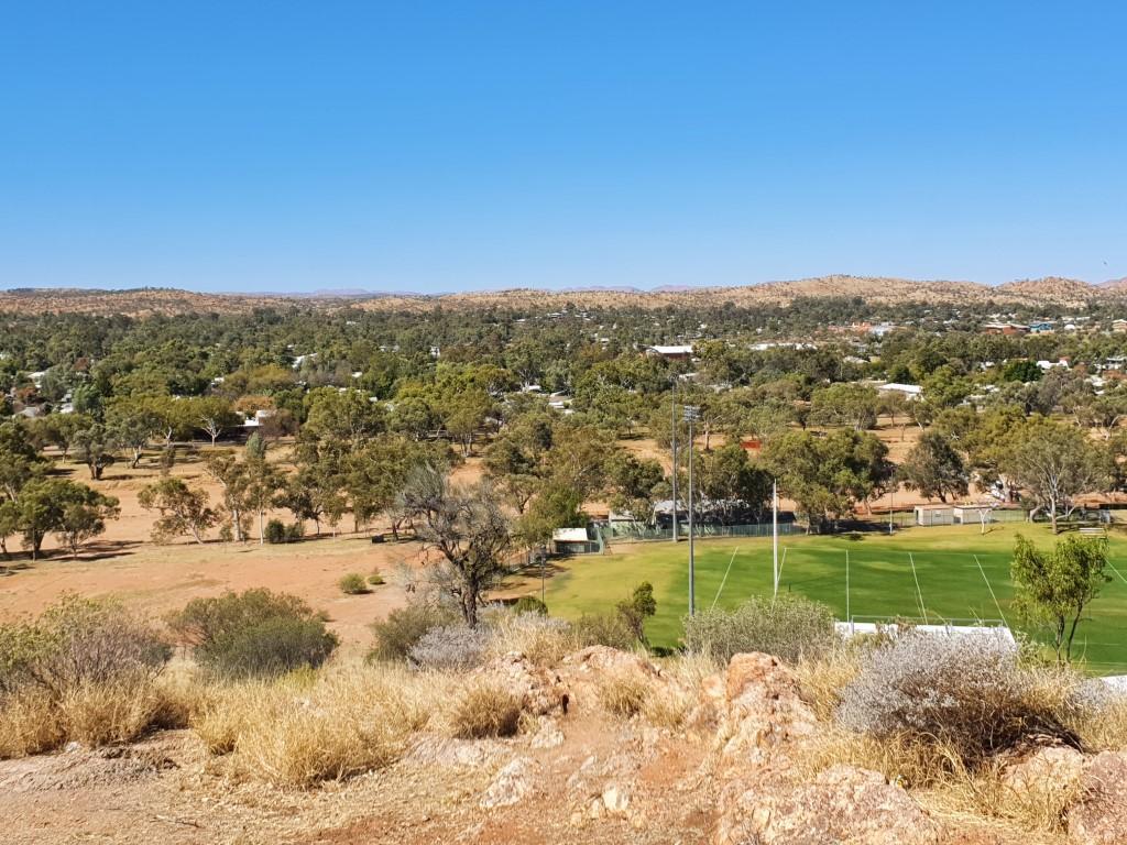
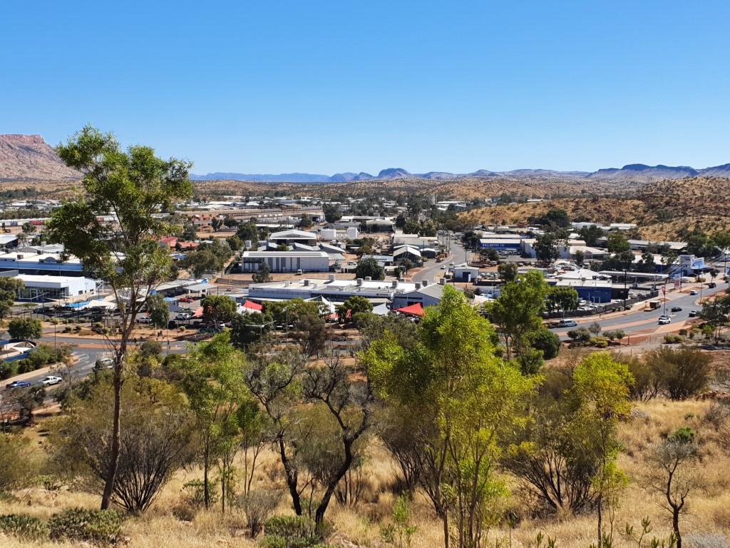
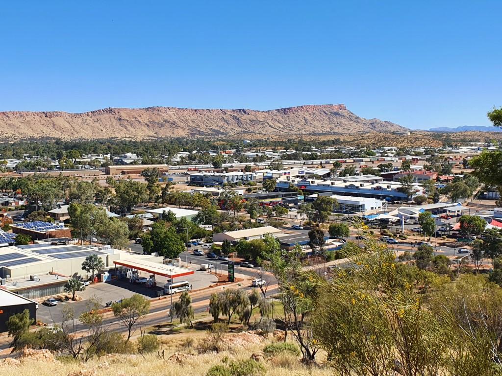
There is a tall hill in the centre of Alice Springs that has been turned into an ANZAC memorial covering all of the warsthat Australian service men and women have been involved in, including some of the lesser known minor conflicts. ANZAC Hill is manages to be a solemn and respectful memorial to those service men and women as well as being an excellent viewing lookout providing sweeping 360 degree views of Alice Springs and surrounds.
The drive up is one way and quite steep although tourist coaches can still manage it. The road is lined with placards that denotes each of the conflicts and the services. It’s quite a special place and would no doubt have greater significance for those men and women who were involved or had loved ones involved in the conflicts. Alice Springs should be congratulated for devoting such a beautiful and prominent part of the town to this memorial.
The Gap from ANZAC Hill
The views truly are magnificent from ANZAC Hill taking in both sides of the MacDonnell Ranges, straight down the main street to The Gap and north along the highway.
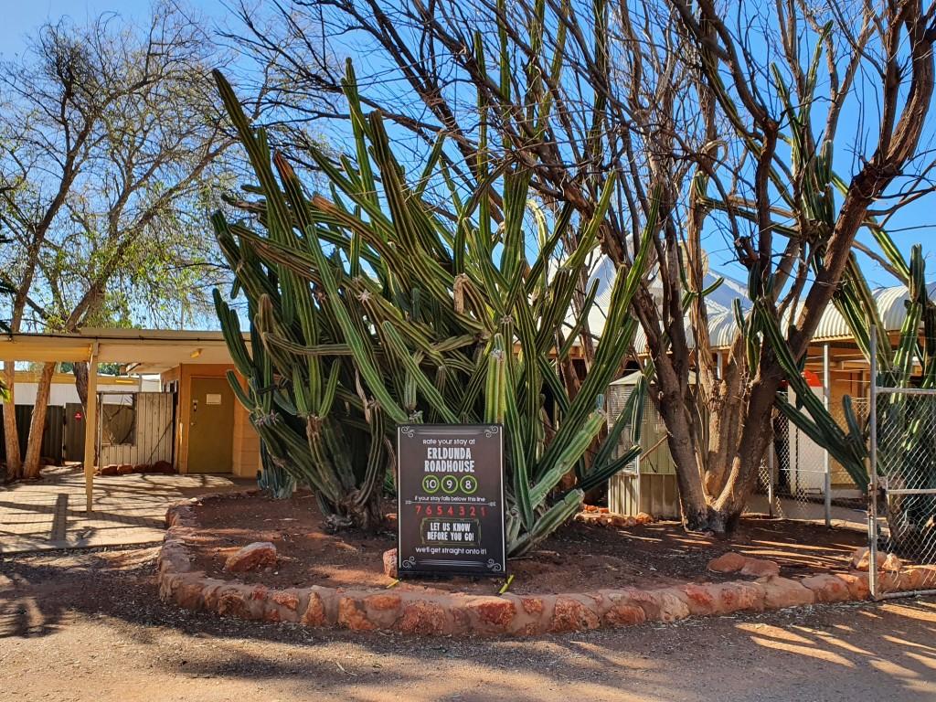
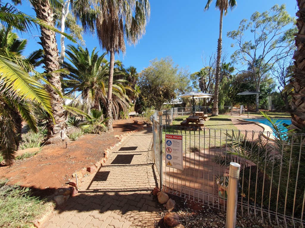
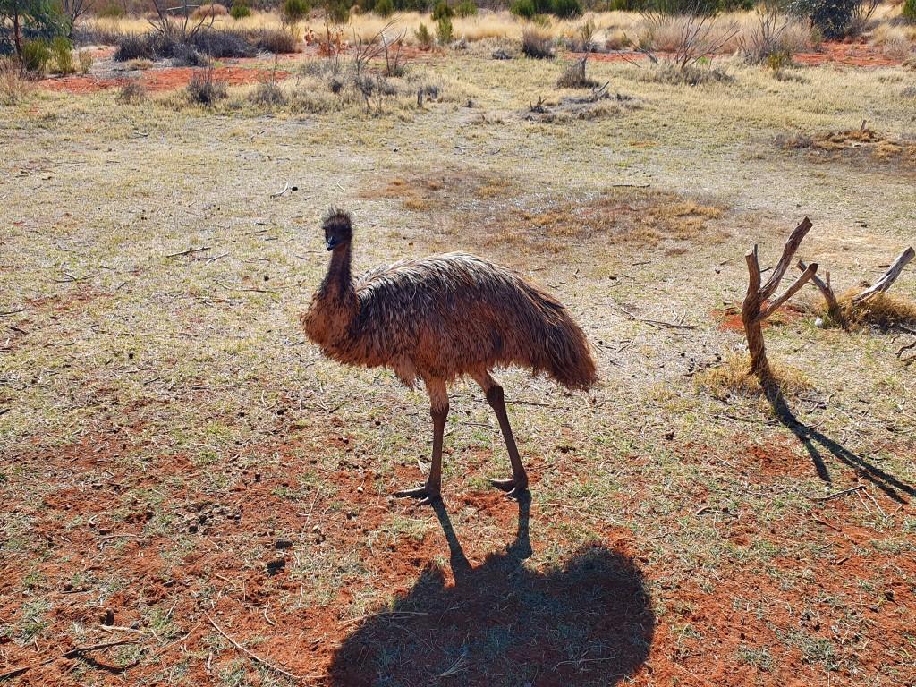
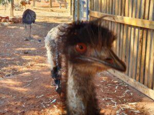
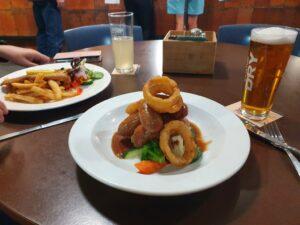
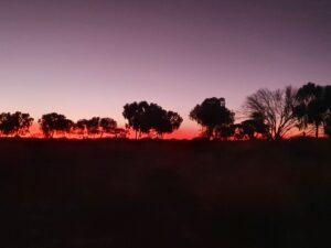
Massive CactusErldunda PoolBangers’n’Mash with Onion RingsErldunda SunsetErldunda SunsetErldunda SunsetErldunda EmuErldunda Emu up closeErldunda Emu up closeErldunda Emu up closeErldunda Emu
After the grandeur, magnificence and glory of Uluru, Kata-Tjuta and Kings Canyon we needed to head east to resume our norther slog up the Stuart Highway towards Alice Springs. We chose to overnight at Erldunda Roadhouse, which is at the intersection of the Stuart and Lasseter Highways.
We didn’t stop there on the way previously due to bad reviews regarding the mouse plague and that the place was smelly and somewhat unclean. However, our Coober Pedy friends Barbara and Paul did stay there and said it was fine so we took their word for it and found it to be perfectly fine as well.
Massive Cactus
It was a bit of an oasis with cactus and palm trees surrounding the pool. The van sites are nice big drive-throughs where you can stay hitched. The only draw-back is that the water is bore water… No problem as we were carrying more than enough drinking water aboard the van.
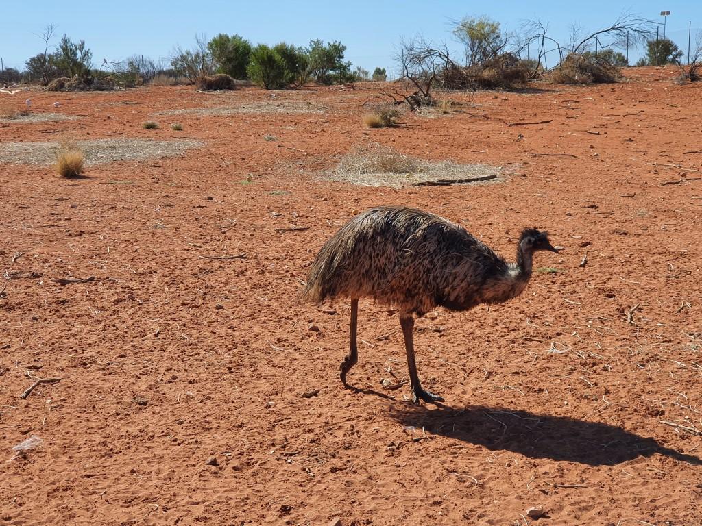
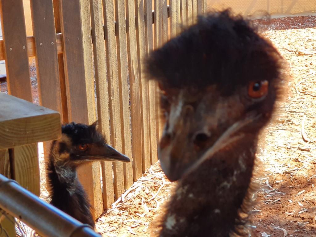
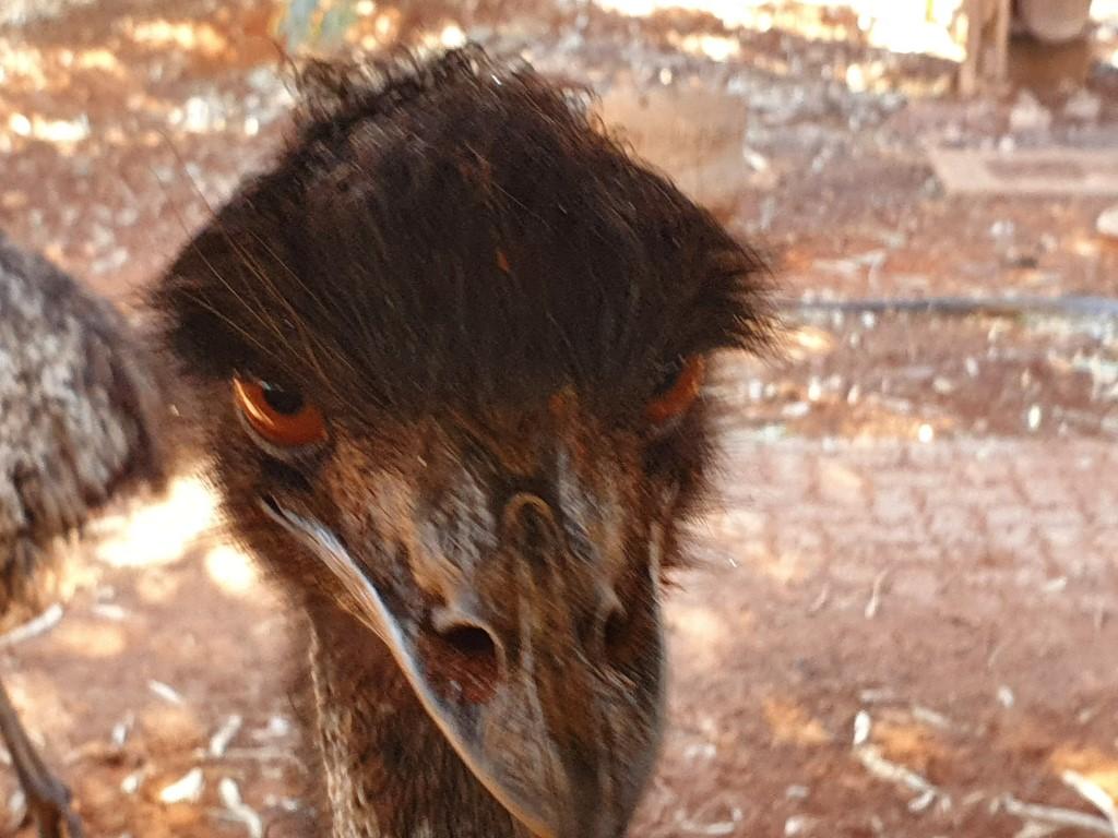
Erldunda Emu up close
Erldunda Roadhouse has a large emu farm and enclosure where you can get up close and personal to them. They’re really quite inquisitive although their red eyes have an evil glint in them that gives you the impression that they’re secretly planning to drag you into the pen and kick the living daylights out of you.
Bangers’n’Mash with Onion Rings
We had another rib-sticking roadhouse meal there. Rob went for the Banger’n’Mash (that came with Onion Rings) whereas Jo went for the… you guessed it… desert fish’n’chips. Roadhouse meals aren’t fancy but they fill you up and they’re good honest cooking and good quality.
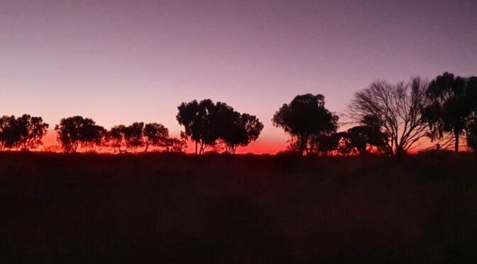
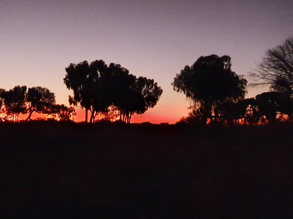
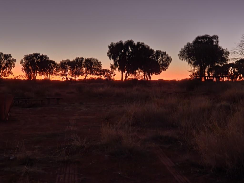
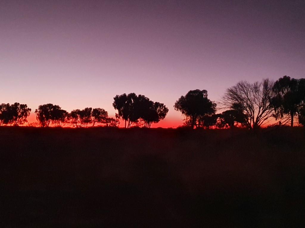
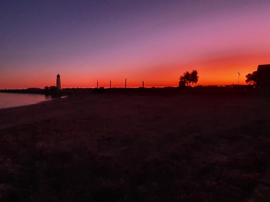
Erldunda Sunset
We were treated to another of those beautiful outback sunsets where the trees are silhouetted against a band of pink that transitions to purple and black as you look higher from the horizon. The Northern Territory has a certain, simple way of wrapping itself around your heart…
Van site at Marla RoadhouseVan site at Marla RoadhouseMarla Roadhouse campgroundMarla RoadhouseMarla RoadhouseMassive Army TanksRoadtrain at MarlaRest stop on way to KulgeraNorthen Territory BorderVan site at Kulgera RoadhouseVan site at Kulgera RoadhouseBras at Kulgera Roadhouse
Marla Roadhouse
Van site at Marla Roadhouse
Moving north from Coober Pedy We began the long haul up the centre to the top of South Australia and ultimately on to the Northern Territory. Marla was our first roadhouse overnighter at the Marla Travellers Rest roadhouse and the last stop in South Australia.
The drive from Coober Pedy to Marla was a 236km slog into the wind that made it feel a whole lot longer than it really was. You could feel the cruiser sucking the diesel down like a cold beer in the desert and it showed at the bowser when we finally got to Marla and filled up. We were expecting to see jacked up fuel prices this far north but tour our surprise it was only $2.30/L which wasn’t much above what we paying back down in Adelaide.
Marla Roadhouse
Barbara and Paul, from Tomcat Hill in Coober Pedy, also pulled in at Marla so we had dinner with them in the roadhouse bar & grill and reminisced on our time in Coober Pedy. This was our first taste of roadhouse cuisine. Jo and I both had the Braised Beef Spare Ribs, which were next level tender, succulent, juicy and beefy. After slogging up the Stuart Highway it was just the sort rib-sticking, hunger-busting comfort meal you need to wind-down and relax into the night. Barbara opted for their Chicken Schnitty and took half back to her van and had two other meals from it the next day. No half servings in the outback roadhouses…
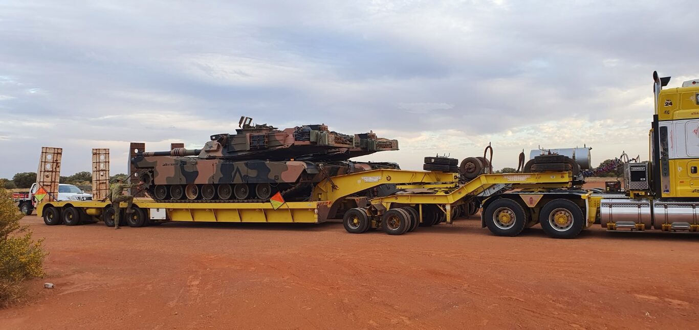
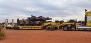
Massive Army Tanks
While we were in Marla a couple of wide load prime movers pulled up, each one transporting an enormous Army Tank north. They were quite interesting and we were somewhat amazed at their size. It’s hard to imagine how tracked vehicles of that size can actually move let alone manoeuvre. The thought of the fuel bill for them made the cruiser’s fuel costs seem a little more palatable given the fuel-sucking drive to Marla.
Marla was also our first stop with no phone reception. It is a little jarring when you’re used to doing some instant research on your phone about the place you’re in and where you’re going next. Thankfully Google Maps still works, to some extent, offline. That said… having no phone or television reception gives you some perspective and you finally realise that you’re deep in the outback and things are a little bit quieter. Things that used to seem important receive a dose of perspective as you open your eyes and ears a bit more and re-engage with the real world.
Kulgera
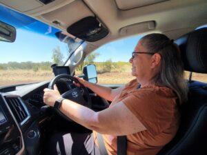
The next day we farewelled Barbara and Paul as we headed to Kulgera Roadhouse. They were continuing a bit further to Erldudnda Roadhouse before we would all meet up again in Yulara. Jo took the wheel for the second time and thankfully the wind had blown itself out the previous day so it was a much more relaxed drive north.
Rest stop on way to Kulgera
We took a rest stop at Marryat Creek Rest Area, just south of the Northern Territory border, and had the first use of our portable gas stove, which was shiny new until this point. We made a couple of cups of Rooibos tea (South African Red Bush). Rooibos makes a red coloured tea that does not contain caffeine and has a slightly sweet flavour such that sugar or sweetner is not required for those of us who don’t like overly sweet beverages. It makes a pleasant change from normal tea.
Northen Territory Border
After our break Rob was back in the saddle as we crossed the border into the Northern Territory. It was the first time in the N.T for both of us. The border has an impressive rest area monument area and a notice that unless otherwise sign-posted the maximum speed limit in the N.T. is 130km/h. 100km/h is plenty and much safer when you’re towing a van even though the Stuart Highway is hard, flat, fairly straight and easy to drive.
Interestingly, to this point, we had been rarely overtaken nor had we overtaken anything more than a few times. We also had not been overtaken by any road trains and had not passed many coming the other way. The few that had passed by us caused little to no turbulence but there still remains a slight anxiety when you see one coming towards you in the distance.
Van site at Kulgera Roadhouse
The push through to Kulgera Roadhouse was dry and desolate with strong winds but not as consistent and in our face as the drive to Marla. We pulled into Kulgera Roadhouse and thankfully it began to cool down and actually ended up raining that night. Not a lot but enough to settle the dust and produce that beautiful, fresh, clean-air smell that comes the rain.
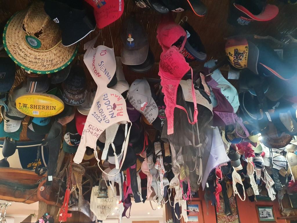
Bras at Kulgera Roadhouse
Kulgera Roadhouse bar has a Happy Hour from 5:00 til 7:00 so we wandered into the bar for that and dinner. The ceiling of the bar is festooned with bra’s, hundreds of them, from liberated passers-by over the years. There was even a prosthetic leg dangling from one spot. We settled in for a few drinks before dinner and got to talking with Linda and her partner Marty, whose Winnebago camper van had broken down on the Northern Territory border.
They got out at the border for a break and then discovered when they started up again that they had lost 10 litres of diesel and figured that they should probably call for help. The mechanic from Kulgera towed them to the Kulgera Roadhouse but was unable to fix it there and arranged for his heavy truck to come from Qld to transport their camper to Alice Springs for repairs. This meant that they were stuck at Kulgera for four nights while they waited for the heavy truck. They were making the most of it and enjoying their forced stay. We had a great time chatting with them and learning about their trip and their current woes, all being handled in good spirits.
For dinner Rob had a camel burger that was every bit as good as a beef burger and seemed quite fitting out here. Jo had, of all things, a seafood basket. When in the middle of the outback and as far away from the coast as you can get, have a seafood basket! Actually… it was pretty good. Distance doesn’t seem to have as much meaning these days with refrigerated transport…
The other amazing thing about Kulgera was our phone and internet reception. From no reception in Marla to 30Mbps in Kulgera. 30Mbps is what we get back home and we were not expecting that sort of speed out here. However, despite the strong internet speeds, we got our first taste of central Australian fuel prices. Diesel at Kulgera jumped to $2.75/L, which is a bit of a shock after $2.30 at Marla. We were expecting it at some point and this was the point. You just have to accept it though because there are no choices. Interestingly… nobody seems to grumble about it and just accepts it as being how it is and fair enough really. It can’t be easy for these places who live and die on the supply trucks that ply the route.
After dinner Linda and Marty gave us a quick tour of their stricken Winnebago. It was about the size of the six berth campervan we had in New Zealand many years ago and was surprisingly spacious. They used the double bed area above the cabin as storage space. They had a double bed at the back which could be raised to the roof, and lowered, electriconically, which basically gave them a small living room underneath. They even had a (compact) two-seater lounge and two separate single-seater armchairs. Plenty of room to stretch out and relax, which given their current situation would have been quite comforting.
Kulgera proved to be a really good overnighter before our 321km push through to Yulara the next day and the magnificaent monoliths of Uluru and Kata-Tjuta…
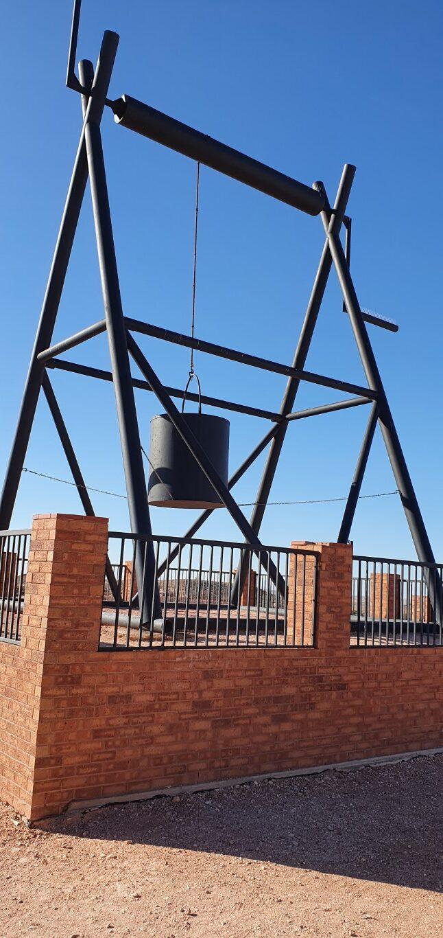
Coober PedyVacuum Dump TruckThe Big WinchView from The Big WinchView from The Big WinchCrashed ‘Pitch Black’ SpaceshipCrashed ‘Pitch Black’ SpaceshipOpal Mine TunnelUndergrond Hotel LookoutUndergrond Hotel LookoutMullock HeapsJunkyard/Fuel StationMine ShaftFaye’s Underground HouseFaye’s Underground HouseFaye’s Underground HouseFaye’s Underground HouseFaye’s Mine SiteFaye’s Mine SiteHistoric Underground Home
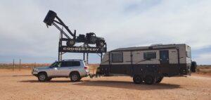
Coober Pedy
The longest tow of our trip so far today, being 378km from Woomera to Coober Pedy… Rob drove the first leg to Glendambo, where we topped up with diesel, Jo drove a couple of hours to a rest stop and then Rob for the last stint into Coober Pedy.
A long but fairly easy drive given the excellent condition of the Stuart Highway, which is better than a lot of major regional roads back in NSW. There was a bit of headwind coming at us, which makes it a bit of slog when you’re towing but could have been worse. Quite a few road trains coming south past us but surprisingly none heading past overtaking us.
Mullock Heaps
We did get stuck behind a camper van, dawdling along between 70 and 80kph while Jo was driving, which forced her to pluck up the courage to overtake after a number of hesitant false starts… After a stretch and a swap over at the rest stop, with Rob back at the wheel, we were about 5km from Coober Pedy when… yep… we came up behind the same dawdling campervan again who had obviously gone past us at the rest stop… Slow and steady – blah blah blah… Needless to say it wasn’t worth overtaking him again.
Vacuum Dump Truck
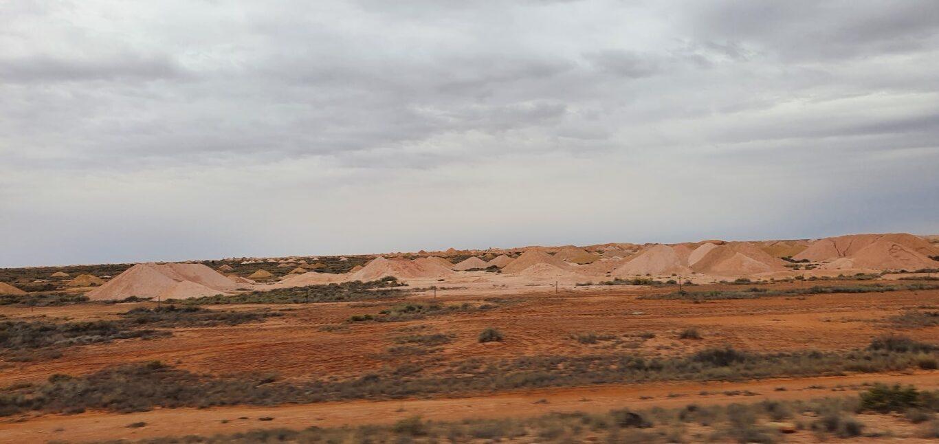
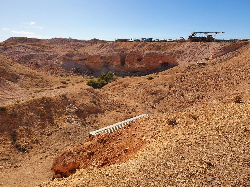
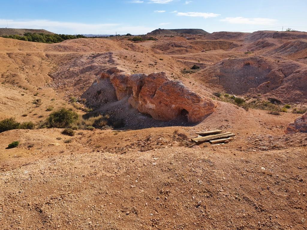
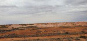
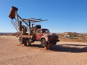
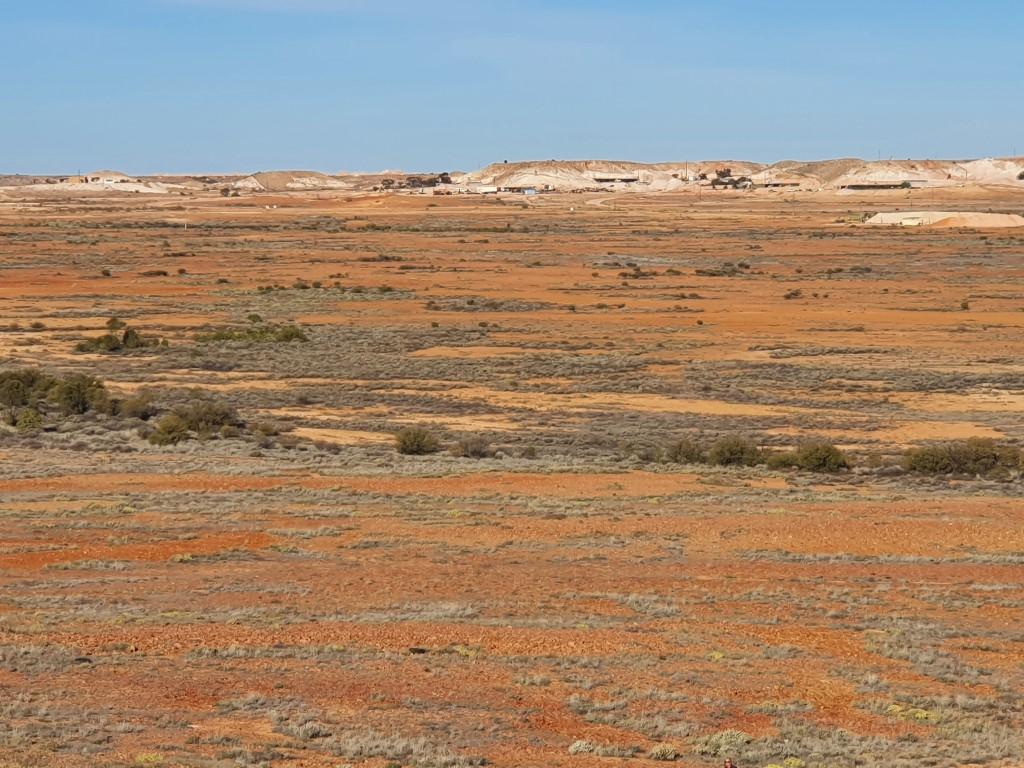
As you come into Coober Pedy you start driving past the mounds of mullock that have been hoovered up from the opal mine shafts by the vacuum trucks and dumped out on the ground. So you have a contrasting landscape of red dirt and dirty green scrub dotted with off-white, conical mullock mounds like a gigantic version of anthills. In between the mullock heaps you’ll spot the odd excavator and the ubiquitous vacuum trucks with their overhead collection bins. You turn off the highway into Coober Pedy and it turns into a maze of bitumen streets and dirt roads lined with blocks of above ground homes, personal junk yards, opal shops and the like.
For all it’s hidden riches Coober Pedy also has it’s less attractive side and on our first trip to the IGA we were greeted, harmlessly, by a couple of indigenous locals who tried to entice us to buy some grog for them… They didn’t pester when told no but it was that first rude shock and sadness at seeing the emptiness and shallowness of their lives that makes you feel very uneasy about how they have been, and are being treated, since colonisation. Nothing felt unsafe in Coober Pedy just the air of awkwardness and sorrow for what we have and they don’t.
That aside… Coober Pedy appears to be thriving and as long as they keep finding opal then it will always continue to thrive…
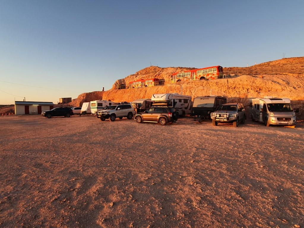
Tomcat HillTomcat HillTomcat HillTomcat HillView from Tomcat HillTomcat HillNight Skiy at Tomcat HillView from Tomcat HillView from Tomcat HillView from Tomcat HillView from Tomcat HillTomcat HillSunrise at Tomcat HillSunrise at Tomcat HillOld windlass at Tomcat HillTomcat HillOld windlass at Tomcat HillSunrise at Tomcat HillSunrise at Tomcat HillSunrise at Tomcat HillFirepit at Tomcat HillFirepit at Tomcat HillSunset at Tomcat HillSunset at Tomcat HillSunset at Tomcat HillThe road into Tomcat HillThe road into Tomcat HillThe road into Tomcat HillThe road into Tomcat Hill
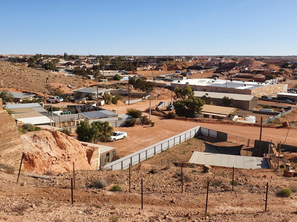
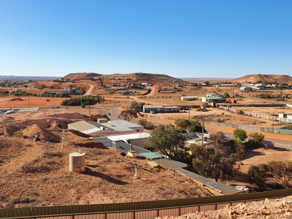
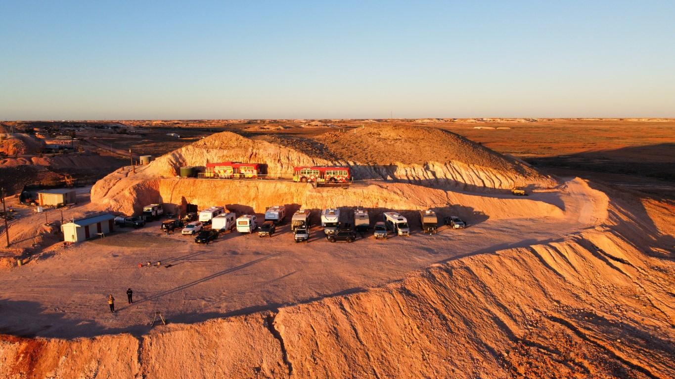
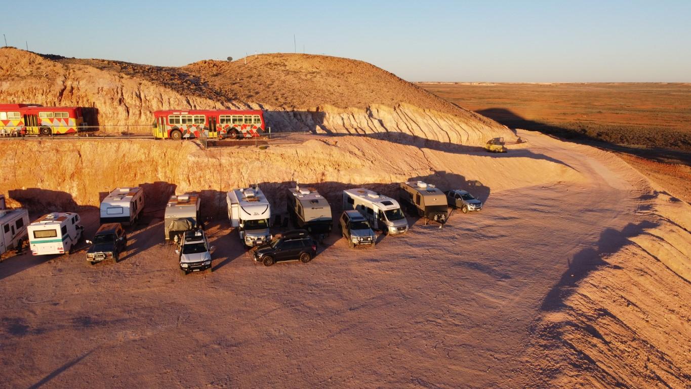
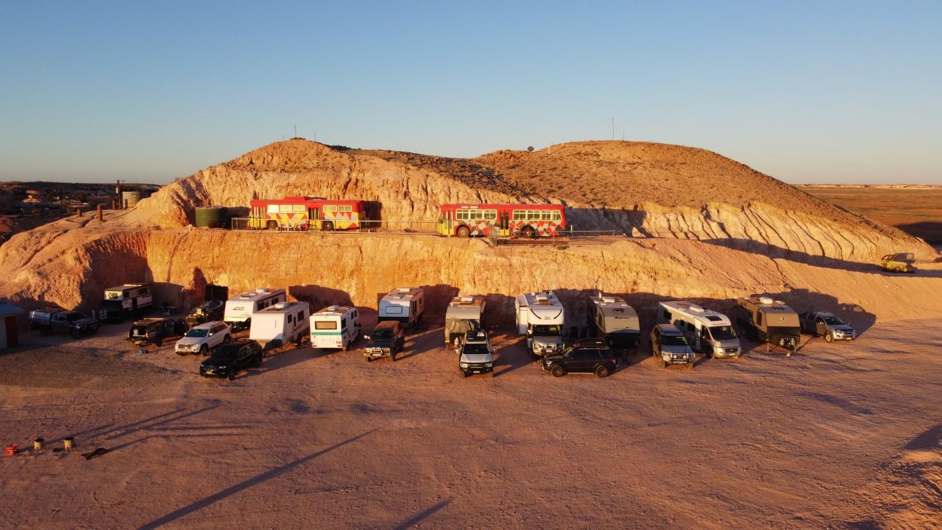
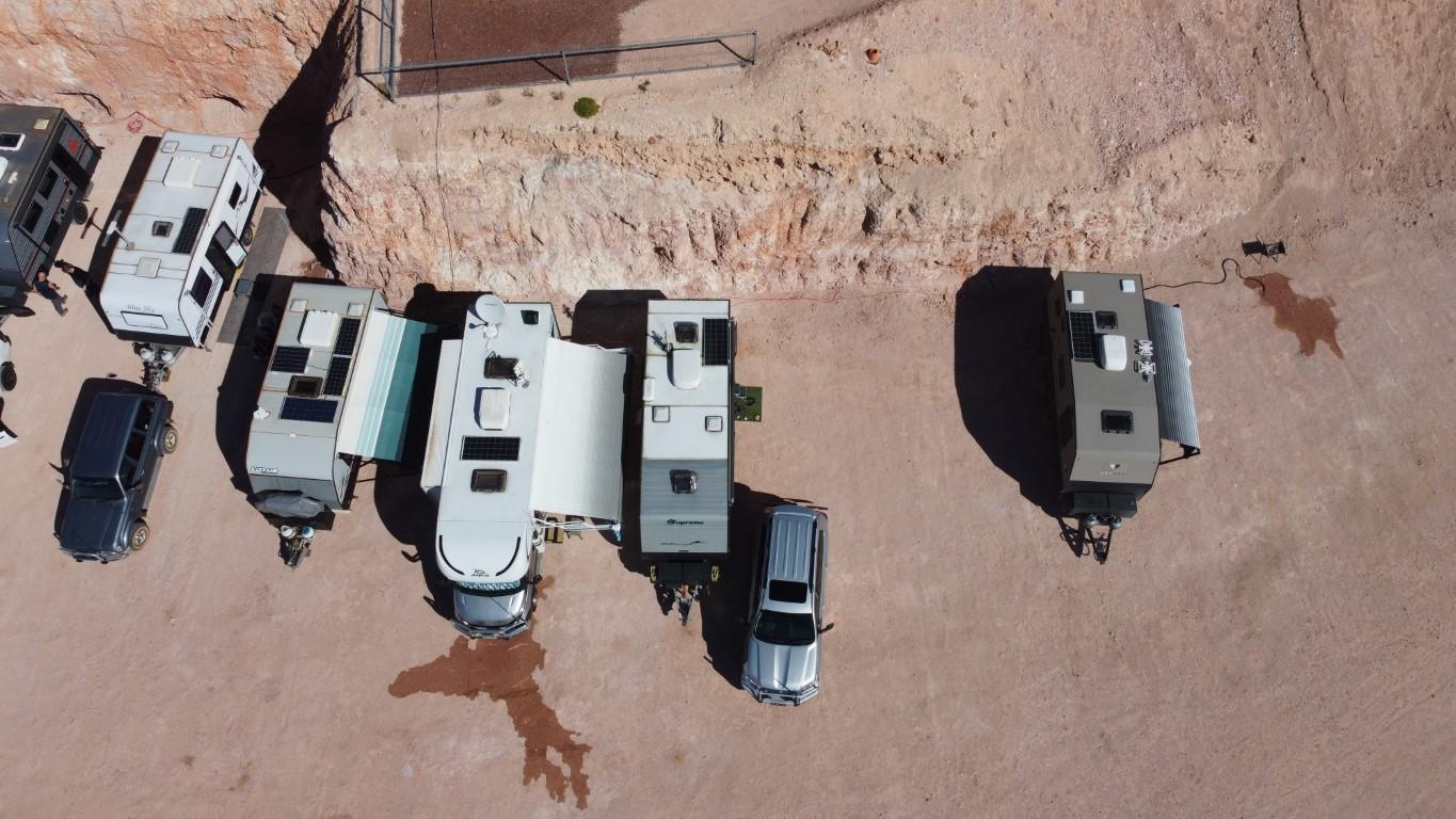
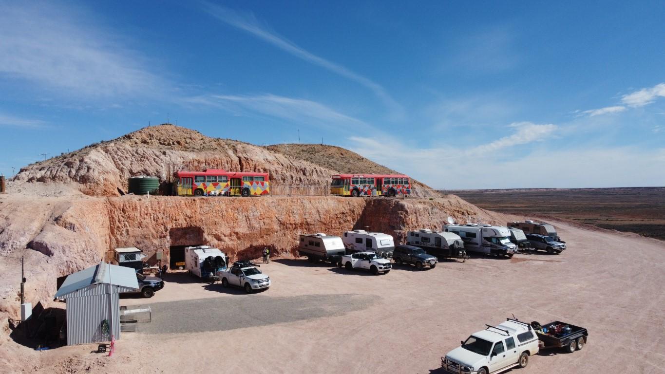
After arriving at Coober Pedy we drove around the outside of town to find our way to Tomcat Hill Caravan Park, which is carved into the north facing side of… Tomcat Hill, about thirty metres above the plain below.
The road into Tomcat Hill
On the other side of the hill is what looks like a private residence and a B&B of some sort that is partly dug into the hill. The road in is a slightly confusing jumble of graded paths with a variety of markings painted on old tires. It’s steep and snakes around the hill and is only just wide enough for the car and van. Thankfully it’s one way in and one way out (not that people don’t get them mixed up).
Tomcat Hill
There’s one short steep section where you’re looking at blue sky over the dashboard and then a final shallow drop that has an outward slope on it that also makes you wonder if you’ve taken the wrong road and you’re going to then have to take five hoursreversing the van back down. Thankfully you drop onto a magnificent, wide, flat ledge area that is the van park with an absolute world-beating panoramic 210o view out over plain towards The Breakaways. Just simply spectacular and you know in that instant that you have chosen the absolute best place to stay in Coober Pedy and possibly in outback South Australia.
Tomcat Hill
We were greeted by Des, the owner/host who guided us into our site back against the cut rock wall. Des is one of the nicest blokes you’d ever want to meet. He was a cop in Coober Pedy many years ago, who left and five years ago returned to do some opal mining. His Tomcat Hill Caravan Park is a bit of a labour of love and, to our surprise, has only been operating for the last three months. The mains water is as good as Canberra water and the three ensuite style shower/toilets are very probably the best amenities we’ve seen since we started the trip. All built into the side of a hill in the white clay dirt that is Coober Pedy.
Old windlass at Tomcat Hill
After we set our van up Des wandered over and explained to us that the snaking mound around the ledge of the caravan park ledge consists of opal mine mullock that he had had dumped there as fill. With a bit of patience and a ‘black light’ that he lent us for the night you could ‘noodle’ through the mullock and possibly find some opal, which others had done previously. If you found an opal you could keep it. We found a few pieces of ‘potch’, which is colourless, worthless opal. Jo insists that she found a bit of ‘colour’ that Des examined and declared to be a tiny piece of ‘beer bottle potch’ due to the almost microscopic flecks of orange. Value… $Less than worthless!
Whilst noodling we were joined by Barabara and Paul, a lovely couple from the Adelaide Hills region who were following roughly the same track and iteinerary as us going north. We got to know them over the fire pit and would ultimately continue meeting up with them and swapping tales over the coming weeks as we headed north from Coober Pedy.
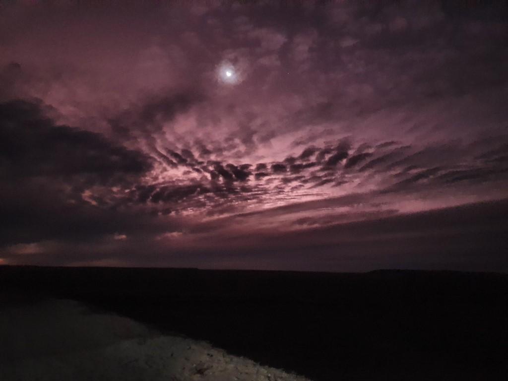
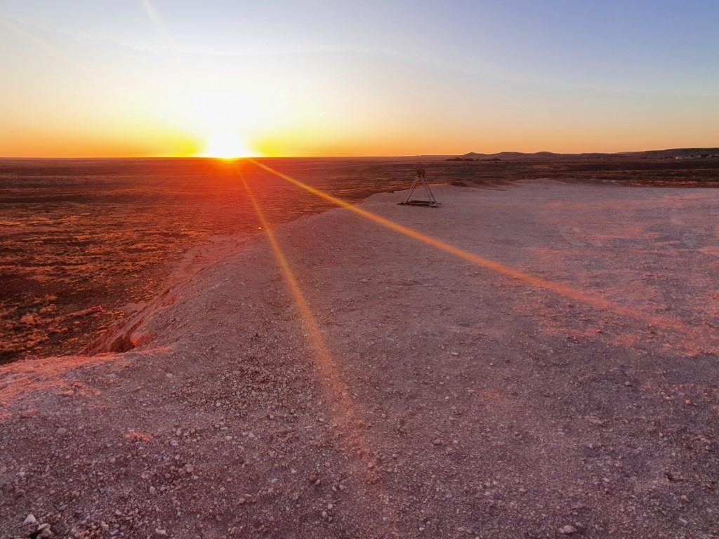
Tomcat Hill Caravan Park provides its campers with glorious sunrises and sunsets, except our first night due to the cloud cover. The second night though, after Des lit the fire pits, treated us to a magnificent horizon light show traversing the spectrum from pale purple all the way through to bright orange and ember red.
Old windlass at Tomcat Hill
The sunrise is a whole different show where the entire side of the hill is bathed in a golden glow and the air itself looks like honey and just makes you feel wealthy basking in it. It is natures treasure and it’s all yours if only for fifteen minutes or so.
Tomcat Hill also gave us our first chance to get the drone up. Up until now the weather had conspired to keep it safely grounded. The ledge of the campsite was the perfect place to launch and our little drone captured a perfect birds eye view of the hill and the surrounding plains out to the Breakaways. Rob was a little rusty at the controls but the video turned out well.
After three months of travelling we both agree that Tomcat Hill Caravan Park is far and away the best van site we’ve had and is going to be incredibly hard to beat as we travel on…
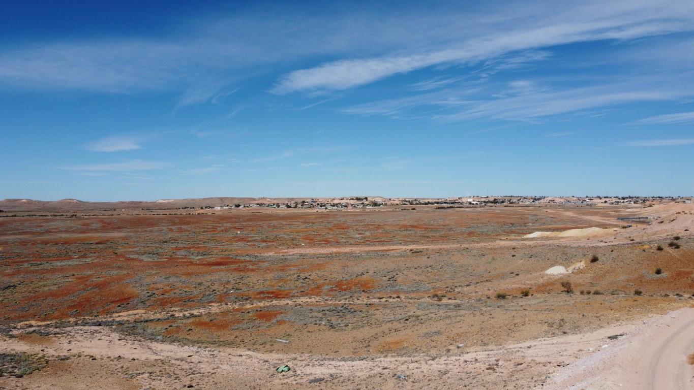
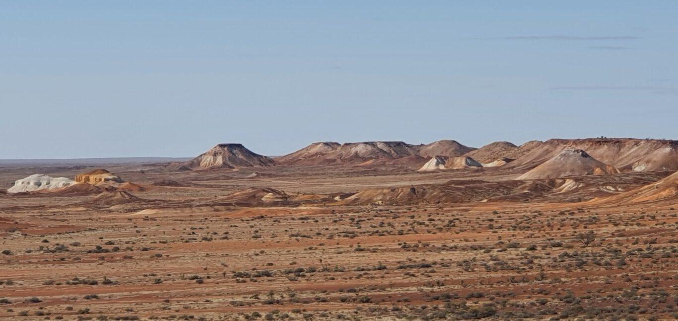
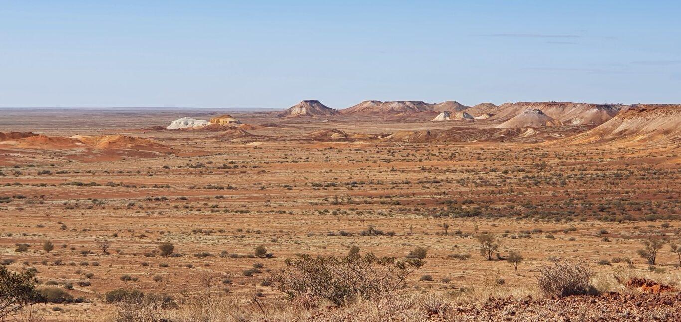
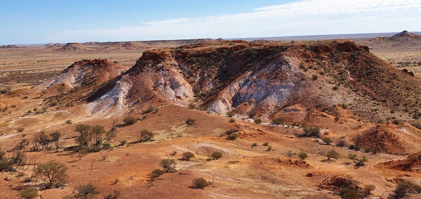
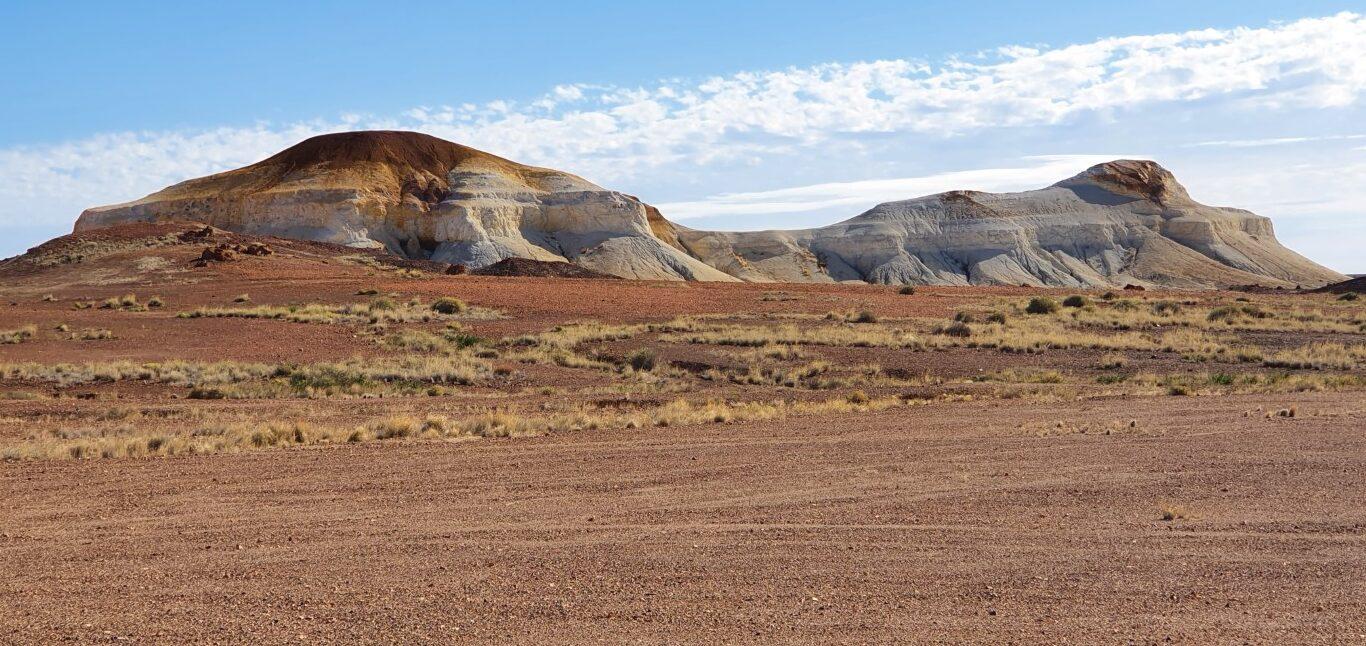
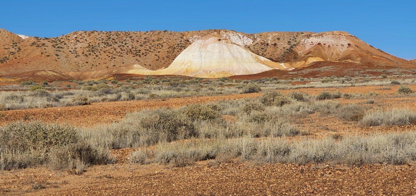
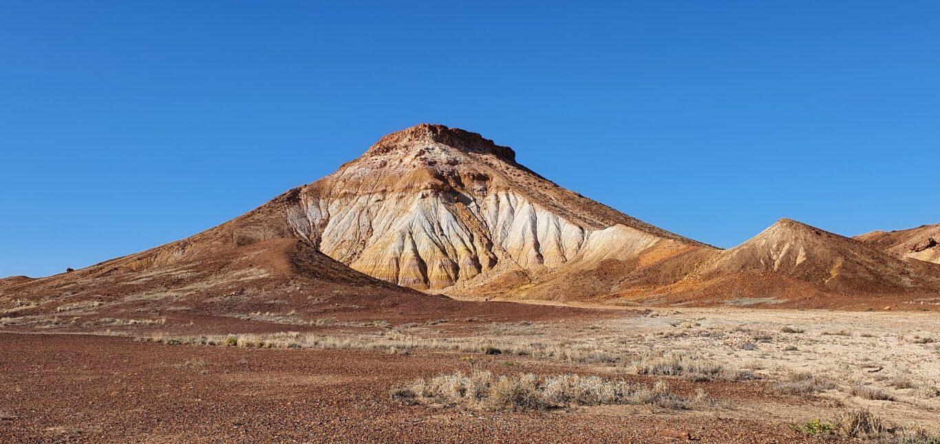
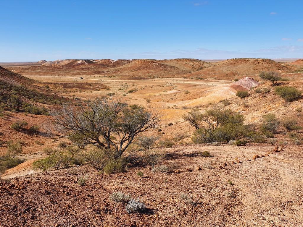
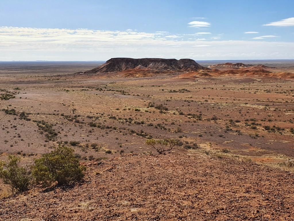
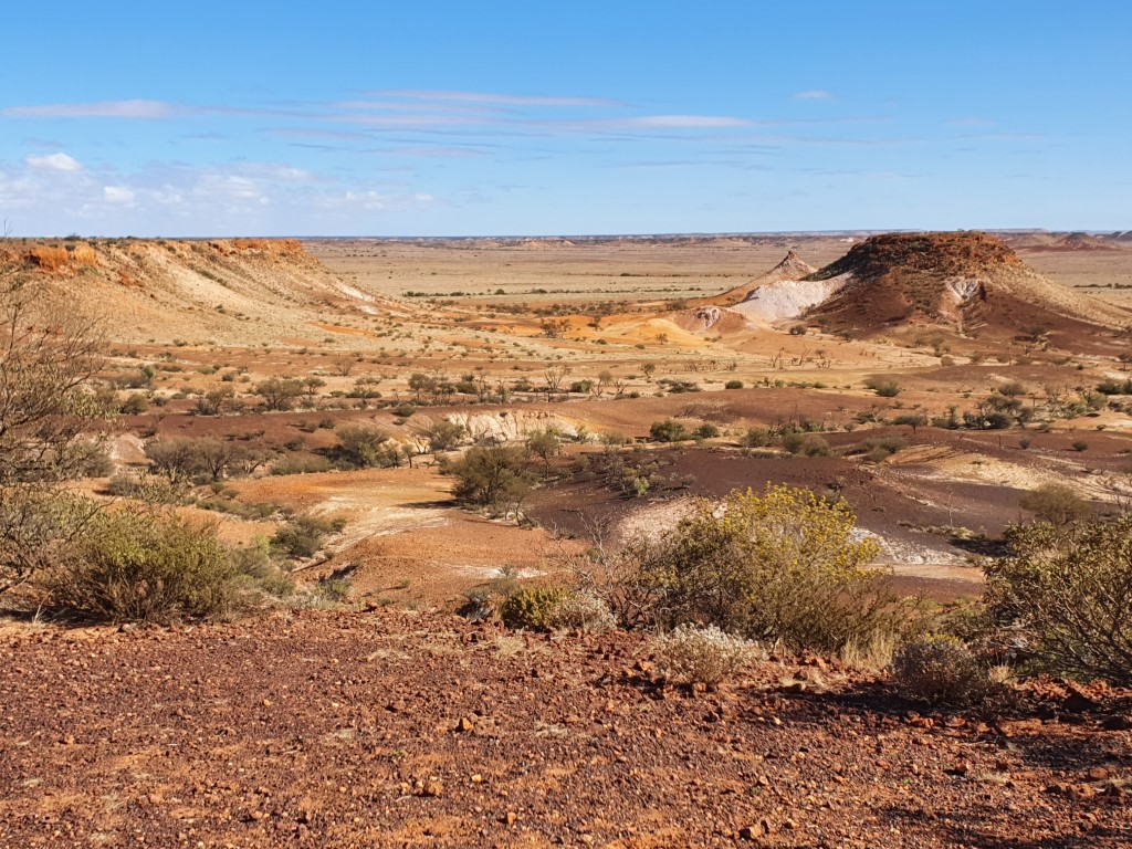
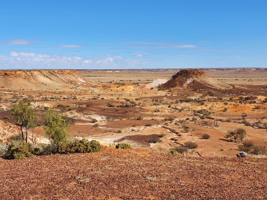
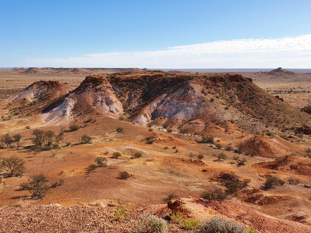
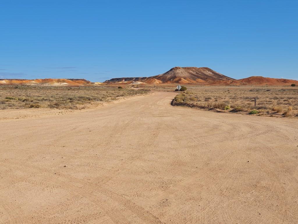
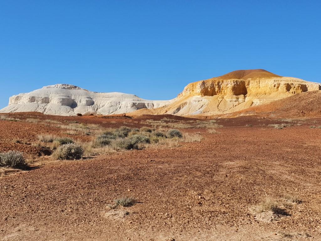
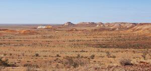
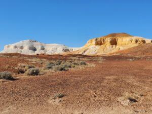
The BreakawaysThe BreakawaysThe BreakawaysThe BreakawaysThe BreakawaysThe BreakawaysThe BreakawaysThe BreakawaysThe BreakawaysThe BreakawaysThe BreakawaysThe BreakawaysThe BreakawaysThe BreakawaysThe BreakawaysThe BreakawaysThe BreakawaysThe BreakawaysThe BreakawaysThe BreakawaysThe BreakawaysThe BreakawaysThe BreakawaysThe BreakawaysTHe Dog FenceThe White and Brown Dogs OwnerThe White and Brown Dogs
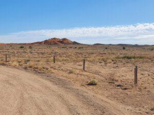
THe Dog Fence
Tomcat Hill faces the magnificent Breakaways a small range of hills, cliffs and gullies about 30km away. You basically follow the bitumen out to the ‘dog fence’, hang a left and follow the corrugated dirt road out to The Breakaways. It requires a permit that can be bought online.
The Breakaways
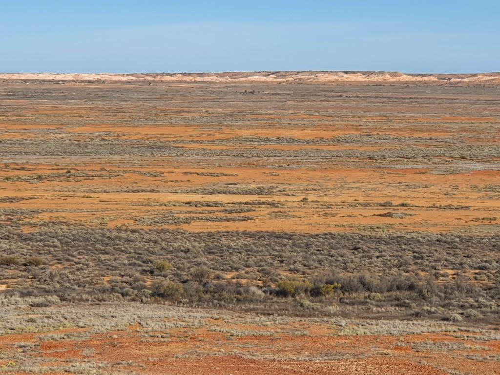
We were a little undecided about going out to them but so glad we decided to. The whole area is magnificent and steeped in indigenous folklore. The range of earthy colours are the first real introduction to the South Australian desert outback, and the spectacular scenery to be found there.
The Breakaways
Most unexpected were the cliffs and gorges that were hidden at distance by the sweeping flat plains as viewed from Tomcat Hill. When visiting the Breakaways you drive through a series of mounds and hills and then suddenly find yourself atop a cliff line that looks further out over the dry, arid plains.
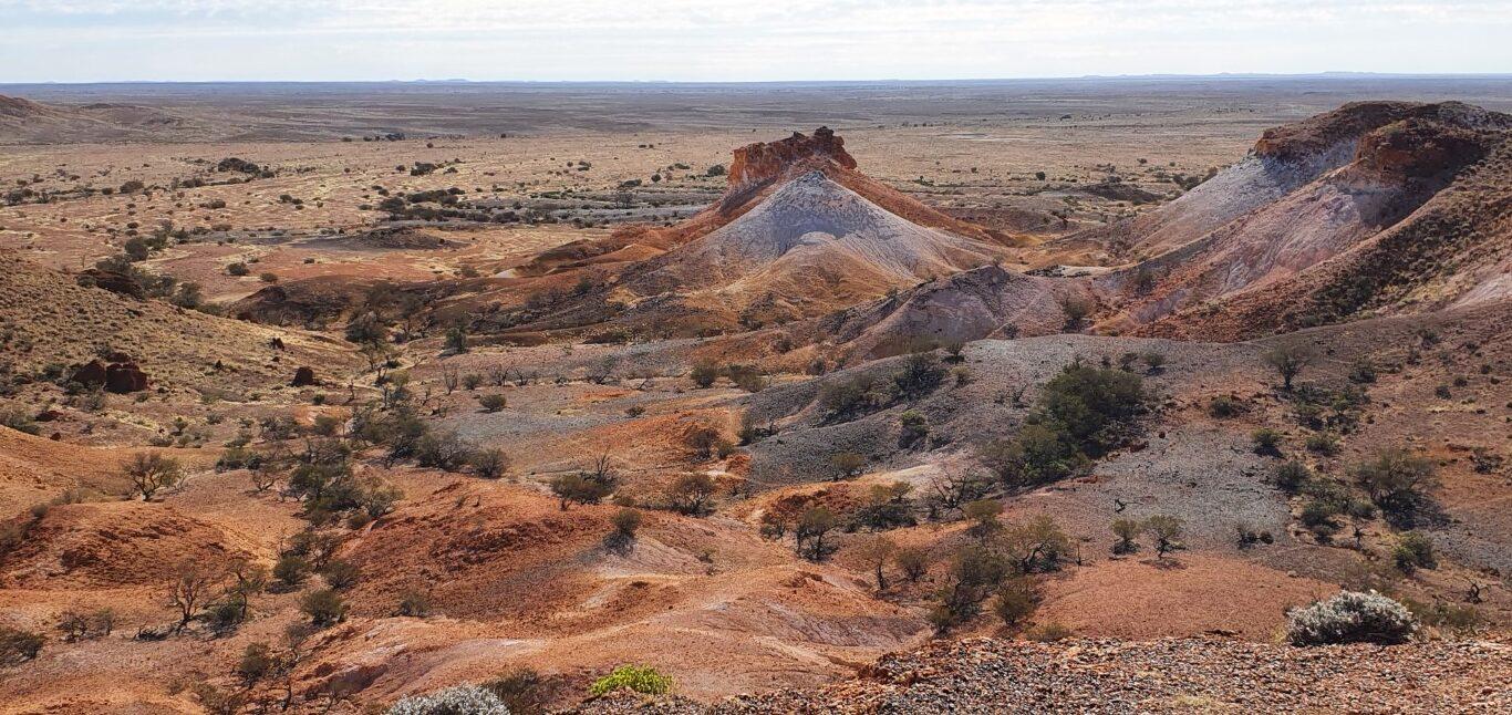
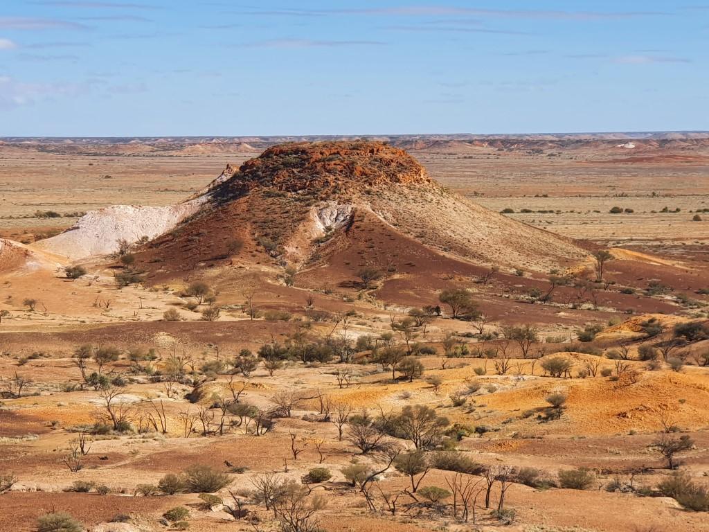
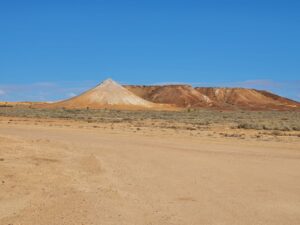
The White and Brown Dogs Owner
The White and Brown Dogs
The hills and mounds provide the most dramatic colours of the area. One pair of hills are referred to by indigenous owners as the ‘brown and white dogs’, with a conical nearby hill referred to as the dogs’ owner. The Breakaways were our first real introduction to the range of earthy colours that define the Australian outback desert.
The Big WinchCrashed ‘Pitch Black’ SpaceshipOpal seam under black lightOpal seam under white lightHistoric Underground HomeVacuum Dump TruckView from The Big WinchView from The Big WinchOpal Mine TunnelUnderground Hotel LookoutUnderground Hotel Lookout
The Opal Cave
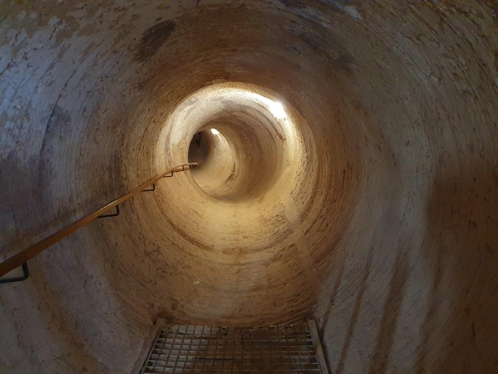
Opal Mine Tunnel
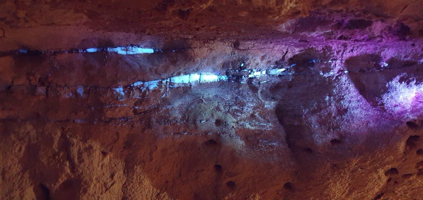
The Opal Cave is an opal shop and opal cutting/demonstration spot that is cut in underground on the main street near the IGA. We took a tour of an underground mine that is no longer in operation. Mining is no longer permitted within the town itself. Some older areas were hand dug whereas the newer tunnels were mechanically bored. At one point we were shown a small seam of opal still in the tunnel wall and it was interesting to see how it was detected with black light and the difference when under white light. Check the slider below…
Historic Underground Home
The Opal Cave also houses two underground display homes. One is a recreation of a miners dugout in the 1800’s, the other is a representation of a modern underground home. They were interesting to view and showed how much more comfortable it is living in the constant cooler temperature under the ground. At one point the guide turned off the lights and, as expected, it was completely pitch black and a pure absence of light.
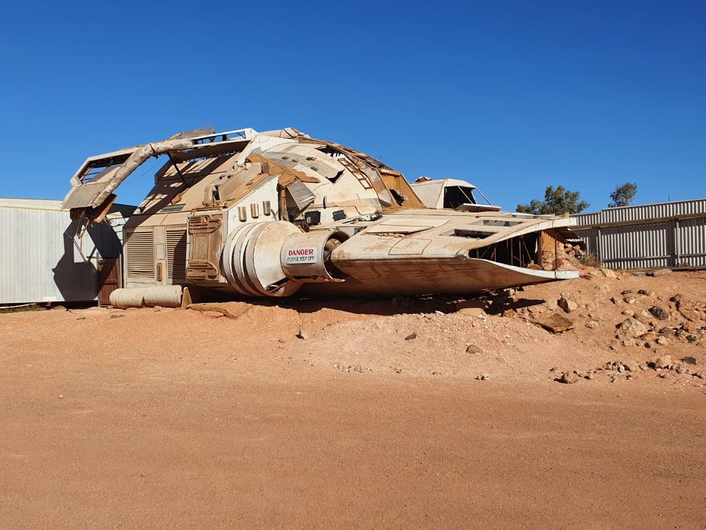
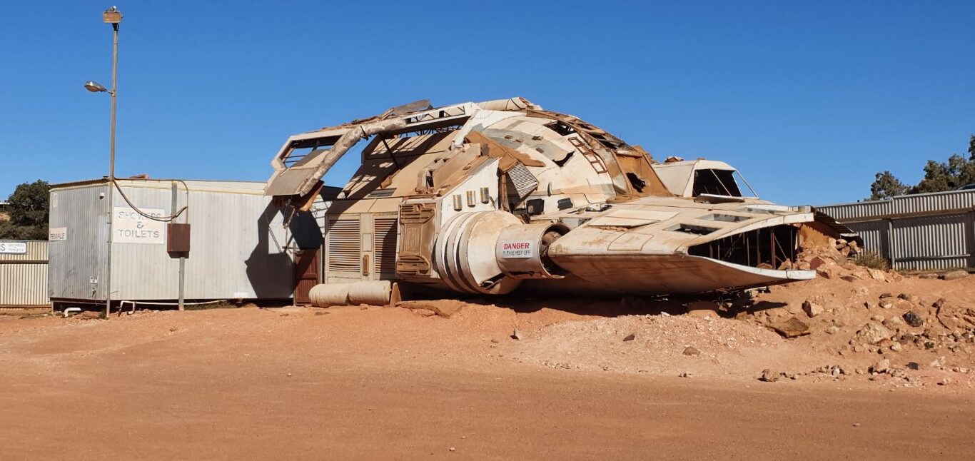
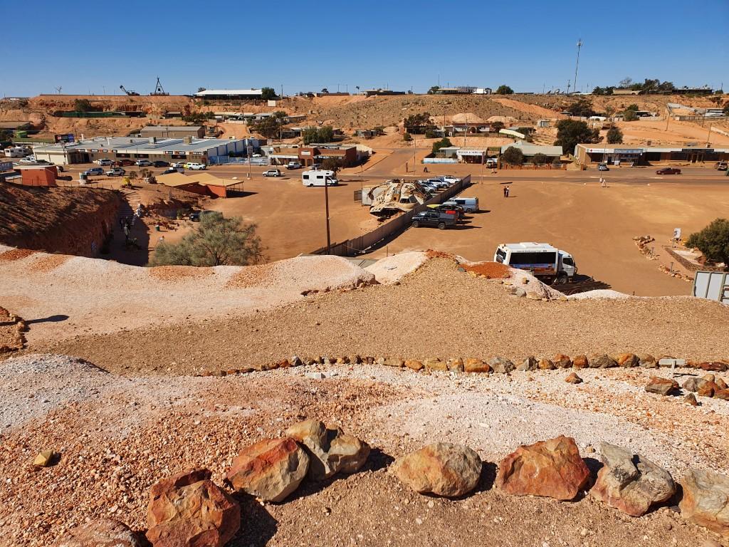
Crashed ‘Pitch Black’ Spaceship
The pitch black of the underground home also took on another meaning due to the crashed space ship outside The Opal Cave in the car park. It was actually the crashed space ship from the movie ‘Pitch Black’ that starred Vin Diesel and was shot in Coober Pedy. It’s quite well preserved and looks oddly at home sitting in the middle of Coober Pedy. It’s interesting to note that Pitch Black was set on a fictional desert planet that suffered from extreme heat but was actually shot in the Coober Pedy winter when they days can be quite cool, as we experienced. The sweat on the actors in the movie was sprayed onto them with spray bottles.
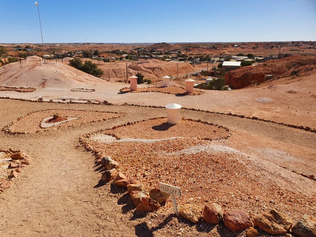
The Big Winch
The Big Winch
The Big Winch is Coober Pedy‘s ‘big thing’ tourist attraction. It sits atop the highest hill in the centre of Coober Pedy and is a magnified version of a miners windlass style winch. It houses a bar and grill and provides patrons with a 360o view of Coober Pedy and surrounds. It also houses a unique 360o cinema show where you are fully surrounded by the screen. For us it was late in the day and we decided not to view the movie preferring instead to see the real thing outside at the lookout.
The Desert Cave Hotel
Next door to The Opal Cave is the ritzy Desert Cave Hotel. An international underground hotel that has an extensive underground tunnel display area with exhibits, stories and historical information. It’s free to enter and explore and takes you from the carpark into an underground area that ends up in the lobby area of the hotel.
The displays explain the geology of the area, opal formation, mining, classification and grading. We spent the better part of an hour in there looking at the exhibits and reading about the opal trade and all things Coober Pedy. It really is a grandiose setting for a hotel and quite unique for being able to stay in an underground room with all the usual hotel features. We stopped in at the cafe for a coffee on our way out but noted that it felt a bit deserted and lacking in atmosphere. No doubt the tour buses keep it thriving but we much preferred our elevated campsite at Tomcat Hill.
Faye’s PoolFaye’s Underground HouseFaye’s Underground HouseFaye’s Underground House
Faye Nayler was a stoic and indefatiguable single women who lobbed into Coober Pedy in 1961 and decided to stay. She built a cafe by herself from scrounged materials and made her living by cooking for the miners and the early tourist buses passing through. She was a pioneer entrepreneur and began the first tours of Coober Pedy that started the tourism trade in the town.
Faye’s Underground House
That was…until her cafe burned down in a fire. Instead of giving up she bought a previously worked out opal mine and began opal mining herself and digging out, by hand, her own dugout home. As luck would have it she found a rich vein of opal only 3 metres in from the old mine (worth $1 million plus at the time).
She learned to cut and polish her own opals and started the original Opal Cave business that also contributed to the growing tourist trade. She was a genuine outback character and invited two girlfriends to come to Coober Pedy to live and work with her. When they arrived they had to dig out their own rooms, which expanded Faye’s underground home turning it into a three-bedroom dugout complete with kitchen, living room, pantry and bar.
Faye and her friends were all gay and her parties were legendary events that sometimes went on for days. Our Tomcat Hill host, Des, said that he had been to a few back in the day but that they were a bit to rowdy for him and not to his liking.
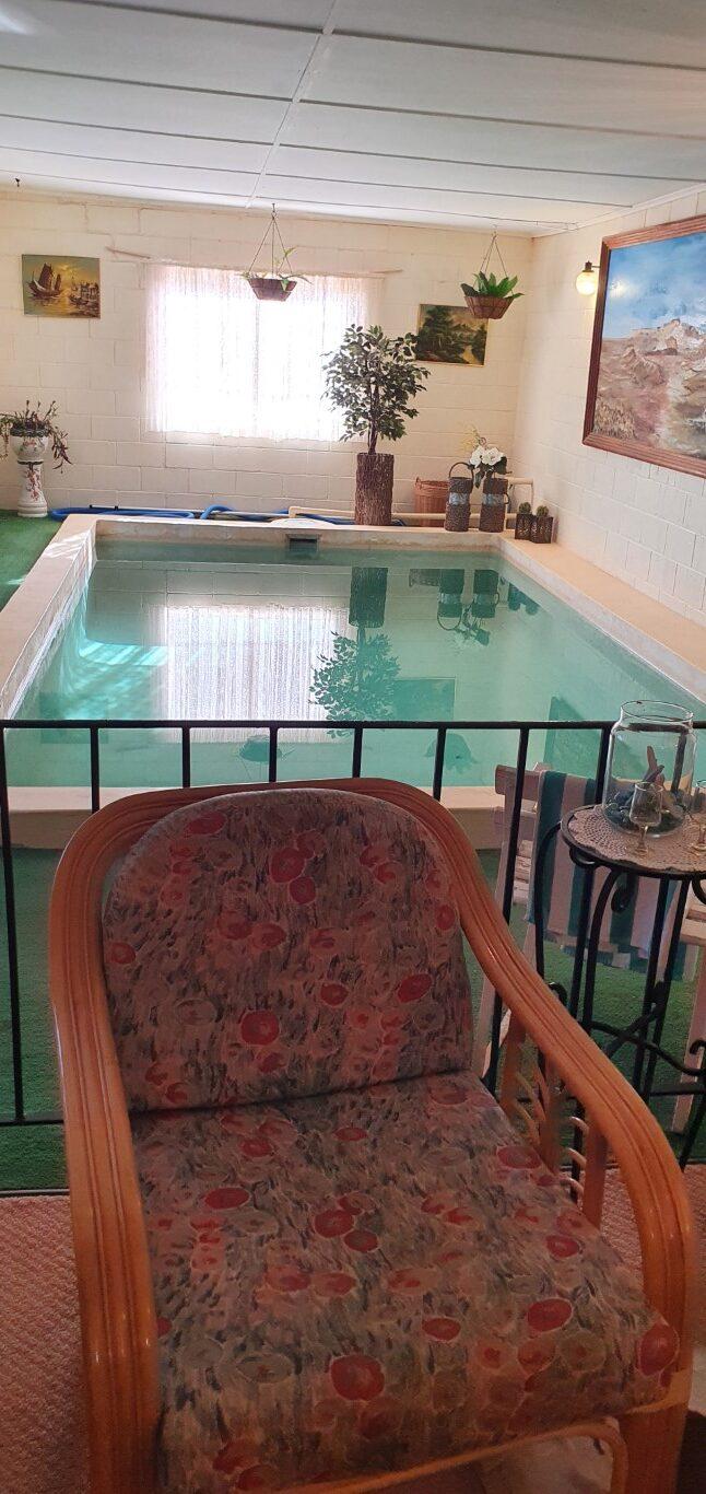
Faye’s Pool
Not content with her underground home, Faye actually hand dug a swimming pool at the back entrance of the dugout, which was ultimately enclosed by besser block walls and a roof but still accessible from the inside underground. The pool, as well, was party central and ‘clothing optional’ back in the day.
Faye ultimately left Coober Pedy to buy a pub and retire back in Queensland where she died. She is fondly remembered in Coober Pedy as the pioneer of tourism in the town, an outback character and a woman who could pretty much do anything and take care of herself against blokes bigger than herself.
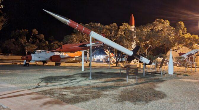
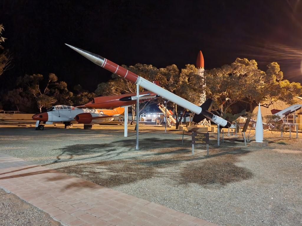
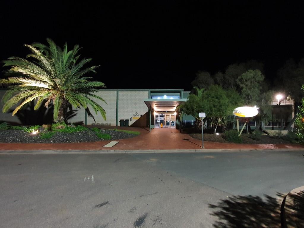
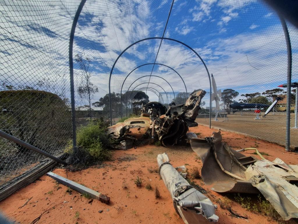
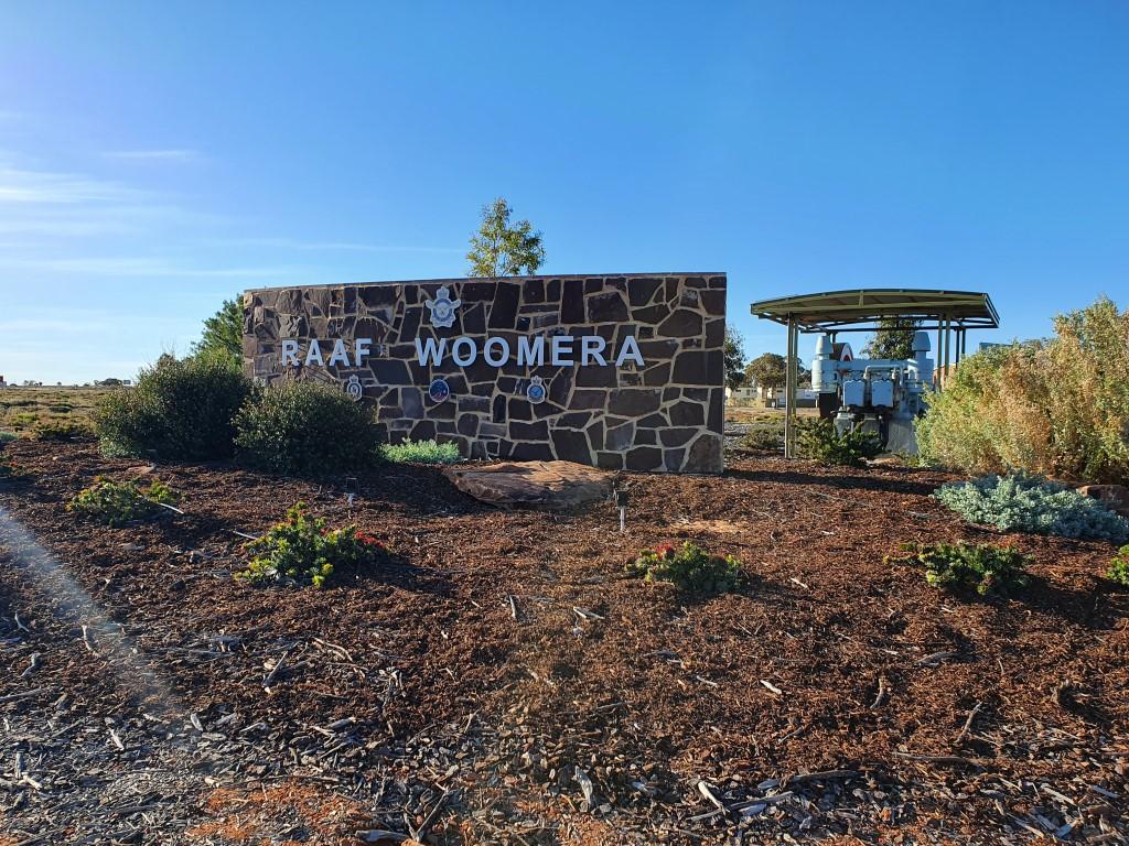
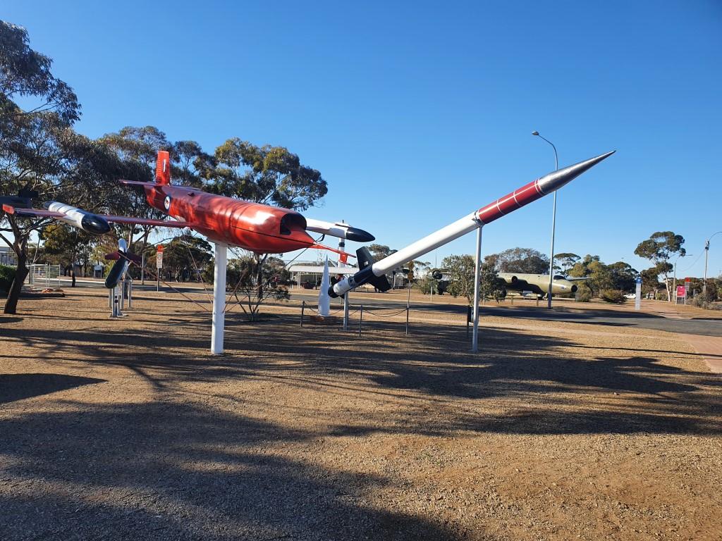
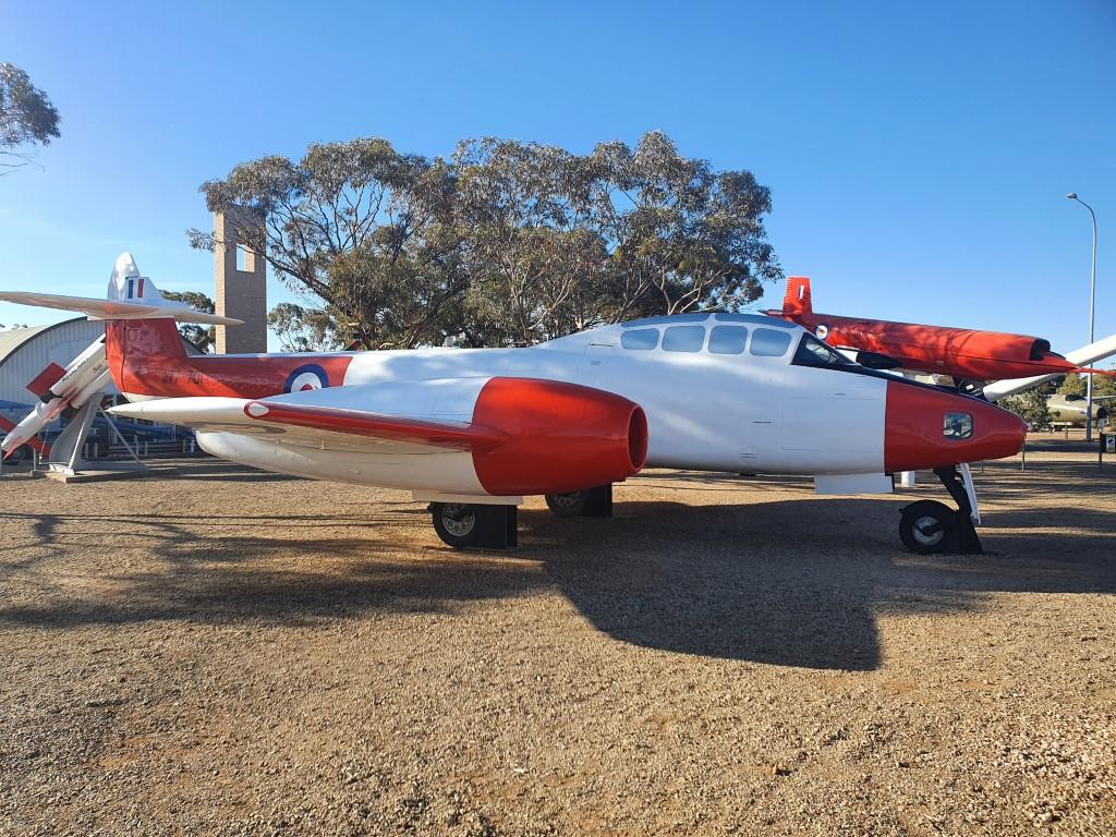
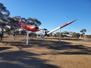
Woomera Rocket ParkANZAC Memorial – WoomeraEldo HotelBeef Parmi – Eldo HotelWoomera Rocket ParkWoomera Rocket ParkWoomera Rocket ParkWoomera Rocket ParkWoomera Rocket ParkWoomera Rocket ParkVan siteOutback WoomeraLong way from nowhereWoomeraWoomera Test RangeWoomera Rocket ParkWoomera Rocket ParkWoomera Rocket ParkWoomera Rocket ParkWoomera StreetscapeEldo Hotel
Outback Woomera
Very easy towing up the Stuart Highway with hard flat bitumen, long straights and long slow curves. We were expecting the landscape to be very flat but surprised to find a number of long low ascents and descents, quite a few rest stops with lookouts into reasonbly deep gullies and gorges with a lot of flat in between. Also the odd mesa… there’s one curious spot where the road goes up over a long, man-made hump, just to cross the railway line… seemed a bit strange but then realised that the Ghan and super-long freight trains ply this route so level crossings would be tedious and dangerous.
Long way from nowhere
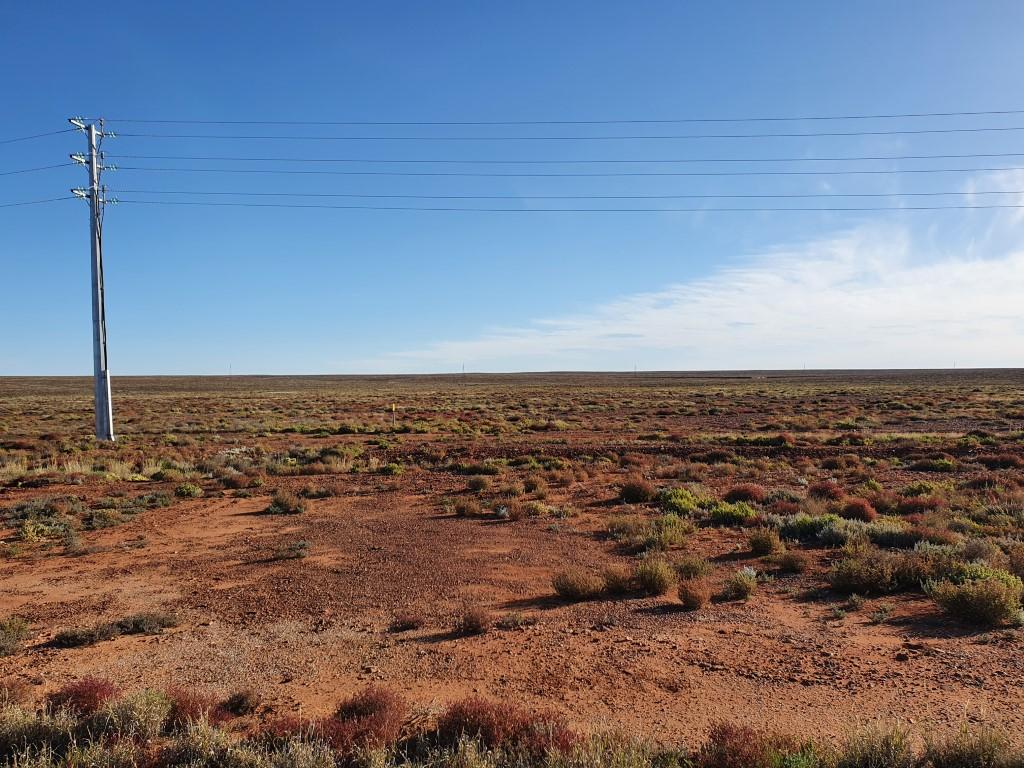
The other thing you notice as you enter the outback for the first time, apart from the red dirt and the mulga, is that one hundred kilometres is a very short distance BUT every individual kilometre is a LONG kilometre… It’s a very strange juxtaposition of distances on the outback highway.
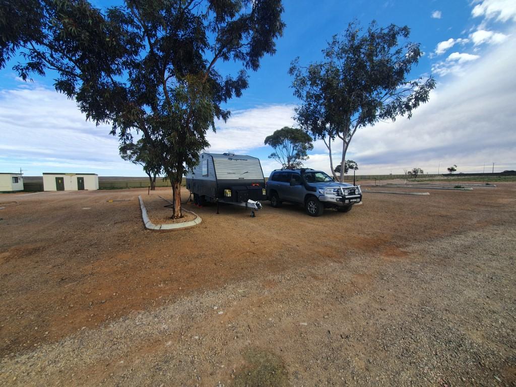
Van site
We pulled into the infamous (according to Wikicamps) Woomera Caravan Park where the manager, ‘Hoffy’, has a reputation for being a bit of rules Nazi and hard-arse… We didn’t actually get to meet him but were greeted by friendly reception staff who simply gave us a copy of the park rules, which were in fact very sensible and easy to follow. The van site itself was really quite large as van sites go and you could even stay hitched up if you weren’t going to drive anywhere.
We had a very comfortable stay at Woomera Caravan Park and would gladly stay there again even though there are lots of negative reviews on Wikicamps. Unfortunately the caravan park bar wasn’t open while we were there, it is appararently a fun place when it does open and the beers there as cheap as you’ll find in the outback.
There’s not much need drive anywhere if you’re just going to look around Woomera Village. It’s probably a fifteen minute walk to the other side but Spud’s Roadhouse, the only fuel station, is 6km back at the turnoff to Woomera.
Woomera Streetscape
Woomera Village is a weird and eery place. It’s like a town suspended in a time gone by. Basically it’s a square mile of houses with the museum, rocket park, movie theatre, cafe/shop and sporting facilities in the middle. There is nobody on the streets. Apparently there are only about 190 permanent residents there so it exudes an atmosphere that is part ghost town, part apocolyptic wasteland and part deserted zombie movie set! It is truly strange walking through empty, but perfectly maintained, streets, day and night and then seeing a well stocked, super clean, mini-supermaket with one person sitting behind the counter on their phone because nobody else is in there.
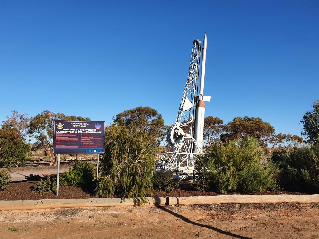
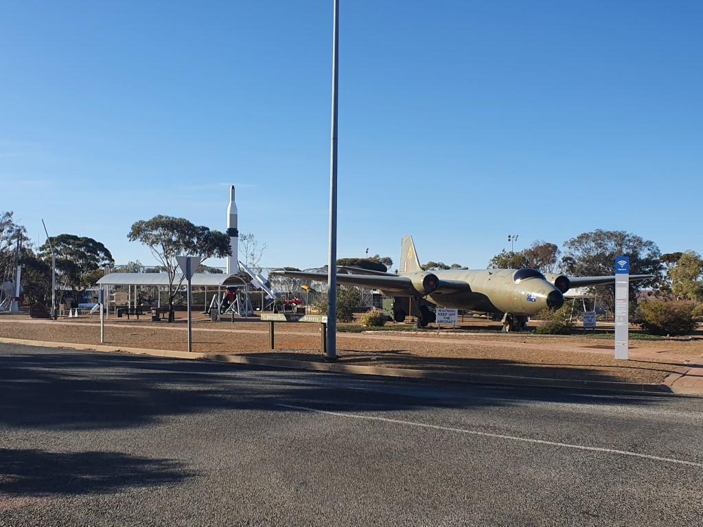
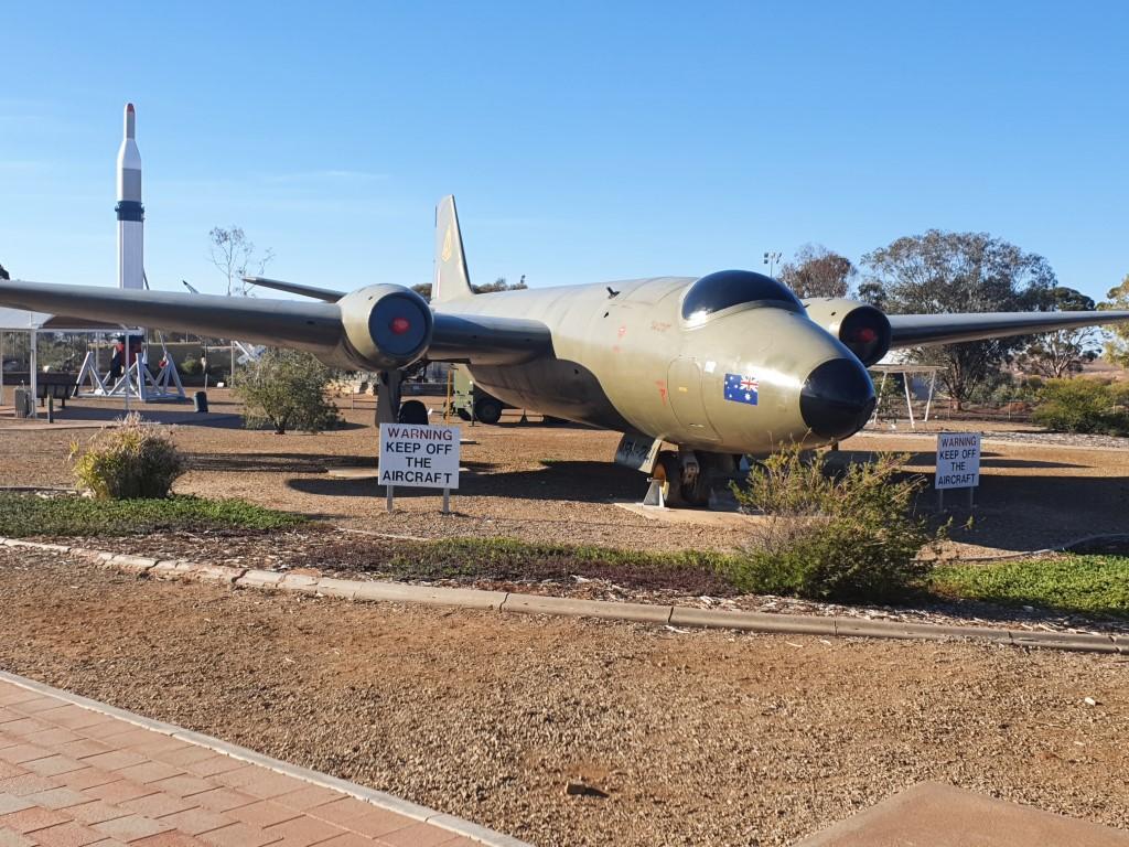
Woomera Rocket Park
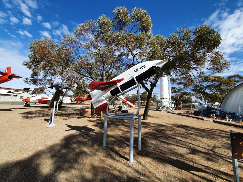
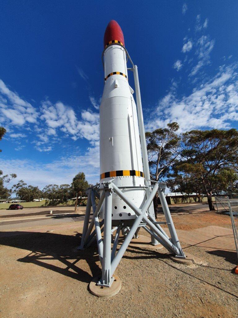
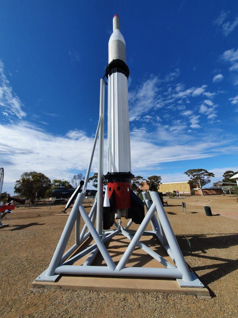
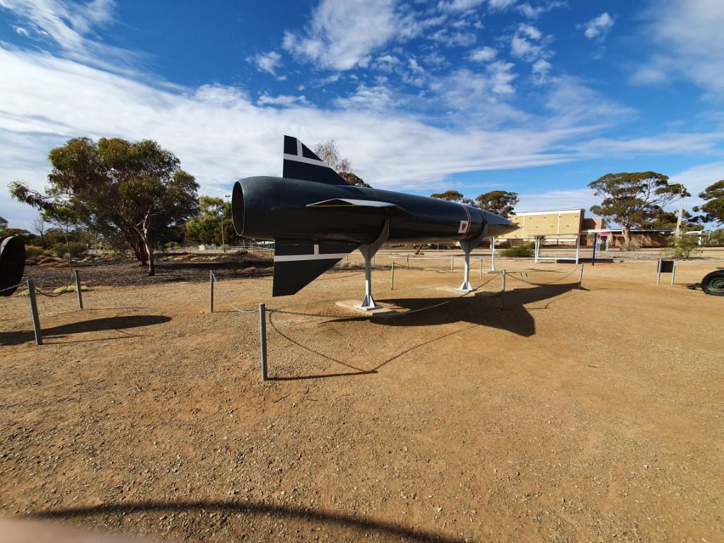
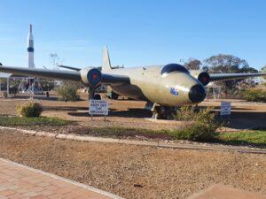
There is life though… The movie theatre plays every Sunday night and admission is FREE! “Elvis” was playing while we were there but it wasn’t Sunday during our stay so we didn’t get to enjoy it… We did, however, poke around the museum and the very interesting rocket park where there’s an old Gloster Meteor and Canberra jet plane plus assorted rockets and missiles that were tested back in the day. Also some rocket and missile debris that showcase just how important Woomera was back in the 50’s and 60’s in it’s hey day.
Woomera Rocket Park
The photos of Woomera past show an exciting and vibrant village populated by highly educated ‘rocket scientists’ and engineers living a very social life with vital work during the day and parties, soirees and sports in the down time.
Being a Dep’t of Defence town it was also very class-ridden with social activities revolving around three staff mess facilities:
The Senior Staff Mess;
The Sargeant’s Mess; and
The Junior Staff Mess (the Jazza).
ANZAC Memorial – Woomera
These were the social hubs of Woomera, which, back in the day boasted the highest birth rate in Australia as defence personnel’s and scientist’s families moved out there for what would have been strange but hectic and enjoyable lifestyle.
There’s a desert golf course, public swimming pool, beautifully grassed football oval, basketball and tennis courts all of which are in immaculate condition but sparsely used these days without any population to take advantage of them. It’s a little sad to see so much unused, quality infrastructure, that is simply waiting there in the outback desert for some sort of rennaisance that may, or may not, ever happen.
Woomera was briefly used at the height of the Australian refugee hysteria as a refugee detention camp, with a temporary camp being built away from the village itself. Ultimately it was a failed effort with conditions being too spartan and a minor outbreak by the refugees into town… And who’d blame them the way they were treated and kept… It would have been very bleak and dismal to say the least.
Eldo Hotel
The unexpected highlight of our stay in Woomera was on our last night… Our custom has been, where available, to have pub night on the last night of our stay in most places. So we shanks’d it 15 minutes to the other side of town to the Eldo Hotel, which is still an operating accomodation hotel, with a bar and bistro. The Eldo Hotel looks like something out of a 50’s Elvis Presley movie, with palms out the front and a very 50’s oval shaped sign announcing the hotel’s presence. You can feel yourself humming “Viva Las Vegas” in the back of your mind as you approach the entrance.
We did book a table (as strongly advised), thinking that booking was more about making sure there would be something available on the menu than actually reserving a table. Upon arrival the foyer area was deserted but up the stairs there were a couple of young blokes playing pool, out the back there was a group of ten or so probably having Friday after-work drinks and one or two others in the bar. We were welcomed at the bar by two young ladies who very friendly and almost seemed over-eager to serve us… explaining the menu, taking us through the drinks and advising us that wine by the bottle was probably a better option than by the glass (and that if we didn’t finish the bottle that it could be taken away).
They had reserved a a beaut’ little table by the window and with beer and wine in hand we sat down to peruse the menu. The young ladies had also advised that Woomera, being a blokey town these days, meant that some of the meals were very full on and which ones were a more normal size. To our surprise people started dribbling in and by the time we were ordering there were quite a few people eating, drinking and bringing the place to life.
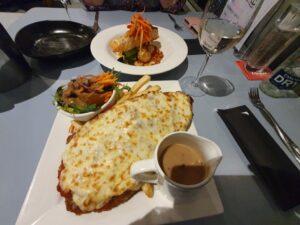
Beef Parmi – Eldo Hotel
So in the end we very good Arancini Balls to share for entree followed by Grilled Salmon for Jo and Beef Schnitzel for Rob. It was another plate sized slab of crumbed cow covering a wheelbarrow sized serving of chips and vege’s but it was very good. The salmon was excellent and also came with a very fresh green salad and all served personally by the chef. A chap at the table beside us ordered the Lamb Shanks, which when they arrived looked like two whole legs of lamb, slowly braised to the point of perfection… Nobody goes hungry at the Eldo Hotel. And the prices were as good as anywhere else we’ve been thus far…
All in all, Woomera is a must visit place just for the history and nostalgia of the place. It’s a great introduction to the outback never-never and is intensely interesting to say the least… just a little sad when comparing what it is now to what it was in its glory days.
Sunset at Port GermeinHigh Tide Port GermeinFish SculptureCrab SculptureCormorant SculptureShip SculptureShoreline near jettyLow Tide – Port GermeinLawn Bowls in Port GermeinPort Germein JettyPort Germein JettyPort Germein Jetty – Looking back to landPort Germein JettyPort Germein Jetty – EntranceJetty SculpturesPort Germein Tide ClockJetty rail linePort Germein – Low TidePort Germein Jetty ShedSailing Ship sculptureMain Street JettyMain Street – Port GermeinMain Street – Port GermeinPort Germein JettyPort Germein Historic Buildings
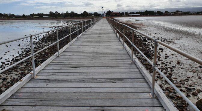
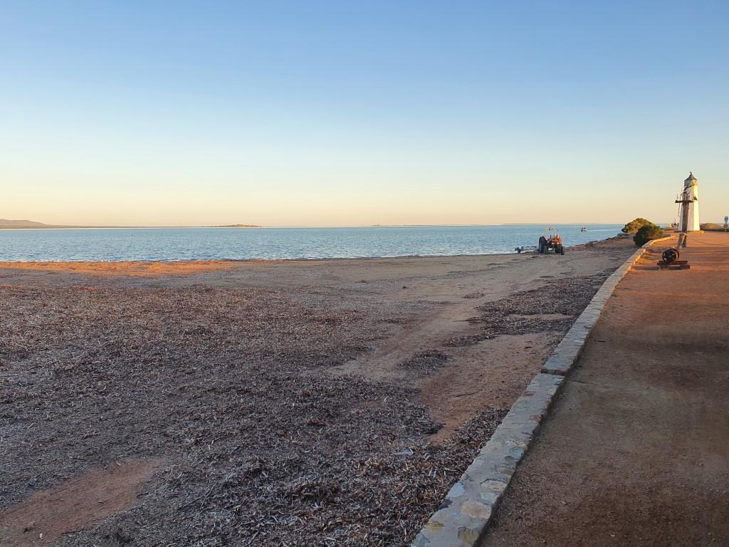
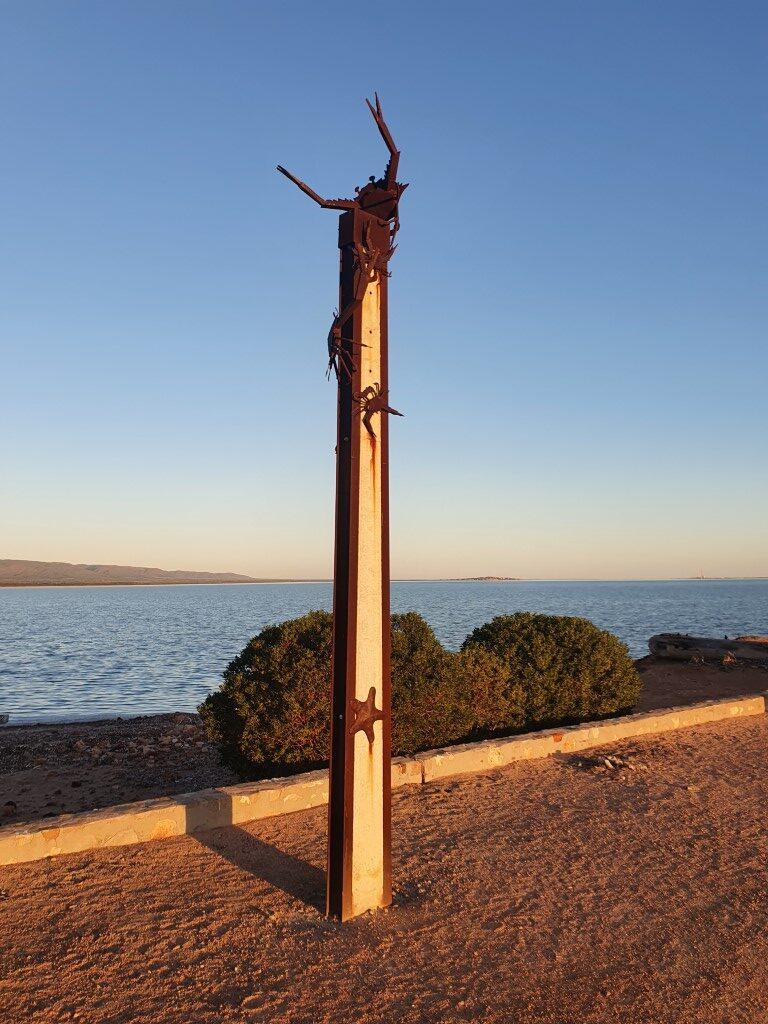
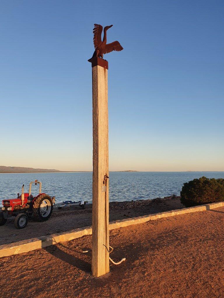
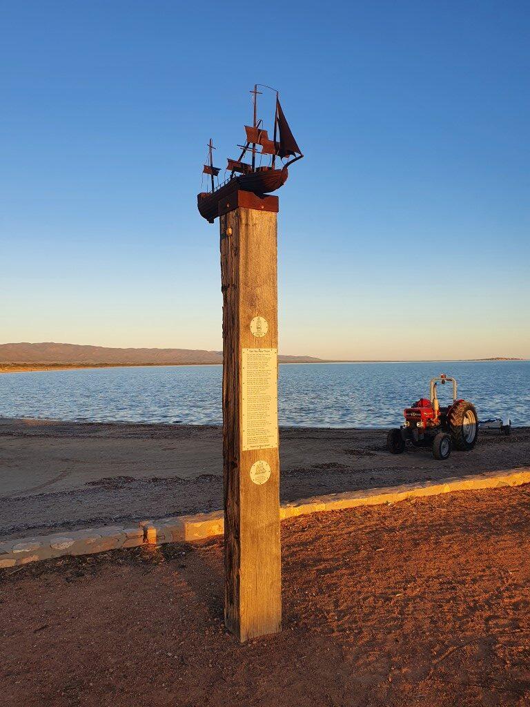
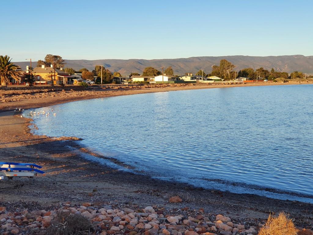
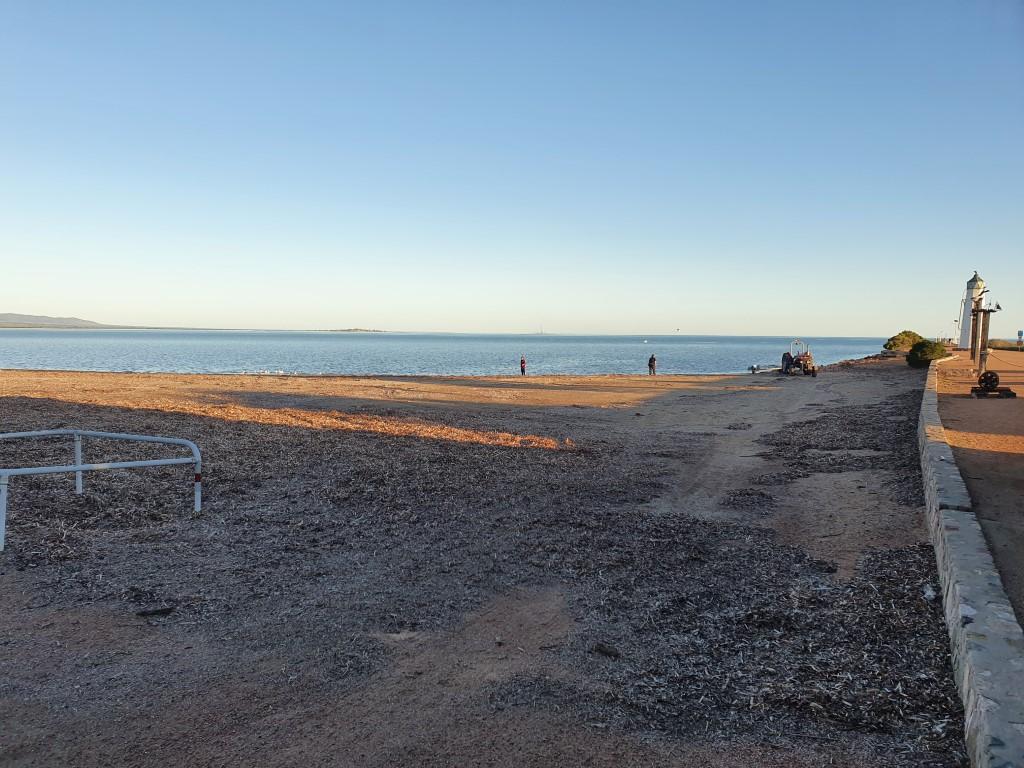
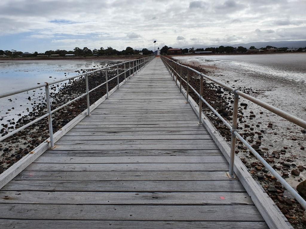
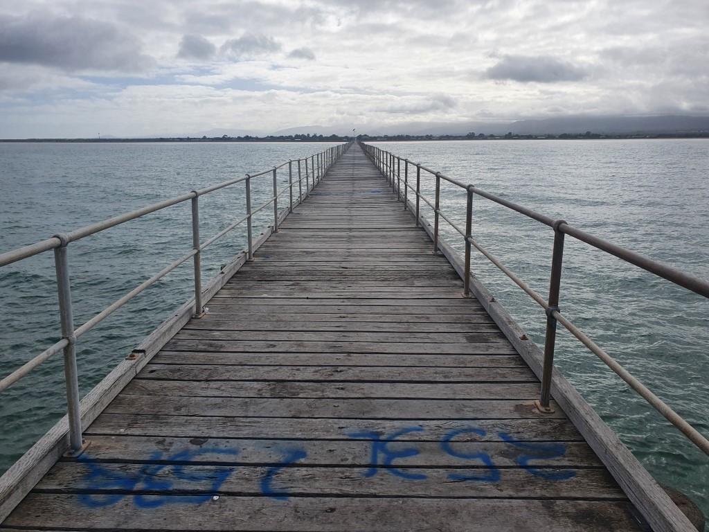
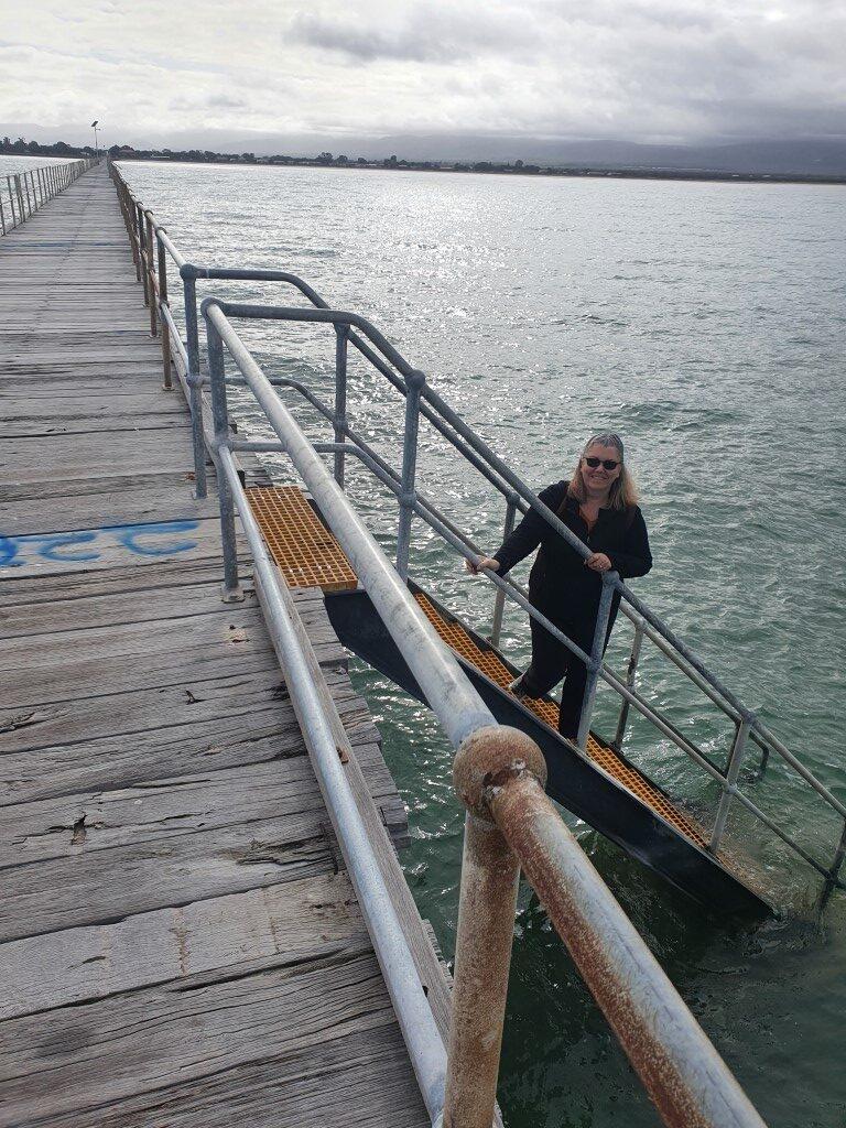
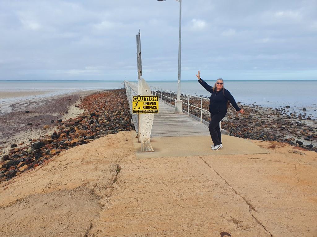
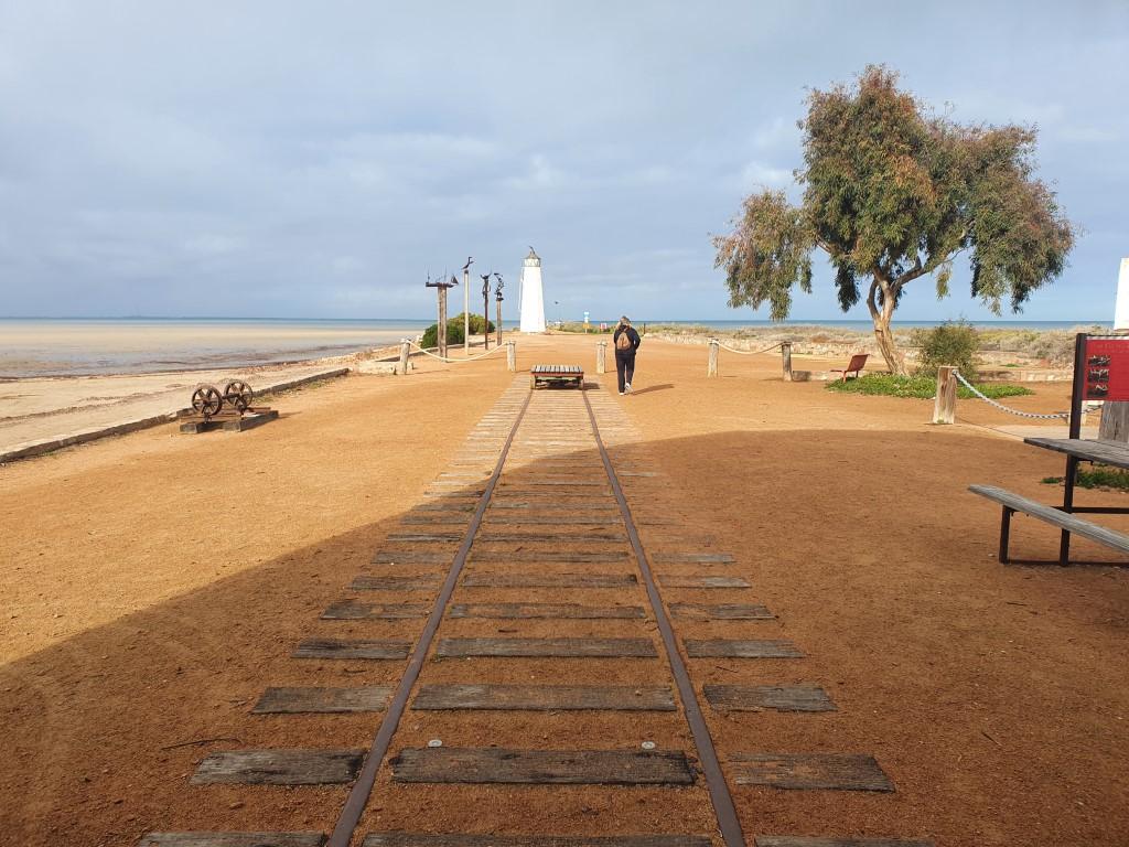
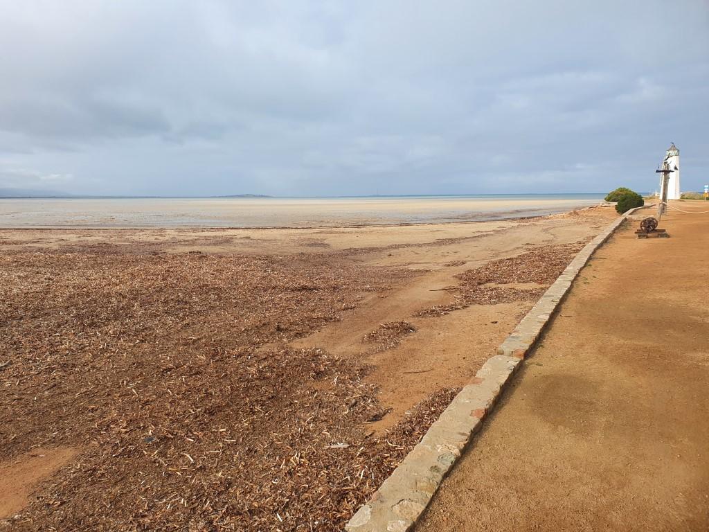
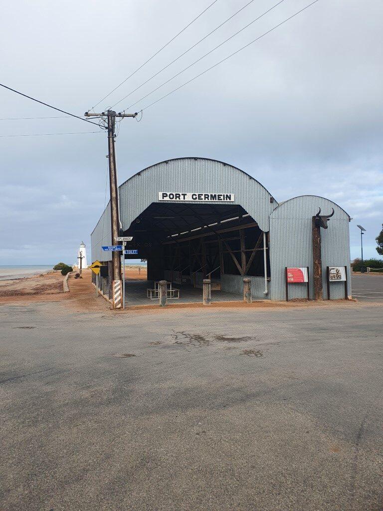
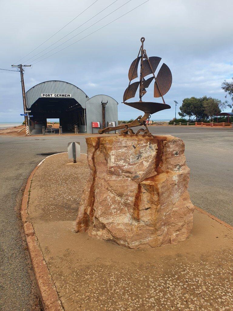
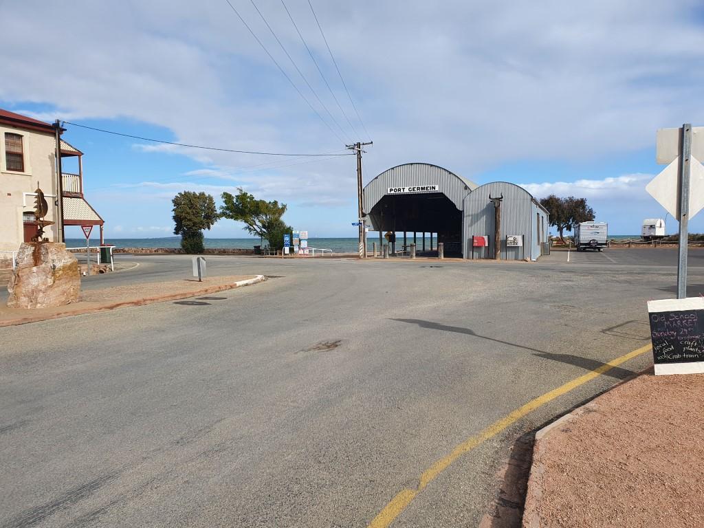
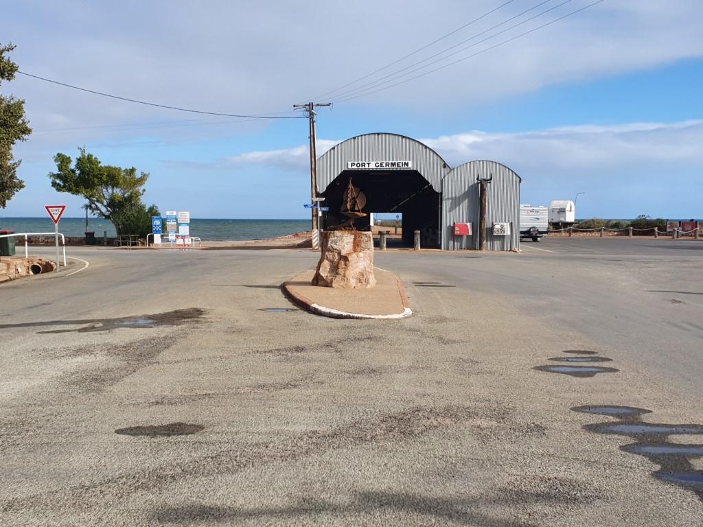
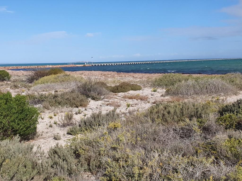
Port Germein is a small but picturesque town on the eastern side of Spencer Gulf half way between Port Pirie and Port Augusta. It’s very quiet (at this time of the year anyway) and is famous for having the longest wooden jetty in Australia, some 1400m long, reduced from it’s original 1700m.
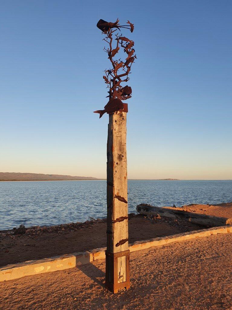
Sailing Ship sculpture
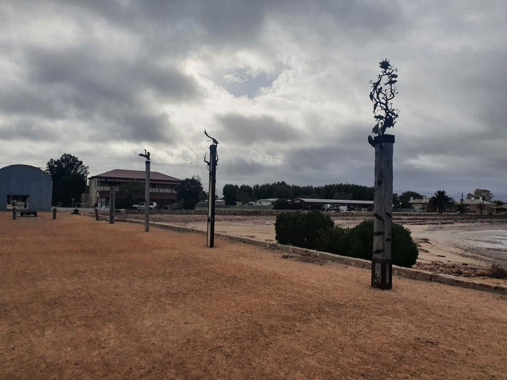
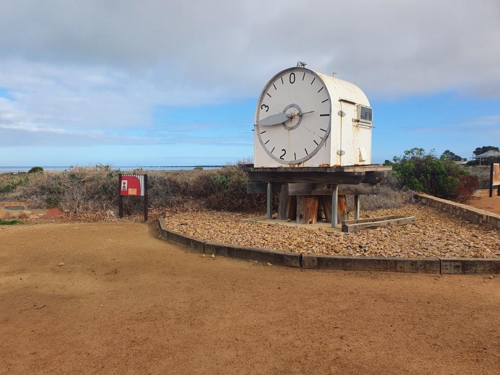
There is the caravan park, where we stayed, a general store with post office and a cafe that is open on Wednesday through Sunday and a Bowling Club. The caravan park and cafe, next door, are directly across from the jetty, which is fronted by an historic corrugated shed structure and has a area with some totem like sculptures, small lighthouse and a massive ‘tide clock’ that, back in the day, was mounted atop a high platform in the water so that ships could see the height of the tide from a fair distance.
Port Germein Jetty
The water is quite shallow for a long way out, hence the length of the jetty, as evidenced by the amount and distance of dry flat sand bed that can be seen at low tide that is subsequently covered at high tide. The rocks that make up the first section of the jetty where it meets the shore were actually ballast from sailing ships as the port was coming into being.
Back in the day, ships would anchor a long way out in the bay and the cargoes would be unloaded onto flat-bottom barges to be transfered into the jetty at high tide. The barges would then be reloaded with outgoing goods to be taken away by the ships.
Port Germein Jetty
It seems that Port Germein is more a fishermans weekend town and is known for it’s blue swimmer crabs and whiting. We walked out to the end of the jetty, as you do, during high tide and could see a few schools of whiting darting around. We believe they are the type that the locals call ‘silvers’. We noticed them because you see slender dark streaks in the water and every so often they turn on their sides, which catch the sun and flash bright silver. They looked a decent size and if we had have been staying an extra day we would certainly have unpacked the rods and had a crack at catching a feed. As it was, there was a chilly polar wind blowing up from the south that would have made standing out on the jetty a little uncomfortable on that particular day with a 5:15pm high tide.
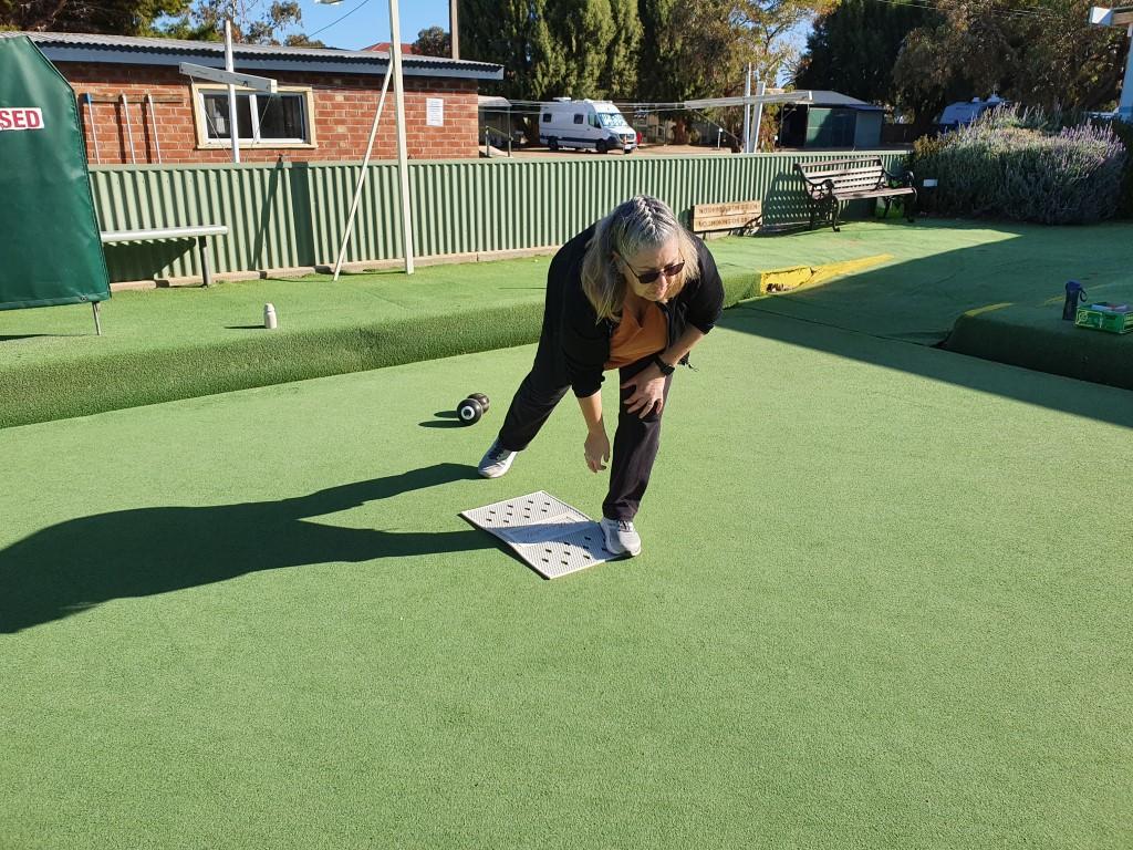
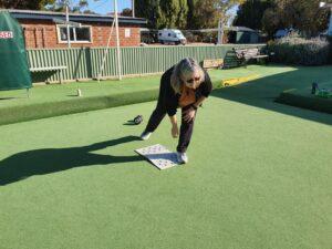
Lawn Bowls in Port Germein
The Bowling Club next to the Caravan Park has a single synthetic grass bowling green and they allow anyone to grab a set of lawn bowls, that they leave in a cabinet near the green, and have a go. We advantage on our second afternoon, which was warm and sunny under a clear blue sky. We decided to play first to 21 and it was a torrid affair with Rob quickly going to an 11-5 lead, however Jo then turned the table over a few ends levelling at 11 all. In the end it was one horse race though as Rob cleared out to a 21-11 victory and bragging rights.
Port Germein Tide Clock
So… Jo hasn’t driven, by choice, up until this point. On the morning that we left Port Germein we decided to grab a couple of bacon and eggs rolls from the cafe next to the caravan park and we decided that she should, at the very least, drive the cruiser and van out of the park and across the road whilst we got breakfast. She jumped in and guided it out perfectly whilst I walked behind to check clearance between a couple of trees. As she crossed the street, with me walking behind, a couple of coucil workers were painting one of the picnic shelters looking out over the water towards the jetty. Jo drove slowly past them and into a long parking area and one of the workers, who looked a bit like a refugee from ‘ZZ Top’ calls out to me, “Not many blokes let their missus drive their 200 Series… Farken ‘ell!” Ya gotta love small secluded towns…
Port Pirie from The Bluff LookoutThe Bluff LookoutThe Bluff LookoutThe Bluff LookoutThe Bluff LookoutThe Bluff LookoutThe Bluff LookoutSilo Art – WirraburraMassive gnarled Gum – MelroseFirst World War monument MelroseMountain Bike Track – MelroseLookout – MelroseSuspension Bridge – MelroseSuspension Bridge – MelroseBangor Historic Site – Germein GorgePioneer’s Monument – Germein GorgeHelicopter over Germein Gorge
In lieu of fishing the next day we took a drive up into the Flinders Ranges to the small village of Melrose. It was a very scenic drive up through the Germein Gorge to the plateau where Melrose is located at the foot of Mt Remarkable.
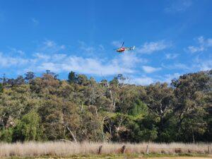
Helicopter over Germein Gorge
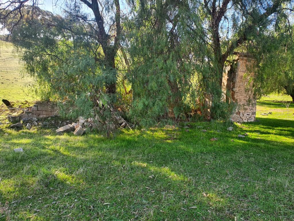
We stopped at one point to look at a farmhouse ruin as large helicopter came quite close overhead doing a slow scan of the area as though it was looking for a missing person or trying to find somewhere to set down. It looked a bit like a rescue or care flight helicopter.
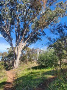
Mountain Bike Track – Melrose
Melrose is another of those small out-of-the-way villages but seems to be thriving as part of the Heysen Trail. It is notable for an extensive network of mountain biking trails in the hills that adjoin the town. There is a lookout that you can walk up to following the bike trails, some of which look very extreme. Before walking to the lookout we had a coffee in small shop that also ran a bike shop catering to moutain biking enthusiasts with lots of expensive, high-tech, high-end machinery as well as bike hire.
You can camp below the bike trails and pedal your heart out during the day and there are even mountain bkie skills sessions that you can meet up and do. Not enticing enough for us to hire though… The walk up to and down from the lookout was enough of an adventure for that day.
Melrose was also a convenient place to fill the cruiser with diesel, since there is no fuel station in Port Germein, and grab some chicken wraps to take with us for a drive out to the ‘Bluff Lookout’. I was expecting $2.40/L but pleasantly surprised to find it was $2.07/L, the second cheapest price in our trip so far.
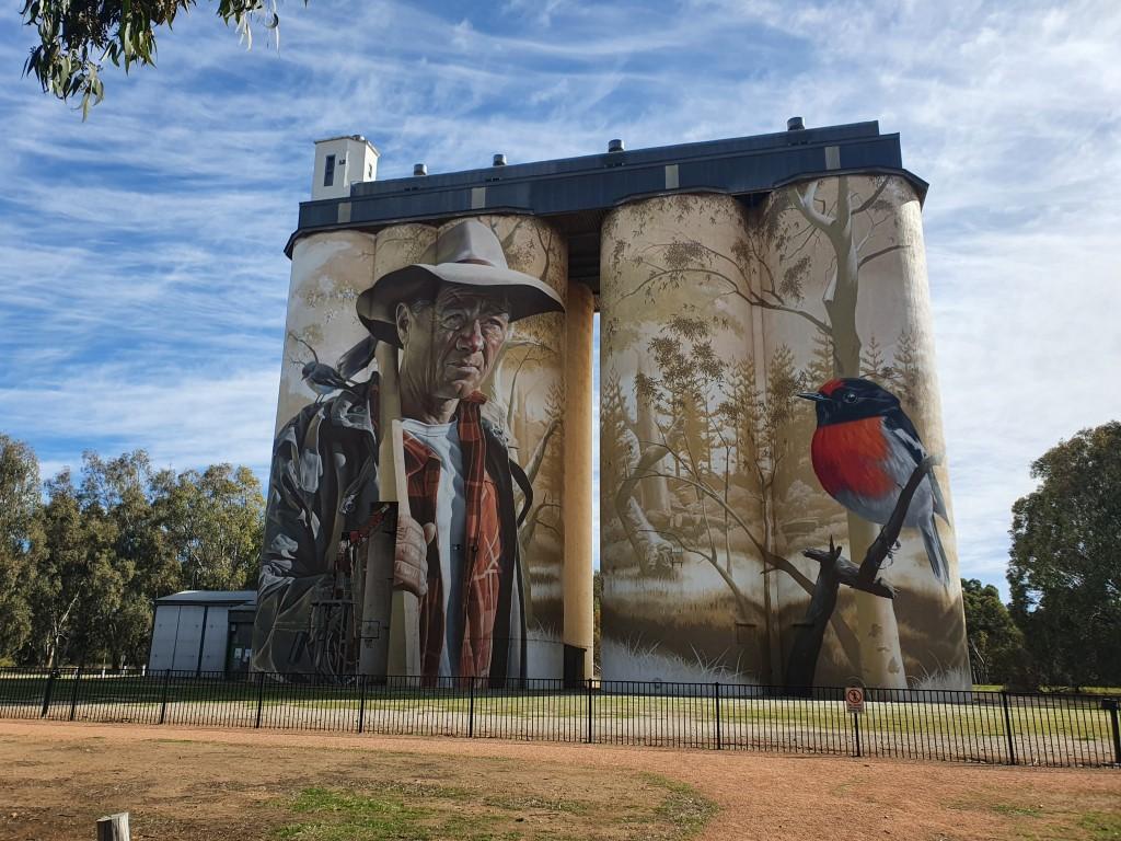
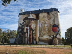
Silo Art – Wirraburra
After Melrose we headed south toward The Bluff Lookout, via Wirrabara, where there was yet another outstanding piece of silo art. The portrait of the farmer is of no actual person. It simply depicts a man of the land as a tribute to local farmers in the region.
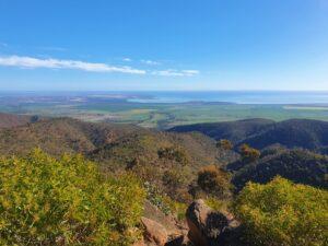
The Bluff Lookout
Onwards to The Bluff Lookout we followed a series of dirt roads only to end up getting half-lost and having to turn back from a restricted Helipad area, which we thought may have been something to do with helicopter that we saw earlier. In the end we found the right track, which ended in a very steep incline to the lookout parking area.
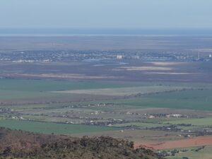
Port Pirie from The Bluff Lookout
Then a short walk to a viewing platform that presented a fantastic panorama from which you could see all the way from Port Pirie through Port Germein and almost to Port Augusta. It really was an unexpected gem after a bit of effort to get there.
After two fairly relaxing weeks in Victor Harbor it was time to head north in the direction of Darwin. We were intending to spend a week on the Yorke Peninsula but changed our minds and headed for Leasingham, in the Clare Valley region instead. We decided to reserve the Yorke Peninsula for when we return to South Australia next year coming from Western Australia. It proved to be a good choice as we once again hit the South Australian wine trails.
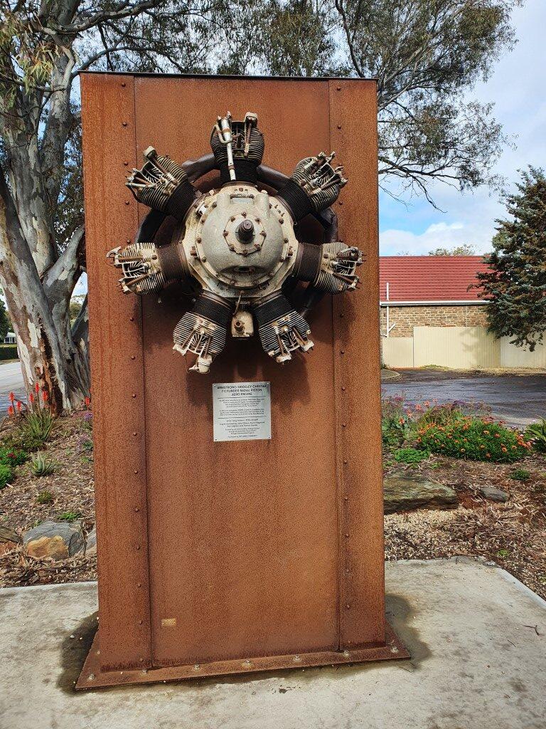
The drive was fairly easy skirting the western edge of Adelaide, mostly on motorway. We had a brief stop in Tarlee, a small town that actually had a set of silos that were not painted. They did have an interesting little information area that had a mounted Armstrong Siddely Cheetah radial aircraft engine from from an AVRO Anson aircraft that crashed near the town in 1943 causing a bit of stir at that time.
From Tarlee it was just another short hop to Leasingham, which is a small village south of Clare. We pulled into the Clare Valley Caravan & Cabin Park (in Leasingham) to find a small but cosy caravan park that had been bought by new owners only three months earlier. The young couple had performed a big cleanup and were now in the process of preparing to get rid of a number of the cabins and create more caravan sites as well as upgrading the amenities and layout. At first glance our site looked a little tight between two other vans on a sloping rise but turned out to be a breeze to back into and really quite spacious.
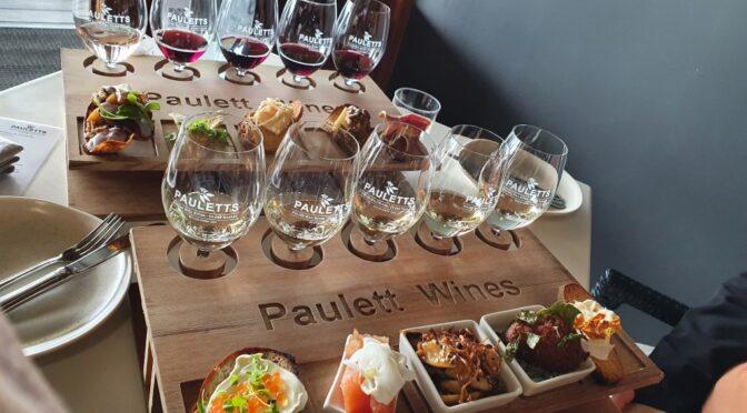
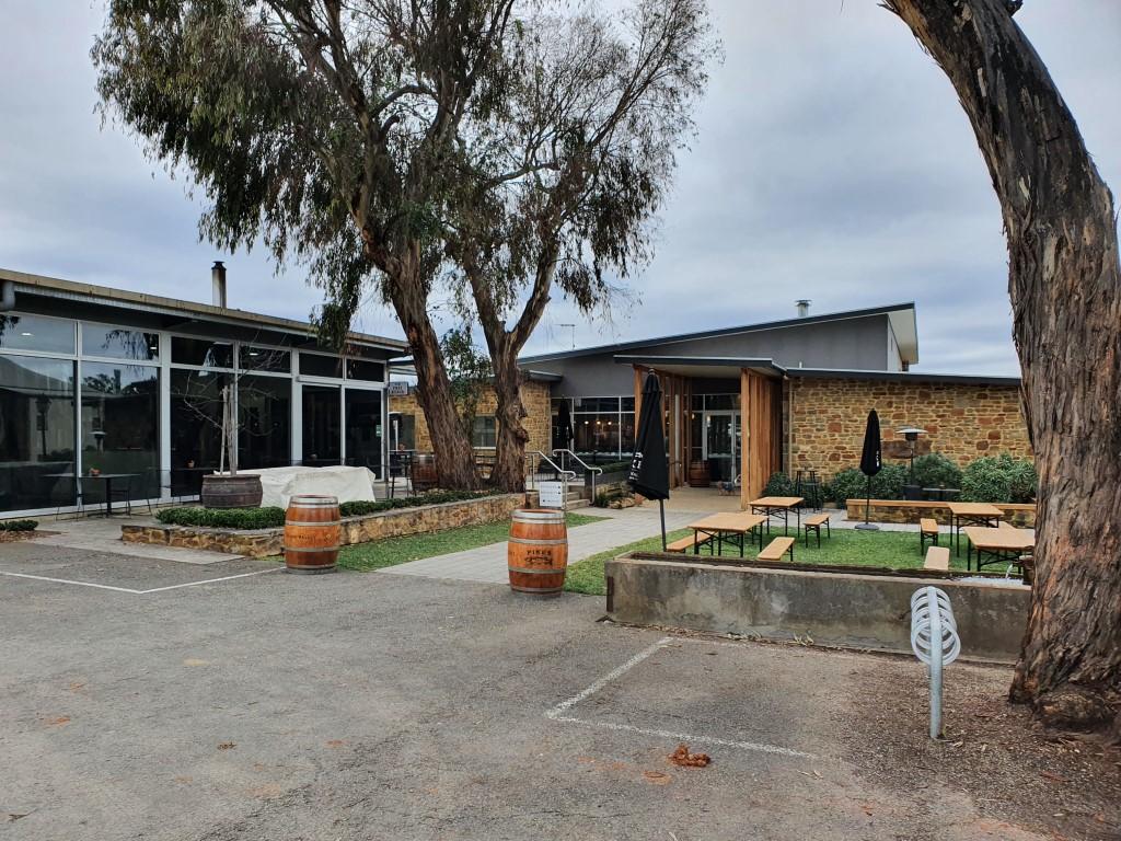
The owners wanted to create a boutique style caravan park with a social atmosphere, not a family fun park style of place. They had a public firepit that anyone could use and also provided the wood for a communal fire pit every Saturday evening… Unfortunately the Cafe/Coffee shop (The Little Red Grape) next door was closed while we we there. They had a staff COVID outbreak and decided to close for the period that we were there. The park was also bordered by vineyards and wineries, a number of which were within easy walking distance but we had already set our sights on a number Clare Valley wineries that we wanted to visit.
So aside from the caravan park and the closed cafe…there’s not actually that much to Leasingham but it is a very good place to base yourself for a week exploring the delights of the Clare Valley, of which there are many…
Clare
Clare, as you would expect, is the heart of the Clare Valley and the largest town. Its about fifteen minutes north of Leasingham and was notable to us in that it had a Woolworths and a couple of service stations. Other than that Clare was just a grocery stop.
Watervale
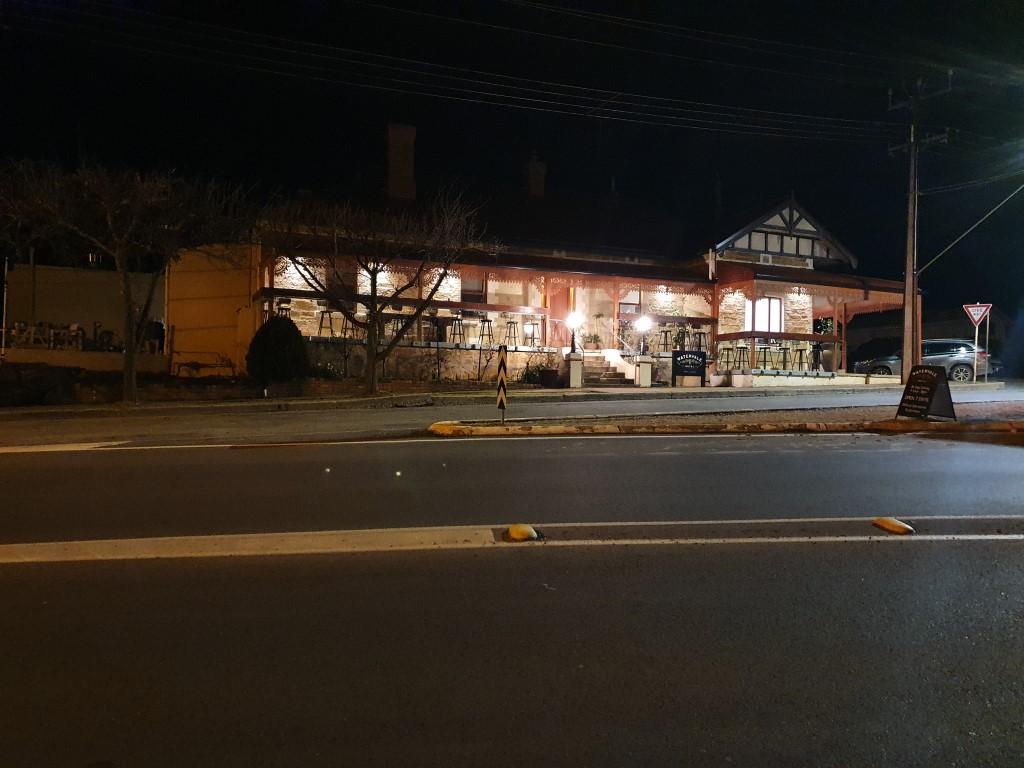
Watervale Hotel
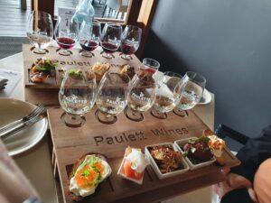
A couple of minutes north of Leasingham is the village of Watervale. We had been told to try the Watervale Hotel for dinner so we chose this as our last night pub meal for Leasingham. From the outside it is your typical stone South Australian country pub but the inside has been extended to include a large dining area with inside and courtyard style seating. The kitchen is open to view and the chefs are on display as the whip up their range of culinary delights. The food was excellent and the service greate. The owner popped out at one point to check that everything was to our satisfaction and had a good chat with us without being overly-intrusive as well as telling about his vision of the pub. If it were’nt for Paulettes Wines this would have been our star food pick for the region. Still… it was very good!
Our nephew Anthony and his wife Dee had previously recommended that we go to Paulettes Wines and do the tasting flight with matched canapes, which we duly did. Wow!!! Just absolutely superb. At Paulettes staff recommendation we chose to share a white and red flight between us. The wines by themselves were beautiful but when tasted in conjunction with each of the matched canapes took another whole dimension of flavour and enjoyment. The chefs at Paulettes really know their business and the quality and freshness of the produce was completely first class. The two flights didn’t look like a huge amount of food but were more than adequate for the two of us without leaving feeling like we’d over-eaten or that we wanted more. The tasting and canapes were just so good that we booked a table for lunch on our last day in Leasingham as an additional treat. When that day rolled around the lunch was just as good as the tasting and we also had an excellent table out on the deck looking out over the vineyards in the valley below. The wait staff at Paulettes were exceptionally good at making you feel comfortable and enjoy every aspect of the visit. There was no pretentiousness or ‘wine snobbery’ that you sometimes get in some wineries. THey were there to assure you of a good time and pleasant memories. They enjoyed working there! There’s nothing bad to say about Paulettes… They are just simply bloody good! Top quality food, top quality wines, excellent staff, beautiful location. We both agree that this was the best food and wine experience of our trip!
Sevenhill Cellars
Cellar at Sevenhill Cellars
Continuing our seemingly never-ending wine tour in South Australia we drove out to Sevenhill Cellars which is owned and run by Jesuit priests. The vineyard is set on a massive estate that with a monastery, cathedral, winery and gardens. The Jesuits study there as a kind of retreat.
The winery is a massive old building with a truly impressive underground cellar with arching roofs and tunnels housing barrels of wine maturing in their own good time. Before tasting we took a leisurely stroll around the property, despite the very cold conditions of the day, to view the cellars, the vineyard, a crumbling historic homestead being that is being preserved and a couple of small dry-stone chapels used by the Jesuits over the years. The entire estate just reeked of history.
The Cornish Pasty Hunt
Little Red Grape – Cornish Pasty
Whilst in Sevenhill, we stopped in at The Little Red Grape, which was the sister cafe bakery to the one that was closed next door to our caravan park in Leasingham. Rob took a last chance to get a genuine Cornish Pasty but was once again disappointed although the pasty itself was quite generous and delicious. The pastry, once again was more flakey than short crust and the filling was good but a bit over-processed when compared to the rustic dice of the genuine Cornish Pasty.
Pikes Wines
Pikes Wines
Having enjoyed a Pikes Reisling back in Nuriootpa, we decided to drop into Pikes Wines, which are close to Sevenhill and Paulettes. We tried their range, which was good, but decided that their reisling was the pick of the range.
It was a pleasant tasting with a casual atmosphere and an interesting host. It was our last winery tasting in South Australia and we were probably at the point we had had our fill of wineries and were well and truly stocked up in the van and car…
On our first night in Leasingham we took a short drive out to Mintaro to the Magpie & Stump for dinner. It’s your typical South Australian country pub, first opened in 1850. Can’t sat it was the best pub meal ever but it wasn’t the worst either. It probably would have been much more enjoyable sitting in the beer garden area on a warm summer’s day listening to live music instead of a cold, damp winter’s night.
Mintaro Maze was a bit of a surprise. A delightful place for kids but also a bit of fun for us old fogeys as well. It is a large hedge style maze with a steel-walled extension area. As a maze it is not difficult to find your way around but you are gicen a sheet of questions to see if you can find the answers as you work your way around looking for various statues and signs. They also have large gnome garden as well as some topiary trees in the garden area.
Martindale Hall
Martindale Hall is a grand Georgian style square mansion with stately gardens and grounds a shot way outside Mintaro. The National Trust of South Australia is in a running battle with the former Liberal South Australian Government to keep it from being privatised (bloody Liberals!!!). It is probably most well known, despite being in South Australia, as the private girl’s school in the Australian classic film ‘Picnic At Hanging Rock‘, the events of which occur in Victoria.
You can pay to do a tour of Martindale Hall but at the time we decided that we had seen it from the outside and that that was sufficient on the day…
The CascadesThe CascadesThe CascadesThe CascadesThe CascadesThe CascadesThe CascadesThe CascadesSpring Gully
As a change from wineries we decided to take a drive out to The Cacscades. Located in Spring Gully Conservation Park this is a series of rock pools that spill into each other like a slow moving waterfall.
The Cascades
We were hoping that it would be a bit more impressive than it was, especially given that it had been raining fairly consistently. As it was it really was just a series of rock pools slowly spilling into each other. But with that said it was a very nice gorge with rough hewn sides showing the red-brown colours that were a hint of the things to come as we headed north into the outback.
It was also a nice walk out to The Cascades through Spring Gully Conservation Park through the bushy scrub land. Not the most spectacular of sights but worth a visit when you’ve reached peak wine tasting…
We took the opportunity to drive down to Auburn for diesel one day as there in no service station in Leasingham, the only other option being to go north to Clare. Auburn was also slightly cheaper at the time. There’s not much to Auburn, although it is regared as the Gateway to the Clare Valley and the start of the Riesling Trail.
C. J. Denniss birthplace memorial
Auburn‘s claim to fame is that it is the birthplace of C. J. Dennis, the noted Australian poet and journalist wrote, “The Songs Of A Sentimental Bloke.” The site behind the monument now holds a CWQ Meeting room, which is probably a fitting use for it.
Pie Floater
The real gem in Auburn though was the bakery where Rob had the opporutinity to have a genuine South Australian ‘Pie Floater‘. The uniquely South Australian dish consisting of a meat pie with tomatoe sauce (usually optional) floating in the middle of a bowl of thick pea and ham soup. The Pie Floater can be difficult to find these days but is a true culinary delight when you do. Eaten with a spoon, it is genuine comfort food and on a cool, damp winter’s day, such as we had, is sheer perfection. This one was good!